Iuka, Mississippi

Last updated

Iuka, Mississippi
Central Iuka Historic District.JPG
Downtown Iuka, 2013
Flag of Iuka, Mississippi.png
Seal of Iuka, Mississippi.png
Tishomingo County Mississippi Incorporated and Unincorporated areas Iuka Highlighted.svg
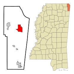
Location of Iuka, Mississippi
Usa edcp location map.svg
Red pog.svg
Iuka, Mississippi
Location in the United States
Coordinates: 34°48′38″N88°11′45″W / 34.81056°N 88.19583°W / 34.81056; -88.19583
Country United States
State Mississippi
County Tishomingo
Government
  MayorJoel Robertson
Area
[1]
  Total9.70 sq mi (25.12 km2)
  Land9.69 sq mi (25.11 km2)
  Water0.01 sq mi (0.01 km2)
Elevation
561 ft (171 m)
Population
 (2020)
  Total3,139
  Density323.81/sq mi (125.03/km2)
Time zone UTC-6 (Central (CST))
  Summer (DST) UTC-5 (CDT)
ZIP code
38852
Area code 662
FIPS code 28-35300
GNIS feature ID0671750
Website iukams.com

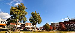
Iuka is a city in and the county seat of Tishomingo County, [2] Mississippi, United States. Its population was 3,028 at the 2010 census. Woodall Mountain, the highest point in Mississippi, is located just south of Iuka.

Contents

History

Iuka is built on the site of a Chickasaw Indian village that is thought to have been subordinate to the settlement at Underwood Village. The name "Iuka" comes from the name of one of the chiefs of the village. Iuka was founded by David Hubbard, a wagon train scout.

Euro-American settlers arrived with the Memphis and Charleston Railroad in 1857. Before the American Civil War, the town boasted an all-female college, a boys' military academy, and a fine hotel. The Civil War brought widespread devastation when a major engagement here occurred on September 19, 1862. The Battle of Iuka resulted in 1200 to 1500 killed or wounded. The dead Confederate soldiers were buried in a long trench that eventually became Shady Grove Cemetery.

Iuka, circa 1865 View of Iuka, Mississippi, from near the Brinkley House (5613688921).jpg
Iuka, circa 1865

The first normal school built in the former Confederacy after the Civil War, Iuka Normal Institute, was built here. However, the town did not return to prosperity for many years. The building of Pickwick Landing Dam and Pickwick Lake by the Tennessee Valley Authority brought activity back to the town.

In 1904, water from Iuka's mineral springs won first prize for the purest and best mineral water at the World's Fair in St. Louis.

Geography

Iuka is located in northeast Mississippi. U.S. Route 72 runs through the southern part of the city from west to east, leading southeast 14 mi (23 km) to Cherokee, Alabama, and northwest 8 mi (13 km) to Burnsville. Mississippi Highway 25 runs to the west of downtown from south to north, leading north 16 mi (26 km) to Red Sulphur Springs, Tennessee, and south 13 mi (21 km) to Tishomingo.

According to the United States Census Bureau, the city has a total area of 9.7 square miles (25 km2), all land.

Climate

Climate is characterized by relatively high temperatures and evenly distributed precipitation throughout the year. The Köppen Climate Classification subtype for this climate is "Cfa" (humid subtropical climate). [3]

Climate data for Iuka, Mississippi
MonthJanFebMarAprMayJunJulAugSepOctNovDecYear
Mean daily maximum °F (°C)49
(9)
54
(12)
62
(17)
72
(22)
79
(26)
86
(30)
89
(32)
90
(32)
84
(29)
73
(23)
63
(17)
52
(11)
71
(22)
Mean daily minimum °F (°C)27
(−3)
29
(−2)
37
(3)
44
(7)
54
(12)
62
(17)
66
(19)
65
(18)
57
(14)
44
(7)
37
(3)
29
(−2)
46
(8)
Average precipitation inches (mm)5.3
(130)
5.1
(130)
5.9
(150)
5
(130)
5.9
(150)
4.2
(110)
4.2
(110)
4
(100)
4.2
(110)
3.6
(91)
5.5
(140)
6.8
(170)
59.7
(1,520)
Source: Weatherbase [4]

Demographics

Historical population
CensusPop.Note
1880 845
1890 1,01920.6%
1900 882−13.4%
1910 1,22138.4%
1920 1,3067.0%
1930 1,44110.3%
1940 1,66415.5%
1950 1,527−8.2%
1960 2,01031.6%
1970 2,38918.9%
1980 2,84619.1%
1990 3,1229.7%
2000 3,059−2.0%
2010 3,028−1.0%
2020 3,1393.7%
U.S. Decennial Census [5]

2020 census

Iuka racial composition [6]
RaceNum.Perc.
White (non-Hispanic)2,73487.1%
Black or African American (non-Hispanic)1885.99%
Native American 130.41%
Asian 80.25%
Other/Mixed 1304.14%
Hispanic or Latino 662.1%

As of the 2020 United States census, there were 3,139 people, 1,244 households, and 727 families residing in the city.

2000 census

As of the census [7] of 2000, there were 3,059 people, 1,325 households, and 809 families residing in the city. The population density was 316.6 people per square mile (122.2 people/km2). There were 1,550 housing units at an average density of 160.4 per square mile (61.9/km2). The racial makeup of the city was 91.14% White, 7.09% African American, 0.23% Native American, 0.16% Asian, 0.59% from other races, and 0.78% from two or more races. Hispanic or Latino of any race were 1.21% of the population.

There were 1,325 households, out of which 25.0% had children under the age of 18 living with them, 44.8% were married couples living together, 13.4% had a female householder with no husband present, and 38.9% were non-families. 36.9% of all households were made up of individuals, and 17.4% had someone living alone who was 65 years of age or older. The average household size was 2.13 and the average family size was 2.77.

In the city, the population was spread out, with 19.5% under the age of 18, 7.4% from 18 to 24, 23.4% from 25 to 44, 23.7% from 45 to 64, and 26.1% who were 65 years of age or older. The median age was 45 years. For every 100 females, there were 76.9 males. For every 100 females age 18 and over, there were 72.1 males.

The median income for a household in the city was $24,082, and the median income for a family was $36,863. Males had a median income of $30,449 versus $20,658 for females. The per capita income for the city was $17,261. About 16.0% of families and 20.4% of the population were below the poverty line, including 26.6% of those under age 18 and 15.4% of those age 65 or over.

Economy

A major employer in Iuka's industrial sector is Alliant Techsystems, a major U.S. aerospace and defense contractor.

Iuka is home to the Apron Museum, the only museum in the United States dedicated to aprons.

Parks and recreation

Education

Media

Radio Stations

TV Stations

Infrastructure

Transportation

Highways

Railroads

Airports

  • Iuka Airport

Healthcare

Libraries

The Secret Sisters, a singing and songwriting duo from neighboring Colbert County, Alabama, wrote a song called "Iuka" for their album Put Your Needle Down . Greg Puckett, a country singer/songwriter from Iuka, MS, wrote a song called "Sittin in Iuka" for his album A Certain Man.Blues guitarist Albert King recorded the Don Nix-penned "Going Back to Iuka."

See also

Related Research Articles

<span class="mw-page-title-main">Tishomingo County, Mississippi</span> County in Mississippi, United States

Tishomingo County is a county located in the northeastern corner of the U.S. state of Mississippi. As of the 2020 census, the population was 18,850. Its county seat is Iuka.

<span class="mw-page-title-main">Calera, Alabama</span> City in Alabama, United States

Calera is a city in Shelby and Chilton counties in the U.S. state of Alabama. It is the location of the Shelby County Airport.

<span class="mw-page-title-main">Red Bay, Alabama</span> City in Alabama, United States

Red Bay is a city in Franklin County, Alabama, United States. It was founded in 1907; its western boundary line is integral with the state line between Mississippi and Alabama. The population was 3,232 at the 2020 census. The town's name comes from the area's red clay soil and the many redbay trees in this area of north Alabama.

<span class="mw-page-title-main">Manila, Arkansas</span> City in Arkansas, United States

Manila is a city in Mississippi County, Arkansas, United States. The population was 3,682 at the 2020 census, up from 3,342 in 2010. It was the hometown of World War I sniper Herman Davis.

<span class="mw-page-title-main">Gladwin, Michigan</span> City in Michigan, United States

Gladwin is a city in Gladwin County in the U.S. state of Michigan. The population was 3,069 at the 2020 census. Gladwin is the county seat of Gladwin County. The city is at the southwest corner of Gladwin Township, but the two are administered autonomously.

<span class="mw-page-title-main">Hickory Flat, Mississippi</span> Town in Mississippi, United States

Hickory Flat is a town in Benton County, Mississippi, United States. The population was 601 at the 2010 census.

<span class="mw-page-title-main">Hernando, Mississippi</span> City in Mississippi, United States

Hernando is a city in, and the county seat of, DeSoto County, which is on the northwestern border of Mississippi, United States. The population was 17,138 according to the 2020 census records. DeSoto County is the second-most-populous county in the Memphis metropolitan area, which includes counties in Tennessee, Arkansas and Mississippi.

<span class="mw-page-title-main">Booneville, Mississippi</span> City in Mississippi, United States

Booneville is a city in the U.S. state of Mississippi and is the county seat of Prentiss County. It is located in the hilly North Mississippi region, and ecologically is part of the Southeastern Plains region.

<span class="mw-page-title-main">Belmont, Mississippi</span> Town in Mississippi, United States

Belmont is a town in Tishomingo County, Mississippi, United States. The population was 2,021 at the 2010 census.

<span class="mw-page-title-main">Burnsville, Mississippi</span> Town in Mississippi, United States

Burnsville is a town in Tishomingo County in northeastern Mississippi, United States. The population was 936 at the 2010 census.

<span class="mw-page-title-main">Paden, Mississippi</span> Village in Mississippi, United States

Paden is a village in Tishomingo County, Mississippi, United States. The population was 116 at the 2010 census.

<span class="mw-page-title-main">Tishomingo, Mississippi</span> Town in Mississippi

Tishomingo is a town in Tishomingo County, Mississippi, United States. The population of the city of Tishomingo was 339 at the 2010 census.

<span class="mw-page-title-main">Schurz, Nevada</span> CDP in Nevada, United States

Schurz is a census-designated place (CDP) in Mineral County, Nevada, United States. The population was 658 at the 2010 census. It is located on the Walker River Indian Reservation. It is the burial place of Wovoka, the Paiute messiah who originated the Ghost Dance movement.

<span class="mw-page-title-main">Kosciusko, Mississippi</span> City in Mississippi, United States

Kosciusko is a city in Attala County, Mississippi, United States. The population was 7,402 at the 2010 census. It is the county seat of Attala County.

<span class="mw-page-title-main">Bowman, North Dakota</span> City in North Dakota, United States

Bowman is a city and county seat of Bowman County, North Dakota, United States. The population was 1,470 at the 2020 census.

<span class="mw-page-title-main">Tishomingo, Oklahoma</span> City in Oklahoma

Tishomingo is the largest city in, and the county seat of, Johnston County, Oklahoma, United States. The population was 3,034 at the 2010 census, a decline of 4.1 percent from the figure of 3,162 in 2000. It was the first capital of the Chickasaw Nation, from 1856 until Oklahoma statehood in 1907. The city is home to Murray State College, a community college with an annual enrollment of 3,015 students. Tishomingo is part of the Texoma region.

<span class="mw-page-title-main">Celina, Tennessee</span> City in Tennessee, United States

Celina is a city in and the county seat of Clay County, Tennessee, United States. The population was 1,495 at the 2010 census.

<span class="mw-page-title-main">Loudon, Tennessee</span> City in Tennessee, United States

Loudon is a city in and the county seat of Loudon County, Tennessee, United States. Its population was 6,001 at the 2020 census. It is included in the Knoxville, Tennessee Metropolitan Statistical Area. The city is located in East Tennessee, southwest of Knoxville, on the Tennessee River. Fort Loudoun, the colonial era fort for which the city was named, is located several miles to the south in Monroe County.

<span class="mw-page-title-main">Frost, Texas</span> City in Texas, United States

Frost is a city in Navarro County, Texas, United States. The population was 643 at the 2010 census.

<span class="mw-page-title-main">Baldwyn, Mississippi</span> City in Mississippi, United States

Baldwyn is a city located in Lee and Prentiss counties, Mississippi, located in the northern part of the Tupelo micropolitan area. The population was 3,071 at the 2020 census.

References

  1. "2020 U.S. Gazetteer Files". United States Census Bureau. Retrieved July 24, 2022.
  2. "Find a County". National Association of Counties. Archived from the original on May 31, 2011. Retrieved June 7, 2011.
  3. Climate Summary for Iuka, Mississippi
  4. "Weatherbase.com". Weatherbase. 2013. Retrieved on August 15, 2013.
  5. "Census of Population and Housing". Census.gov. Retrieved June 4, 2015.
  6. "Explore Census Data". data.census.gov. Retrieved December 16, 2021.
  7. "U.S. Census website". United States Census Bureau . Retrieved January 31, 2008.
  8. "North Mississippi Medical Center-Iuka".