Canton, Mississippi

Last updated

Canton, Mississippi
Madison County Mississippi Courthouse.jpg
Madison County Courthouse in Canton
Flag of Canton, Mississippi.png
Logo of Canton, Mississippi.png
Madison County Mississippi Incorporated and Unincorporated areas Canton Highlighted.svg
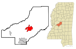
Location in Madison County and the state of Mississippi
Usa edcp location map.svg
Red pog.svg
Canton, Mississippi
Location in the United States
Coordinates: 32°36′43″N90°1′54″W / 32.61194°N 90.03167°W / 32.61194; -90.03167
CountryUnited States
State Mississippi
County Madison
Government
  MayorDr. William Truly Jr
Area
[1]
  Total21.57 sq mi (55.9 km2)
  Land21.28 sq mi (55.1 km2)
  Water0.30 sq mi (0.8 km2)
Elevation
233 ft (71 m)
Population
 (2020) [2]
  Total10,948
  Density514.59/sq mi (198.68/km2)
Time zone UTC−6 (Central (CST))
  Summer (DST) UTC−5 (CDT)
ZIP code
39046
Area code 601
FIPS code 28-11100
GNIS feature ID0691133
Website cityofcantonms.com

Canton is a city in Madison County, Mississippi, United States. The population was 10,948 at the 2020 census, [2] down from 13,189 in 2010. It is the county seat of Madison County, [3] and is situated in the northern part of the metropolitan area surrounding the state capital, Jackson.

Contents

The city is adjacent to a large auto manufacturing facility owned by Nissan.

History

Although not a major battle site during the Civil War, Canton was important as a rail and logistics center. Many wounded soldiers were treated in or transported through the city, and as a consequence it has a large Confederate cemetery.

Much of Canton is on the National Register of Historic Places. The courthouse square is a historic shopping district and host to the Canton Flea Market. The picturesque Georgian courthouse is particularly notable and often appears in photographic exhibits of the South. The east side of town is a large part of the historic district with many homes.

Geography

Canton is in central Madison County at 32°36′43″N90°1′54″W / 32.61194°N 90.03167°W / 32.61194; -90.03167 (32.612015, -90.031638). [4] It is 24 miles (39 km) northeast of Jackson. Canton is bordered to the south by the city of Gluckstadt.

U.S. Route 51 passes through the center of the city as Liberty Street and Union Street, leading southwest to Jackson and north-northeast 19 miles (31 km) to Pickens. Mississippi Highway 16 passes through the city center on East Peace Street and North Liberty Street, leading east 31 miles (50 km) to Carthage and northwest 30 miles (48 km) to Yazoo City. MS 22 has its eastern terminus in the center of Canton and leads west 18 miles (29 km) to Flora. MS 43 passes through the east side of Canton, leading northeast 47 miles (76 km) to Kosciusko and southeast 30 miles (48 km) to Pelahatchie. Interstate 55 passes through the west side of the city, with access from Exits 118 (Nissan Parkway) and Exit 119 (MS 22). I-55 leads southwest to Jackson and north 85 miles (137 km) to Grenada.

According to the U.S. Census Bureau, the city of Canton has a total area of 21.6 square miles (56 km2), of which 21.3 square miles (55 km2) are land and 0.3 square miles (0.8 km2), or 1.38%, are water. [1] Batchelor Creek flows westward through the city just north of downtown, and Bear Creek flows to the northwest through the southern part of the city. The city is in the watershed of the Big Black River.

Climate

According to the Köppen Climate Classification system, Canton has a humid subtropical climate, abbreviated "" on climate maps. The hottest temperature recorded in Canton was 108 °F (42.2 °C) on September 7, 1925, while the coldest temperature recorded was −11 °F (−23.9 °C) on January 27, 1940. [5]

Climate data for Canton, Mississippi, 1991–2020 normals, extremes 1892–present
MonthJanFebMarAprMayJunJulAugSepOctNovDecYear
Record high °F (°C)83
(28)
87
(31)
95
(35)
95
(35)
99
(37)
104
(40)
106
(41)
107
(42)
108
(42)
100
(38)
89
(32)
85
(29)
108
(42)
Mean maximum °F (°C)74.1
(23.4)
77.2
(25.1)
82.9
(28.3)
86.0
(30.0)
90.9
(32.7)
94.6
(34.8)
97.5
(36.4)
97.5
(36.4)
95.1
(35.1)
89.6
(32.0)
80.5
(26.9)
75.4
(24.1)
99.1
(37.3)
Mean daily maximum °F (°C)56.0
(13.3)
59.8
(15.4)
68.2
(20.1)
75.3
(24.1)
82.5
(28.1)
88.8
(31.6)
91.8
(33.2)
91.1
(32.8)
87.6
(30.9)
77.9
(25.5)
66.0
(18.9)
58.1
(14.5)
75.3
(24.0)
Daily mean °F (°C)44.8
(7.1)
47.8
(8.8)
55.8
(13.2)
63.0
(17.2)
71.4
(21.9)
77.7
(25.4)
81.0
(27.2)
80.0
(26.7)
75.2
(24.0)
64.4
(18.0)
53.1
(11.7)
46.7
(8.2)
63.4
(17.5)
Mean daily minimum °F (°C)33.6
(0.9)
35.9
(2.2)
43.4
(6.3)
50.7
(10.4)
60.3
(15.7)
66.6
(19.2)
70.2
(21.2)
68.9
(20.5)
62.8
(17.1)
50.8
(10.4)
40.4
(4.7)
35.3
(1.8)
51.6
(10.9)
Mean minimum °F (°C)17.0
(−8.3)
21.6
(−5.8)
27.1
(−2.7)
35.3
(1.8)
45.5
(7.5)
58.6
(14.8)
63.8
(17.7)
62.2
(16.8)
49.6
(9.8)
35.3
(1.8)
25.9
(−3.4)
21.2
(−6.0)
15.1
(−9.4)
Record low °F (°C)−11
(−24)
−3
(−19)
15
(−9)
28
(−2)
35
(2)
43
(6)
51
(11)
52
(11)
34
(1)
20
(−7)
12
(−11)
2
(−17)
−11
(−24)
Average precipitation inches (mm)5.15
(131)
4.92
(125)
5.69
(145)
6.09
(155)
4.73
(120)
4.02
(102)
4.60
(117)
3.84
(98)
4.06
(103)
4.30
(109)
4.64
(118)
5.01
(127)
57.05
(1,450)
Average snowfall inches (cm)0.0
(0.0)
0.1
(0.25)
0.0
(0.0)
0.0
(0.0)
0.0
(0.0)
0.0
(0.0)
0.0
(0.0)
0.0
(0.0)
0.0
(0.0)
0.0
(0.0)
0.0
(0.0)
0.4
(1.0)
0.5
(1.25)
Average precipitation days (≥ 0.01 in)9.79.39.88.38.58.89.29.15.96.57.68.8101.5
Average snowy days (≥ 0.1 in)0.00.10.00.00.00.00.00.00.00.00.00.00.1
Source 1: NOAA [6]
Source 2: National Weather Service [5]

Demographics

Historical population
CensusPop.Note
1870 1,963
1880 2,1318.6%
1890 3,40459.7%
1900 3,4641.8%
1910 3,92913.4%
1920 3,252−17.2%
1930 4,72545.3%
1940 6,01127.2%
1950 7,04817.3%
1960 9,70737.7%
1970 10,5038.2%
1980 11,1165.8%
1990 10,062−9.5%
2000 12,91128.3%
2010 13,1892.2%
2020 10,948−17.0%
U.S. Decennial Census [7]
Courthouse Square Courthouse Square, Canton, Mississippi.jpg
Courthouse Square

2020 census

Canton Racial Composition [8]
RaceNum.Perc.
White 1,66415.2%
Black or African American 7,98872.96%
Native American 330.3%
Asian 470.43%
Pacific Islander 10.01%
Other/Mixed 2342.14%
Hispanic or Latino 9818.96%

As of the 2020 United States Census, there were 10,948 people, 4,774 households, and 2,953 families residing in the city.

2010 census

As of the census [9] of 2010, there were 13,189 people and 4,494 households in the city with an average household size of 2.99. The population density was 621.1 inhabitants per square mile (239.8/km2). There were 4,933 housing units. The racial makeup of the city was 19.5% White, 74.7% African American, 0.2% Native American, 0.6% Asian, 0.1% Native Hawaiian and Other Pacific Islander, and 0.8% from two or more races. Hispanic or Latino of any race were 5.5% of the population.

The age distribution was 27.5% under the age of 18 and 10.8% 65 or older. 50.8% of the population were female.

The median household income was $33,350. The per capita income for the city was $15,192. About 31.4% of the population were below the poverty line.

2000 census

At the 2000 census, there were 12,911 people in 4,093 households, including 2,991 families, in the city. The population density was 694.1 inhabitants per square mile (268.0/km2). There were 4,333 housing units at an average density of 232.9 per square mile (89.9/km2). The racial makeup of the city was 18.64% White, 80.30% African American, 0.15% Native American, 0.20% Asian, 0.14% from other races, and 0.57% from two or more races. Hispanic or Latino of any race were 0.43% of the population.

Of the 4,093 households 37.1% had children under the age of 18 living with them, 32.4% were married couples living together, 34.9% had a female householder with no husband present, and 26.9% were non-families. 23.8% of households were one person and 10.9% were one person aged 65 or older. The average household size was 2.99 and the average family size was 3.55.

The age distribution was 32.3% under the age of 18, 11.2% from 18 to 24, 26.1% from 25 to 44, 18.5% from 45 to 64, and 11.9% 65 or older. The median age was 30 years. For every 100 females, there were 85.7 males. For every 100 females age 18 and over, there were 79.7 males.

The median household income was $24,237 and the median family income was $27,782. Males had a median income of $25,179 versus $20,815 for females. The per capita income for the city was $12,643. About 27.7% of families and 34.8% of the population were below the poverty line, including 49.8% of those under age 18 and 25.5% of those age 65 or over.

Economy

A Nissan plant is sited just outside the southwest city limits. In 2011 Canton officials considered annexing it. [10]

Notable people

Mississippi Blues Trail

Canton is officially on the Mississippi Blues Trail. Elmore James, a blues singer and a familiar figure in Canton, learned electronics by working in a radio repair shop on Hickory Street. Canton is rich in blues history centered on the juke joints of Hickory Street, known to locals as "The Hollow", as well as other places in Canton. A Mississippi Blues Trail historic marker was placed in Canton on Hickory Street to honor the contribution of James to the development of the blues in Mississippi. Other noted blues performers associated with Canton include Grady Champion, Little Brother Montgomery, William "Do-Boy" Diamond, Boyd Rivers and Johnny Temple. Musicians include studio guitarist Bucky Barrett and the slide guitarist Sonny Landreth. Gospel singers include the Canton Spirituals and Reverend Cleophus Robinson. [14]

In his dedication of Hickory Street, Governor Haley Barbour said,

With his innovative contributions to the electric slide guitar style, legendary Elmore James is among the many reasons Mississippi is truly the birthplace of America's music. Like so many others, Elmore's work was greatly influenced by his childhood home in Canton, where he joined the ranks of musicians like B.B. King and Little Milton to play the blues on Hickory Street. Today's blues trail marker not only recognizes the achievements of the talented Elmore James but also pays tribute to Canton's colorful blues heritage. [14]

Education

The city of Canton is served by the Canton Public School District and Canton High School. Canton Academy is a segregation academy in the area.

Climate

The climate in this area is characterized by hot, humid summers and generally mild to cool winters. According to the Köppen Climate Classification system, Canton has a humid subtropical climate, abbreviated "Cfa" on climate maps. [15]

JanuaryFebruaryMarchAprilMayJune
Average High in °F:556068768389
Average Low in °F:333643505967
Average Precipitation in Inch:5.1654.925.25.433.7
JulyAugustSeptemberOctoberNovemberDecember
Average High in °F:929287786758
Average Low in °F:696962504134
Average Precipitation in Inch:3.823.583.464.024.725.59

[15]

Related Research Articles

<span class="mw-page-title-main">Deatsville, Alabama</span> Town in Alabama, United States

Deatsville is a town in Elmore County, Alabama, United States. Although Deatsville initially incorporated in 1903, it lapsed at some point after the 1910 U.S. Census and did not appear again as incorporated until 2000. As of the 2020 census, the population was 1,679.

<span class="mw-page-title-main">Elmore, Alabama</span> Town in Alabama, United States

Elmore is a town in Elmore County, Alabama, United States. Although initially incorporated in 1906, it lapsed and was not reincorporated again until 1997. At the 2010 census the population was 1,262, up from 199 in 2000. It is part of the Montgomery Metropolitan Statistical Area.

<span class="mw-page-title-main">Eutaw, Alabama</span> City in and county seat of Greene County, Alabama

Eutaw is a city in and the county seat of Greene County, Alabama, United States. At the 2020 census, the population was 2,937. The city was named in honor of the Battle of Eutaw Springs, the last engagement of the American Revolutionary War in the Carolinas.

<span class="mw-page-title-main">Reform, Alabama</span> City in Alabama, United States

Reform is a city in Pickens County, Alabama, United States. At the 2010 census the population was 1,702, down from 1,978 in 2000. It is located approximately halfway between Columbus, Mississippi and Tuscaloosa on U.S. Route 82.

<span class="mw-page-title-main">Santa Ynez, California</span> Census-designated place in California, United States

Santa Ynez is a census-designated place (CDP) in the Santa Ynez Valley of Santa Barbara County, California.

<span class="mw-page-title-main">Mountain Home, Idaho</span> City in Idaho, United States

Mountain Home is the largest city and county seat of Elmore County, Idaho, United States. The population was 15,979 in the 2020 census. It is the principal city of the Mountain Home Micropolitan Statistical Area, which includes Elmore County.

<span class="mw-page-title-main">Hickory Hill, Kentucky</span> City in Kentucky, United States

Hickory Hill is a home rule-class city in Jefferson County, Kentucky, United States. The population was 114 at the 2010 census.

<span class="mw-page-title-main">Oakdale, Minnesota</span> City in Minnesota, United States

Oakdale is a city in Washington County, Minnesota, United States. It is a suburb of Saint Paul and is on the eastern side of the Twin Cities Metropolitan area. The population was 28,303 at the 2020 census. Oakdale is the 36th largest city in Minnesota by population.

<span class="mw-page-title-main">Corinth, Mississippi</span> City in Mississippi, United States

Corinth is a city in and the county seat of Alcorn County, Mississippi, United States. The population was 14,573 at the 2010 census. Its ZIP codes are 38834 and 38835. It lies on the state line with Tennessee.

<span class="mw-page-title-main">Hickory Flat, Mississippi</span> Town in Mississippi, United States

Hickory Flat is a town in Benton County, Mississippi, United States. The population was 601 at the 2010 census.

<span class="mw-page-title-main">Houston, Mississippi</span> City in Mississippi, United States

Houston is a city and one of two county seats of Chickasaw County, in northeastern Mississippi, United States. The population was 3,623 at the 2010 census.

<span class="mw-page-title-main">Hernando, Mississippi</span> City in Mississippi, United States

Hernando is the county seat of DeSoto County, on the northwestern border of Mississippi, United States. The population was 17,138 according to the 2020 census records. DeSoto County is the second-most-populous county in the Memphis metropolitan area, which includes counties in Tennessee, Arkansas and Mississippi.

<span class="mw-page-title-main">Cruger, Mississippi</span> Town in Mississippi, United States

Cruger is a town in Holmes County, Mississippi, United States. Per the 2020 census, the population was 268.

<span class="mw-page-title-main">Belzoni, Mississippi</span> City in Mississippi, United States

Belzoni is a city in Humphreys County, Mississippi, United States, in the Mississippi Delta region, on the Yazoo River. The population was 2,235 at the 2010 census. It is the county seat of Humphreys County. It was named for the 19th-century Italian archaeologist/explorer Giovanni Battista Belzoni.

<span class="mw-page-title-main">Forest, Mississippi</span> City in Mississippi, United States

Forest is a city and the county seat of Scott County, Mississippi, United States. The population was 5,684 at the 2010 census and the population is a minority-majority.

<span class="mw-page-title-main">Iuka, Mississippi</span> City in Mississippi, United States

Iuka is a city in and the county seat of Tishomingo County, Mississippi, United States. Its population was 3,028 at the 2010 census. Woodall Mountain, the highest point in Mississippi, is located just south of Iuka.

<span class="mw-page-title-main">Tishomingo, Mississippi</span> Town in Mississippi

Tishomingo is a town in Tishomingo County, Mississippi, United States. The population of the city of Tishomingo was 339 at the 2010 census.

<span class="mw-page-title-main">Kosciusko, Mississippi</span> City in Mississippi, United States

Kosciusko is a city in Attala County, Mississippi, United States. The population was 7,402 at the 2010 census. It is the county seat of Attala County.

<span class="mw-page-title-main">Canton, Pennsylvania</span> Borough in Pennsylvania, United States

Canton is a borough in Bradford County, Pennsylvania, United States. It is part of Northeastern Pennsylvania. The population was 1,723 at the 2020 census.

<span class="mw-page-title-main">Frost, Texas</span> City in Texas, United States

Frost is a city in Navarro County, Texas, United States. The population was 643 at the 2010 census.

References

  1. 1 2 "2023 U.S. Gazetteer Files: Mississippi". United States Census Bureau. Retrieved February 16, 2024.
  2. 1 2 "P1. Race – Canton city, Mississippi: 2020 DEC Redistricting Data (PL 94-171)". U.S. Census Bureau. Retrieved February 16, 2024.
  3. "Find a County". National Association of Counties. Archived from the original on May 31, 2011. Retrieved June 7, 2011.
  4. "US Gazetteer files: 2010, 2000, and 1990". United States Census Bureau. February 12, 2011. Retrieved April 23, 2011.
  5. 1 2 "NOAA Online Weather Data – NWS Jackson". National Weather Service. Retrieved February 27, 2023.
  6. "U.S. Climate Normals Quick Access – Station: Canton 4N, MS". National Oceanic and Atmospheric Administration. Retrieved February 27, 2023.
  7. United States Census Bureau. "Census of Population and Housing". Archived from the original on April 26, 2015. Retrieved February 5, 2014.
  8. "Explore Census Data". data.census.gov. Retrieved December 8, 2021.
  9. "Canton (city) QuickFacts from the US Census Bureau". Quickfacts.census.gov. Archived from the original on September 5, 2015. Retrieved July 27, 2015.
  10. "Canton considering annexing Nissan plant". WLBT. May 6, 2011. Retrieved July 1, 2021.
  11. "Sister Thea Bowman Home". Canton Tourism.
  12. Ownby, Ted; Wilson, Charles Reagan; Abadie, Ann J.; Lindsey, Odie; Jr, James G. Thomas (May 25, 2017). "Brown-Wright, Flozie (Goodloe) b. 1942, activist". The Mississippi Encyclopedia. Univ. Press of Mississippi. p. 147. ISBN   978-1-4968-1159-2.
  13. Career statistics. basketball-reference.com. Retrieved on 5 December 2015.
  14. 1 2 "Canton To Honor Blues Legend with Mississippi Blues Trail Marker" (PDF). 209.85.215.104. Archived from the original (PDF) on October 4, 2007. Retrieved May 28, 2008.
  15. 1 2 "Canton, Mississippi Köppen Climate Classification". Weatherbase. Retrieved July 27, 2015.