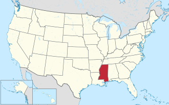
According to the U.S. Census Bureau, the county has a total area of 619 square miles (1,600km2), of which 589 square miles (1,530km2) is land and 30 square miles (78km2) (4.9%) is water.[3]
The county exists in two sections, connected only by a narrow 500-foot wide section between Madison Parish, Louisiana and Issaquena County, Mississippi along the delta of the Yazoo River. This area was once along the Mississippi River, but has since become an oxbow lake and marsh and no roads traverse this strip of land. The community of Eagle Bend is in this area.
In 2000,[12] there were 49,644 people, 18,756 households, and 13,222 families living in the county. The population density was 85 peopleper square mile (33 people/km2). There were 20,789 housing units at an average density of 35 unitsper square mile (14 units/km2). The racial makeup of the county was 54.97% White, 43.19% Black or African American, 0.23% Native American, 0.62% Asian, 0.02% Pacific Islander, 0.33% from other races, and 0.66% from two or more races. 1.04% of the population were Hispanic or Latino of any race.
2005 census estimates based on the American Community Survey suggested that non-Hispanic whites were 51.5% of Warren County's population. Warren County was the only county in Mississippi along the Mississippi River, in addition to Desoto, where whites made up a majority of the population. African Americans were 46.0% of the county's population. People identifying as of two or more races were 0.6%, less than in the previous ACS. The Latino population was 1.2% of the total for the county.[13]
In 2000 there were 18,756 households, out of which 35.60% had children under the age of 18 living with them, 46.80% were married couples living together, 19.10% had a female householder with no husband present, and 29.50% were non-families. 25.80% of all households were made up of individuals, and 9.70% had someone living alone who was 65 years of age or older. The average household size was 2.61 and the average family size was 3.14.
In the county, the population was spread out, with 28.50% under the age of 18, 9.10% from 18 to 24, 28.40% from 25 to 44, 22.40% from 45 to 64, and 11.70% who were 65 years of age or older. The median age was 35 years. For every 100 females there were 88.30 males. For every 100 females age 18 and over, there were 84.40 males.
The median income for a household in the county was $35,056, and the median income for a family was $41,706. Males had a median income of $33,566 versus $21,975 for females. The per capita income for the county was $17,527. About 15.00% of families and 18.70% of the population were below the poverty line, including 27.80% of those under age 18 and 16.20% of those age 65 or over.
Warren County has the seventh highest per capita income in the state of Mississippi.
Government and politics
Warren County was historically Democratic until 1948, then was a Republican stronghold until 2008 (when it was narrowly carried by John McCain), and has recently become a bellwether. It voted for Barack Obama in 2012, Donald Trump in 2016, Joe Biden in 2020, and Donald Trump in 2024. Warren County is one of two counties (the other being Nash County, North Carolina) to alternate its presidential vote the last five elections.[a]
Board of Supervisors
Members are elected from each of the five supervisory districts. The Board of Supervisors guides and establishes policies for the county government. Members of the board of make decisions regarding economic development, public health and welfare and county roads.
United States presidential election results for Warren County, Mississippi[14]
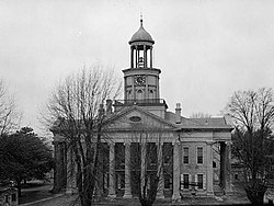
The Warren County sheriff's department is located in an annex building across from the courthouse.The Warren County Board of Supervisors meets in this mall building in Vicksburg.Old Courthouse Museum, also known as the Eva W. Davis Memorial is located in Vicksburg across the street from the 1940 courthouse.
↑ "Admission Guide 2019-2020"(PDF). Hinds Community College. p.10 (PDF p. 12/20). Retrieved September 27, 2024. [...]located in the Hinds Community College District (Hinds, Rankin, Warren, Claiborne, and Copiah counties)[...]
This page is based on this Wikipedia article Text is available under the CC BY-SA 4.0 license; additional terms may apply. Images, videos and audio are available under their respective licenses.