History
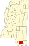
Harrison County, established on February 5, 1841, is named after President William Henry Harrison. Gulfport and Biloxi are the county seats. [5] Located on the Gulf Coast, it was created from portions of Hancock, Jackson, and Perry counties. [6]
Mississippi's Gulf Coast played an important role in colonial history, serving as a meeting point for European settlers and Native Americans. In 1699, the French established Fort Maurepas, the first European capital in Mississippi, with leaders like Pierre Le Moyne and Jean-Baptiste Le Moyne. Bienville, a key military and political figure, lived on the Gulf Coast until 1722.
By the 1850 census, Harrison County had a population of 3,378 whites, 56 free blacks, and 1,441 slaves. During the antebellum period, the county's agricultural economy was underdeveloped, ranking low in the state for cotton and livestock but was the leading rice producer by 1860. That year, there were 584 foreign-born residents in Harrison County, the third-highest in Mississippi. Slaves constituted 21 percent of the population.
After the Civil War, while not many battles occurred there, Harrison County became a refuge for former Confederates, with Jefferson Davis moving to Beauvoir Plantation in 1877. Post-war, the county's population and agricultural sector remained small, but foreign-born residents, mainly Germans and Irish, made up nearly 7 percent of the population in 1880. Harrison had few farms, but most farmers owned their land; African Americans were 27 percent of the population.
Rapid growth in Harrison County occurred from the late 1800s to 1900, with the population rising to 21,002. As industrial jobs rose, agriculture declined, leading to the introduction of the Biloxi schooner for fishing. By 1900, industrial firms employed 1,577 people. The immigrant population expanded, diversifying into many nationalities engaged in fishing and canning.
Religiously, Harrison County had a mix of denominations, with a significant rise in Catholicism due to new immigrants. The arts, tourism, and gambling became part of the county's charm, with hotels opening in the 1880s to cater to visitors, spurred by railroad expansion and proximity to New Orleans.
George Ohr, known as the Mad Potter of Biloxi, opened Biloxi Art and Novelty Pottery in 1879 and created innovative pottery until 1910. Painter Dusti Bongé was born in Biloxi in 1903, and the author Mary Kimbrough Sinclair spent much of her childhood there. Barq’s Root Beer, invented by Edward Barq in 1898, highlights the area's link to New Orleans.
During the early to mid-1900s, Harrison County saw military developments, like the opening of Beauvoir Plantation as a museum in 1941 and Keesler Field, which attracted many during World War II. By 1930, the population was over 44,000, with a significant number of unemployed due to the Great Depression.
Population growth surged from 1930 to 1960, reaching nearly 120,000, with a mix of immigrant communities, including Vietnamese, who primarily worked in fishing.
Harrison County, in 1960, had a diverse labor force primarily in nonagricultural jobs, with few employed in agriculture. It boasted the second-highest high school graduation rate in Mississippi and the lowest percentage of residents with minimal schooling. The county has a notable civil rights legacy, highlighted by Dr. Gilbert Mason's “wade-in” protests against beach segregation and the establishment of the NAACP chapter.
Prominent figures from the county include poet Natasha Trethewey, astronaut Fred Haise, journalist Robin Roberts, basketball player Mahmoud Abdul-Rauf, and author Jesmyn Ward. The Ohr-O’Keefe Museum of Art, opened in 1992, is a cultural landmark.
Harrison County faced significant devastation from hurricanes Camille in 1969 and Katrina in 2005, impacting its population and economy. As of 2010, the county's population surpassed 187,000, reflecting a 56% increase since 1960, while maintaining a white majority alongside notable Hispanic/Latino and Asian minorities.