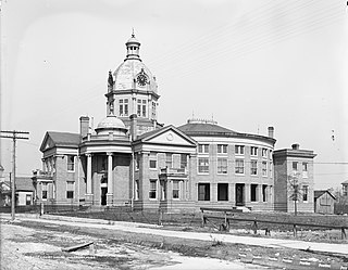
Stone County is a county located in the U.S. state of Mississippi. As of the 2010 census, the population was 17,786. Its county seat is Wiggins. Stone County was formed from the northern portion of Harrison County on June 5, 1916. The county was named for John M. Stone, who served as Governor of Mississippi from 1876 to 1882 and again from 1890 to 1896.

Harrison County is a county located in the U.S. state of Mississippi. As of the 2010 census, the population was 187,105, making it the second-most populous county in Mississippi. Its county seats are Biloxi and Gulfport. The county is named after U.S. President William Henry Harrison.
Protected areas of Tasmania consist of protected areas located within Tasmania and its immediate onshore waters, including Macquarie Island. It includes areas of crown land managed by Tasmanian Government agencies as well as private reserves. As of 2016, 52% of Tasmania's land area has some form of reservation classification, the majority is managed by the Tasmania Parks & Wildlife Service. Marine protected areas cover about 7.9% of state waters.

De Soto National Forest, named for 16th-century Spanish explorer Hernando de Soto, is 518,587 acres of pine forests in southern Mississippi. It is one of the most important protected areas for the biological diversity of the Gulf Coast ecoregion of North America.

The Mississippi Gulf Coast, also known as the Mississippi Gulf Coast region, Coastal Mississippi, or simply The Coast, is the area of southern Mississippi along the Mississippi Sound along the Gulf of Mexico.

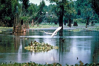
The wetlands of Louisiana are water-saturated coastal and swamp regions of southern Louisiana, often called 'Bayou'.

The Pascagoula River is a river, about 80 miles (130 km) long, in southeastern Mississippi in the United States. The river drains an area of about 8,800 square miles (23,000 km²) and flows into Mississippi Sound of the Gulf of Mexico. The Pascagoula River Basin is managed by the Pat Harrison Waterway District.

Black Creek Wilderness is a 5,052-acre (20 km2) wilderness area in the U.S. state of Mississippi. Located within the De Soto National Forest, Mississippi's largest wilderness lies in the broad valley of Black Creek, stained a deep caramel color by the tannic acid of decaying vegetation. The upland areas protect significant areas of longleaf pine forest, while the river creates bottomland hardwoods and shorelines with sand bars. It is therefore an important representation of typical coastal plain ecosystems that existed before forests were cleared and the rivers dammed. The Pascagoula River is nationally significant as one of the largest unimpeded rivers remaining in the lower 48 states. Rare species include the Pearl darter and the Yellow-blotched map turtle, both found only in this river and its tributaries. This wilderness area is surrounded by De Soto National Forest, which is also one of the nation's most important areas of coastal plain ecosystems.
Conserving Carolina is a non-profit conservation organization working to preserve water and land resources in Western North Carolina. Conserving Carolina was created in July 2017, from a merger of two previously-separate organizations, Carolina Mountain Land Conservancy and Pacolet Area Conservancy. The combined organization maintains a primary office in Hendersonville, NC and a regional office in Columbus, NC.
California Rangeland Trust is a nonprofit organization founded in 1998 by a group of innovative ranchers committed to conservation. The Rangeland Trust is now the largest land trust in California, having conserved nearly 300,000 acres (1,200 km2) of rangeland on 61 ranches across 24 counties.

Ramsey Springs is an unincorporated community in Stone County, Mississippi, United States. It is part of the Gulfport–Biloxi, Mississippi Metropolitan Statistical Area.

Shaupeneak Ridge Cooperative Recreation Area is a 790-acre (320 ha) recreational and protected area in the U.S. state of New York. It is located in the town of Esopus in eastern Ulster County. Shaupeneak Ridge Cooperative Recreation Area (CRA) covers part of the ridge-top, slope, and base of Shaupeneak Mountain, an 892-foot (272 m) high ridge of the Marlboro Mountains, which stretch from Newburgh, New York to Kingston, New York.

Sweetbay Bogs Preserve was established in 1989 by the Mississippi Chapter of the Nature Conservancy. Located in the western portion of Stone County, Mississippi, the property contains a classic example of a hillside seepage bog which the Conservancy designated as Sweetbay Bogs Preserve because of the multitude of sweetbay trees that occupy the site. The Preserve contains 194 acres near Red Creek, within the Pascagoula River watershed.

Turkey Creek Community Historic District is a settlement established by emancipated African Americans during the Reconstruction Era after the American Civil War. The community is situated in north Gulfport, Mississippi, and was added to the National Register of Historic Places in 2007.
Scenic Hudson is a non-profit environmental organization in New York that protects land, creates, and enhances parks, and advocates for environmentally responsible policies and development practices.
The North Branch Land Trust is a conservation easement group that aims to buy the developing rights to land in the Back Mountain area of the Northeastern part of Pennsylvania. The North Branch Land Trust was established in 1993 and has grown from one conserved property a year to over 12,000 acres of conserved land. The watersheds affected by the NBLT are the Susquehanna River and Delaware River watersheds.
The Land Trust for Tennessee is an American non-profit conservation organization working to protect Tennessee's natural, scenic and historic landscapes and sites. Since 1999, The Land Trust has partnered to conserve more than 131,000 acres (530 km2) of land across 65-plus Tennessee counties.

The Big Sur Land Trust is a private 501(c)(3) non-profit located in Monterey, California, that has played an instrumental role in preserving land in California's Big Sur and Central Coast regions. The trust was the first to conceive of and use the "conservation buyer" method in 1989 by partnering with government and developers to offer tax benefits as an inducement to sell land at below-market rates. As of 2016, it has protected around 40,000 acres (16,187 ha) through acquisition and resale to government agencies. It has added conservation easements to another 17,000 acres (6,880 ha) and has retained ownership of a number of parcels totaling about 4,500 acres (1,821 ha).

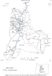
The Deschutes Land Trust is a private charitable conservation organization focused on preserving natural landscapes and rivers in the Deschutes River Basin in Oregon, USA. The Trust was formed in 1995, and since then has grown to conserve more than 7,000 hectares of land in over 17 preserves.
The Palo Corona Regional Park is a 4,500 acres (1,800 ha) park owned by the Monterey Peninsula Regional Park District on land east of Big Sur Coast Highway and Garrapata State Park in California. The 9,898 acres (4,006 ha) property stretches southeast about 11 miles (18 km) from the near the Carmel River State Beach to the Los Padres National Forest. The park is long from north to south, bordered on the northwest by Highway 1 and across from Carmel River State Beach. It wraps around Point Lobos Ranch and abuts Santa Lucia Preserve to the east. In the middle, it is sandwiched by Mitteldorf Preserve and Garrapata State Park. It's southern border abuts Joshua Creek Canyon Ecological Reserve. Environmental interests were concerned that it would be converted to an estate-type development like that done for Rancho San Carlos. In May 2002, the Big Sur Land trust and The Nature Conservancy joined together to buy the Ranch. Overall, the park directly and indirectly connects nine conservation properties preserved for their biological, recreation and scenic values. It includes the former Rancho Caňada Country Club and golf course in Carmel Valley


