Pearl River County | |
---|---|
Coordinates: 30°46′N89°35′W / 30.77°N 89.59°W | |
Country | United States |
State | Mississippi |
Founded | 1890 |
Named for | Pearl River |
Seat | Poplarville |
Largest city | Picayune |
Area | |
• Total | 819 sq mi (2,120 km2) |
• Land | 811 sq mi (2,100 km2) |
• Water | 8.0 sq mi (21 km2) 1.0% |
Population (2020) | |
• Total | 56,145 |
• Estimate (2023) | 57,978 |
• Density | 69/sq mi (26/km2) |
Time zone | UTC−6 (Central) |
• Summer (DST) | UTC−5 (CDT) |
Congressional district | 4th |
Website | www |
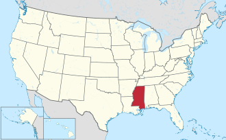
Pearl River County is a county located in the U.S. state of Mississippi. The population was 56,145 at the 2020 census. [1] Its county seat is Poplarville. [2] Pearl River County comprises the Picayune, MS Micropolitan Statistical Area, which is included in the New Orleans-Metairie-Hammond, LA-MS Combined Statistical Area. Pearl River County is a dry county, [3] and as such, the sale, transportation, and even private possession of beverage alcohol is prohibited by law, [4] except within Picayune and Poplarville. [5]
Pearl River County was originally formed as Pearl County in 1872 from portions of Hancock and Marion Counties. [6] Because of low population density and a small tax base, Pearl County dissolved in 1878. Present-day Pearl River County was organized in 1890 by an act of the Mississippi Legislature utilizing the same land area as its predecessor Pearl County. [6]
On the night of April 24, 1959, Mack Charles Parker, an African-American accused of rape, was abducted from the Pearl River County jail in Poplarville by a mob [7] and shot to death. His body was found in the Pearl River 10 days later. The FBI investigated and even obtained confessions from some of the eight suspects. [8] However, the county prosecutor refused to present evidence to a state grand jury and a federal grand jury refused to indict. The case focused national attention on the persistence of lynching in the South [9] and helped accelerate the American Civil Rights Movement.
On August 29, 2005, Hurricane Katrina inflicted heavy damage on the small town of Poplarville. The storm's most powerful, unofficially recorded gust of wind was reported at Pearl River Community College, at 135 mph (217 km/h). On September 2, 2005, the 1st Battalion, 134th Field Artillery (Ohio Army National Guard) arrived at the National Guard armory in Poplarville to assist the community and Pearl River County in recovery efforts in the wake of Hurricane Katrina. Initial efforts were the security of banks, pharmacies and gas stations as well as initial responses to rural emergencies. The unit stayed for three weeks ultimately checking on every family and structure in the county. On September 5, 2005, Poplarville played host to a visit by George W. Bush, Laura Bush, and Governor Haley Barbour to Pearl River Community College in the aftermath of Hurricane Katrina. [10]
According to the U.S. Census Bureau, the county has a total area of 819 square miles (2,120 km2), of which 811 square miles (2,100 km2) is land and 8.0 square miles (21 km2) (1.0%) is water. [11] It is the fourth-largest county in Mississippi by land area.
Picayune's local newspaper is the Picayune Item . [12]
The local radio station is WRJW 1320-AM. [13]
Television and Radio stations of New Orleans and Biloxi/Gulfport listening areas are part of Picayune area.
Census | Pop. | Note | %± |
---|---|---|---|
1890 | 2,957 | — | |
1900 | 6,697 | 126.5% | |
1910 | 10,593 | 58.2% | |
1920 | 15,648 | 47.7% | |
1930 | 19,405 | 24.0% | |
1940 | 19,125 | −1.4% | |
1950 | 20,641 | 7.9% | |
1960 | 22,411 | 8.6% | |
1970 | 27,802 | 24.1% | |
1980 | 33,795 | 21.6% | |
1990 | 38,714 | 14.6% | |
2000 | 48,621 | 25.6% | |
2010 | 55,834 | 14.8% | |
2020 | 56,145 | 0.6% | |
2023 (est.) | 57,978 | [14] | 3.3% |
U.S. Decennial Census [15] 1790-1960 [16] 1900-1990 [17] 1990-2000 [18] 2010-2013 [19] 2018 [20] |
Race | Num. | Perc. |
---|---|---|
White (non-Hispanic) | 44,101 | 78.55% |
Black or African American (non-Hispanic) | 6,666 | 11.87% |
Native American | 256 | 0.46% |
Asian | 275 | 0.49% |
Other/Mixed | 2,563 | 4.56% |
Hispanic or Latino | 2,284 | 4.07% |
As of the 2020 United States census, there were 56,145 people, 21,020 households, and 15,078 families residing in the county.
As of the 2010 census Pearl River County had a population of 55,834. The ethnic and racial make-up of the population was 82.2% non-Hispanic white, 12.3% African-American, 0.6% Native American, 0.4% Asian, 0.1% Pacific Islander, 0.1% non-Hispanic from some other race, 1.7% from two or more races (0.5% reporting being white and black) and 2.9% Hispanic or Latino. [22] [ failed verification ]
As of the census [23] [ failed verification ] of 2000, there were 48,621 people, 18,078 households, and 13,576 families residing in the county. The population density was 60 people per square mile (23 people/km2). There were 20,610 housing units at an average density of 25 per square mile (9.7/km2). The racial makeup of the county was 85.55% White, 12.18% Black or African American, 0.50% Native American, 0.27% Asian, 0.03% Pacific Islander, 0.34% from other races, and 1.13% from two or more races. 1.41% of the population were Hispanic or Latino of any race.
There were 18,078 households, out of which 34.80% had children under the age of 18 living with them, 58.30% were married couples living together, 12.50% had a female householder with no husband present, and 24.90% were non-families. 21.70% of all households were made up of individuals, and 9.00% had someone living alone who was 65 years of age or older. The average household size was 2.65 and the average family size was 3.08.
In the county, the population was spread out, with 27.00% under the age of 18, 9.40% from 18 to 24, 27.10% from 25 to 44, 23.90% from 45 to 64, and 12.60% who were 65 years of age or older. The median age was 36 years. For every 100 females there were 94.40 males. For every 100 females age 18 and over, there were 91.00 males.
The median income for a household in the county was $30,912, and the median income for a family was $35,924. Males had a median income of $30,370 versus $21,519 for females. The per capita income for the county was $15,160. About 15.50% of families and 18.40% of the population were below the poverty line, including 25.60% of those under age 18 and 12.50% of those age 65 or over.
Year | Republican | Democratic | Third party(ies) | |||
---|---|---|---|---|---|---|
No. | % | No. | % | No. | % | |
2024 | 20,438 | 82.74% | 3,982 | 16.12% | 281 | 1.14% |
2020 | 19,595 | 81.53% | 4,148 | 17.26% | 290 | 1.21% |
2016 | 17,782 | 81.26% | 3,604 | 16.47% | 497 | 2.27% |
2012 | 17,549 | 78.96% | 4,366 | 19.65% | 309 | 1.39% |
2008 | 17,881 | 79.67% | 4,320 | 19.25% | 242 | 1.08% |
2004 | 14,896 | 76.44% | 4,472 | 22.95% | 119 | 0.61% |
2000 | 11,575 | 70.25% | 4,611 | 27.98% | 291 | 1.77% |
1996 | 8,212 | 57.12% | 4,892 | 34.03% | 1,273 | 8.85% |
1992 | 7,726 | 52.21% | 4,683 | 31.65% | 2,388 | 16.14% |
1988 | 10,220 | 71.30% | 3,939 | 27.48% | 174 | 1.21% |
1984 | 9,978 | 76.10% | 3,085 | 23.53% | 49 | 0.37% |
1980 | 6,822 | 56.19% | 5,028 | 41.41% | 291 | 2.40% |
1976 | 4,332 | 44.82% | 5,024 | 51.98% | 309 | 3.20% |
1972 | 7,487 | 88.04% | 901 | 10.60% | 116 | 1.36% |
1968 | 1,298 | 15.69% | 926 | 11.19% | 6,050 | 73.12% |
1964 | 4,009 | 84.51% | 735 | 15.49% | 0 | 0.00% |
1960 | 651 | 18.69% | 1,276 | 36.64% | 1,556 | 44.67% |
1956 | 1,129 | 39.64% | 1,274 | 44.73% | 445 | 15.63% |
1952 | 1,741 | 45.80% | 2,060 | 54.20% | 0 | 0.00% |
1948 | 46 | 2.17% | 146 | 6.88% | 1,929 | 90.95% |
1944 | 84 | 3.79% | 2,131 | 96.21% | 0 | 0.00% |
1940 | 88 | 4.15% | 2,022 | 95.47% | 8 | 0.38% |
1936 | 81 | 6.53% | 1,156 | 93.23% | 3 | 0.24% |
1932 | 99 | 6.14% | 1,500 | 92.99% | 14 | 0.87% |
1928 | 918 | 51.09% | 879 | 48.91% | 0 | 0.00% |
1924 | 164 | 14.67% | 855 | 76.48% | 99 | 8.86% |
1920 | 53 | 10.21% | 464 | 89.40% | 2 | 0.39% |
1916 | 35 | 6.28% | 521 | 93.54% | 1 | 0.18% |
1912 | 7 | 2.24% | 290 | 92.95% | 15 | 4.81% |
School districts include: [27]
Former school districts: [28]
The county is in the service area of Pearl River Community College. [30]
Tippah County is a county located on the northern border of the U.S. state of Mississippi. As of the 2020 census, the population was 21,815. Its county seat is Ripley. The name "Tippah" is derived from a Chickasaw language word meaning "cut off." It was taken from the creek of the same name that flows across much of the original county from northeast to southwest before emptying into the Tallahatchie River. The creek probably was so named because it, and the ridges on either side, "cut off" the western part of the region from the eastern portion.
Sharkey County is a county located in the U.S. state of Mississippi. Part of the eastern border is formed by the Yazoo River. According to the 2020 census, the population was 3,800, making it the second-least populous county in Mississippi, after Issaquena County. Its county seat is Rolling Fork. The county is named after William L. Sharkey, the provisional Governor of Mississippi in 1865.
Madison County is a county located in the U.S. state of Mississippi. As of the 2020 census, the population was 109,145. The county seat is Canton. The county is named for Founding Father and U.S. President James Madison. Madison County is part of the Jackson, MS Metropolitan Statistical Area.
Lincoln County is a county located in the U.S. state of Mississippi. As of the 2020 census, the population was 34,907. Its county seat is Brookhaven. The county was created by the legislature on April 7, 1870, during the Reconstruction Era. It was formed from portions of Lawrence, Pike, Franklin, Copiah, and Amite counties. It was named for Abraham Lincoln, the 16th President of the United States. Lincoln County comprises the Brookhaven, MS Micropolitan Statistical Area, which is included in the Jackson–Vicksburg–Brookhaven Combined Statistical Area. The county is southwest of the state capital of Jackson.
Lamar County is a county located in the U.S. state of Mississippi. As of the 2020 census, the population was 64,222. Its county seat is Purvis. Named for Confederate Lucius Quintus Cincinnatus Lamar, the county was carved out of Marion County to the west in 1904.
Forrest County is a county located in the U.S. state of Mississippi. As of the 2020 census, the population was 78,158. Its county seat and largest city is Hattiesburg. The county was created from Perry County in 1908 and named in honor of Nathan Bedford Forrest, a Confederate general in the American Civil War and the first Grand Wizard of the Ku Klux Klan. Forrest County is part of the Hattiesburg, MS Metropolitan Statistical Area.
Benton County is a county located in the U.S. state of Mississippi. As of the 2020 census, the population was 7,646. Its county seat is Ashland.
Beulah is a town in Bolivar County, Mississippi, United States. Per the 2020 census, the population was 242.
Calhoun City is a town in Calhoun County, Mississippi, United States. The population was 1,774 at the 2010 census.
Pickens is a town in Holmes County, Mississippi, United States. Per the 2020 census, the population was 920.
Picayune is the largest city in Pearl River County, Mississippi, United States. The population was 11,885 at the 2020 census. The city is located approximately 45 miles (72 km) from New Orleans, Hattiesburg, and Gulfport–Biloxi. The Stennis Space Center is 10 miles (16 km) away. Picayune is part of the New Orleans–Metairie–Hammond combined statistical area.
Poplarville is a city in Pearl River County, Mississippi, United States. As of the 2010 census, the city population was 2,894. It is the county seat of Pearl River County. It hosts an annual Blueberry Jubilee, which includes rides, craft vendors and rodeos.
Pearl is a city located in Rankin County, Mississippi, United States, on the east side of the Pearl River across from the state capital Jackson. The population was 27,115 as of the 2020 census. It is part of the Jackson Metropolitan Statistical Area.
West Hattiesburg is an unincorporated area and census-designated place (CDP) in Lamar County, Mississippi, west of the city of Hattiesburg and east of the community of Oak Grove. It is part of the Hattiesburg metropolitan area. It had a decline in population from 6,305 at the 2000 census to 5,909 at the 2010 census.
Lumberton is a city in Lamar and Pearl River counties, Mississippi, United States. It is part of the Hattiesburg, Mississippi Metropolitan Statistical Area. The population was 2,086 at the 2010 census.
Mack Charles Parker was a Black American victim of lynching in the United States. He had been accused of raping a pregnant white woman in northern Pearl River County, Mississippi. Three days before he was to stand trial, Parker was kidnapped from his jail cell in the Pearl River County Courthouse by a mob, beaten and shot. His body was found in the Pearl River, 20 miles west of Poplarville, 10 days later. Following an investigation by the Federal Bureau of Investigation, the men who killed him were released. Despite confessions, no one was ever indicted for the killing. Historian Howard Smead called the killing the "last classic lynching in America."
The Lamar County School District (LCSD) is a public school district based in Purvis, Mississippi (USA).
The Lumberton Public School District was a public school district based in Lumberton, Mississippi, United States.
The Poplarville School District is a public school district based in Poplarville, Mississippi (USA).
Hide-A-Way Lake is an unincorporated community and census-designated place in Pearl River County, Mississippi, United States. Its population was 2,065 as of the 2020 census.
Media related to Pearl River County, Mississippi at Wikimedia Commons