Quitman County, Mississippi

Last updated

Quitman County
Marks MS 038.jpg
Quitman County Courthouse
Map of Mississippi highlighting Quitman County.svg
Location within the U.S. state of Mississippi
Mississippi in United States.svg
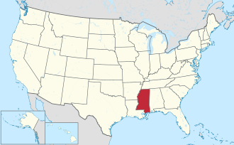
Mississippi's location within the U.S.
Coordinates: 34°15′N90°17′W / 34.25°N 90.29°W / 34.25; -90.29
CountryFlag of the United States.svg United States
StateFlag of Mississippi.svg  Mississippi
Founded1877
Named for John A. Quitman
Seat Marks
Largest town Lambert
Area
  Total406 sq mi (1,050 km2)
  Land405 sq mi (1,050 km2)
  Water1.4 sq mi (4 km2)  0.3%
Population
 (2020)
  Total6,176
  Density15/sq mi (5.9/km2)
Time zone UTC−6 (Central)
  Summer (DST) UTC−5 (CDT)
Congressional district 2nd
Website quitmancountyms.org

Quitman County is a county located in the U.S. state of Mississippi. As of the 2020 census, the population was 6,176, [1] making it the third-least populous county in Mississippi. Its county seat is Marks. [2] The county is named after John A. Quitman, Governor of Mississippi from 1835 to 1836 and from 1850 to 1851.

Contents

Quitman County is located in the Mississippi Delta region of Mississippi.

History

The county was developed for cotton cultivation. Much of the bottomlands behind the riverfront were not developed until the late 19th century, and population continued to increase as the frontier was cleared and cultivated. The county reached its peak population in 1940. Agricultural mechanization reduced the need for farm labor, and workers were recruited to northern and midwestern industrial cities. Thousands of African Americans left in the Great Migration, many going upriver to St. Louis and Chicago.

Poor People's Campaign

Martin Luther King Jr. originally wanted the Poor People's Campaign to start in Quitman County because of the intense and visible economic disparity there. On March 18, 1968, King visited the town of Marks, Mississippi. He watched a teacher feeding black schoolchildren their lunch, consisting only of a slice of apple and some crackers, and was moved to tears.

After King's death, the Southern part of the Campaign began in Quitman County. Participants rode a train of mules to Washington, D.C. to protest about economic conditions. [3] According to wagonmaster Willie Bolden, white citizens of Marks harassed the mule train on its way out of town. Bolden stated that they "would drive by blowing their horns, purposely trying to spook the mules and us." [4] More recently, Quitman County residents have made an effort to promote tourism based on the county's role in the Poor People's Campaign. [4]

Geography

According to the U.S. Census Bureau, the county has a total area of 406 square miles (1,050 km2), of which 405 square miles (1,050 km2) is land and 1.4 square miles (3.6 km2) (0.3%) is water. [5] It is the fourth-smallest county in Mississippi by land area and third-smallest by total area.

Major highways

Adjacent counties

National protected area

Demographics

Reflecting the decreased need for farm labor after mechanization and the development of industrial farms, the population has declined by more than two thirds since its peak in 1940.

Historical population
CensusPop.Note
1880 1,407
1890 3,286133.5%
1900 5,43565.4%
1910 11,593113.3%
1920 19,86171.3%
1930 25,30427.4%
1940 27,1917.5%
1950 25,885−4.8%
1960 21,019−18.8%
1970 15,888−24.4%
1980 12,636−20.5%
1990 10,490−17.0%
2000 10,117−3.6%
2010 8,223−18.7%
2020 6,176−24.9%
U.S. Decennial Census [6]
1790-1960 [7] 1900-1990 [8]
1990-2000 [9] 2010-2013 [10]

2020 census

Quitman County racial composition [11]
RaceNum.Perc.
White (non-Hispanic)1,48424.03%
Black or African American (non-Hispanic)4,54673.61%
Native American 10.02%
Asian 120.19%
Pacific Islander 30.05%
Other/Mixed 1091.76%
Hispanic or Latino 210.34%

As of the 2020 United States census, there were 6,176 people, 3,027 households, and 1,833 families residing in the county.

2010 census

As of the 2010 United States Census, there were 8,223 people living in the county. 69.6% were Black or African American, 29.0% White, 0.2% Native American, 0.1% Asian, 0.3% of some other race and 0.8% of two or more races. 0.7% were Hispanic or Latino (of any race).

2000 census

As of the census [12] of 2000, there were 10,117 people, 3,565 households, and 2,506 families living in the county. The population density was 25 people per square mile (9.7 people/km2). There were 3,923 housing units at an average density of 10 units per square mile (3.9 units/km2). The racial makeup of the county was 68.62% Black or African American, 30.47% White, 0.13% Native American, 0.17% Asian, 0.01% Pacific Islander, 0.08% from other races, and 0.52% from two or more races. 0.54% of the population were Hispanic or Latino of any race.

In 2000, there were 3,565 households, out of which 34.40% had children under the age of 18 living with them, 37.60% were married couples living together, 26.80% had a female householder with no husband present, and 29.70% were non-families. 26.90% of all households were made up of individuals, and 12.30% had someone living alone who was 65 years of age or older. The average household size was 2.80 and the average family size was 3.42.

In the county, the population was spread out, with 32.00% under the age of 18, 9.60% from 18 to 24, 25.70% from 25 to 44, 19.50% from 45 to 64, and 13.20% who were 65 years of age or older. The median age was 32 years. For every 100 females there were 86.50 males. For every 100 females age 18 and over, there were 79.30 males.

The median income for a household in the county was $20,636, and the median income for a family was $25,394. Males had a median income of $23,571 versus $16,993 for females. The per capita income for the county was $10,817. About 28.60% of families and 33.10% of the population were below the poverty line, including 43.10% of those under age 18 and 30.60% of those age 65 or over.

Quitman County has the fifth-lowest per capita income in Mississippi and the 51st lowest in the United States.

Government and infrastructure

The Mississippi Department of Corrections (MDOC) operates the Quitman County Community Work Center (CWC) in an area near Lambert. [13] In addition MDOC operates the Mississippi State Penitentiary (Parchman) in an unincorporated area in Sunflower County, in the area. Camp B, an inmate housing unit, was a satellite complex located away from the main Parchman prison property in unincorporated Quitman County, [14] near Lambert. [15] Camp B was one of Parchman's largest African-American housing units. [15] Camp B's buildings have been demolished. [16] The Mississippi Code (§ 47-5-131) gives Quitman County the right to "not over twenty (20) offenders from the Parchman facility for five (5) workdays of each week for the purpose of working the roads of Quitman County", and goes on to state that the "board of supervisors of Quitman County shall lay out and designate roads to be worked by the offenders, and the board of supervisors shall furnish transportation to and from the Parchman facility for offenders." [17]

United States presidential election results for Quitman County, Mississippi [18]
Year Republican Democratic Third party
No.%No.%No.%
2020 1,02631.80%2,15066.65%501.55%
2016 1,00129.75%2,31268.71%521.55%
2012 1,11628.05%2,83771.30%260.65%
2008 1,33432.01%2,80367.25%310.74%
2004 1,36039.79%2,03259.45%260.76%
2000 1,28037.50%2,10361.62%300.88%
1996 1,12132.54%2,18663.45%1384.01%
1992 1,45135.45%2,42259.17%2205.38%
1988 1,83242.11%2,49757.39%220.51%
1984 2,19848.33%2,34351.52%70.15%
1980 1,69135.16%2,92660.83%1934.01%
1976 1,28731.82%2,62164.80%1373.39%
1972 2,52474.41%79023.29%782.30%
1968 4349.91%1,50234.30%2,44355.79%
1964 2,06586.01%33613.99%00.00%
1960 29919.22%58337.47%67443.32%
1956 27618.41%95463.64%26917.95%
1952 49229.82%1,15870.18%00.00%
1948 211.81%917.84%1,04890.34%
1944 595.06%1,10694.94%00.00%
1940 292.45%1,15297.46%10.08%
1936 90.87%1,02599.03%10.10%
1932 182.43%72097.04%40.54%
1928 869.78%79390.22%00.00%
1924 365.90%57494.10%00.00%
1920 399.35%37790.41%10.24%
1916 124.21%27295.44%10.35%
1912 41.83%19589.04%209.13%

Education

On July 24, 1969, federal judge William Keady found that Quitman County school officials were maintaining an unconstitutional de jure racially segregated school system, and he placed the school board under the supervision of United States District Court for the Northern District of Mississippi. As of 1993, this order had not been set aside. [19] In March 1991, the school board asked the district court for permission to close Crowder elementary and junior high school, a majority-white school. The court gave permission, and a group of parents sued for an injunction to prevent the closing. The district court denied them an injunction, and this decision was affirmed by the United States Court of Appeals for the Fifth Circuit. [19]

By 1975, the majority of African-American students in Quitman County were attending public schools, which had earlier been segregated. But the majority of white students had been moved into newly established private academies. [4] This situation has continued; in 2007 the Mississippi Department of Education found that the students in the district were 97.92% African American, 1.81% White, and 0.27% Hispanic. [20]

Schools in Quitman County remain effectively segregated by race. White students almost exclusively attend private schools while Black children attend the local public schools.

SchoolTotal StudentsWhite StudentsBlack StudentsNote
Delta Academy (Private)175147 (84.0%)17 (9.7%) [21]
M. S. Palmer High School (Public)3514 (1.1%)347 (98.9%) [22]
Combined (Public plus private)526151 (28.7%)364 (69.2%)

Communities

City

Towns

Census-designated place

Other unincorporated communities

Notable people

See also

Related Research Articles

<span class="mw-page-title-main">Tunica County, Mississippi</span> County in Mississippi, United States

Tunica County is a county located in the U.S. state of Mississippi. As of the 2020 census, the population was 9,782. Its county seat is Tunica. The county is named for the Tunica Native Americans. Most migrated to central Louisiana during the colonial period.

<span class="mw-page-title-main">Tallahatchie County, Mississippi</span> County in Mississippi, United States

Tallahatchie County is a county in the U.S. state of Mississippi. At the 2020 census, the population was 12,715. Its county seats are Charleston and Sumner.

<span class="mw-page-title-main">Sunflower County, Mississippi</span> County in Mississippi, United States

Sunflower County is a county located in the U.S. state of Mississippi. As of the 2020 census, the population was 25,971. Its largest city and county seat is Indianola.

<span class="mw-page-title-main">Panola County, Mississippi</span> County in Mississippi, United States

Panola County is a county located in the U.S. state of Mississippi. As of the 2020 census, the population was 33,208. Its county seats are Sardis and Batesville. The county is located just east of the Mississippi Delta in the northern part of the state. It is bisected by the Tallahatchie River flowing to the southwest; travel difficulties because of the river resulted in two county seats being established.

<span class="mw-page-title-main">Coahoma County, Mississippi</span> County in Mississippi, United States

Coahoma County is a county located in the U.S. state of Mississippi. As of the 2020 census, the population was 21,390. Its county seat is Clarksdale.

<span class="mw-page-title-main">Quitman County, Georgia</span> County in Georgia, United States

Quitman County is a county located in the southwestern part of the U.S. state of Georgia. As of the 2020 census, the population was 2,235, making it the second-least populous county in Georgia. The county seat is Georgetown. The county was created on December 10, 1858, and named after General John A. Quitman, leader in the Mexican–American War, and once Governor of Mississippi. In November 2006, residents voted to consolidate the city government of Georgetown and the county government of Quitman into a consolidated city-county.

<span class="mw-page-title-main">Quitman, Georgia</span> City in Georgia, United States

Quitman is a city in and the county seat of Brooks County, Georgia, United States. The population was 3,850 at the 2010 census. The Quitman Historic District is listed on the National Register of Historic Places.

<span class="mw-page-title-main">Batesville, Mississippi</span> City in Mississippi, United States

Batesville is a city in Panola County, Mississippi, United States. The population was 7,523 at the 2020 census, up from 7,463 at the 2010 census.

<span class="mw-page-title-main">Como, Mississippi</span> Town in Mississippi, United States

Como is a town in Panola County, Mississippi, which borders the Mississippi Delta and is in the northern part of the state, known as hill country. The population was 1,279 as of the 2010 census.

<span class="mw-page-title-main">Sardis, Mississippi</span> Town in Mississippi, United States

Sardis is a town in Panola County, Mississippi. As of the 2010 census, the town population was 1,703. Sardis is one of two county seats for Panola County; the other is Batesville, on the south side of the Tallahatchie River.

<span class="mw-page-title-main">Lambert, Mississippi</span> Town in Mississippi, United States

Lambert is a town in Quitman County, Mississippi. The population was 1,638 at the 2010 census.

<span class="mw-page-title-main">Marks, Mississippi</span> City in Mississippi, United States

Marks is a city in and the county seat of Quitman County, Mississippi. As of the 2010 census, the city population was 1,735.

<span class="mw-page-title-main">Sledge, Mississippi</span> Town in Mississippi, United States

Sledge is a town located in Quitman County, Mississippi, United States. As of the 2020 census, the town had a total population of 368.

<span class="mw-page-title-main">Forest, Mississippi</span> City in Mississippi, United States

Forest is a city and the county seat of Scott County, Mississippi, United States. The population was 5,684 at the 2010 census and the population is a minority-majority.

<span class="mw-page-title-main">Charleston, Mississippi</span> City in Mississippi, United States

Charleston is a city in north central Mississippi and one of the two county seats of Tallahatchie County, which is located on both sides of the Tallahatchie River. This city is located east of the river and its population was 2,193 at the 2010 census.

<span class="mw-page-title-main">Courtland, Mississippi</span> Town in Mississippi, United States

Courtland is a town in Panola County, Mississippi. The population was 511 at the time of the 2010 census.

<span class="mw-page-title-main">Pope, Mississippi</span> Village in Mississippi, United States

Pope is a village in Panola County, Mississippi. The population was 241 at the 2000 census.

<span class="mw-page-title-main">Crenshaw, Mississippi</span> Town in Mississippi, United States

Crenshaw is a town in Panola and Quitman counties in the U.S. state of Mississippi. The population was 885 at the 2010 census.

<span class="mw-page-title-main">Crowder, Mississippi</span> Town in Mississippi, United States

Crowder is a town in Panola and Quitman counties in the state of Mississippi. The population was 712 at the 2010 census.

The Quitman County School District is a public school district based in Marks, Mississippi (USA). The district's boundaries are the same as Quitman County. The District's only high school ranks 189th out of 237 High Schools in Mississippi.

References

  1. "Census - Geography Profile: Quitman County, Mississippi". United States Census Bureau . Retrieved January 14, 2023.
  2. "Find a County". National Association of Counties. Archived from the original on May 31, 2011. Retrieved June 7, 2011.
  3. Amy Bach (2009). Ordinary Injustice: How America Holds Court . New York: Metropolitan Books. p.  133. ISBN   978-0-8050-7447-5.
  4. 1 2 3 Amy Nathan Wright. "The 1968 Poor People's Campaign: Marks, Mississippi and the Mule Train". pp. 109–143. in Emilye Crosby, ed. (2011). Civil Rights History from the Ground Up: Local Struggles, a National Movement. University of Georgia Press. ISBN   978-0-8203-3865-1. at google books
  5. "2010 Census Gazetteer Files". United States Census Bureau. August 22, 2012. Archived from the original on September 28, 2013. Retrieved November 6, 2014.
  6. "U.S. Decennial Census". United States Census Bureau. Retrieved November 6, 2014.
  7. "Historical Census Browser". University of Virginia Library. Retrieved November 6, 2014.
  8. "Population of Counties by Decennial Census: 1900 to 1990". United States Census Bureau. Retrieved November 6, 2014.
  9. "Census 2000 PHC-T-4. Ranking Tables for Counties: 1990 and 2000" (PDF). United States Census Bureau. Archived (PDF) from the original on March 27, 2010. Retrieved November 6, 2014.
  10. "State & County QuickFacts". United States Census Bureau. Archived from the original on February 2, 2016. Retrieved September 5, 2013.
  11. "Explore Census Data". data.census.gov. Retrieved December 17, 2021.
  12. "U.S. Census website". United States Census Bureau . Retrieved January 31, 2008.
  13. "COMMUNITY WORK CENTERS Archived 2010-08-15 at the Wayback Machine ", Mississippi Department of Corrections; retrieved September 23, 2010.
  14. "Quitman County General Highway Map [ permanent dead link ]", Mississippi Department of Transportation; retrieved September 20, 2010.
  15. 1 2 William Ferris. Give My Poor Heart Ease: Voices of the Mississippi Blues . University of North Carolina Press. ISBN   978-0-8078-3325-4. ; accessed November 17, 2014.
  16. "FEATURED WRITER OF THE MONTH Interview with: WILLIAM FERRIS" Archived June 13, 2010, at the Wayback Machine , Oxford American , December 7, 2009; retrieved September 21, 2010. "While many of the communities in which I worked have changed dramatically—Parchman's Camp B buildings in Lambert, Mississippi, have been leveled to the ground,[...]"
  17. "2010 Mississippi Code TITLE 47 Ch. 5 §47-5-131 - Offenders to work certain roads; Quitman County" . Retrieved August 6, 2011.
  18. Leip, David. "Dave Leip's Atlas of U.S. Presidential Elections". uselectionatlas.org. Retrieved March 5, 2018.
  19. 1 2 "1 F. 3d 1450 - Hull v. Quitman County Board of Education". September 2, 1993. Retrieved August 6, 2011.
  20. "Mississippi Assessment and Accountability Reporting System". Office of Research and Statistics, Mississippi Department of Education. Archived from the original on March 23, 2007.
  21. "Delta Academy". National Center for Educational Statistics. US Department of Education. Retrieved June 15, 2019.
  22. "M S Palmer High School". National Center for Educational Statistics. US Department of Education. Retrieved June 15, 2019.
  23. "SCHOOL DISTRICT REFERENCE MAP (2010 CENSUS): Quitman County, MS" (PDF). U.S. Census Bureau . Retrieved July 31, 2022. - Text list
  24. Home. Delta Academy. Retrieved on April 8, 2012. "1150 Riverside Drive Marks, MS 38646"
  25. Sebastian Danchin (2001). Earl Hooker, Blues Master. University Press of Mississippi. ISBN   978-1-57806-307-9. Available at Google Books
  26. "Charley Pride". Country Music Hall of Fame. Archived from the original on September 7, 2011. Retrieved August 7, 2011.
  27. Tony Russell (November 10, 2006). "Obituary of Snooky Pryor". The Guardian. Retrieved August 7, 2011.
  28. Tony Russell (1997). The Blues - From Robert Johnson to Robert Cray . Dubai: Carlton Books Limited. p. 171. ISBN   1-85868-255-X.

34°15′N90°17′W / 34.25°N 90.29°W / 34.25; -90.29