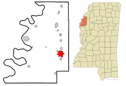
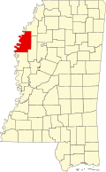
Cleveland, Mississippi

Last updated

Cleveland, Mississippi
ClevelandMSSign.jpg
Motto: 
A Different Kind of Delta
Bolivar County Mississippi Incorporated and Unincorporated areas Cleveland Highlighted.svg
Location of Cleveland, Mississippi
Usa edcp location map.svg
Red pog.svg
Cleveland, Mississippi
Location in the United States
Coordinates: 33°44′38″N90°43′29″W / 33.74389°N 90.72472°W / 33.74389; -90.72472 [1]
CountryUnited States
State Mississippi
County Bolivar
Area
[2]
  Total7.58 sq mi (19.63 km2)
  Land7.58 sq mi (19.63 km2)
  Water0.00 sq mi (0.00 km2)
Elevation
[1]
141 ft (43 m)
Population
 (2020)
  Total11,199
  Density1,478.03/sq mi (570.63/km2)
Time zone UTC−6 (Central (CST))
  Summer (DST) UTC−5 (CDT)
ZIP codes
38732-38733
Area code 662
FIPS code 28-14260
GNIS feature ID0668601
Website City Website

Cleveland is a city in Bolivar County, Mississippi, United States. The population was 11,199 as of the 2020 United States Census.

Contents

Cleveland has a large commercial economy, with numerous restaurants, stores, and services along U.S. 61. Cleveland is one of the two county seats of Bolivar County (the other being Rosedale) Cleveland is also home to Delta State University and The Grammy Museum Mississippi, the first Grammy Museum outside of Los Angeles.

History

Named after President Grover Cleveland, [ citation needed ] the town began formation in 1869 as people moved inland from the Mississippi River. The Louisville, New Orleans & Texas Railroad ran through the town and a portion of the railroad remains there today. Early records show the community was called Fontaine in 1884 and at some point Coleman's Station. Moses W. Coleman built the first home on the bayou in the area. In 1885, it was officially named Sims after Rueben T. Sims, who owned part of the land on which the town stood. The village of Cleveland was chartered on March 25, 1886, and the United States Post Office recognized the town as such on August 5, 1887. It was Sims's son, B.C. Sims, who was responsible for the name change to Cleveland.[ citation needed ]

The town grew steadily and by 1901 Cleveland was named the second county seat and a new courthouse was erected. Bolivar County is one of ten counties in Mississippi with two judicial districts. [3]

As more trees were cleared, more land was put into cultivation. In the early days, all of the planting and harvesting was done by hand. At the end of WWI, African Americans left Bolivar County in great numbers, but many stayed, becoming tenant farmers. There was an increasing demand for labor and Delta planters began to recruit overseas. Today, in addition to the first settlers of English, Scottish, German, Irish, and African descent, Bolivar County is its own “melting pot” of ethnicities. [4]

The African-American influence in Cleveland's history is quite evident. Nearby Dockery Plantation is designated with a Mississippi Blues Trail marker declaring the location as the probable “Birthplace of the Blues.” Many of the early Delta Bluesmen lived and worked around Dockery, influencing each other and educating the next generation. [5]

In the early 1920s, as the State Legislature considered a location for a new Normal college, Cleveland became the obvious choice due to its central Delta location, the railroad, and the donation of land. However, perhaps the most important factor in the equation was the City leaders’ willingness to relocate the infamous Black Bear Saloon that was located between the depot and the soon-to-be Delta Normal College, now Delta State University. In the early 1950s city leaders were able to attract Baxter Laboratories and Mississippi Power & Light’s Delta Steam Electric Station just north of town. The population of Cleveland basically doubled over the following decade. [6]

In 1967, Senators Robert F. Kennedy and Joseph S. Clark Jr. began Senate hearings to assess the effectiveness of the War on Poverty programs. The first field hearings were held in Jackson, Mississippi, and the following day Kennedy and Clark set out to visit "pockets of poverty" in the Mississippi Delta. They arrived in Cleveland, along with Marian Wright and Peter Edelman, for a tour conducted by Amzie Moore. There they observed barefoot, underfed African-American children in tattered clothing, with vacant expressions and distended bellies. Kennedy told Edelman that he thought he had seen the worst poverty in the nation in West Virginia, but it paled in comparison to the poverty he observed in Cleveland. [7]

Most recently, the City of Cleveland and Bolivar County, partnering with DSU, was able to see the realization of the Grammy Museum adjacent to Delta State’s campus. It is the most technologically advanced music museum in the world.

Cleveland is also home to the Railroad Heritage Museum, housing the largest O gauge model layout in the southeast, thousands of railroad artifacts, and a 1941 Illinois Central caboose, all paying tribute to Cleveland's railroad beginnings. The Mississippi Delta Chinese Heritage Museum is located on the third floor of the Delta State Archives & Museum. The Boo Ferriss Baseball Museum, located beside the DSU baseball stadium, honors the late Red Sox pitcher and Hall of Famer, Boo Ferriss, a Shaw, Miss. native and legendary coach at DSU. The Amzie Moore House is the actual home of the late Civil Rights leader, which has been preserved and converted into a museum, paying tribute to his efforts. The home has also been designated as a stop on the Freedom Trail. [6]

Geography and climate

Cleveland, Mississippi
Climate chart (explanation)
J
F
M
A
M
J
J
A
S
O
N
D
 
 
5.7
 
 
51
33
 
 
5.4
 
 
56
36
 
 
5.4
 
 
66
44
 
 
6
 
 
75
52
 
 
5.7
 
 
83
62
 
 
5.1
 
 
90
70
 
 
3.7
 
 
92
72
 
 
3.5
 
 
93
72
 
 
3.9
 
 
88
65
 
 
4.9
 
 
77
53
 
 
4.2
 
 
64
42
 
 
5.8
 
 
54
36
Average max. and min. temperatures in °F
Precipitation totals in inches
Metric conversion
J
F
M
A
M
J
J
A
S
O
N
D
 
 
145
 
 
11
1
 
 
137
 
 
13
2
 
 
137
 
 
19
7
 
 
152
 
 
24
11
 
 
145
 
 
28
17
 
 
130
 
 
32
21
 
 
94
 
 
33
22
 
 
89
 
 
34
22
 
 
99
 
 
31
18
 
 
124
 
 
25
12
 
 
107
 
 
18
6
 
 
147
 
 
12
2
Average max. and min. temperatures in °C
Precipitation totals in mm

Cleveland is located 19 mi (31 km) southeast of Rosedale and the Mississippi River along Mississippi Highway 8. U.S. Route 61 (N-S) and route 8 (E-W) are the main highways serving Cleveland. Jones Bayou and the old Illinois Central Railroad pass through the city from south to north. [8] [9]

According to the United States Census Bureau, the city has a total area of 7.58 square miles (19.6 km2), all land.

Climate data for Cleveland, Mississippi
MonthJanFebMarAprMayJunJulAugSepOctNovDecYear
Record high °F (°C)80
(27)
88
(31)
98
(37)
95
(35)
100
(38)
106
(41)
106
(41)
110
(43)
103
(39)
100
(38)
90
(32)
82
(28)
110
(43)
Mean daily maximum °F (°C)51.3
(10.7)
56.2
(13.4)
65.5
(18.6)
74.6
(23.7)
83.1
(28.4)
89.6
(32.0)
92.0
(33.3)
93.1
(33.9)
87.7
(30.9)
77.0
(25.0)
63.7
(17.6)
54.1
(12.3)
74.0
(23.3)
Mean daily minimum °F (°C)33.2
(0.7)
36.3
(2.4)
43.7
(6.5)
52.4
(11.3)
62.1
(16.7)
69.5
(20.8)
72.3
(22.4)
71.6
(22.0)
64.9
(18.3)
53.3
(11.8)
42.1
(5.6)
36.2
(2.3)
53.1
(11.7)
Record low °F (°C)−6
(−21)
−6
(−21)
17
(−8)
27
(−3)
38
(3)
46
(8)
54
(12)
51
(11)
25
(−4)
25
(−4)
13
(−11)
3
(−16)
−6
(−21)
Average precipitation inches (mm)5.68
(144)
5.35
(136)
5.41
(137)
6.01
(153)
5.69
(145)
5.06
(129)
3.65
(93)
3.52
(89)
3.94
(100)
4.92
(125)
4.24
(108)
5.82
(148)
59.29
(1,506)
Average snowfall inches (cm)0.6
(1.5)
0.8
(2.0)
0.5
(1.3)
0
(0)
0
(0)
0
(0)
0
(0)
0
(0)
0
(0)
0
(0)
0
(0)
0
(0)
1.9
(4.8)
Source: NOAA [10]

Demographics

Historical population
CensusPop.Note
1900 479
1910 1,001109.0%
1920 1,67467.2%
1930 3,24093.5%
1940 4,18929.3%
1950 6,74761.1%
1960 10,17250.8%
1970 13,32731.0%
1980 14,5249.0%
1990 15,3845.9%
2000 13,841−10.0%
2010 12,334−10.9%
2020 11,199−9.2%
U.S. Decennial Census [11]
Bologna Performing Arts Center in Cleveland, Mississippi Bologna Performing Arts Center.jpg
Bologna Performing Arts Center in Cleveland, Mississippi
Ellis Theater in Cleveland Ellis Theater - Cleveland, MS.jpg
Ellis Theater in Cleveland

2020 census

Cleveland Racial Composition [12]
RaceNum.Perc.
Black or African American 5,51949.28%
White 4,88743.64%
Native American 50.04%
Asian 1881.68%
Pacific Islander 70.02%
Other/Mixed 3162.82%
Hispanic or Latino 2842.54%

As of the 2020 United States Census, there were 11,199 people, 4,266 households, and 2,611 families residing in the city.

Arts and culture

Chrisman Street Mississippi Blues Trail Marker ChrismanStreetHMississippiBluesTrailMarker.jpg
Chrisman Street Mississippi Blues Trail Marker

Mississippi Blues Trail

Four Mississippi Blues Trail markers are located in Cleveland. The first marker recognizes Chrisman Street, which once served as the center of African-American business and social life in Cleveland. The second marker celebrates blues musician W. C. Handy. The third marker is located at the Grammy Museum Mississippi. The fourth marker recognizes Rev. C.L. Franklin, who preached at St. Peter's Rock M.B. Church here, influenced gospel, R&B and blues artists, and his daughters Aretha, Erma and Carolyn became noted soul singers after starting out singing in church. [13]

Education

Colleges and universities

Bolivar County residents have residency for two community colleges: Coahoma Community College and Mississippi Delta Community College. [14] [15] Their main campuses respectively are in unincorporated Coahoma County and Moorhead in Sunflower County.

Primary and secondary schools

The City of Cleveland is served by the Cleveland School District. Schools within the Cleveland city limits include:

Elementary schools

Other:

Private schools

Previously ethnic Chinese students were required to attend separate schools, something that persisted into the 1940s. [17] The Chinese Mission School educated them. This building was demolished in 2003. [18]

Media

Newspapers

Television

FM radio

Infrastructure

Police services

The city of Cleveland is served and protected by the Cleveland Police Department and is located on South Sharpe Avenue. Currently, 45 people are employed by the department. Of the 45, 39 are sworn police officers and six civilians serve in a support role. Sworn officers average out to one officer per 357 citizens. [19]

Fire services

The Cleveland Volunteer Fire Department is currently rated Class 4 by the State Rating Bureau and has three paid employees and 37 volunteer fire fighters. The paid employees include a Fire Inspector, Maintenance Engineer and Maintenance Assistant. All other positions are volunteer. The department operates from three separate fire stations, including a new station at the Cleveland Municipal Airport that opened in late 2011 and utilizes four front line pumpers, two rescue/utility vehicles, an aerial platform pumper, an airport/crash rescue truck, one Ford F-2500 with a bed mounted deluge gun, a Hazardous Materials Response Unit and one backup pumper for its daily operations. The department also operates a training facility that is home to a rope rescue tower, smoke house, ventilation simulator, confined space maze, drafting pit, and a Class A burn facility.

Health care

Bolivar Medical Center is a hospital in Cleveland with emergency services.

Notable people

Related Research Articles

<span class="mw-page-title-main">Coahoma County, Mississippi</span> County in Mississippi, United States

Coahoma County is a county located in the U.S. state of Mississippi. As of the 2020 census, the population was 21,390. Its county seat is Clarksdale.

<span class="mw-page-title-main">Bolivar County, Mississippi</span> County in Mississippi, United States

Bolivar County is a county located on the western border of the U.S. state of Mississippi. As of the 2020 census, the population was 30,985. Its county seats are Rosedale and Cleveland. The county is named in honor of Simón Bolívar, early 19th-century leader of the liberation of several South American territories from Spain.

<span class="mw-page-title-main">Boyle, Mississippi</span> Town in Mississippi, United States

Boyle is a town in Bolivar County, Mississippi, United States. The population was 650 at the 2010 census.

<span class="mw-page-title-main">Merigold, Mississippi</span> Town in Mississippi, United States

Merigold is a town in Bolivar County, Mississippi, United States. Per the 2020 census, the population was 379.

<span class="mw-page-title-main">Mound Bayou, Mississippi</span> City in Mississippi, United States

Mound Bayou is a city in Bolivar County, Mississippi, United States. The population was 1,533 at the 2010 census, down from 2,102 in 2000. It was founded as an independent black community in 1887 by former slaves led by Isaiah Montgomery. Mound Bayou Historic District is listed on the National Register of Historic Places.

<span class="mw-page-title-main">Rosedale, Mississippi</span> City in Mississippi, United States

Rosedale is a city in Bolivar County, Mississippi, United States. The population was 1,873 at the 2010 census, down from 2,414 in 2000. Located in an agricultural area, the city had a stop on the Yazoo and Mississippi Valley Railroad, which carried many migrants north out of the area in the first half of the 20th century.

<span class="mw-page-title-main">Winstonville, Mississippi</span> Town in Mississippi, United States

Winstonville is a town in Bolivar County, Mississippi, United States. Per the 2020 census, the population was 153.

<span class="mw-page-title-main">Clarksdale, Mississippi</span> City in Mississippi, United States

Clarksdale is a city in and the county seat of Coahoma County, Mississippi, United States. It is located along the Sunflower River. Clarksdale is named after John Clark, a settler who founded the city in the mid-19th century when he established a timber mill and business. Clarksdale is in the Mississippi Delta region and is an agricultural and trading center. Many African-American musicians developed the blues here, and took this original American music with them to Chicago and other northern cities during the Great Migration.

<span class="mw-page-title-main">Friars Point, Mississippi</span> Town in Mississippi, United States

Friars Point is a town in Coahoma County, Mississippi, United States. Per the 2020 census, the population was 896. Situated on the Mississippi River, Friars Point was once a busy port town, and remains the only place in Coahoma County with public access to the river's shore.

<span class="mw-page-title-main">Belzoni, Mississippi</span> City in Mississippi, United States

Belzoni is a city in Humphreys County, Mississippi, United States, in the Mississippi Delta region, on the Yazoo River. The population was 2,235 at the 2010 census. It is the county seat of Humphreys County. It was named for the 19th-century Italian archaeologist/explorer Giovanni Battista Belzoni.

<span class="mw-page-title-main">Glendora, Mississippi</span> Village in Mississippi, United States

Glendora is a village in Tallahatchie County, Mississippi. The population was 285 at the 2000 census.

<span class="mw-page-title-main">Tutwiler, Mississippi</span> Town in Mississippi, United States

Tutwiler is a town in Tallahatchie County, Mississippi, United States. The population at the 2010 census was 3,550.

<span class="mw-page-title-main">Minter City, Mississippi</span> Unincorporated community in Mississippi, United States

Minter City is an unincorporated community in Leflore County and Tallahatchie County, Mississippi. It is part of the Greenwood, Mississippi micropolitan area, and is within the Mississippi Delta.

<span class="mw-page-title-main">Philipp, Mississippi</span> Unincorporated community in Mississippi, United States

Philipp is an unincorporated community in southern Tallahatchie County, Mississippi, United States, along Mississippi Highway 8. Philipp is 6 miles (9.7 km) east of Minter City and 14 miles (23 km) west of Holcomb. Although Philipp is an unincorporated community, it has a post office with a ZIP code of 38950.

<span class="mw-page-title-main">Amzie Moore</span> American businessman

Amzie Moore was an African-American civil rights leader and entrepreneur in the Mississippi Delta. He helped pead voter registration efforts. His former home is a Mississippi Landmark. A historical marker commemorates its history. It is now a museum and interpretive center.

<span class="mw-page-title-main">Dublin, Mississippi</span> Census-designated place in Mississippi, United States

Dublin, also known as Hopson Bayou, is a census-designated place and unincorporated community located along U.S. Route 49 in southeastern Coahoma County, Mississippi, United States. Dublin is located on the Mississippi Delta Railroad. Dublin has a ZIP code of 38739. A post office first began operation under the name Dublin in 1875.

<span class="mw-page-title-main">Vance, Mississippi</span> Unincorporated community in Mississippi, United States

Vance is an unincorporated community in Quitman and Tallahatchie counties, Mississippi. Vance is located on Mississippi Highway 3 northeast of Tutwiler. Vance has a post office with ZIP code 38964.

<span class="mw-page-title-main">Tippo, Mississippi</span> Unincorporated community in Mississippi, United States

Tippo is an unincorporated community located in Tallahatchie County, Mississippi, United States, located approximately 10 miles (16 km) from Swan Lake; 11 miles (18 km) northeast of Glendora; and approximately 14 miles (23 km) from Charleston. Tippo is located at the intersection of Tippo and Sharkey roads.

<span class="mw-page-title-main">Scott, Mississippi</span> Census-designated place in Mississippi, United States

Scott is a census-designated place and unincorporated community located in Bolivar County, Mississippi, United States on Mississippi Highway 1. Scott is approximately 5 miles (8.0 km) north of Lamont and approximately 7 miles (11 km) south of Benoit.

References

  1. 1 2 "Cleveland". Geographic Names Information System . United States Geological Survey, United States Department of the Interior.
  2. "2020 U.S. Gazetteer Files". United States Census Bureau. Retrieved July 24, 2022.
  3. "Circuit Courts - State of Mississippi Judiciary". Courts.md.gov. Retrieved February 24, 2024.
  4. "Bolivar County, Mississippi Demographics - Income, Housing, Race, Business". Biggestuscities.com. Retrieved February 24, 2024.
  5. "Home". The Mississippi Blues Trail. Retrieved March 9, 2023.
  6. 1 2 "Welcome Guide | Cleveland-Bolivar County Chamber of Commerce". Clevelandmschamber.com. Retrieved February 24, 2024.
  7. Schmitt, Edward R. (2011). President of the Other America: Robert Kennedy and the Politics of Poverty. University of Massachusetts Press. pp. 178, 179. ISBN   9781558499041.
  8. Mississippi Atlas & Gazeteer, DeLorme, 4th ed., 2001, pp. 28-9 ISBN   0-89933-346-X
  9. Cleveland, MS, 7.5 Minute Topographic Quadrangle, USGS, 1966 (1984 rev.)
  10. "NOAA NCEI U.S. Climate Normals Quick Access". National Oceanic and Atmospheric Administration . Retrieved November 27, 2021.
  11. United States Census Bureau. "Census of Population and Housing" . Retrieved September 2, 2013.
  12. "Explore Census Data". data.census.gov. Retrieved December 7, 2021.
  13. "List of Blues Trail Markers". Mississippi Blues Commission. Archived from the original on December 31, 2013. Retrieved December 1, 2013.
  14. "Student Residency Archived August 4, 2017, at the Wayback Machine ." Coahoma Community College. Retrieved on July 8, 2017.
  15. "Message from the President Archived July 4, 2017, at the Wayback Machine ." Mississippi Delta Community College. Retrieved on July 8, 2017.
  16. 1 2 Home. Cleveland School District. Retrieved on July 2, 2017.
  17. Estrin, James (March 13, 2018). "Neither Black Nor White in the Mississippi Delta". The New York Times. Retrieved April 26, 2018. In the mid-1940s, there were separate classrooms for Chinese students in Cleveland, Miss.
  18. Thornell, John G. (2008). "A Culture in Decline: The Mississippi Delta Chinese". Southeast Review of Asian Studies. 30: 196–202.
  19. "Police Department". Cleveland, MS Chamber of Commerce. Archived from the original on September 27, 2007. Retrieved May 30, 2007.

Further reading