Waynesboro, Mississippi

Last updated

Waynesboro, Mississippi
Wayne County Mississippi Courthouse.jpg
Wayne County Courthouse in Waynesboro
Flag of Waynesboro, Mississippi.png
Seal of Waynesboro, Mississippi.png
Wayne County Mississippi Incorporated and Unincorporated areas Waynesboro Highlighted.svg
Location of Waynesboro, Mississippi
Usa edcp location map.svg
Red pog.svg
Waynesboro, Mississippi
Location in the United States
Coordinates: 31°40′26″N88°38′37″W / 31.67389°N 88.64361°W / 31.67389; -88.64361
Country United States
State Mississippi
County Wayne
Area
[1]
  Total12.70 sq mi (32.90 km2)
  Land12.69 sq mi (32.87 km2)
  Water0.01 sq mi (0.02 km2)
Elevation
190 ft (58 m)
Population
 (2020)
  Total4,567
  Density359.80/sq mi (138.92/km2)
Time zone UTC-6 (Central (CST))
  Summer (DST) UTC-5 (CDT)
ZIP code
39367
Area code 601
FIPS code 28-78360
GNIS feature ID0690942
Website http://waynesboroms.us/

Waynesboro is a city in Wayne County, Mississippi, United States. The population was 5,043 at the 2010 census. It is the county seat of Wayne County. [2]

Contents

History

In 1854, the Mobile and Ohio Railroad was built through Wayne County, and Waynesboro Station was built about five miles north of Winchester. Around Waynesboro Station, the railroad laid the future town of Waynesboro and sold property. [3]

In 1867, Waynesboro replaced Winchester as the county seat. [4]

The discovery of oil in Wayne County during the 1940s drove an economic and population boom. [3] In the 1940s, Waynesboro's population more than doubled, increasing from 1445 residents in 1940 to 3442 residents in 1950. [5]

Geography

Waynesboro is located at 31°40′26″N88°38′37″W / 31.67389°N 88.64361°W / 31.67389; -88.64361 (31.674026, -88.643553), [6] just east of the Chickasawhay River.

According to the United States Census Bureau, the city has a total area of 6.7 square miles (17 km2), of which 6.7 square miles (17 km2) is land and 0.15% is water.

Climate

Climate data for Waynesboro, Mississippi (1991–2020 normals, extremes 1892–1929, 1954–present)
MonthJanFebMarAprMayJunJulAugSepOctNovDecYear
Record high °F (°C)85
(29)
88
(31)
90
(32)
96
(36)
101
(38)
105
(41)
106
(41)
106
(41)
105
(41)
99
(37)
89
(32)
85
(29)
106
(41)
Mean daily maximum °F (°C)59.2
(15.1)
63.4
(17.4)
70.7
(21.5)
77.3
(25.2)
84.4
(29.1)
89.8
(32.1)
91.8
(33.2)
91.8
(33.2)
87.6
(30.9)
78.9
(26.1)
68.4
(20.2)
61.1
(16.2)
77.0
(25.0)
Daily mean °F (°C)47.7
(8.7)
51.1
(10.6)
58.0
(14.4)
64.6
(18.1)
72.3
(22.4)
79.0
(26.1)
81.3
(27.4)
81.0
(27.2)
76.3
(24.6)
65.8
(18.8)
55.2
(12.9)
49.5
(9.7)
65.1
(18.4)
Mean daily minimum °F (°C)36.1
(2.3)
38.8
(3.8)
45.3
(7.4)
52.0
(11.1)
60.2
(15.7)
68.2
(20.1)
70.8
(21.6)
70.3
(21.3)
65.0
(18.3)
52.8
(11.6)
42.1
(5.6)
37.9
(3.3)
53.3
(11.8)
Record low °F (°C)0
(−18)
−2
(−19)
14
(−10)
26
(−3)
35
(2)
42
(6)
52
(11)
51
(11)
32
(0)
24
(−4)
14
(−10)
5
(−15)
−2
(−19)
Average precipitation inches (mm)6.06
(154)
5.15
(131)
5.87
(149)
4.92
(125)
4.52
(115)
5.88
(149)
5.37
(136)
4.41
(112)
4.06
(103)
3.55
(90)
4.25
(108)
6.01
(153)
60.05
(1,525)
Average snowfall inches (cm)0.1
(0.25)
0.0
(0.0)
0.5
(1.3)
0.0
(0.0)
0.0
(0.0)
0.0
(0.0)
0.0
(0.0)
0.0
(0.0)
0.0
(0.0)
0.0
(0.0)
0.0
(0.0)
0.0
(0.0)
0.6
(1.5)
Average precipitation days (≥ 0.01 in)9.48.28.27.07.99.810.99.26.95.36.88.598.1
Average snowy days (≥ 0.1 in)0.00.00.00.00.00.00.00.00.00.00.00.10.1
Source: NOAA [7] [8]

Demographics

Historical population
CensusPop.Note
1880 156
1890 458193.6%
1900 436−4.8%
1910 65249.5%
1920 6895.7%
1930 1,12062.6%
1940 1,44529.0%
1950 3,442138.2%
1960 3,89213.1%
1970 4,36812.2%
1980 5,34922.5%
1990 5,143−3.9%
2000 5,1971.0%
2010 5,043−3.0%
2020 4,567−9.4%
U.S. Decennial Census [5]

2020 census

Waynesboro Racial Composition [9]
RaceNum.Perc.
White 1,36429.87%
Black or African American 2,88863.24%
Native American 30.07%
Asian 180.39%
Pacific Islander 10.02%
Other/Mixed 851.86%
Hispanic or Latino 2084.55%

As of the 2020 United States Census, there were 4,567 people, 1,786 households, and 1,219 families residing in the city.

2010 census

As of the 2010 United States Census, there were 5,043 people living in the city. 61.9% were African American, 35.2% White, 0.2% Native American, 0.3% Asian, 0.1% Pacific Islander, 1.4% from some other race and 1.0% of two or more races. 1.9% were Hispanic or Latino of any race.

2000 census

As of the census [10] of 2000, there were 5,197 people, 1,982 households, and 1,335 families living in the city. The population density was 781.6 inhabitants per square mile (301.8/km2). There were 2,276 housing units at an average density of 342.3 per square mile (132.2/km2). The racial makeup of the city was 41.54% White, 57.28% African American, 0.21% Native American, 0.37% Asian, 0.25% from other races, and 0.35% from two or more races. Hispanic or Latino of any race were 0.94% of the population.

There were 1,982 households, out of which 36.3% had children under the age of 18 living with them, 36.5% were married couples living together, 26.8% had a female householder with no husband present, and 32.6% were non-families. 29.6% of all households were made up of individuals, and 12.1% had someone living alone who was 65 years of age or older. The average household size was 2.53 and the average family size was 3.12.

In the city, the population was spread out, with 29.5% under the age of 18, 10.9% from 18 to 24, 25.5% from 25 to 44, 20.1% from 45 to 64, and 14.0% who were 65 years of age or older. The median age was 33 years. For every 100 females, there were 82.5 males. For every 100 females age 18 and over, there were 73.3 males.

The median income for a household in the city was $22,357, and the median income for a family was $27,754. Males had a median income of $29,602 versus $16,887 for females. The per capita income for the city was $12,946. About 31.1% of families and 32.7% of the population were below the poverty line, including 43.1% of those under age 18 and 17.4% of those age 65 or over.

Education

The city is served by the Wayne County School District. The city's high school level education is provided by Wayne County High School (public) and Wayne Academy (private).

Notable people

Related Research Articles

<span class="mw-page-title-main">Wayne County, Tennessee</span> County in Tennessee, United States

Wayne County is a county located in south central Tennessee, along the Alabama border. As of the 2020 census, the population was 16,232. Its county seat is Waynesboro. The county is named after General "Mad Anthony" Wayne, a prominent military leader in the American Revolutionary War.

<span class="mw-page-title-main">Perry County, Ohio</span> County in Ohio, United States

Perry County is a county located in the U.S. state of Ohio. As of the 2020 census, the population was 35,408. Its county seat is New Lexington. It was established on March 1, 1818, from parts of Fairfield, Washington and Muskingum counties. The county is named for Oliver Hazard Perry, a hero of the War of 1812. Perry County is included in the Columbus, OH Metropolitan Statistical Area. One of the poorest counties in the state, this is where the lawsuit challenging Ohio's school funding system, DeRolph v. State, began.

<span class="mw-page-title-main">Sharkey County, Mississippi</span> County in Mississippi, United States

Sharkey County is a county located in the U.S. state of Mississippi. Part of the eastern border is formed by the Yazoo River. According to the 2020 census, the population was 3,800, making it the second-least populous county in Mississippi, after Issaquena County. Its county seat is Rolling Fork. The county is named after William L. Sharkey, the provisional Governor of Mississippi in 1865.

<span class="mw-page-title-main">Prentiss County, Mississippi</span> County in Mississippi, United States

Prentiss County is a county located in the U.S. state of Mississippi. As of the 2020 census, the population was 25,008. Its county seat is Booneville. The county is named for Seargent Smith Prentiss, a noted speaker and US Congressman from Natchez.

<span class="mw-page-title-main">Alcorn County, Mississippi</span> County in Mississippi, United States

Alcorn County is a county located in the northeastern portion of the U.S. state of Mississippi. As of the 2020 census, the population was 34,740. Its county seat is Corinth. The county is named in honor of Governor James L. Alcorn.

<span class="mw-page-title-main">Wayne County, Illinois</span> County in Illinois, United States

Wayne County is a county located in the U.S. state of Illinois. According to the 2020 census, it had a population of 16,179. Its county seat is Fairfield. It is located in the southern portion of Illinois known locally as "Little Egypt".

<span class="mw-page-title-main">Burke County, Georgia</span> County in Georgia, United States

Burke County is a county located along the eastern border of the U.S. state of Georgia in the Piedmont. As of the 2020 census, the population was 24,596. The county seat is Waynesboro. Burke County is part of the Augusta-Richmond County, GA-SC metropolitan statistical area.

<span class="mw-page-title-main">Thawville, Illinois</span> Village in Illinois, United States

Thawville is a village in Ridgeland Township, Iroquois County, Illinois, United States. The population was 241 at the 2010 census. The town is 100 miles (160 km) south of Chicago.

<span class="mw-page-title-main">Venice, Illinois</span> City in Illinois, United States

Venice is a city in Madison County, Illinois, United States. The population was 1,498 at the 2020 census, down from 1,890 in 2010.

<span class="mw-page-title-main">Fulton, Mississippi</span> City in Mississippi, United States

Fulton is a city in and the county seat of Itawamba County, Mississippi, United States. The population was 4,542 at the 2020 census.

<span class="mw-page-title-main">Laddonia, Missouri</span> City in Missouri, United States

Laddonia is a city in Audrain County, Missouri, United States. The population was 513 at the 2010 census.

<span class="mw-page-title-main">Imperial, Nebraska</span> City in Nebraska, United States

Imperial is a city in Chase County, Nebraska, United States. The population was 2,071 at the 2010 census. It is the county seat of Chase County.

Wayne Heights is a census-designated place (CDP) in Franklin County, Pennsylvania, United States. The population was 2,606 at the 2020 census.

<span class="mw-page-title-main">Waynesboro, Pennsylvania</span> Borough in Pennsylvania, United States

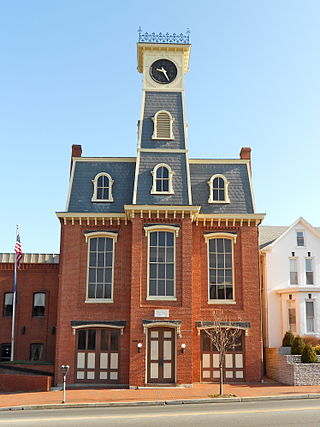
Waynesboro is a borough in Franklin County, Pennsylvania, United States. Located on the southern border of the state, Waynesboro is in the Cumberland Valley between Hagerstown, Maryland, and Chambersburg, Pennsylvania. It is part of Chambersburg, PA Micropolitan Statistical Area, which is part of the Washington–Baltimore metropolitan area. It is two miles north of the Mason–Dixon line and close to Camp David and the Raven Rock Mountain Complex.

<span class="mw-page-title-main">Savannah, Tennessee</span> City in Tennessee, United States

Savannah is a city in and the county seat of Hardin County, Tennessee, United States. The population was 7,213 at the 2020 census. Savannah is located along the east side of the Tennessee River.

<span class="mw-page-title-main">Waynesboro, Tennessee</span> City in Tennessee, United States

Waynesboro is a city in and the county seat of Wayne County, Tennessee, United States. The population was 2,449 at the 2010 census, up from 2,228 in 2000.

<span class="mw-page-title-main">Laona, Wisconsin</span> Town in Wisconsin, United States

Laona is a town in Forest County, Wisconsin, United States. The population was 1,212 at the 2010 census. The census-designated place of Laona is located in the town. The unincorporated community of Blackwell Junction is also located partially in the town.

Dark River is an unorganized territory in Saint Louis County, Minnesota, United States, located north of Chisholm and Balkan Township. The population was 68 at the 2000 census.

<span class="mw-page-title-main">State Line, Mississippi</span> Town in Mississippi, United States

State Line is a town in Greene and Wayne counties, Mississippi, in the United States. The population was 452 at the 2020 census.

<span class="mw-page-title-main">Washburn, Wisconsin</span> City in Wisconsin, United States

Washburn is a city in Bayfield County, in the U.S. state of Wisconsin. The population was 2,051 at the 2020 census. The city is just east of and adjacent to the Town of Washburn. It is in northern Wisconsin, on the shore of Lake Superior's Chequamegon Bay.

References

  1. "2020 U.S. Gazetteer Files". United States Census Bureau. Retrieved July 24, 2022.
  2. "Find a County". National Association of Counties. Retrieved June 7, 2011.
  3. 1 2 "Waynesboro History". Wayne County Economic Development District. Archived from the original on November 5, 2023. Retrieved November 5, 2023.
  4. Rowland, Dunbar (1907). Mississippi: Comprising Sketches of Counties, Towns, Events, Institutions, and Persons, Arranged in Cyclopedic Form. Vol. 2. Southern Historical Publishing Association.
  5. 1 2 "Census of Population and Housing". Census.gov. Retrieved June 4, 2015.
  6. "US Gazetteer files: 2010, 2000, and 1990". United States Census Bureau. February 12, 2011. Retrieved April 23, 2011.
  7. "NOWData - NOAA Online Weather Data". National Oceanic and Atmospheric Administration. Retrieved November 4, 2023.
  8. "Summary of Monthly Normals 1991-2020". National Oceanic and Atmospheric Administration. Retrieved November 4, 2023.
  9. "Explore Census Data". data.census.gov. Retrieved December 7, 2021.
  10. "U.S. Census website". United States Census Bureau . Retrieved January 31, 2008.