Wayne County, Mississippi

Last updated

Wayne County
Wayne County Mississippi Courthouse.jpg
Wayne County courthouse in Waynesboro
Map of Mississippi highlighting Wayne County.svg
Location within the U.S. state of Mississippi
Mississippi in United States.svg
Mississippi's location within the U.S.
Coordinates: 31°38′N88°42′W / 31.64°N 88.7°W / 31.64; -88.7
CountryFlag of the United States.svg United States
StateFlag of Mississippi.svg  Mississippi
Founded1809
Named for Anthony Wayne
Seat Waynesboro
Largest cityWaynesboro
Area
  Total814 sq mi (2,110 km2)
  Land811 sq mi (2,100 km2)
  Water2.8 sq mi (7 km2)  0.3%
Population
 (2020)
  Total19,779
  Density24/sq mi (9.4/km2)
Time zone UTC−6 (Central)
  Summer (DST) UTC−5 (CDT)
Congressional district 4th
Website www.waynecounty.ms

Wayne County is a county located in the U.S. state of Mississippi. As of the 2020 census, the population was 19,779. [1] Its county seat is Waynesboro. [2] The county is named for General Anthony Wayne.

Contents

Geography

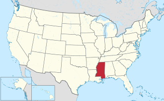
According to the U.S. Census Bureau, the county has a total area of 814 square miles (2,110 km2), of which 811 square miles (2,100 km2) is land and 2.8 square miles (7.3 km2) (0.3%) is water. [3] It is the fifth-largest county in Mississippi by land area.

Major highways

Adjacent counties

National protected area

Demographics

Historical population
CensusPop.Note
1810 1,253
1820 3,323165.2%
1830 2,781−16.3%
1840 2,120−23.8%
1850 2,89236.4%
1860 3,69127.6%
1870 4,20614.0%
1880 8,741107.8%
1890 9,81712.3%
1900 12,53927.7%
1910 14,70917.3%
1920 15,4675.2%
1930 15,295−1.1%
1940 16,92810.7%
1950 17,0100.5%
1960 16,258−4.4%
1970 16,6502.4%
1980 19,13514.9%
1990 19,5172.0%
2000 21,2168.7%
2010 20,747−2.2%
2020 19,779−4.7%
U.S. Decennial Census [4]
1790–1960 [5] 1900–1990 [6]
1990–2000 [7] 2010–2013 [8]
Wayne County by race as of 2020 [9]
RaceNum.Perc.
White 11,31357.2%
Black or African American 7,70838.97%
Native American 310.16%
Asian 350.18%
Pacific Islander 20.01%
Other/Mixed 3471.75%
Hispanic or Latino 3431.73%

As of the 2020 United States Census, there were 19,779 people, 7,683 households, and 5,390 families residing in the county.

Communities

Cities

Towns

Census-designated places

Unincorporated communities

Ghost towns

Politics

United States presidential election results for Wayne County, Mississippi [10]
Year Republican Democratic Third party
No.%No.%No.%
2020 6,30762.72%3,62436.04%1251.24%
2016 5,99062.40%3,52436.71%850.89%
2012 6,11159.15%4,14840.15%730.71%
2008 6,07060.57%3,89038.81%620.62%
2004 5,56263.24%3,19336.30%400.45%
2000 4,63560.16%2,98138.69%891.16%
1996 3,21949.60%2,65240.86%6199.54%
1992 3,87449.78%3,06439.37%84510.86%
1988 4,49660.64%2,88938.97%290.39%
1984 5,00063.81%2,81835.96%180.23%
1980 3,84452.07%3,49447.32%450.61%
1976 3,02247.06%3,30651.48%941.46%
1972 4,64882.08%97517.22%400.71%
1968 2474.87%73914.56%4,08980.57%
1964 3,53992.77%2767.23%00.00%
1960 49021.94%70731.66%1,03646.39%
1956 37317.52%1,49370.13%26312.35%
1952 71730.89%1,60469.11%00.00%
1948 40.29%1379.96%1,23589.75%
1944 352.47%1,38097.53%00.00%
1940 221.56%1,38898.44%00.00%
1936 443.12%1,36796.81%10.07%
1932 232.19%1,02397.43%40.38%
1928 28923.96%91776.04%00.00%
1924 565.83%90594.17%00.00%
1920 11215.84%54777.37%486.79%
1916 475.41%78790.67%343.92%
1912 152.29%56986.87%7110.84%

See also

Related Research Articles

<span class="mw-page-title-main">Clay County, Mississippi</span> County in Mississippi, United States

Clay County is a county in the U.S. state of Mississippi. As of the 2020 census, the population was 18,636. Its county seat is West Point. Its name is in honor of American statesman Henry Clay, member of the United States Senate from Kentucky and United States Secretary of State in the 19th century. J. Wesley Caradine, an African American, was the first state representative for Clay County after it was established in 1871.

<span class="mw-page-title-main">Wayne County, Tennessee</span> County in Tennessee, United States

Wayne County is a county located in south central Tennessee, along the Alabama border. As of the 2020 census, the population was 16,232. Its county seat is Waynesboro. The county is named after General "Mad Anthony" Wayne, a prominent military leader in the American Revolutionary War.

<span class="mw-page-title-main">Tishomingo County, Mississippi</span> County in Mississippi, United States

Tishomingo County is a county located in the northeastern corner of the U.S. state of Mississippi. As of the 2020 census, the population was 18,850. Its county seat is Iuka.

<span class="mw-page-title-main">Tippah County, Mississippi</span> County in Mississippi, United States

Tippah County is a county located on the northern border of the U.S. state of Mississippi. As of the 2020 census, the population was 21,815. Its county seat is Ripley. The name "Tippah" is derived from a Chickasaw language word meaning "cut off." It was taken from the creek of the same name that flows across much of the original county from northeast to southwest before emptying into the Tallahatchie River. The creek probably was so named because it, and the ridges on either side, "cut off" the western part of the region from the eastern portion.

<span class="mw-page-title-main">Tate County, Mississippi</span> County in Mississippi, United States

Tate County is a county located in the northwestern portion of the U.S. state of Mississippi. As of the 2020 census, the population was 28,064. Its county seat is Senatobia. Organized in 1873 during the Reconstruction era, from portions of DeSoto, Marshall, and Tunica counties, the county is named for Thomas Simpson Tate, one of the first prominent American settlers of the area.

<span class="mw-page-title-main">Sharkey County, Mississippi</span> County in Mississippi, United States

Sharkey County is a county located in the U.S. state of Mississippi. Part of the eastern border is formed by the Yazoo River. According to the 2020 census, the population was 3,800, making it the second-least populous county in Mississippi, after Issaquena County. Its county seat is Rolling Fork. The county is named after William L. Sharkey, the provisional Governor of Mississippi in 1865.

<span class="mw-page-title-main">Prentiss County, Mississippi</span> County in Mississippi, United States

Prentiss County is a county located in the U.S. state of Mississippi. As of the 2020 census, the population was 25,008. Its county seat is Booneville. The county is named for Seargent Smith Prentiss, a noted speaker and US Congressman from Natchez.

<span class="mw-page-title-main">Perry County, Mississippi</span> County in Mississippi, United States

Perry County is a county located in the U.S. state of Mississippi. As of the 2020 census, the population was 11,511. The county seat is New Augusta. The county is named after the War of 1812 naval hero, Oliver Hazard Perry.

<span class="mw-page-title-main">Noxubee County, Mississippi</span> County in Mississippi, United States

Noxubee County is a county located in the U.S. state of Mississippi. As of the 2020 census, its population was 10,285. Its county seat is Macon. The name is derived from the Choctaw word nakshobi meaning "to stink".

<span class="mw-page-title-main">Monroe County, Mississippi</span> County in Mississippi, United States

Monroe County is a county on the northeast border of the U.S. state of Mississippi next to Alabama. As of the 2020 census, the population was 34,180. Its county seat is Aberdeen.

<span class="mw-page-title-main">Lowndes County, Mississippi</span> County in Mississippi, United States

Lowndes County is a county on the eastern border of the U.S. state of Mississippi. As of the 2020 United States Census, the population was 58,879. Its county seat is Columbus. The county is named for U.S. Congressman William Jones Lowndes.

<span class="mw-page-title-main">Lauderdale County, Mississippi</span> County in Mississippi, United States

Lauderdale County is a county located on the eastern border of the U.S. state of Mississippi. As of the 2020 census, the population was 72,984. The county seat is Meridian. The county is named for Colonel James Lauderdale, who was killed at the Battle of New Orleans in the War of 1812. Lauderdale County is included in the Meridian, MS Micropolitan Statistical Area.

<span class="mw-page-title-main">Jackson County, Mississippi</span> County in Mississippi, United States

Jackson County is a county located in the U.S. state of Mississippi. As of the 2020 census, the population was 143,252, making it the fifth-most populous county in Mississippi. Its county seat is Pascagoula. The county was named for Andrew Jackson, general in the United States Army and afterward President of the United States.

<span class="mw-page-title-main">Itawamba County, Mississippi</span> County in Mississippi, United States

Itawamba County is a county located in the U.S. state of Mississippi. As of the 2020 United States Census, the population was 23,863. Its county seat is Fulton. The county is part of the Tupelo, MS Micropolitan Statistical Area.

<span class="mw-page-title-main">Greene County, Mississippi</span> County in Mississippi, United States

Greene County is a county located on the southeast border of the U.S. state of Mississippi. As of the 2020 census, the population was 13,530. Its county seat is Leakesville. Established in 1811, the county was named for General Nathanael Greene of the American Revolutionary War.

<span class="mw-page-title-main">George County, Mississippi</span> County in Mississippi, United States

George County is a county located in the U.S. state of Mississippi. As of the 2020 census, the population was 24,350. Its county seat is Lucedale. The county is named for James Z. George, US Senator from Mississippi.

<span class="mw-page-title-main">Forrest County, Mississippi</span> County in Mississippi, United States

Forrest County is located in the U.S. state of Mississippi. As of the 2020 census, the population was 78,158. Its county seat and largest city is Hattiesburg. The county was created from Perry County in 1908 and named in honor of Nathan Bedford Forrest, a Confederate general in the American Civil War and the first Grand Wizard of the Ku Klux Klan. Forrest County is part of the Hattiesburg, MS Metropolitan Statistical Area.

<span class="mw-page-title-main">Clarke County, Mississippi</span> County in Mississippi, United States

Clarke County is a county located in the U.S. state of Mississippi. As of the 2020 census, the population was 15,615. Its county seat is Quitman. Clarke County is named for Joshua G. Clarke, the first Mississippi state chancellor and judge.

<span class="mw-page-title-main">Alcorn County, Mississippi</span> County in Mississippi, United States

Alcorn County is a county located in the northeastern portion of the U.S. state of Mississippi. As of the 2020 census, the population was 34,740. Its county seat is Corinth. The county is named in honor of Governor James L. Alcorn.

<span class="mw-page-title-main">State Line, Mississippi</span> Town in Mississippi, United States

State Line is a town in Greene and Wayne counties, Mississippi, in the United States. The population was 452 at the 2020 census.

References

  1. "Census - Geography Profile: Wayne County, Mississippi". United States Census Bureau . Retrieved January 15, 2023.
  2. "Find a County". National Association of Counties. Retrieved June 7, 2011.
  3. "2010 Census Gazetteer Files". United States Census Bureau. August 22, 2012. Archived from the original on September 28, 2013. Retrieved November 8, 2014.
  4. "U.S. Decennial Census". United States Census Bureau. Retrieved November 8, 2014.
  5. "Historical Census Browser". University of Virginia Library. Retrieved November 8, 2014.
  6. "Population of Counties by Decennial Census: 1900 to 1990". United States Census Bureau. Retrieved November 8, 2014.
  7. "Census 2000 PHC-T-4. Ranking Tables for Counties: 1990 and 2000" (PDF). United States Census Bureau. Archived (PDF) from the original on March 27, 2010. Retrieved November 8, 2014.
  8. "State & County QuickFacts". United States Census Bureau. Retrieved September 7, 2013.
  9. "Explore Census Data". data.census.gov. Retrieved December 8, 2021.
  10. Leip, David. "Dave Leip's Atlas of U.S. Presidential Elections". uselectionatlas.org. Retrieved March 3, 2018.

31°38′N88°42′W / 31.64°N 88.70°W / 31.64; -88.70