Itta Bena, Mississippi

Last updated

Itta Bena, Mississippi
Itta Bena Home In The Woods Sign.jpg
Home in the Woods
Leflore County Mississippi Incorporated and Unincorporated areas Itta Bena Highlighted.svg
Location of Itta Bena, Mississippi
Usa edcp location map.svg
Red pog.svg
Itta Bena, Mississippi
Location in the United States
Coordinates: 33°29′45″N90°19′20″W / 33.49583°N 90.32222°W / 33.49583; -90.32222
CountryFlag of the United States (23px).png  United States
State Flag of Mississippi.svg  Mississippi
County Leflore
Government
   Mayor Reginald Freeman
Area
[1]
  Total1.46 sq mi (3.77 km2)
  Land1.41 sq mi (3.65 km2)
  Water0.04 sq mi (0.12 km2)
Elevation
131 ft (40 m)
Population
 (2020)
  Total1,679
  Density1,189.94/sq mi (459.48/km2)
Time zone UTC−6 (Central (CST))
  Summer (DST) UTC−5 (CDT)
ZIP code
38941
Area code 662
FIPS code 28-35260
GNIS feature ID0671749
Website ittabenams.homestead.com

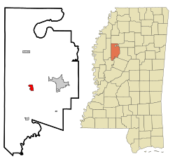
Itta Bena is a city in Leflore County, Mississippi, United States. The population was 2,049 at the 2010 census. The town's name is derived from the Choctaw phrase iti bina, meaning "forest camp". [2] Itta Bena is part of the Greenwood, Mississippi micropolitan area. It developed as a trading center of an area of cotton plantations.

Contents

History

Early history

Roebuck Lake in Itta Bena Roebuck Lake.jpg
Roebuck Lake in Itta Bena

The indigenous Choctaw Indians occupied the Delta region for hundreds of years prior to the arrival of European settlers, with ancestors stretching thousands of years into the past. The first removal treaty carried out under the Indian Removal Act was the 1830 Treaty of Dancing Rabbit Creek, by which the Choctaw ceded about 11 million acres of the Choctaw Nation (now Mississippi) to the United States in exchange for about 15 million acres in Indian Territory (now Oklahoma).

Benjamin Grubb Humphreys, a state senator from Claiborne County, Mississippi, is credited with the founding of Itta Bena. Following several crop failures in the 1850s at his home in Claiborne County, Humphreys took a trip by river steamer up into the Yazoo wilderness to look for a new farming opportunity in the former Choctaw area. [3]

He found such an opportunity on Roebuck Lake, a stretch of old channel that the river had discarded a few miles west of Greenwood, in what was then Sunflower County. Bringing a group of slaves up from his plantations during the winter, when boats could use high water to pass from the Yazoo into Roebuck, he directed them in clearing timber and brush from the overgrown bottomland to develop agricultural fields for cultivation of cotton. Longtime Claiborne County friends became interested in his project, and others began to acquire land in the area two years later. [3]

Humphreys had established a permanent winter residence, "Lucknow", in Claiborne County. He did not bring his family to his Itta Bena plantation until slaves had completed construction of a substantial home in 1857, which he christened as Itta Bena, the Choctaw words for "camp in the woods". It was built from lumber from the land of the plantation, logs which were plastered and painted. The earliest substantial home built in the frontier Yazoo country, it was the center of the plantation’s many hundred acres. The main portion of the original Humphreys home was still used as a residence in 1954 (thought to be the home of Dr. B. B. Harper on Lakeshore Street). [3] Following the Civil War, Humphreys was elected as governor of Mississippi.

As other settlers moved into the area, the village that grew up around the plantation was also called Itta Bena. Planters used the Yazoo River to ship cotton downriver, ultimately to New Orleans for transport to markets in the United States and Great Britain. Cotton continued as the commodity crop and the source of local wealth after the American Civil War.

WW I parade float Itta Bena MS WWI parade Love and Service for Our Boys float.jpg
WW I parade float

Construction of the Columbus and Greenville Railway, begun in 1888 and serving the village, stimulated trade and growth. Among the first to build stores were J. B. Humphreys, P. Cohen, and Uriah Ray. The first store was operated by H. M. Weber and a man named Long. The town’s first school, a one-room building only for white students, was built in 1888 and Emma Cross served as the first teacher. [4]

20th century to present

Development of the growing city continued in the early 20th century. The first high school was erected in 1905, across from the present-day First Baptist Church. The post office in Itta Bena was opened in 1918. The white minority dominated politics and the economy, as the state legislature essentially disenfranchised blacks by the constitution of 1890. Working as sharecroppers and tenant farmers, they had difficulty getting ahead in the agricultural economy. During the 20th century, many left the county for work in industrial cities of the north and midwest, in the Great Migration.

On a march in 1966 between Itta Bena and nearby Greenwood, coordinated by the SNCC but led by Martin Luther King Jr., Stokely Carmichael coined the rallying phrase "Black power!". Byron De La Beckwith, widely known at that time as the murderer of Medgar Evers (although he had been acquitted of charges), drove his truck by the marchers three times while the local police looked on. [5]

The city reached its peak of population in 1980. Population has declined since then, reflecting limited opportunities in the rural region. The population has decreased more markedly in the county outside the city, as agricultural jobs have been reduced.

Geography

According to the United States Census Bureau, the city has a total area of 1.5 square miles (3.9 km2), of which 1.4 square miles (3.6 km2) is land and 0.04 square miles (0.10 km2) (2.72%) is water.

Demographics

Historical population
CensusPop.Note
1900 416
1910 1,427243.0%
1920 1,62013.5%
1930 1,370−15.4%
1940 1,79531.0%
1950 1,725−3.9%
1960 1,91411.0%
1970 2,48930.0%
1980 2,90416.7%
1990 2,377−18.1%
2000 2,208−7.1%
2010 2,049−7.2%
2020 1,679−18.1%
U.S. Decennial Census [6]

2020 census

Itta Bena racial composition [7]
RaceNum.Perc.
White (non-Hispanic)804.76%
Black or African American (non-Hispanic)1,55092.32%
Other/Mixed 241.43%
Hispanic or Latino 251.49%

As of the 2020 United States census, there were 1,679 people, 605 households, and 392 families residing in the city.

2010 census

As of the 2010 United States Census, there were 2,049 people living in the city. The racial makeup of the city was 89.2% Black, 10.1% White, <0.1% Native American and 0.1% from two or more races. 0.5% were Hispanic or Latino of any race.

2000 census

As of the census [8] of 2000, there were 2,208 people, 763 households, and 559 families living in the city. The population density was 1,541.5 inhabitants per square mile (595.2/km2). There were 797 housing units at an average density of 556.4 per square mile (214.8/km2). The racial makeup of the city was 81.34% African American, 18.16% White, 0.23% Asian, and 0.27% from two or more races. Hispanic or Latino of any race were 1.54% of the population.

There were 763 households, of which 38.9% had children under the age of 18 living with them, 32.6% were married couples living together, 35.4% had a female householder with no husband present, and 26.7% were non-families. 24.0% of all households were made up of individuals, and 12.8% had someone living alone who was 65 years of age or older. The average household size was 2.89 and the average family size was 3.43.

In the city, the population was spread out, with 33.3% under the age of 18, 11.7% from 18 to 24, 25.6% from 25 to 44, 18.3% from 45 to 64, and 11.1% who were 65 years of age or older. The median age was 29 years. For every 100 females, there were 82.2 males. For every 100 females age 18 and over, there were 71.4 males.

The median income for a household in the city was $20,968, and the median income for a family was $24,271. Males had a median income of $21,917 versus $16,136 for females. The per capita income for the city was $11,132. About 29.5% of families and 34.5% of the population were below the poverty line, including 43.1% of those under age 18 and 33.1% of those age 65 or over.

Education

Mississippi Valley State University is located 1 mile (1.6 km) northwest of Itta Bena in unincorporated Leflore County. [9] It was the state of Mississippi's black vocational college before educational segregation ended. [10] Jerry Rice, widely considered one of the greatest American football receivers of all time, spent his college days playing for the university's team. The university's Delta Devils play at Itta Bena's 10,000-seat Rice–Totten Stadium.

The City of Itta Bena is served by the Greenwood-Leflore Consolidated School District. Public schools in Itta Bena include Leflore County Elementary School and Leflore County High School. It was previously in the Leflore County School District. [11] Effective July 1, 2019 this district consolidated into the Greenwood-Leflore School District. [12]

Notable people

Related Research Articles

<span class="mw-page-title-main">Yazoo County, Mississippi</span> County in Mississippi, United States

Yazoo County is a county located in the U.S. state of Mississippi. As of the 2020 census, the population was 26,743. The county seat is Yazoo City. It is named for the Yazoo River, which forms its western border. Its name is said to come from a Choctaw language word meaning "River of Death".

<span class="mw-page-title-main">Washington County, Mississippi</span> County in Mississippi, United States

Washington County is a county located in the U.S. state of Mississippi. As of the 2020 census, the population was 44,922. Its county seat is Greenville. The county is named in honor of the first president of the United States, George Washington. It is located to the Arkansas border.

<span class="mw-page-title-main">Warren County, Mississippi</span> County in Mississippi, United States

Warren County is a county located in the U.S. state of Mississippi. Its western border is formed by the Mississippi River. As of the 2020 census, the population was 44,722. Its county seat is Vicksburg. Established by legislative act of December 22, 1809, Warren County is named for American Revolutionary War officer Joseph Warren.

<span class="mw-page-title-main">Tallahatchie County, Mississippi</span> County in Mississippi, United States

Tallahatchie County is a county in the U.S. state of Mississippi. At the 2020 census, the population was 12,715. Its county seats are Charleston and Sumner.

<span class="mw-page-title-main">Leflore County, Mississippi</span> County in Mississippi, United States

Leflore County is a county located in the U.S. state of Mississippi. As of the 2020 census, the population was 28,339. The county seat is Greenwood. The county is named for Choctaw leader Greenwood LeFlore, who signed a treaty to cede his people's land to the United States in exchange for land in Indian Territory. LeFlore stayed in Mississippi, settling on land reserved for him in Tallahatchie County.

<span class="mw-page-title-main">Humphreys County, Mississippi</span> County in Mississippi, United States

Humphreys County is a county located in the U.S. state of Mississippi. As of the 2020 census, the population was 7,785. Its county seat is Belzoni. The county is named for Benjamin G. Humphreys. Humphreys County is Mississippi's newest county, having been formed in 1918. Humphreys County is located in the Mississippi Delta region.

<span class="mw-page-title-main">Carroll County, Mississippi</span> County in Mississippi, United States

Carroll County is a county in the U.S. state of Mississippi. As of the 2020 census, the population was 9,998. Its county seats are Carrollton and Vaiden. The county is named for Charles Carroll of Carrollton, the last surviving signatory of the Declaration of Independence.

<span class="mw-page-title-main">Rosedale, Mississippi</span> City in Mississippi, United States

Rosedale is a city in Bolivar County, Mississippi, United States. The population was 1,873 at the 2010 census, down from 2,414 in 2000. Located in an agricultural area, the city had a stop on the Yazoo and Mississippi Valley Railroad, which carried many migrants north out of the area in the first half of the 20th century.

<span class="mw-page-title-main">Port Gibson, Mississippi</span> City in Mississippi, United States

Port Gibson is a city in Claiborne County, Mississippi, United States. The population was 1,567 at the 2010 census. Port Gibson is the county seat of Claiborne County, which is bordered on the west by the Mississippi River. It is the site of the Claiborne County Courthouse.

<span class="mw-page-title-main">Belzoni, Mississippi</span> City in Mississippi, United States

Belzoni is a city in Humphreys County, Mississippi, United States, in the Mississippi Delta region, on the Yazoo River. The population was 2,235 at the 2010 census. It is the county seat of Humphreys County. It was named for the 19th-century Italian archaeologist/explorer Giovanni Battista Belzoni.

<span class="mw-page-title-main">Silver City, Mississippi</span> Town in Mississippi, United States

Silver City is a town in Humphreys County, Mississippi, United States. The population was 217 at the 2021 census, a massive decline from the 2000 census.

<span class="mw-page-title-main">Morgan City, Mississippi</span> Town in Mississippi, United States

Morgan City, Mississippi is a town in Leflore County along Mississippi Highway 7. The population was 255 at the 2010 census, down from 305 at the 2000 census. It is part of the Greenwood, Mississippi micropolitan area.

<span class="mw-page-title-main">Schlater, Mississippi</span> Town in Mississippi, United States

Schlater is a town in Leflore County, Mississippi, United States. The population was 310 at the 2010 census, down from 388 at the 2000 census. It is part of the Greenwood, Mississippi micropolitan area.

<span class="mw-page-title-main">Sumner, Mississippi</span> Town in Mississippi, United States

Sumner is a town in Tallahatchie County, Mississippi. The population was 407 at the 2000 census. Sumner is one of the two county seats of Tallahatchie County. It is located on the west side of the county and the Tallahatchie River, which runs through the county north–south. The other county seat is Charleston, located east of the river. Charleston was the first county seat, as settlement came from the east, and it is the larger of the two towns.

<span class="mw-page-title-main">Greenwood, Mississippi</span> City in Mississippi, United States

Greenwood is a city in and the county seat of Leflore County, Mississippi, United States, located at the eastern edge of the Mississippi Delta region, approximately 96 miles north of the state capital, Jackson, and 130 miles south of the riverport of Memphis, Tennessee. It was a center of cotton planter culture in the 19th century.

<span class="mw-page-title-main">Mississippi Delta</span> Northwest section of the U.S. state of Mississippi

The Mississippi Delta, also known as the Yazoo–Mississippi Delta, or simply the Delta, is the distinctive northwest section of the U.S. state of Mississippi that lies between the Mississippi and Yazoo rivers. The region has been called "The Most Southern Place on Earth", because of its unique racial, cultural, and economic history. It is 200 miles (320 km) long and 87 miles (140 km) across at its widest point, encompassing about 4,415,000 acres (17,870 km2), or, almost 7,000 square miles of alluvial floodplain. Originally covered in hardwood forest across the bottomlands, it was developed as one of the richest cotton-growing areas in the nation before the American Civil War (1861–1865). The region attracted many speculators who developed land along the riverfronts for cotton plantations; they became wealthy planters dependent on the labor of people they enslaved, who composed the vast majority of the population in these counties well before the Civil War, often twice the number of whites.

<span class="mw-page-title-main">Mississippi Valley State University</span> Public university in Mississippi, US

Mississippi Valley State University is a public historically black university in Mississippi Valley State, Mississippi, adjacent to Itta Bena, Mississippi. MVSU is a member-school of the Thurgood Marshall College Fund.

<span class="mw-page-title-main">Money, Mississippi</span> Unincorporated community in Mississippi, United States

Money is an unincorporated community near Greenwood in Leflore County, Mississippi, United States, in the Mississippi Delta. It has fewer than 100 residents, down from 400 in the early 1950s when a cotton mill operated there. Money is located on a railroad line along the Tallahatchie River, a tributary of the Yazoo River in the eastern part of the Mississippi Delta. The community has ZIP code 38945 in the Greenwood, Mississippi micropolitan area.

<span class="mw-page-title-main">Robert Petway</span> Musical artist

Robert Petway was an American blues singer and guitarist. He recorded only 16 songs, but it has been said that he was an influence on many notable blues and rock musicians, including John Lee Hooker, Muddy Waters, and Jimi Hendrix. There is only one known picture of Petway, a publicity photo from 1941. His birth name may have been Pettyway, Pitway, Petaway, or similar.

<span class="mw-page-title-main">Greenwood, Mississippi micropolitan area</span>

The Greenwood Micropolitan Statistical Area is a micropolitan area in the northwestern Delta region of Mississippi that covers two counties - Leflore and Carroll. As of the 2000 census, the USA had a population of 48,716.

References

  1. "2020 U.S. Gazetteer Files". United States Census Bureau. Retrieved July 24, 2022.
  2. Baca, Keith A. (2007). Native American place names in Mississippi. University Press of Mississippi. ISBN   978-1-57806-954-5. (available at Google books)
  3. 1 2 3 Frank E. Smith, The Yazoo, Rinehart & Company, New York, 1954
  4. James F. Brieger, Hometown Mississippi, 2nd Edition, 1980, James F. Brieger
  5. Garrow, David J. (1986). Bearing the Cross: Martin Luther King, Jr., and the Southern Christian Leadership Conference. HarperCollins. ISBN   0-06-056692-2. (available at Google books).
  6. "Census of Population and Housing". Census.gov. Retrieved June 4, 2015.
  7. "Explore Census Data". data.census.gov. Retrieved December 16, 2021.
  8. "U.S. Census website". United States Census Bureau . Retrieved January 31, 2008.
  9. "Location Archived 2012-06-03 at the Wayback Machine ." Mississippi Valley State University. Retrieved on April 5, 2012.
  10. Williams, Juan and Dwayne Ashley (2007). I'll find a way or make one: a tribute to historically Black colleges and Universities . Amistad (HarperCollins). ISBN   0-06-009453-2. (available at Google books)
  11. "SCHOOL DISTRICT REFERENCE MAP (2010 CENSUS): Leflore County, MS" (PDF). U.S. Census Bureau. Archived (PDF) from the original on May 13, 2021. Retrieved May 12, 2021.
  12. "School District Consolidation in Mississippi Archived 2017-07-02 at the Wayback Machine ." Mississippi Professional Educators. December 2016. Retrieved on July 2, 2017. Page 2 (PDF p. 3/6).
  13. "Hall of Fame". UNI Athletics. Retrieved February 13, 2023.
  14. Doc Rock. "The 1970s". TheDeadRockStarsClub.com. Retrieved January 29, 2014.
  15. Janofsky, Michael (September 14, 1994). "The 1994 Campaign: The Comeback Man in the News: From Disgrace to 'Amazing Grace': Marion Shepilov Barry Jr". The New York Times.
  16. "Robert "Mojo" Elem - Biography & History". AllMusic . Retrieved November 2, 2017.
  17. "HALL, Katie Beatrice, (1938 - 2012)". congress.gov. Retrieved November 13, 2018.
  18. Troupe, Quincy (June 4, 1958). "BB King: American Blues Musician, b. 1925". Jazzandbluesmasters.com. Retrieved February 17, 2010. ...was born on a cotton plantation, in Itta Bene [sic], Mississippi, just outside the delta town of Indianola.
  19. Eagle, Bob L.; LeBlanc, Eric S. (2013). Blues: A Regional Experience. Santa Barbara, California: ABC-CLIO. p. 202. ISBN   978-0-313-34423-7.
  20. Lisa Anderson Todd (December 1, 2014). For a Voice and the Vote: My Journey with the Mississippi Freedom Democratic Party. University Press of Kentucky. p. 49. ISBN   978-0-8131-4717-8.
  21. "Pervis Spann Biography". TheHistoryMakers.com. November 13, 2018.