Moss Point, Mississippi

Last updated

Moss Point, Mississippi
Moss Point City Hall Sept 2012.jpg
Moss Point City Hall
Flag of Moss Point, Mississippi.png
Seal of Moss Point, Mississippi.png
Logo of Moss Point, Mississippi.png
Jackson County Mississippi Incorporated and Unincorporated areas Moss Point Highlighted.svg
Location of Moss Point in the state of Mississippi
Usa edcp location map.svg
Red pog.svg
Moss Point, Mississippi
Location in the United States
Coordinates: 30°24′42″N88°32′04″W / 30.411744°N 88.534355°W / 30.411744; -88.534355
Country United States
State Mississippi
County Jackson
Incorporated1901 (as a city)
Government
   Mayor Billy Knight, Sr.
Area
[1]
  Total26.57 sq mi (68.80 km2)
  Land24.11 sq mi (62.45 km2)
  Water2.45 sq mi (6.35 km2)
Elevation
16 ft (5 m)
Population
 (2020)
  Total12,147
  Density503.75/sq mi (194.50/km2)
Time zone UTC-6 (CST)
  Summer (DST) UTC-5 (CDT)
ZIP codes
39562, 39563, 39581
Area code 228
FIPS code 28-49240
GNIS feature ID0673878
Website cityofmosspoint.org

Moss Point is a city in Jackson County, Mississippi, United States. The population was 12,147 in 2020, a decline from the figure of 13,704 in 2010. The Moss Point Historic District and several individual buildings are listed on the National Register of Historic Places' Jackson County listings.

Contents

History

On August 29, 2005, Moss Point was hit by the strong east side of Hurricane Katrina, and much of the city was flooded or destroyed (see details below). Moss Point is home to Trent Lott International Airport and the Mississippi Export Railroad.

An EF2 tornado touched down in Moss Point on June 19, 2023 [2] The tornado covered six miles of the city and destroyed over 300 homes and businesses. [3] [4]

Geography

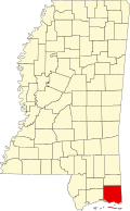
Moss Point is in southeastern Jackson County, on the east side of the Pascagoula River. It is bordered to the south by the city of Pascagoula, the county seat, and to the north by unincorporated Escatawpa. The Escatawpa River flows east–west through the city into the Pascagoula River.

U.S. Route 90 forms the southeastern boundary of Moss Point, leading southwestward into Pascagoula and northeastward to Interstate 10, which runs through the northern part of the Moss Point city limits. I-10 leads west 22 miles (35 km) to the Biloxi area and northeast 36 miles (58 km) to Mobile, Alabama. Mississippi Highways 63 and 613 (Main Street) are north–south roads through Moss Point. Highway 63 leads south to US-90 and north 38 miles (61 km) to Lucedale, while Highway 613 leads south 4 miles (6 km) to the center of Pascagoula and north 5 miles (8 km) to Escatawpa.

Moss Point has a total area of 26.6 square miles (68.8 km2), of which 24.2 square miles (62.6 km2) are land and 2.4 square miles (6.3 km2), or 9.11%, are water. [5]

Moss Point (right edge) is north of Pascagoula, on Mississippi Highway 63, north of the Gulf of Mexico. MS CoastTowns NOAA.jpg
Moss Point (right edge) is north of Pascagoula, on Mississippi Highway 63, north of the Gulf of Mexico.

Demographics

Historical population
CensusPop.Note
1870 440
1880 1,333203.0%
1910 3,054
1920 3,3409.4%
1930 2,453−26.6%
1940 3,04224.0%
1950 3,78224.3%
1960 6,63175.3%
1970 19,321191.4%
1980 18,998−1.7%
1990 17,837−6.1%
2000 17,653−1.0%
2010 13,704−22.4%
2020 12,147−11.4%
U.S. Decennial Census [6]
Moss Point racial composition as of 2020 [7]
RaceNum.Perc.
White (non-Hispanic)2,61721.54%
Black or African American (non-Hispanic)8,65571.25%
Native American 230.19%
Asian 400.33%
Pacific Islander 10.01%
Other/Mixed 3612.97%
Hispanic or Latino 4503.7%

As of the 2020 United States census, there were 12,147 people, 5,102 households, and 3,263 families residing in the city.

Education

The city is served by the Moss Point School District.

Hurricane Katrina

On August 29, 2005, Moss Point was hit by the strong eastern side of Hurricane Katrina, when it passed 30 miles (48 km) east of central New Orleans with minimal gale-force winds. However, on the east side of Hurricane Katrina, much of Moss Point was flooded or destroyed in one day, by the strong hurricane-force winds which lasted several hours and a storm surge exceeding 20 feet (6.1 m) in some sections. [8]

Sister city

In the wake of Hurricane Katrina, Burlington, Vermont became the sister city of Moss Point and provided much-needed aid to the city. [9]

Notable people

See also

Related Research Articles

<span class="mw-page-title-main">Jackson County, Mississippi</span> County in Mississippi, United States

Jackson County is a county located in the U.S. state of Mississippi. As of the 2020 census, the population was 143,252, making it the fifth-most populous county in Mississippi. Its county seat is Pascagoula. The county was named for Andrew Jackson, general in the United States Army and afterward President of the United States.

<span class="mw-page-title-main">Bay St. Louis, Mississippi</span> City in Mississippi, United States

Bay St. Louis is a city in and the county seat of Hancock County, Mississippi, in the United States. Located on the Gulf Coast on the west side of the Bay of St. Louis, it is part of the Gulfport–Biloxi Metropolitan Statistical Area. The population was 9,284 at the 2020 census, up from 9,260 at the 2010 census.

<span class="mw-page-title-main">Waveland, Mississippi</span> City in Mississippi, United States

Waveland is a city located in Hancock County, Mississippi, United States, on the Gulf of Mexico. It is part of the Gulfport–Biloxi, Mississippi Metropolitan Statistical Area. The city of Waveland was incorporated in 1972. As of the 2010 census, the city had a population of 6,435. Waveland was nearly destroyed by Hurricane Camille on August 17, 1969, and by Hurricane Katrina on August 29, 2005.

<span class="mw-page-title-main">Biloxi, Mississippi</span> City in Mississippi, United States

Biloxi is a city in Harrison County, Mississippi, United States. It lies on the Gulf Coast in southern Mississippi thirteen miles east of Gulfport along US-90. The adjacent cities are both designated as seats of Harrison County. The population of Biloxi was 49,449 at the 2020 census, making it the state's 4th most populous city. It is a principal city of the Gulfport–Biloxi metropolitan area, home to 416,259 residents in 2020. The area's first European settlers were French colonists.

<span class="mw-page-title-main">Gulfport, Mississippi</span> City in Mississippi, United States

Gulfport is the 2nd most populous city in the U.S. state of Mississippi after the state capital, Jackson. Along with Biloxi, Gulfport is the co-county seat of Harrison County and the larger of the two principal cities of the Gulfport–Biloxi metropolitan area. As of the 2020 census, the city of Gulfport had a total population of 72,926, with 416,259 residents in its metro area. The city lies along the Gulf Coast in southern Mississippi, taking its name from its port on the Mississippi Sound. It is also home to the U.S. Navy Atlantic Fleet Seabees.

<span class="mw-page-title-main">Escatawpa, Mississippi</span> Census-designated place in Mississippi, United States

Escatawpa is an unincorporated community and census-designated place (CDP) in Jackson County, Mississippi, United States. It is part of the Pascagoula Metropolitan Statistical Area. The population was 3,254 at the 2020 census.

<span class="mw-page-title-main">Gautier, Mississippi</span> City Gautier in Mississippi, United States

Gautier is a city in Jackson County, Mississippi, United States, along the Gulf of Mexico west of Pascagoula. It is part of the Pascagoula Metropolitan Statistical Area. The population was 18,572 at the 2010 census, up from 11,681 at the 2000 census. In 2002, Gautier had annexed land more than doubling its area.

<span class="mw-page-title-main">Ocean Springs, Mississippi</span> City in Mississippi, United States

Ocean Springs is a city in Jackson County, Mississippi, United States, approximately 2 miles (3.2 km) east of Biloxi and west of Gautier. It is part of the Pascagoula, Mississippi Metropolitan Statistical Area. The population was 17,225 at the 2000 U.S. Census. As of the 2010 U.S. Census, the city of Ocean Springs had a population of 17,442.

<span class="mw-page-title-main">Columbia, Mississippi</span> City in Mississippi, United States

Columbia is a U.S. city in and the county seat of Marion County, Mississippi, which was formed six years before Mississippi was admitted to statehood. Columbia was named for Columbia, South Carolina, from which many of the early settlers had migrated. The population was 6,582 as of the 2010 census, and 5,864 in 2020.

<span class="mw-page-title-main">Pascagoula, Mississippi</span> City in Mississippi, United States

Pascagoula is a city in Jackson County, Mississippi, United States. It is the principal city of the Pascagoula metropolitan area, and is part of the Gulfport–Biloxi–Pascagoula Combined Statistical Area and the Gulfport-Biloxi metropolitan area. The population was 22,392 at the 2010 census, down from 26,200 at the 2000 census. In 2019 the population was 21,699. It is the county seat of Jackson County.

The article covers the Hurricane Katrina effects by region, within the United States and Canada. The effects of Hurricane Katrina, in late August 2005, were catastrophic and widespread. It was one of the deadliest natural disasters in U.S. history, leaving at least 1,836 people dead, and a further 135 missing. The storm was large and had an effect on several different areas of North America.

<span class="mw-page-title-main">Effects of Hurricane Katrina in Mississippi</span>

Hurricane Katrina's winds and storm surge reached the Mississippi coastline on the morning of August 29, 2005. beginning a two-day path of destruction through central Mississippi; by 10 a.m. CDT on August 29, 2005, the eye of Katrina began traveling up the entire state, only slowing from hurricane-force winds at Meridian near 7 p.m. and entering Tennessee as a tropical storm. Many coastal towns of Mississippi had already been obliterated, in a single night. Hurricane-force winds reached coastal Mississippi by 2 a.m. and lasted over 17 hours, spawning 11 tornadoes and a 28-foot (8.5 m) storm surge flooding 6–12 miles (9.7–19.3 km) inland. Many, unable to evacuate, survived by climbing to attics or rooftops, or swimming to higher buildings and trees. The worst property damage from Katrina occurred in coastal Mississippi, where all towns flooded over 90% in hours, and waves destroyed many historic buildings, with others gutted to the 3rd story. Afterward, 238 people died in Mississippi, and all counties in Mississippi were declared disaster areas, 49 for full federal assistance. Regulations were changed later for emergency centers and casinos. The emergency command centers were moved higher because all 3 coastal centers flooded at 30 ft (9.1 m) above sea level. Casinos were allowed on land rather than limited to floating casino barges as in 2005.

<span class="mw-page-title-main">Mississippi Gulf Coast</span> Region

The Mississippi Gulf Coast, also known as Mississippi Coast, Mississippi Gulf Coast region, Coastal Mississippi, and The Coast, is the area of Mississippi along the Mississippi Sound at the northern extreme of the Gulf of Mexico.

<span class="mw-page-title-main">Gulfport–Biloxi metropolitan area</span> Metropolitan statistical area in Mississippi, US

The Gulfport-Biloxi Metropolitan Statistical Area is a metropolitan statistical area (MSA) in the Mississippi Gulf Coast region that includes four counties – Hancock, Harrison, Jackson and Stone. The principal cities are Gulfport and Biloxi. The 2010 census placed the Gulfport-Biloxi MSA population at 388,488, though as of 2019, it was estimated to have increased to 417,665. The area was significantly impacted by Hurricane Katrina on August 29, 2005, and prior to the hurricane, had experienced steady to moderate population growth. However, growth has since rebounded, with the population steadily increasing every year throughout the 2010s.

<span class="mw-page-title-main">Pascagoula metropolitan area</span>

The Pascagoula Metropolitan Statistical Area is a metropolitan area in the southeastern corner of Mississippi that covers two counties - Jackson and George. As of the 2000 census, the MSA had a population of 150,564. The area was significantly impacted by Hurricane Katrina in 2005. A July 1, 2009 estimate placed the population at 155,603. Prior to the hurricane, the area had experienced steady population growth. It is also part of the larger Gulfport-Biloxi-Pascagoula Combined Statistical Area.

<span class="mw-page-title-main">Gulfport–Biloxi–Pascagoula, MS Combined Statistical Area</span>

The Gulfport–Biloxi–Pascagoula Combined Statistical Area is made up of five counties in the Mississippi Gulf Coast region. The statistical area consists of the Gulfport–Biloxi Metropolitan Statistical Area and the Pascagoula Metropolitan Statistical Area. The 2010 census placed the CSA population at 411,066, and as of 2019, is estimated to be 442,165. The area was significantly impacted by Hurricane Katrina on August 29, 2005, although population growth has steadily rebounded in recent years.

The Moss Point School District is a public school district based in Moss Point, Mississippi (USA). The district serves the communities of Moss Point, most of Escatawpa and all of Helena.

<span class="mw-page-title-main">Interstate 10 in Mississippi</span> Highway in Mississippi

Interstate 10 (I-10), a major east–west Interstate Highway in the southern areas of the United States, has a section of about 77 miles (124 km) in Mississippi.

Otis Wonsley is a former American football running back who played for the Washington Redskins of the National Football League (NFL). He played college football at Alcorn State University and was drafted in the ninth round of the 1980 NFL Draft.

<span class="mw-page-title-main">Mississippi Highway 613</span> State Highway in Mississippi

Mississippi Highway 613 is a 45.7-mile-long (73.5 km) north-south state highway in the eastern Mississippi Gulf Coast region of southeastern Mississippi. It connects the town of Lucedale with the city of Pascagoula.

References

  1. "2020 U.S. Gazetteer Files". United States Census Bureau. Retrieved July 24, 2022.
  2. Tornado touches down in Moss Point WXXV-TV, June 19, 2023. Retrieved July 1, 2023
  3. City of Moss Point provides update on tornado WXXV-TV, June 21, 2023. Retrieved July 1, 2023
  4. Moss Point community prepares to rebuild after tornado WXXV-TV, June 21, 2023. Retrieved July 1, 2023
  5. "Geographic Identifiers: 2010 Census Summary File 1 (G001): Moss Point city, Mississippi". American Factfinder. U.S. Census Bureau. Archived from the original on February 13, 2020. Retrieved August 3, 2018.
  6. United States Census Bureau. "Census of Population and Housing" . Retrieved October 23, 2013.
  7. "Explore Census Data". data.census.gov. Retrieved December 16, 2021.
  8. Gary Tuchman, Transcript of "Anderson Cooper 360 Degrees" (2006-08-29) 19:00 ET, CNN, CNN-ACooper082906 GARY TUCHMAN, CNN Correspondent: Responds to Anderson Cooper that it felt like it would never end, saying winds were at least 100 miles per hour in Gulfport for seven hours, between about 7:00 a.m. and 2:00 p.m. For another five or six hours, on each side of that, they had hurricane-force winds over 75 miles per hour; much of the city of Gulfport, Mississippi, in Harrison County of 71,000 was then under water.
  9. "Moss Point receives aid from Burlington, VT; become sister cities". Archived from the original on June 7, 2008. Retrieved May 2, 2023.
  10. Ward, Cherie (August 1, 2010). "Moss Point alumni honor classmate who now runs Coca-Cola at reunion". Gulflive.com. Retrieved May 2, 2023.