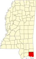
Helena, Mississippi

Last updated • 2 min readFrom Wikipedia, The Free Encyclopedia

Helena, Mississippi
Jackson County Mississippi Incorporated and Unincorporated areas Helena Highlighted.svg
Location of Helena, Mississippi
Usa edcp location map.svg
Red pog.svg
Helena, Mississippi
Location in the United States
Coordinates: 30°29′13″N88°30′17″W / 30.48694°N 88.50472°W / 30.48694; -88.50472
Country United States
State Mississippi
County Jackson
Area
[1]
  Total4.19 sq mi (10.85 km2)
  Land4.19 sq mi (10.85 km2)
  Water0.00 sq mi (0.00 km2)
Elevation
10 ft (3 m)
Population
 (2020)
  Total983
  Density234.66/sq mi (90.61/km2)
Time zone UTC-6 (Central (CST))
  Summer (DST) UTC-5 (CDT)
ZIP code
39567
Area code 228
FIPS code 28-31460
GNIS feature ID0671089

Helena is an unincorporated community and census-designated place (CDP) in Jackson County, Mississippi, United States. It is part of the Moss Point Metropolitan Statistical Area. Per the 2020 Census, the population was 983. [2]

Contents

History

A post office operated under the name Helena from 1910 to 1924. [3]

Geography

Helena is in eastern Jackson County, east of Escatawpa and north of Moss Point. Interstate 10 passes 4 miles (6 km) south of the community, and Pascagoula, the county seat, is 12 miles (19 km) to the southwest.

According to the United States Census Bureau, the Helena CDP has a total area of 4.2 square miles (10.8 km2), all land. [4]

Demographics

Historical population
CensusPop.Note
2010 1,184
2020 983−17.0%
U.S. Decennial Census [5]
2010 [6] 2020 [7]

2020 census

Helena CDP, Mississippi – Racial and ethnic composition
Note: the US Census treats Hispanic/Latino as an ethnic category. This table excludes Latinos from the racial categories and assigns them to a separate category. Hispanics/Latinos may be of any race.
Race / Ethnicity (NH = Non-Hispanic)Pop 2010 [6] Pop 2020 [7] % 2010% 2020
White alone (NH)1,00879185.14%80.47%
Black or African American alone (NH)1218910.22%9.05%
Native American or Alaska Native alone (NH)030.00%0.31%
Asian alone (NH)980.76%0.81%
Pacific Islander alone (NH)000.00%0.00%
Some Other Race alone (NH)050.00%0.51%
Mixed Race or Multi-Racial (NH)19521.60%5.29%
Hispanic or Latino (any race)27352.28%3.56%
Total1,184983100.00%100.00%

2000 Census

As of the census [8] of 2000, there were 778 people, 266 households, and 222 families residing in the CDP. The population density was 385.3 inhabitants per square mile (148.8/km2). There were 280 housing units at an average density of 138.7 per square mile (53.6/km2). The racial makeup of the CDP was 93.83% White, 5.14% African American, 0.39% Asian, 0.26% from other races, and 0.39% from two or more races. Hispanic or Latino of any race were 0.26% of the population.

There were 266 households, out of which 38.0% had children under the age of 18 living with them, 66.9% were married couples living together, 10.9% had a female householder with no husband present, and 16.5% were non-families. 14.3% of all households were made up of individuals, and 4.5% had someone living alone who was 65 years of age or older. The average household size was 2.92 and the average family size was 3.21.

In the CDP, the population was spread out, with 26.3% under the age of 18, 13.0% from 18 to 24, 26.9% from 25 to 44, 24.4% from 45 to 64, and 9.4% who were 65 years of age or older. The median age was 34 years. For every 100 females, there were 100.0 males. For every 100 females age 18 and over, there were 97.6 males.

The median income for a household in the CDP was $36,302, and the median income for a family was $36,302. Males had a median income of $31,588 versus $18,173 for females. The per capita income for the CDP was $12,346. About 6.2% of families and 5.2% of the population were below the poverty line, including 6.0% of those under age 18 and 17.9% of those age 65 or over.

Education

Helena is served by the Moss Point School District, and students attend schools in Moss Point, Mississippi.

Schools

Related Research Articles

<span class="mw-page-title-main">West Crossett, Arkansas</span> CDP in Arkansas, United States

West Crossett is a census-designated place (CDP) in Ashley County, Arkansas, United States. Per the 2020 census, the population was 1,144.

<span class="mw-page-title-main">Landmark, Arkansas</span> CDP in Arkansas, United States

Landmark is a census-designated place (CDP) in Pulaski County, Arkansas, United States. Per the 2020 census, the population was 3,585. It is part of the Little Rock–North Little Rock–Conway Metropolitan Statistical Area.

<span class="mw-page-title-main">Progress Village, Florida</span> Census-designated place in Florida, United States

Progress Village is a census-designated place (CDP) in Hillsborough County, Florida, United States. Per the 2020 census, the population was 11,188.

<span class="mw-page-title-main">Pinewood, Florida</span> Census-designated place in Florida

Pinewood is an unincorporated community and census-designated place (CDP) in Miami-Dade County, Florida, United States. It is part of the Miami metropolitan area of South Florida. The population was 17,246 at the 2020 census.

<span class="mw-page-title-main">Sunset, Florida</span> Census-designated place in Florida

Sunset is a census-designated place (CDP) in Miami-Dade County, Florida, United States. It is part of the Miami metropolitan area of South Florida. The population was 15,912 at the 2020 census. The U.S. Postal Service uses the ZIP Codes of 33173 and 33183 for Sunset.

<span class="mw-page-title-main">South Apopka, Florida</span> Census-designated place in Florida, United States

South Apopka is a census-designated place and an unincorporated area in Orange County, Florida, United States. Per the 2020 census, the population was 6,803. It is part of the Orlando–Kissimmee Metropolitan Statistical Area.

<span class="mw-page-title-main">Channel Lake, Illinois</span> Census-designated place in Illinois, United States

Channel Lake is an unincorporated community and census-designated place (CDP) in Antioch Township, Lake County, Illinois, United States. Per the 2020 census, the population was 1,581.

Fox Lake Hills is an unincorporated community and census-designated place (CDP) in Lake Villa Township, Lake County, Illinois, United States. Per the 2020 census, the population was 2,684.

North Vacherie is a census-designated place (CDP) in St. James Parish, Louisiana, United States. The population was 2,411 at the 2000 census. Vacherie was noted in the 2000 census as being the town with the least mobility of all in the United States.

Garyville is a census-designated place (CDP) in St. John the Baptist Parish, Louisiana, United States. The population was 2,775 at the 2000 census and 2,123 in 2020. It is part of the New Orleans–Metairie–Kenner Metropolitan Statistical Area.

<span class="mw-page-title-main">Brooklyn Park, Maryland</span> Census-designated place in Maryland, United States

Brooklyn Park is a census-designated place (CDP) in Anne Arundel County, Maryland, United States. The population was 14,373 at the 2010 census.

<span class="mw-page-title-main">Milford Mill, Maryland</span> Census-designated place in Maryland, United States

Milford Mill is an unincorporated community and census-designated place in Baltimore County, Maryland, United States. Per the 2020 census, the population was 30,622.

<span class="mw-page-title-main">Bennsville, Maryland</span> Census-designated place in Maryland, United States

Bennsville is a census-designated place (CDP) in Charles County, Maryland, United States. Per the 2020 census, the population was 15,288. The area is not an official postal designation, but is part of the Waldorf or Pomfret postal area. The Bennsville area is growing with new residential development, encouraged by the extension in the 1990s of Maryland Route 228 which provides quick access to Maryland Route 210. Bennsville has experienced the 2006 opening of North Point High School and the straightening of Middletown Road in 2008.

<span class="mw-page-title-main">Fairland, Maryland</span> Census-designated place in Maryland, United States

Fairland is a census-designated place and an unincorporated area in Montgomery County, Maryland, United States. It had a population of 25,396 per the 2020 census.

<span class="mw-page-title-main">Big Point, Mississippi</span> Census-designated place in Mississippi, United States

Big Point is an unincorporated community and census-designated place (CDP) in Jackson County, Mississippi, United States. It is part of the Pascagoula, Mississippi Metropolitan Statistical Area. Per the 2020 Census, the population was 618.

<span class="mw-page-title-main">Escatawpa, Mississippi</span> Census-designated place in Mississippi, United States

Escatawpa is an unincorporated community and census-designated place (CDP) in Jackson County, Mississippi, United States. It is part of the Pascagoula Metropolitan Statistical Area. The population was 3,254 at the 2020 census.

<span class="mw-page-title-main">Castle Point, Missouri</span> Place in Missouri, United States

Castle Point is an unincorporated community and census-designated place (CDP) in St. Louis County, Missouri, United States. The population was 3,962 at the 2010 census.

<span class="mw-page-title-main">Hillandale, Maryland</span> Census-designated place in Maryland, United States

Hillandale is an unincorporated area and census-designated place located in Montgomery and Prince George's counties, Maryland, United States. As of the 2020 census, it had a population of 5,774. Hillandale is contained between the Prince George's / Montgomery County line to the east, the Anacostia River to the west, McCeney Avenue to the north, and D.C.'s Capital Beltway to the south. It borders the communities of Adelphi, Avenel, White Oak and Beltsville.

<span class="mw-page-title-main">Gulfport–Biloxi metropolitan area</span> Metropolitan statistical area in Mississippi, US

The Gulfport-Biloxi Metropolitan Statistical Area is a metropolitan statistical area (MSA) in the Mississippi Gulf Coast region that includes four counties – Hancock, Harrison, Jackson and Stone. The principal cities are Gulfport and Biloxi. The 2010 census placed the Gulfport-Biloxi MSA population at 388,488, though as of 2019, it was estimated to have increased to 417,665. The area was significantly impacted by Hurricane Katrina on August 29, 2005, and prior to the hurricane, had experienced steady to moderate population growth. However, growth has since rebounded, with the population steadily increasing every year throughout the 2010s.

<span class="mw-page-title-main">Gulfport–Biloxi–Pascagoula, MS Combined Statistical Area</span>

The Gulfport–Biloxi–Pascagoula Combined Statistical Area is made up of five counties in the Mississippi Gulf Coast region. The statistical area consists of the Gulfport–Biloxi Metropolitan Statistical Area and the Pascagoula Metropolitan Statistical Area. The 2010 census placed the CSA population at 411,066, and as of 2019, is estimated to be 442,165. The area was significantly impacted by Hurricane Katrina on August 29, 2005, although population growth has steadily rebounded in recent years.

References

  1. "2020 U.S. Gazetteer Files". United States Census Bureau. Retrieved July 24, 2022.
  2. "Helena CDP, Mississippi". United States Census Bureau . Retrieved March 13, 2022.
  3. "Jackson County". Jim Forte Postal History. Retrieved September 18, 2021.
  4. "Geographic Identifiers: 2010 Census Summary File 1 (G001): Helena CDP, Mississippi". American Factfinder. U.S. Census Bureau. Archived from the original on February 13, 2020. Retrieved August 9, 2018.
  5. "Decennial Census of Population and Housing by Decades". US Census Bureau.
  6. 1 2 "P2 Hispanic or Latino, and Not Hispanic or Latino by Race – 2010: DEC Redistricting Data (PL 94-171) – Helena CDP, Mississippi". United States Census Bureau .
  7. 1 2 "P2 Hispanic or Latino, and Not Hispanic or Latino by Race – 2020: DEC Redistricting Data (PL 94-171) – Helena CDP, Mississippi". United States Census Bureau .
  8. "U.S. Census website". United States Census Bureau . Retrieved January 31, 2008.