Gulf Park Estates, Mississippi | |
|---|---|
 Location of Gulf Park Estates, Mississippi | |
 Gulf Park Estates, Mississippi Location in the United States | |
| Coordinates: 30°22′37″N88°45′38″W / 30.37694°N 88.76056°W | |
| Country | United States |
| State | Mississippi |
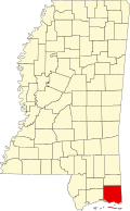
| County | Jackson |
| Area | |
• Total | 2.79 sq mi (7.22 km2) |
| • Land | 2.66 sq mi (6.88 km2) |
| • Water | 0.14 sq mi (0.35 km2) |
| Elevation | 16 ft (5 m) |
| Population (2020) | |
• Total | 5,972 |
| • Density | 2,249.5/sq mi (868.55/km2) |
| Time zone | UTC-6 (Central (CST)) |
| • Summer (DST) | UTC-5 (CDT) |
| ZIP code | 39564 |
| Area code | 228 |
| FIPS code | 28-29660 |
| GNIS feature ID | 0689021 |
Gulf Park Estates is an unincorporated community and census-designated place (CDP) located south of Ocean Springs in Jackson County, Mississippi, United States. It is part of the Pascagoula Metropolitan Statistical Area. The population was 5,719 at the 2010 census, [2] up from 4,272 at the 2000 census.