Wade, Mississippi | |
---|---|
Coordinates: 30°38′31″N88°33′4″W / 30.64194°N 88.55111°W Coordinates: 30°38′31″N88°33′4″W / 30.64194°N 88.55111°W | |
Country | United States |
State | Mississippi |
County | Jackson |
Area | |
• Total | 6.19 sq mi (16.04 km2) |
• Land | 6.17 sq mi (15.97 km2) |
• Water | 0.03 sq mi (0.07 km2) |
Elevation | 43 ft (13 m) |
Population (2020) | |
• Total | 996 |
• Density | 161.56/sq mi (62.37/km2) |
Time zone | UTC-6 (Central (CST)) |
• Summer (DST) | UTC-5 (CDT) |
ZIP code | 39567 |
Area code | 228 |
FIPS code | 28-77080 |
GNIS feature ID | 0692298 |
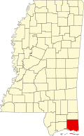
Wade is an unincorporated community and census-designated place (CDP) in Jackson County, Mississippi, United States. It is part of the Pascagoula Metropolitan Statistical Area. The population was 1,074 at the 2010 census, [2] up from 491 at the 2000 census.
Wade is located in northeastern Jackson County at 30°38′31″N88°33′4″W / 30.64194°N 88.55111°W (30.641942, -88.551069), [3] around the intersection of Mississippi Highway 63 and Mississippi Highway 614. Highway 63 leads north 21 miles (34 km) to Lucedale and south 22 miles (35 km) to Pascagoula, the Jackson county seat. Highway 614 leads east 5 miles (8 km) to Hurley and west 10 miles (16 km) to Mississippi Highway 57 north of Vancleave.
According to the United States Census Bureau, the Wade CDP has a total area of 6.2 square miles (16.0 km2), of which 0.03 square miles (0.07 km2), or 0.44%, are water. [2]
Historical population | |||
---|---|---|---|
Census | Pop. | %± | |
2020 | 996 | — | |
U.S. Decennial Census [4] |
Race | Num. | Perc. |
---|---|---|
White (non-Hispanic) | 932 | 93.57% |
Black or African American (non-Hispanic) | 13 | 1.31% |
Native American | 3 | 0.3% |
Asian | 5 | 0.5% |
Other/Mixed | 37 | 3.71% |
Hispanic or Latino | 6 | 0.6% |
As of the 2020 United States census, there were 996 people, 483 households, and 288 families residing in the CDP.
At the 2000 census, [6] there were 491 people, 169 households and 147 families residing in the CDP. The population density was 112.6 per square mile (43.5/km2). There were 174 housing units at an average density of 39.9/sq mi (15.4/km2). The racial makeup of the CDP was 96.95% White, 1.02% African American, 0.20% Asian, 0.81% Pacific Islander, 0.20% from other races, and 0.81% from two or more races. Hispanic or Latino of any race were 0.20% of the population.
There were 169 households, of which 45.0% had children under the age of 18 living with them, 76.3% were married couples living together, 5.9% had a female householder with no husband present, and 13.0% were non-families. 11.2% of all households were made up of individuals, and 3.0% had someone living alone who was 65 years of age or older. The average household size was 2.91 and the average family size was 3.15.
29.3% of the populationwere under the age of 18, 6.3% from 18 to 24, 31.4% from 25 to 44, 25.3% from 45 to 64, and 7.7% who were 65 years of age or older. The median age was 34 years. For every 100 females, there were 101.2 males. For every 100 females age 18 and over, there were 105.3 males.
The median household income was $50,972 and the median family income was $60,982. Males had a median income of $45,673 compared with $23,000 for females. The per capita income for the CDP was $15,993. About 4.5% of families and 2.7% of the population were below the poverty line, including none of those under age 18 and 16.3% of those age 65 or over.
Wade is served by the Jackson County School District. [7] It includes two elementary schools, one middle school, and one high school. Students in Wade attend schools in Hurley, Mississippi.
Jackson County is a county located in the U.S. state of Mississippi. As of the 2010 census, the population was 139,668, making it the fifth-most populous county in Mississippi. Its county seat is Pascagoula. The county was named for Andrew Jackson, general in the United States Army and afterward President of the United States.
Grand Bay is an unincorporated community and census-designated place (CDP) in Mobile County, Alabama, United States. It is part of the Mobile metropolitan area. The population was 3,460 at the 2020 census.
Tillman's Corner is an unincorporated community and census-designated place (CDP) in Mobile County, Alabama, United States. At the 2020 census, the population was 17,731. It is a part of the Mobile metropolitan area.
Hope is a census-designated place (CDP) in Kenai Peninsula Borough in the U.S. state of Alaska. It is eighty-seven miles south from Anchorage. As of the 2010 census the population was 192, up from 137 in 2000.
Lucedale is a city in George County, Mississippi, United States. It is part of the Pascagoula, Mississippi Metropolitan Statistical Area. Lucedale was founded in 1901 when Governor A.H. Longino signed his name and his seal to the proclamation. It was named after its founder, Gregory Marston Luce, who operated a lumber business there. The population was 2,923 at the 2010 census, up from 2,458 at the 2000 census. It is the county seat of George County.
Big Point is an unincorporated community and census-designated place (CDP) in Jackson County, Mississippi, United States. It is part of the Pascagoula, Mississippi Metropolitan Statistical Area. Per the 2020 Census, the population was 618.
Escatawpa is an unincorporated community and census-designated place (CDP) in Jackson County, Mississippi, United States. It is part of the Pascagoula Metropolitan Statistical Area. The population was 3,254 at the 2020 census.
Gautier is a city in Jackson County, Mississippi, United States, along the Gulf of Mexico west of Pascagoula. It is part of the Pascagoula Metropolitan Statistical Area. The population was 18,572 at the 2010 census, up from 11,681 at the 2000 census. In 2002, Gautier had annexed land more than doubling its area.
Gulf Hills is an unincorporated community and census-designated place (CDP) in Jackson County, Mississippi, United States. It is part of the Pascagoula Metropolitan Statistical Area. The population was 7,144 at the 2010 census, up from 5,900 at the 2000 census.
Gulf Park Estates is an unincorporated community and census-designated place (CDP) located south of Ocean Springs in Jackson County, Mississippi, United States. It is part of the Pascagoula Metropolitan Statistical Area. The population was 5,719 at the 2010 census, up from 4,272 at the 2000 census.
Helena is an unincorporated community and census-designated place (CDP) in Jackson County, Mississippi, United States. It is part of the Moss Point Metropolitan Statistical Area. Per the 2020 Census, the population was 983.
Hickory Hill is a neighborhood in the city of Gautier in Jackson County, Mississippi, United States. Prior to 2010 it was an unincorporated area and recorded as a census-designated place, with a population of 3,046 at the 2000 census. At the 2010 census its population was included in the data for the city of Gautier. It is part of the Pascagoula Metropolitan Statistical Area.
Hurley is an unincorporated community and census-designated place (CDP) in Jackson County, Mississippi, United States. It is part of the Pascagoula Metropolitan Statistical Area. The population was 1,551 at the 2010 census, up from 985 at the 2000 census.
Latimer is a census-designated place (CDP) in Jackson County, Mississippi, United States. It is part of the Pascagoula Metropolitan Statistical Area. The population was 6,079 at the 2010 census, up from 4,288 at the 2000 census.
Moss Point is a city in Jackson County, Mississippi, United States. The population was 13,704 at the 2010 census, a decline from the figure of 17,653 in 2000. The Moss Point Historic District and several individual buildings are listed on the National Register of Historic Places' Jackson County listings.
St. Martin is a census-designated place (CDP) in Jackson County, Mississippi, United States. It is part of the Pascagoula Metropolitan Statistical Area. The population was 7,730 at the 2010 census, up from 6,676 at the 2000 census.
Redwater is a census-designated place (CDP) in Leake County, Mississippi, United States. It is one of the eight communities of the Mississippi Band of Choctaw Indians Reservation, and the population is 61% Choctaw. The population was 633 at the 2010 census, up from 409 at the 2000 census.
Vancleave is an unincorporated community and census-designated place (CDP) in Jackson County, Mississippi, United States. It is part of the Pascagoula Metropolitan Statistical Area. The population was 5,886 at the 2010 census, up from 4,910 at the 2000 census.
Collinsville is an unincorporated community and census-designated place (CDP) in Lauderdale County, Mississippi, United States. The population was 1,984 at the 2020 census.
Nellieburg is an unincorporated community and census-designated place (CDP) in Lauderdale County, Mississippi, United States. The population was 1,316 at the 2020 census. It is a suburb of Meridian.