Prentiss County, Mississippi

Last updated

Prentiss County
Prentiss Co MS Courthouse.jpg
The Prentiss County courthouse in Booneville
Map of Mississippi highlighting Prentiss County.svg
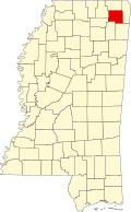
Location within the U.S. state of Mississippi
Mississippi in United States.svg
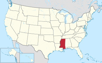
Mississippi's location within the U.S.
Coordinates: 34°37′N88°31′W / 34.61°N 88.52°W / 34.61; -88.52
CountryFlag of the United States.svg United States
StateFlag of Mississippi.svg  Mississippi
FoundedApril 15, 1870
(153 years ago)
 (1870-04-15)
Named for Seargent Smith Prentiss
Seat Booneville
Largest cityBooneville
Area
  Total418 sq mi (1,080 km2)
  Land415 sq mi (1,070 km2)
  Water3.2 sq mi (8 km2)  0.8%
Population
 (2020)
  Total25,008
  Density60/sq mi (23/km2)
Time zone UTC−6 (Central)
  Summer (DST) UTC−5 (CDT)
Congressional district 1st
Website www.prentisscounty.org

Prentiss County is a county located in the U.S. state of Mississippi. As of the 2020 census, the population was 25,008. [1] Its county seat is Booneville. [2] The county is named for Seargent Smith Prentiss, a noted speaker and US Congressman from Natchez.

Contents

Geography

According to the U.S. Census Bureau, the county has a total area of 418 square miles (1,080 km2), of which 415 square miles (1,070 km2) is land and 3.2 square miles (8.3 km2) (0.8%) is water. [3]

Major highways

Adjacent counties

National protected area

Demographics

Historical population
CensusPop.Note
1870 9,348
1880 12,15830.1%
1890 13,67912.5%
1900 15,78815.4%
1910 16,9317.2%
1920 17,6064.0%
1930 19,2659.4%
1940 20,9218.6%
1950 19,810−5.3%
1960 17,949−9.4%
1970 20,13312.2%
1980 24,02519.3%
1990 23,278−3.1%
2000 25,5569.8%
2010 25,276−1.1%
2020 25,008−1.1%
U.S. Decennial Census [4]
1790-1960 [5] 1900-1990 [6]
1990-2000 [7] 2010-2013 [8]

2020 census

Prentiss County Racial Composition [9]
RaceNum.Perc.
White 20,16680.64%
Black or African American 3,54714.18%
Native American 620.25%
Asian 850.34%
Pacific Islander 50.02%
Other/Mixed 7382.95%
Hispanic or Latino 4051.62%

As of the 2020 United States Census, there were 25,008 people, 9,145 households, and 6,092 families residing in the county.

2000 census

As of the census [10] of 2000, there were 25,556 people, 9,821 households, and 7,169 families living in the county. The population density was 62 people per square mile (24 people/km2). There were 10,681 housing units at an average density of 26 units per square mile (10 units/km2). The racial makeup of the county was 85.85% White, 12.94% Black or African American, 0.18% Native American, 0.16% Asian, 0.17% from other races, and 0.70% from two or more races. 0.69% of the population were Hispanic or Latino of any race.

In 2000 there were 9,821 households, out of which 33.70% had children under the age of 18 living with them, 56.30% were married couples living together, 12.60% had a female householder with no husband present, and 27.00% were non-families. 24.90% of all households were made up of individuals, and 12.00% had someone living alone who was 65 years of age or older. The average household size was 2.52 and the average family size was 3.00.

In the county, the population was spread out, with 25.00% under the age of 18, 11.60% from 18 to 24, 27.10% from 25 to 44, 22.40% from 45 to 64, and 13.90% who were 65 years of age or older. The median age was 35 years. For every 100 females there were 94.10 males. For every 100 females age 18 and over, there were 89.40 males.

The median income for a household in the county was $28,446, and the median income for a family was $35,125. Males had a median income of $26,862 versus $19,766 for females. The per capita income for the county was $14,131. About 13.10% of families and 16.50% of the population were below the poverty line, including 18.60% of those under age 18 and 22.40% of those age 65 or over.

Communities

Cities

Towns

Census-designated places

Unincorporated communities

Politics

United States presidential election results for Prentiss County, Mississippi [11]
Year Republican Democratic Third party
No.%No.%No.%
2020 8,37078.64%2,15320.23%1211.14%
2016 7,64877.47%2,06720.94%1571.59%
2012 7,07570.52%2,81728.08%1411.41%
2008 7,70370.39%3,02027.60%2212.02%
2004 6,53865.83%3,32733.50%670.67%
2000 5,10160.14%3,28738.75%941.11%
1996 3,47348.73%3,05342.84%6018.43%
1992 4,31750.63%3,38539.70%8249.66%
1988 4,34855.09%3,42943.45%1151.46%
1984 4,82162.35%2,89737.47%140.18%
1980 3,26439.91%4,83259.09%821.00%
1976 2,36233.85%4,43163.51%1842.64%
1972 4,60791.12%3987.87%511.01%
1968 72311.63%4407.08%5,05581.30%
1964 2,28969.32%1,01330.68%00.00%
1960 74024.79%1,77759.53%46815.68%
1956 38315.96%1,94280.95%743.08%
1952 73121.48%2,67278.52%00.00%
1948 744.44%60236.16%98959.40%
1944 1759.58%1,65290.42%00.00%
1940 1185.28%2,11794.72%00.00%
1936 502.68%1,80997.10%40.21%
1932 763.70%1,97696.30%00.00%
1928 26916.45%1,36683.55%00.00%
1924 17912.73%1,22587.13%20.14%
1920 49632.27%99264.54%493.19%
1916 16410.66%1,34287.26%322.08%
1912 857.74%83976.41%17415.85%

See also

Related Research Articles

<span class="mw-page-title-main">Walthall County, Mississippi</span> County in Mississippi, United States

Walthall County is a county located in the U.S. state of Mississippi. As of the 2020 census, the population was 13,884. Its county seat is Tylertown. The county is named after Civil War Confederate general and Mississippi Senator Edward C. Walthall.

<span class="mw-page-title-main">Union County, Mississippi</span> County in Mississippi, United States

Union County is a county located in the U.S. state of Mississippi. It was formed in 1870 from Tippah and Pontotoc counties, and in 1874 a portion of Lee County was added. As of the 2020 census, the population was 27,777. Its county seat is New Albany. According to most sources, the county received its name by being a union of pieces of several large counties, like other Union counties in other states. However, other sources say that the name was meant to mark the re-union of Mississippi and the other Confederate states after the Civil War.

<span class="mw-page-title-main">Tishomingo County, Mississippi</span> County in Mississippi, United States

Tishomingo County is a county located in the northeastern corner of the U.S. state of Mississippi. As of the 2020 census, the population was 18,850. Its county seat is Iuka.

<span class="mw-page-title-main">Tippah County, Mississippi</span> County in Mississippi, United States

Tippah County is a county located on the northern border of the U.S. state of Mississippi. As of the 2020 census, the population was 21,815. Its county seat is Ripley. The name "Tippah" is derived from a Chickasaw language word meaning "cut off." It was taken from the creek of the same name that flows across much of the original county from northeast to southwest before emptying into the Tallahatchie River. The creek probably was so named because it, and the ridges on either side, "cut off" the western part of the region from the eastern portion.

<span class="mw-page-title-main">Sharkey County, Mississippi</span> County in Mississippi, United States

Sharkey County is a county located in the U.S. state of Mississippi. Part of the eastern border is formed by the Yazoo River. According to the 2020 census, the population was 3,800, making it the second-least populous county in Mississippi, after Issaquena County. Its county seat is Rolling Fork. The county is named after William L. Sharkey, the provisional Governor of Mississippi in 1865.

<span class="mw-page-title-main">Pontotoc County, Mississippi</span> County in Mississippi, United States

Pontotoc County is a county located in the U.S. state of Mississippi. As of the 2020 census, the population was 31,184. Its county seat is Pontotoc. It was created on February 9, 1836, from lands ceded to the United States under the Chickasaw Cession. Pontotoc is a Chickasaw word meaning "land of hanging grapes". The original Natchez Trace and the current-day Natchez Trace Parkway both pass through the southeast corner of Pontotoc County.

<span class="mw-page-title-main">Madison County, Mississippi</span> County in Mississippi, United States

Madison County is a county located in the U.S. state of Mississippi. As of the 2020 census, the population was 109,145. The county seat is Canton. The county is named for Founding Father and U.S. President James Madison.

<span class="mw-page-title-main">Lee County, Mississippi</span> County in Mississippi, United States

Lee County is a county in U.S. state of Mississippi. At the 2020 census, the population was 83,353. Lee County is included in the Tupelo Micropolitan Statistical Area.

<span class="mw-page-title-main">Leake County, Mississippi</span> County in Mississippi, United States

Leake County is a county in the center of the U.S. state of Mississippi. As of the 2020 census, the population was 21,275. Its county seat is Carthage. The county is named for Walter Leake, the Governor of Mississippi from 1822 to 1825.

<span class="mw-page-title-main">Itawamba County, Mississippi</span> County in Mississippi, United States

Itawamba County is a county located in the U.S. state of Mississippi. As of the 2020 United States Census, the population was 23,863. Its county seat is Fulton. The county is part of the Tupelo, MS Micropolitan Statistical Area.

<span class="mw-page-title-main">Chickasaw County, Mississippi</span> County in Mississippi, United States

Chickasaw County is a county located in the U.S. state of Mississippi. As of the 2020 census, the population was 17,106. Its county seats are Houston and Okolona. The county is named for the Chickasaw people, who lived in this area for hundreds of years. Most were forcibly removed to Indian Territory in the 1830s, but some remained and became citizens of the state and the United States.

<span class="mw-page-title-main">Attala County, Mississippi</span> County in Mississippi, United States

Attala County is a county located in the U.S. state of Mississippi. As of the 2020 census, the population was 17,889. Its county seat is Kosciusko. Attala County is named for Atala, a fictional Native American heroine from an early-19th-century novel of the same name by François-René de Chateaubriand.

<span class="mw-page-title-main">Alcorn County, Mississippi</span> County in Mississippi, United States

Alcorn County is a county located in the northeastern portion of the U.S. state of Mississippi. As of the 2020 census, the population was 34,740. Its county seat is Corinth. The county is named in honor of Governor James L. Alcorn.

<span class="mw-page-title-main">Booneville, Mississippi</span> City in Mississippi, United States

Booneville is a city in the U.S. state of Mississippi and is the county seat of Prentiss County. It is located in the hilly North Mississippi region, and ecologically is part of the Southeastern Plains region.

<span class="mw-page-title-main">Marietta, Mississippi</span> Town in Mississippi, United States

Marietta is a town in Prentiss County, Mississippi, United States. The population was 248 at the 2000 census.

<span class="mw-page-title-main">Belmont, Mississippi</span> Town in Mississippi, United States

Belmont is a town in Tishomingo County, Mississippi, United States. The population was 2,021 at the 2010 census.

<span class="mw-page-title-main">Golden, Mississippi</span> Town in Mississippi, United States

Golden is a town in Tishomingo County, Mississippi, United States. The population was 191 at the 2010 census. The village's current mayor is Davy Ginn.

<span class="mw-page-title-main">Paden, Mississippi</span> Village in Mississippi, United States

Paden is a village in Tishomingo County, Mississippi, United States. The population was 116 at the 2010 census.

<span class="mw-page-title-main">Tishomingo, Mississippi</span> Town in Mississippi

Tishomingo is a town in Tishomingo County, Mississippi, United States. The population of the city of Tishomingo was 339 at the 2010 census.

<span class="mw-page-title-main">Baldwyn, Mississippi</span> City in Mississippi, United States

Baldwyn is a city located in Lee and Prentiss counties, Mississippi, located in the northern part of the Tupelo micropolitan area. The population was 3,071 at the 2020 census.

References

  1. "Census - Geography Profile: Prentiss County, Mississippi". United States Census Bureau . Retrieved January 14, 2023.
  2. "Find a County". National Association of Counties. Retrieved June 7, 2011.
  3. "2010 Census Gazetteer Files". United States Census Bureau. August 22, 2012. Archived from the original on September 28, 2013. Retrieved November 6, 2014.
  4. "U.S. Decennial Census". United States Census Bureau. Retrieved November 6, 2014.
  5. "Historical Census Browser". University of Virginia Library. Retrieved November 6, 2014.
  6. "Population of Counties by Decennial Census: 1900 to 1990". United States Census Bureau. Retrieved November 6, 2014.
  7. "Census 2000 PHC-T-4. Ranking Tables for Counties: 1990 and 2000" (PDF). United States Census Bureau. Archived (PDF) from the original on March 27, 2010. Retrieved November 6, 2014.
  8. "State & County QuickFacts". United States Census Bureau. Archived from the original on February 26, 2016. Retrieved September 5, 2013.
  9. "Explore Census Data". data.census.gov. Retrieved December 8, 2021.
  10. "U.S. Census website". United States Census Bureau . Retrieved May 14, 2011.
  11. Leip, David. "Dave Leip's Atlas of U.S. Presidential Elections". uselectionatlas.org. Retrieved March 5, 2018.

34°37′N88°31′W / 34.61°N 88.52°W / 34.61; -88.52