Tate County, Mississippi

Last updated

Tate County
Tate County Courthouse Front.jpg
Tate County Courthouse in Senatobia
Map of Mississippi highlighting Tate County.svg
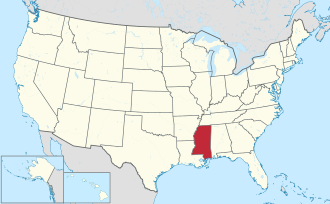
Location within the U.S. state of Mississippi
Mississippi in United States.svg
Mississippi's location within the U.S.
Coordinates: 34°39′N89°56′W / 34.65°N 89.94°W / 34.65; -89.94
CountryFlag of the United States.svg United States
StateFlag of Mississippi.svg  Mississippi
Founded1873
Seat Senatobia
Largest citySenatobia
Area
  Total
411 sq mi (1,060 km2)
  Land405 sq mi (1,050 km2)
  Water6.2 sq mi (16 km2)  1.5%
Population
 (2020)
  Total
28,064
  Density68/sq mi (26/km2)
Time zone UTC−6 (Central)
  Summer (DST) UTC−5 (CDT)
Congressional district 1st
Website www.tatecountygov.com

Tate County is a county located in the northwestern portion of the U.S. state of Mississippi. As of the 2020 census, the population was 28,064. [1] Its county seat is Senatobia. [2] Organized in 1873 during the Reconstruction era, from portions of DeSoto, Marshall, and Tunica counties, the county is named for Thomas Simpson Tate, one of the first prominent American settlers of the area.

Contents

Tate County is part of the Memphis, TN-MS-AR Metropolitan Statistical Area. It is located about 40 miles (64 km) south of Memphis and one county east of the Mississippi River. This fertile river valley was developed for cotton cultivation in the 19th century.

History

As it was developed for cotton culture in the antebellum years, planters in the county depended on the labor of African American slaves. Blacks comprised a majority of the population for many decades. After Reconstruction, whites sometimes enforced their dominance through political intimidation or violence against blacks.

In 1932, a deputy sheriff and son of County Sheriff C.A. Williams, was allegedly shot by a black man, Jesse Williams. Sheriff Williams illegally organized a posse and murdered at least five and possibly as many as seven black people, family members of a man known as "Judge" Crawford. A month later Jesse Williams was caught, "tried" and lynched by hanging. No charges were ever considered against the sheriff or lynch mob. [3]

Geography

Map of Tate County Senatobiacountymap.gif
Map of Tate County

According to the U.S. Census Bureau, the county has a total area of 411 square miles (1,060 km2), of which 405 square miles (1,050 km2) is land and 6.2 square miles (16 km2) (1.5%) is water. [4] It is the third-smallest county in Mississippi by land area.

Major highways

Adjacent counties

Demographics

Historical population
CensusPop.Note
1880 18,721
1890 19,2532.8%
1900 20,6187.1%
1910 19,714−4.4%
1920 19,636−0.4%
1930 17,671−10.0%
1940 19,3099.3%
1950 18,011−6.7%
1960 18,1380.7%
1970 18,5442.2%
1980 20,1198.5%
1990 21,4326.5%
2000 25,37018.4%
2010 28,88613.9%
2020 28,064−2.8%
2023 (est.)28,261 [5] 0.7%
U.S. Decennial Census [6]
1790-1960 [7] 1900-1990 [8]
1990-2000 [9] 2010-2013 [10]

2020 census

Tate County Racial Composition [11]
RaceNum.Perc.
White 18,01964.21%
Black or African American 8,23129.33%
Native American 520.19%
Asian 630.22%
Pacific Islander 10.0%
Other/Mixed 8933.18%
Hispanic or Latino 8052.87%

As of the 2020 United States census, there were 28,064 people, 10,324 households, and 7,580 families residing in the county.

2000 census

As of the census [12] of 2000, there were 25,370 people, 8,850 households, and 6,717 families residing in the county. The population density was 63 inhabitants per square mile (24/km2). There were 9,354 housing units at an average density of 23 per square mile (8.9/km2). The racial makeup of the county was 67.84% White, 31.02% Black or African American, 0.20% Native American, 0.10% Asian, 0.04% Pacific Islander, 0.25% from other races, and 0.56% from two or more races. 0.88% of the population were Hispanic or Latino of any race.

There were 8,850 households, out of which 36.10% had children under the age of 18 living with them, 56.00% were married couples living together, 15.50% had a female householder with no husband present, and 24.10% were non-families. 21.30% of all households were made up of individuals, and 9.10% had someone living alone who was 65 years of age or older. The average household size was 2.74 and the average family size was 3.18.

As of 2000, the county's population was spread out, with 27.10% under the age of 18, 11.70% from 18 to 24, 27.50% from 25 to 44, 22.30% from 45 to 64, and 11.40% who were 65 years of age or older. The median age was 34 years. For every 100 females there were 93.70 males. For every 100 females age 18 and over, there were 90.50 males.

The median income for a household in the county was $35,836, and the median income for a family was $41,423. Males had a median income of $33,064 versus $21,154 for females. The per capita income for the county was $16,154. About 10.60% of families and 13.50% of the population were below the poverty line, including 14.20% of those under age 18 and 21.10% of those age 65 or over.

Communities

Tate County MS sign 002 2012-03-31.jpg

City

Town

Census-designated places

Unincorporated communities

Education

The school districts are: [13]

Politics

United States presidential election results for Tate County, Mississippi [14]
Year Republican Democratic Third party(ies)
No.%No.%No.%
2024 9,18571.42%3,55527.64%1210.94%
2020 8,70766.50%4,18331.95%2031.55%
2016 7,49564.46%3,92633.77%2061.77%
2012 7,33259.10%4,93339.76%1411.14%
2008 7,67860.09%5,00339.15%970.76%
2004 6,76060.54%4,34738.93%600.54%
2000 5,14859.22%3,44139.58%1041.20%
1996 3,69450.40%3,19543.59%4416.02%
1992 4,19650.13%3,51942.04%6567.84%
1988 4,55361.12%2,87238.56%240.32%
1984 4,67761.89%2,84637.66%340.45%
1980 3,34345.38%3,89252.84%1311.78%
1976 2,49738.80%3,74758.22%1922.98%
1972 3,96675.74%1,15121.98%1192.27%
1968 60513.22%1,16225.39%2,81061.39%
1964 2,39089.41%28310.59%00.00%
1960 24113.60%68638.71%84547.69%
1956 1719.78%1,41480.85%1649.38%
1952 38719.72%1,57580.28%00.00%
1948 161.13%19914.09%1,19784.77%
1944 291.95%1,45598.05%00.00%
1940 30.19%1,60999.81%00.00%
1936 70.64%1,08899.36%00.00%
1932 90.90%98699.00%10.10%
1928 423.19%1,27496.81%00.00%
1924 60.59%1,00298.82%60.59%
1920 11711.65%87687.25%111.10%
1916 181.64%1,07497.73%70.64%
1912 233.26%61286.81%709.93%

Notable people

See also

References

  1. "Census - Geography Profile: Tate County, Mississippi". United States Census Bureau . Retrieved January 15, 2023.
  2. "Find a County". National Association of Counties. Retrieved June 7, 2011.
  3. "Entire Black Family Murdered In Unsuccessful Manhunt (1932)". Archived from the original on June 4, 2019. Retrieved December 16, 2017.
  4. "2010 Census Gazetteer Files". United States Census Bureau. August 22, 2012. Archived from the original on September 28, 2013. Retrieved November 8, 2014.
  5. "Annual Estimates of the Resident Population for Counties: April 1, 2020 to July 1, 2023". United States Census Bureau. Retrieved April 5, 2024.
  6. "U.S. Decennial Census". United States Census Bureau. Retrieved November 8, 2014.
  7. "Historical Census Browser". University of Virginia Library. Retrieved November 8, 2014.
  8. "Population of Counties by Decennial Census: 1900 to 1990". United States Census Bureau. Retrieved November 8, 2014.
  9. "Census 2000 PHC-T-4. Ranking Tables for Counties: 1990 and 2000" (PDF). United States Census Bureau. Archived (PDF) from the original on March 27, 2010. Retrieved November 8, 2014.
  10. "State & County QuickFacts". United States Census Bureau. Archived from the original on June 7, 2011. Retrieved September 7, 2013.
  11. "Explore Census Data". data.census.gov. Retrieved December 7, 2021.
  12. "U.S. Census website". United States Census Bureau . Retrieved January 31, 2008.
  13. "2020 CENSUS - SCHOOL DISTRICT REFERENCE MAP: Tate County, MS" (PDF). U.S. Census Bureau . Retrieved February 20, 2024. - Text list
  14. Leip, David. "Dave Leip's Atlas of U.S. Presidential Elections". uselectionatlas.org. Retrieved March 6, 2018.

34°39′N89°56′W / 34.65°N 89.94°W / 34.65; -89.94