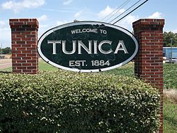
Tunica, Mississippi | |
---|---|
Coordinates: 34°41′20″N90°22′50″W / 34.68889°N 90.38056°W | |
Country | United States |
State | Mississippi |
County | Tunica |
Incorporated | 1884 |
Area | |
• Total | 0.66 sq mi (1.72 km2) |
• Land | 0.66 sq mi (1.72 km2) |
• Water | 0.00 sq mi (0.00 km2) |
Elevation | 197 ft (60 m) |
Population (2020) | |
• Total | 1,026 |
• Density | 1,545.18/sq mi (596.88/km2) |
Time zone | UTC−6 (CST) |
• Summer (DST) | UTC−5 (CDT) |
ZIP code | 38676 |
Area code | 662 |
FIPS code | 28-74760 |
GNIS feature ID | 0678927 |
Website | townoftunica.com |
Tunica is a town in and the county seat of Tunica County, Mississippi, United States, near the Mississippi River. Until the early 1990s when casino gambling was introduced in the area, Tunica had been one of the most impoverished places in the United States. Despite this economic improvement, Tunica's population continues to decline from its peak in 1970.
The community derives its name from the Tunica Indians which once were numerous in the area. [2] Tunica is the fourth community to serve as county seat of Tunica County, [3] succeeding earlier county seats at Commerce (1839–1842, 1842–1847), Peyton (1842, temporary) and Austin (1847–1888). [4]
Tunica gained national attention for its deprived neighborhood known as "Sugar Ditch Alley", named for the open sewer located there. [5] Its fortunes have improved since development of a gambling resort area nearby during the early 1990s. While population growth has taken place mostly outside Tunica, the major casinos employ numerous locals. They attract visitors from nearby Memphis, Tennessee, West Memphis, Arkansas and all over the Southeastern United States.
Tunica is located approximately 20 miles (32 km) south of Downtown Memphis, Tennessee. [5]
According to the United States Census Bureau, the town has a total area of 0.7 square miles (1.8 km2), all land.
Climate data for Tunica, Mississippi (1991–2020 normals, extremes 1959–2019) | |||||||||||||
---|---|---|---|---|---|---|---|---|---|---|---|---|---|
Month | Jan | Feb | Mar | Apr | May | Jun | Jul | Aug | Sep | Oct | Nov | Dec | Year |
Record high °F (°C) | 78 (26) | 81 (27) | 86 (30) | 94 (34) | 98 (37) | 101 (38) | 105 (41) | 106 (41) | 106 (41) | 96 (36) | 86 (30) | 80 (27) | 106 (41) |
Mean daily maximum °F (°C) | 49.2 (9.6) | 53.7 (12.1) | 62.9 (17.2) | 72.8 (22.7) | 81.6 (27.6) | 89.0 (31.7) | 91.3 (32.9) | 90.9 (32.7) | 86.1 (30.1) | 75.4 (24.1) | 62.5 (16.9) | 52.3 (11.3) | 72.3 (22.4) |
Daily mean °F (°C) | 40.8 (4.9) | 44.8 (7.1) | 53.5 (11.9) | 62.8 (17.1) | 72.1 (22.3) | 79.6 (26.4) | 82.1 (27.8) | 80.9 (27.2) | 75.3 (24.1) | 64.0 (17.8) | 52.4 (11.3) | 43.9 (6.6) | 62.7 (17.1) |
Mean daily minimum °F (°C) | 32.5 (0.3) | 35.9 (2.2) | 44.2 (6.8) | 52.8 (11.6) | 62.5 (16.9) | 70.1 (21.2) | 72.9 (22.7) | 71.0 (21.7) | 64.5 (18.1) | 52.6 (11.4) | 42.4 (5.8) | 35.4 (1.9) | 53.1 (11.7) |
Record low °F (°C) | −5 (−21) | 2 (−17) | 7 (−14) | 27 (−3) | 37 (3) | 46 (8) | 53 (12) | 50 (10) | 37 (3) | 27 (−3) | 15 (−9) | −10 (−23) | −10 (−23) |
Average precipitation inches (mm) | 4.65 (118) | 4.95 (126) | 5.80 (147) | 6.02 (153) | 6.00 (152) | 4.28 (109) | 4.01 (102) | 3.15 (80) | 3.33 (85) | 3.86 (98) | 4.80 (122) | 5.66 (144) | 56.51 (1,435) |
Average snowfall inches (cm) | 0.4 (1.0) | 0.5 (1.3) | 0.1 (0.25) | 0.0 (0.0) | 0.0 (0.0) | 0.0 (0.0) | 0.0 (0.0) | 0.0 (0.0) | 0.0 (0.0) | 0.0 (0.0) | 0.1 (0.25) | 0.0 (0.0) | 1.1 (2.8) |
Average precipitation days (≥ 0.01 in) | 10.4 | 8.6 | 10.7 | 9.2 | 10.6 | 8.1 | 7.9 | 6.9 | 6.6 | 7.4 | 9.2 | 10.7 | 106.3 |
Average snowy days (≥ 0.1 in) | 0.3 | 0.3 | 0.0 | 0.0 | 0.0 | 0.0 | 0.0 | 0.0 | 0.0 | 0.0 | 0.1 | 0.0 | 0.7 |
Source: NOAA [6] [7] |
Census | Pop. | Note | %± |
---|---|---|---|
1890 | 198 | — | |
1900 | 485 | 144.9% | |
1910 | 555 | 14.4% | |
1920 | 955 | 72.1% | |
1930 | 1,043 | 9.2% | |
1940 | 1,322 | 26.7% | |
1950 | 1,354 | 2.4% | |
1960 | 1,445 | 6.7% | |
1970 | 1,685 | 16.6% | |
1980 | 1,361 | −19.2% | |
1990 | 1,175 | −13.7% | |
2000 | 1,132 | −3.7% | |
2010 | 1,030 | −9.0% | |
2020 | 1,026 | −0.4% | |
U.S. Decennial Census [8] |
Race | Num. | Perc. |
---|---|---|
White | 602 | 58.67% |
Black or African American | 345 | 33.63% |
Asian | 5 | 0.49% |
Other/Mixed | 33 | 3.22% |
Hispanic or Latino | 41 | 4.0% |
As of the 2020 United States Census, there were 1,026 people, 501 households, and 293 families residing in the town.
As of the census [10] of 2000, there were 1,132 people, 537 households, and 254 families residing in the town. The population density was 1,588.4 inhabitants per square mile (613.3/km2). There were 592 housing units at an average density of 830.7 per square mile (320.7/km2). The racial makeup of the town was 67.84% White, 29.42% African American, 0.27% Native American, 1.06% Asian, 0.88% from other races, and 0.53% from two or more races. Hispanic or Latino of any race were 2.30% of the population.
There were 537 households, of which 18.4% had children under the age of 18 living with them, 34.3% were married couples living together, 11.2% had a female householder with no husband present, and 52.7% were non-families. Of all households, 48.0% were made up of individuals, and 26.4% had someone living alone who was 65 years of age or older. The average household size was 2.01 and the average family size was 2.94.
In the town, the population was spread out, with 18.9% under the age of 18, 6.1% from 18 to 24, 23.4% from 25 to 44, 28.3% from 45 to 64, and 23.3% who were 65 years of age or older. The median age was 46 years. For every 100 females, there were 87.7 males. For every 100 females age 18 and over, there were 80.0 males.
The median income for a household in the town was $26,607, and the median income for a family was $54,583. Males had a median income of $30,208 versus $22,250 for females. The per capita income for the town was $20,114. About 17.1% of families and 25.5% of the population were below the poverty line, including 33.3% of those under age 18 and 21.3% of those age 65 or over.
Casino gambling's effect on the local economy has spurred population growth in unincorporated parts of the county outside Tunica proper. Since 1990, the town's name has been popularly associated with several casinos located near the Mississippi River. However, the current group of casinos is located in the community of Tunica Resorts, 10 miles north of the town of Tunica, and extending to the DeSoto County line.
Tunica Resorts was originally named "Robinsonville", but the name was changed in 2005 to eliminate confusion over the location of the casinos, which have always used the name "Tunica" as an identifier. The success of these gaming houses in northern Tunica County came at the expense of the area's first group of casinos in the early 1990s, located just northwest of Tunica proper, in an area known as Mhoon Landing. This now comprises the current census-designated place of North Tunica. These casinos were closed or moved as larger resorts opened closer to Memphis to attract its larger residential base.
Unlike the area including casinos along Mississippi's Gulf Coast region, Tunica was not in the path of Hurricane Katrina. As a result, some of the regular Gulf Coast customer traffic from casinos drifted northward to Tunica County while repairs and reconstruction were underway in the Gulf Coast locations.
Though the casinos lie outside the town limits, the benefits of tax revenue generated have also aided the town. Major improvements to the public school system and downtown district are among the most visible aspects. Long-term effects include major highway improvements on U.S. Route 61 and a much-discussed potential expansion of Tunica Municipal Airport.
As of 2007, some Tunica Resorts residents are trying to incorporate their community as a separate town government, [11] rather than operate under the jurisdiction of Tunica County or be annexed into the town of Tunica. If Tunica Resorts incorporates, the new town government would directly benefit from casino tax revenue, enabling construction of municipal government offices. Depending on population and revenue growth, fire and police stations, libraries and other public infrastructure could be other likely additions.[ citation needed ] Potential effects on the existing town of Tunica are unclear.
The Town of Tunica is served by the Tunica County School District. [12] Zoned schools include Tunica Elementary School, Tunica Middle School, and Rosa Fort High School.
Tunica Academy is located in an unincorporated area in Tunica County, near Tunica. [13] [14]
Tunica is mentioned in Elmore Leonard's 2002 novel Tishomingo Blues . [15]
Tunica is mentioned by Terry Benedict, a character played by Andy Garcia, in the 2007 film Ocean's Thirteen. Tony Joe White sings about Tunica in his early 90's song, Tunica Motel, Just outside of Memphis, Highway 61, Sleepy little town, down by the Mississippi River.
Tunica Municipal Airport has had airline service intermittently with aircraft such as Boeing 727 jets of Pan Am Clipper Connection and Boeing 737 jets of Air Tran offering commercial services. The closest airport with continuous airline service is Memphis International Airport in Memphis, Tennessee, which is about 30 minutes away by car.
Tunica County is a county located in the U.S. state of Mississippi. As of the 2020 census, the population was 9,782. Its county seat is Tunica. The county is named for the Tunica Native Americans. Most migrated to central Louisiana during the colonial period.
Tishomingo County is a county located in the northeastern corner of the U.S. state of Mississippi. As of the 2020 census, the population was 18,850. Its county seat is Iuka.
Tate County is a county located in the northwestern portion of the U.S. state of Mississippi. As of the 2020 census, the population was 28,064. Its county seat is Senatobia. Organized in 1873 during the Reconstruction era, from portions of DeSoto, Marshall, and Tunica counties, the county is named for Thomas Simpson Tate, one of the first prominent American settlers of the area.
Alcorn County is a county located in the northeastern portion of the U.S. state of Mississippi. As of the 2020 census, the population was 34,740. Its county seat is Corinth. The county is named in honor of Governor James L. Alcorn.
Crittenden County is a county located in the U.S. state of Arkansas. As of the 2020 census, the population was 48,163. The county seat is Marion, and the largest city is West Memphis.
Horseshoe Lake is a town in Crittenden County, Arkansas, United States. The population was 264 at the 2020 census.
West Memphis is the largest city in Crittenden County, Arkansas, United States. The population was 26,245 at the 2010 census, ranking it as the state's 18th largest city, behind Bella Vista. It is part of the Memphis metropolitan area, and is located directly across the Mississippi River from Memphis, Tennessee.
Marksville is a small city in and the parish seat of Avoyelles Parish, Louisiana, United States. The population was 5,702 at the 2010 census, an increase of 165 over the 2000 tabulation of 5,537.
Corinth is a city in and the county seat of Alcorn County, Mississippi, United States. The population was 14,573 at the 2010 census. Its ZIP codes are 38834 and 38835. It lies on the state line with Tennessee.
Belmont is a town in Tishomingo County, Mississippi, United States. The population was 2,021 at the 2010 census.
Burnsville is a town in Tishomingo County in northeastern Mississippi, United States. The population was 936 at the 2010 census.
Golden is a town in Tishomingo County, Mississippi, United States. The population was 191 at the 2010 census. The village's current mayor is Davy Ginn.
Iuka is a city in and the county seat of Tishomingo County, Mississippi, United States. Its population was 3,028 at the 2010 census. Woodall Mountain, the highest point in Mississippi, is located just south of Iuka.
Tishomingo is a town in Tishomingo County, Mississippi, United States. The population of the city of Tishomingo was 339 at the 2010 census.
Southaven is a city in DeSoto County, Mississippi, United States. It is a principal city in Greater Memphis. The 2020 census reported a population of 54,648, making it the 3rd most populous city in Mississippi and the 2nd most populous suburb of Memphis. Southaven is traversed north to south by the I-55/I-69 freeway. The city's name derives from the fact that Southaven is located south of Whitehaven, a neighborhood in Memphis.
Coldwater is a town in Tate County, Mississippi, United States, and is part of the Memphis Metropolitan Area. The population was 1,677 at the 2010 census.
Tishomingo is the largest city in, and the county seat of, Johnston County, Oklahoma, United States. The population was 3,034 at the 2010 census, a decline of 4.1 percent from the figure of 3,162 in 2000. It was the first capital of the Chickasaw Nation, from 1856 until Oklahoma statehood in 1907. The city is home to Murray State College, a community college with an annual enrollment of 3,015 students. Tishomingo is part of the Texoma region.
Baldwyn is a city located in Lee and Prentiss counties, Mississippi, located in the northern part of the Tupelo micropolitan area. The population was 3,071 at the 2020 census.
Tunica Resorts, formerly known as Robinsonville until 2005, is a census-designated place (CDP) in northern Tunica County, Mississippi, United States, north of the county seat of Tunica. The community is situated mostly between the Mississippi River and U.S. Route 61, along the border with Arkansas. The population as of the 2020 census was 2,132.
The Memphis–Clarksdale-Forrest City Combined Statistical Area, TN–MS–AR (CSA) is the commercial and cultural hub of the Mid-South or Ark-Miss-Tenn. The census-defined combined statistical area covers eleven counties in three states, Tennessee, Mississippi, and Arkansas. As of 2020 census, the Memphis metropolitan area had a population of 1,389,905 The Forrest City, Arkansas Micropolitan area was added to the Memphis area in 2012 to form the Memphis–Forrest City Combined Statistical area. In 2023 the Clarksdale, Mississippi Micropolitan area was also added to form the new Memphis-Clarksdale-Forrest City Combined Statistical Area which as of 2023 had a population of roughly 1.4 million people according to census estimates.