Rosedale, Mississippi

Last updated
Rosedale, Mississippi
WelcomeToRosedaleSign.jpg
Motto: 
The Delta City of Brotherly Love
Bolivar County Mississippi Incorporated and Unincorporated areas Rosedale Highlighted.svg
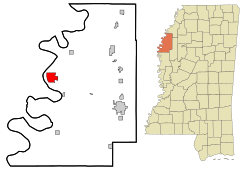
Location of Rosedale, Mississippi
Usa edcp location map.svg
Red pog.svg
Rosedale, Mississippi
Location in the United States
Coordinates: 33°51′13″N91°1′37″W / 33.85361°N 91.02694°W / 33.85361; -91.02694 Coordinates: 33°51′13″N91°1′37″W / 33.85361°N 91.02694°W / 33.85361; -91.02694
Country United States
State Mississippi
County Bolivar
Area
[1]
  Total5.48 sq mi (14.19 km2)
  Land5.42 sq mi (14.02 km2)
  Water0.06 sq mi (0.16 km2)
Elevation
151 ft (46 m)
Population
 (2020)
  Total1,584
  Density292.52/sq mi (112.95/km2)
Time zone UTC-6 (Central (CST))
  Summer (DST) UTC-5 (CDT)
ZIP code
38769
Area code 662
FIPS code 28-63720
GNIS feature ID0676870
Website www.cityofrosedale-ms.com

Rosedale is a city in Bolivar County, Mississippi, United States. The population was 1,873 at the 2010 census, [2] down from 2,414 in 2000. Located in an agricultural area, the city had a stop on the Yazoo and Mississippi Valley Railroad, which carried many migrants north out of the area in the first half of the 20th century.

Contents

History

The A. Y. Scott Residence in Rosedale, 1920. Scott was a director of the Rosedale Oil Mill. A Y Scott Residence, Rosedale, Mississippi (1920).jpg
The A. Y. Scott Residence in Rosedale, 1920. Scott was a director of the Rosedale Oil Mill.

Rosedale was settled around 1838 and became one of the two county seats in 1872. [4] This area was developed by European American planters for extensive cotton plantations, dependent on enslaved laborers. After the Civil War and emancipation, some freedmen managed to clear and buy land in the bottomlands, with many becoming landowners before the end of the nineteenth century. By 1910, a lengthy recession and declining economic and political conditions resulted in most blacks in the state losing their land. They could not compete with the financing gained by railroads, which were constructed in the area beginning in 1882 [5] Many stayed in the area to work as sharecroppers and laborers. The railroad brought new business to Rosedale, which had a depot and shipped cotton to northern and other markets. Rosedale incorporated as a town February 2, 1882 and became a city in 1930. [4] [6]

Beginning in the early twentieth century, tens of thousands of blacks left the state of Mississippi as part of the Great Migration, north by railroad to Chicago and other Midwestern industrial cities. During and after World War II, others went to California to work in the defense industry. Others remained where their families had lived for generations, with strong local ties.

In 2007, the Mississippi Blues Commission placed a historic marker at Rosedale's former Yazoo and Mississippi Valley Railroad depot site, designating it as a site on the Mississippi Blues Trail. The marker commemorates the sites in the original lyrics of legendary blues artist Robert Johnson's song "Travelling Riverside Blues". He traced the railway route which ran south from Friars Point to Rosedale among other stops, including Vicksburg and north to Memphis. The marker emphasizes that a common theme of blues songs was riding on the railroad, which was seen as a metaphor for travel and escape from poverty and Jim Crow in the Delta. It also commemorates another common blues theme, life on the banks of a moody river bank, a theme heard in Charlie Patton's "High Water Everywhere".

Locals claim that Johnson sold his soul to the Devil at the intersection of Mississippi state highways 1 and 8, on the south end of town, and that he tells this story metaphorically in "Cross Road Blues." Other artists have referred to his songs. [7] Johnson's deal with the Devil is mentioned as occurring in Rosedale in 1930 in an episode of the TV series Supernatural. However, a number of other Delta municipalities claim that the transaction took place in or near their boundaries.

Geography

Rosedale is located 19 miles (31 km) northwest of Cleveland.

According to the United States Census Bureau, Rosedale has a total area of 5.5 square miles (14.2 km2), of which 5.4 square miles (14.0 km2) is land and 0.08 square miles (0.2 km2), or 1.14%, is water. [2]

Rosedale is situated on the eastern side of the Mississippi River, approximately midway between the mouths of the Arkansas and White rivers, which flow into the Mississippi from the Arkansas (western) side.

Demographics

Historical population
CensusPop.Note
1890 376
1900 62265.4%
1910 1,10377.3%
1920 1,69653.8%
1930 2,11724.8%
1940 2,063−2.6%
1950 2,1976.5%
1960 2,3396.5%
1970 2,59911.1%
1980 2,7937.5%
1990 2,595−7.1%
2000 2,414−7.0%
2010 1,873−22.4%
2020 1,584−15.4%
U.S. Decennial Census [8]
Grace Episcopal Church in Rosedale is listed on the National Register of Historic Places. Grace Episcopal Church, Rosedale, MS.JPG
Grace Episcopal Church in Rosedale is listed on the National Register of Historic Places.

2020 census

Rosedale Racial Composition [9]
RaceNum.Perc.
White 1408.84%
Black or African American 1,39588.07%
Native American 10.06%
Other/Mixed 301.89%
Hispanic or Latino 181.14%

As of the 2020 United States Census, there were 1,584 people, 642 households, and 398 families residing in the city.

2000 census

As of the census [10] of 2000, there were 2,414 people, 780 households, and 567 families residing in the city. The population density was 444.2 inhabitants per square mile (171.5/km2). There were 842 housing units at an average density of 154.9 per square mile (59.8/km2). The racial makeup of the city was 16.86% White, 82.02% African American, 0.37% Asian, 0.17% from other races, and 0.58% from two or more races. Hispanic or Latino of any race were 0.75% of the population.

There were 780 households, out of which 38.1% had children under the age of 18 living with them, 29.2% were married couples living together, 37.8% had a female householder with no husband present, and 27.3% were non-families. 24.5% of all households were made up of individuals, and 11.4% had someone living alone who was 65 years of age or older. The average household size was 2.99 and the average family size was 3.56.

In the city, the population was spread out, with 34.9% under the age of 18, 10.4% from 18 to 24, 27.2% from 25 to 44, 17.6% from 45 to 64, and 9.9% who were 65 years of age or older. The median age was 28 years. For every 100 females, there were 85.3 males. For every 100 females age 18 and over, there were 78.3 males.

The median income for a household in the city was $17,955, and the median income for a family was $18,810. Males had a median income of $24,922 versus $15,714 for females. The per capita income for the city was $8,534. About 43.3% of families and 46.0% of the population were below the poverty line, including 58.6% of those under age 18 and 34.6% of those age 65 or over.

In 2010, Rosedale had the 22nd-lowest median household income of all places in the United States with a population over 1,000. [11]


Education

Rosedale is served by the West Bolivar Consolidated School District (formerly West Bolivar School District). Children in Rosedale are assigned to West Bolivar Elementary School, West Bolivar Middle School, and West Bolivar High School.

The case of Gong Lum v. Rice , wherein the U.S. Supreme Court held that a Chinese student was ineligible to attend the school for white children, and instead, was required to attend the school for colored children, originated in Rosedale.

Notable people

Related Research Articles

<span class="mw-page-title-main">Yazoo County, Mississippi</span> County in Mississippi, United States

Yazoo County is a county located in the U.S. state of Mississippi. As of the 2020 census, the population was 26,743. The county seat is Yazoo City. It is named for the Yazoo River, which forms its western border. Its name is said to come from a Choctaw language word meaning "River of Death."

<span class="mw-page-title-main">Bolivar County, Mississippi</span> County in Mississippi, United States

Bolivar County is a county located on the western border of the U.S. state of Mississippi. As of the 2020 census, the population was 30,985. Its county seats are Rosedale and Cleveland. The county is named in honor of Simón Bolívar, early 19th-century leader of the liberation of several South American colonies from Spain.

<span class="mw-page-title-main">Beulah, Mississippi</span> Town in Mississippi, United States

Beulah is a town in Bolivar County, Mississippi, United States. Per the 2020 census, the population was 242.

<span class="mw-page-title-main">Boyle, Mississippi</span> Town in Mississippi, United States

Boyle is a town in Bolivar County, Mississippi, United States. The population was 650 at the 2010 census.

<span class="mw-page-title-main">Gunnison, Mississippi</span> Town in Mississippi, United States

Gunnison is a town in Bolivar County, Mississippi, United States. Per the 2020 census, the population was 295.

<span class="mw-page-title-main">Merigold, Mississippi</span> Town in Mississippi, United States

Merigold is a town in Bolivar County, Mississippi, United States. Per the 2020 census, the population was 379.

<span class="mw-page-title-main">Renova, Mississippi</span> Town in Mississippi, United States

Renova is a town in Bolivar County, Mississippi, United States.Per the 2020 census, the population was 676. The community was founded by African Americans and remains predominantly African American.

<span class="mw-page-title-main">Shelby, Mississippi</span> City in Mississippi, United States

Shelby is a city in Bolivar County, Mississippi, United States. The population was 2,229 at the 2010 census, down from 2,926 in 2000. The town of Shelby was established in 1853 by Tom Shelby, who had purchased a block of land there from the federal government.

<span class="mw-page-title-main">Winstonville, Mississippi</span> Town in Mississippi, United States

Winstonville is a town in Bolivar County, Mississippi, United States. Per the 2020 census, the population was 153.

<span class="mw-page-title-main">Bruce, Mississippi</span> Town in Mississippi, United States

Bruce is a town situated along the Skuna River in Calhoun County, Mississippi, United States. As of the 2010 census, it had a population of 1,939.

<span class="mw-page-title-main">Cruger, Mississippi</span> Town in Mississippi, United States

Cruger is a town in Holmes County, Mississippi, United States. Per the 2020 census, the population was 268.

<span class="mw-page-title-main">Silver City, Mississippi</span> Town in Mississippi, United States

Silver City is a town in Humphreys County, Mississippi, United States. The population was 337 at the 2010 census, unchanged from the 2000 census.

<span class="mw-page-title-main">Itta Bena, Mississippi</span> City in Mississippi, United States

Itta Bena is a city in Leflore County, Mississippi, United States. The population was 2,049 at the 2010 census. The town's name is derived from the Choctaw phrase iti bina, meaning "forest camp". Itta Bena is part of the Greenwood, Mississippi micropolitan area. It developed as a trading center of an area of cotton plantations.

<span class="mw-page-title-main">Morgan City, Mississippi</span> Town in Mississippi, United States

Morgan City, Mississippi is a town in Leflore County along Mississippi Highway 7. The population was 255 at the 2010 census, down from 305 at the 2000 census. It is part of the Greenwood, Mississippi micropolitan area.

<span class="mw-page-title-main">Marks, Mississippi</span> City in Mississippi, United States

Marks is a city in and the county seat of Quitman County, Mississippi. As of the 2010 census, the city population was 1,735.

<span class="mw-page-title-main">Moorhead, Mississippi</span> City in Mississippi, United States

Moorhead is a city in Sunflower County, Mississippi, United States. As of the 2010 census, the city population was 2,405.

<span class="mw-page-title-main">Bentonia, Mississippi</span> Town in Mississippi, United States

Bentonia is a town in Yazoo County, Mississippi, United States. The population as of the 2020 census was 319.

<span class="mw-page-title-main">Eden, Mississippi</span> Village in Mississippi, United States

Eden is a village in Yazoo County, Mississippi. Per the 2020 Census, the population was 133.

<span class="mw-page-title-main">Alligator, Mississippi</span> Town in Mississippi, United States

Alligator is a town in Bolivar County, Mississippi, United States. Per the 2020 Census, the population was 116.

<span class="mw-page-title-main">Shaw, Mississippi</span> City in Mississippi, United States

Shaw is a city in Bolivar and Sunflower counties, Mississippi, United States, located in the Mississippi Delta region. The name was derived from an old Indian tribe northeast of this region. The population was 1,952 at the 2010 census.

References

  1. "2020 U.S. Gazetteer Files". United States Census Bureau. Retrieved July 24, 2022.
  2. 1 2 "Geographic Identifiers: 2010 Demographic Profile Data (G001): Rosedale city, Mississippi". U.S. Census Bureau, American Factfinder. Archived from the original on February 12, 2020. Retrieved January 21, 2014.
  3. "Rosedale Oil Mill". MississippiCorps. Retrieved June 2, 2015.
  4. 1 2 Hellmann, Paul T. (2006-02-02). Historical Gazetteer of the United States. p. 604. ISBN   9781135948597.
  5. John C. Willis, Forgotten Time: The Yazoo-Mississippi Delta after the Civil War. Charlottesville: University of Virginia Press, 2000
  6. "Chapter CCCCXII, an act to incorporate the town of Rosedale in Bolivar county". Act of February 2, 1882. State of Mississippi.
  7. Tributes to these songs have been recorded by many artists, notably a live performance titled "Crossroads" by Cream in 1968, and one of "Traveling Riverside Blues" by Led Zeppelin in 1997 on their BBC Sessions album.
  8. "Census of Population and Housing". Census.gov. Retrieved June 4, 2015.
  9. "Explore Census Data". data.census.gov. Retrieved 2021-12-08.
  10. "U.S. Census website". United States Census Bureau . Retrieved 2008-01-31.
  11. "US Census" . Retrieved 18 January 2014.
  12. "Travarus Bennett". ESPN. Retrieved 18 May 2020.
  13. Edward M. Komara (2006). Encyclopedia of the Blues: A-J, index. Routledge. p. 82. ISBN   978-0-415-92700-0.
  14. Robert Pruter (1992). Chicago Soul. University of Illinois Press. p. 124. ISBN   978-0-252-06259-9.