Poplarville, Mississippi | |
|---|---|
 Pearl River County Courthouse | |
| Nicknames: | |
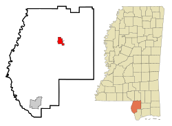 Location of Poplarville, Mississippi | |
 Poplarville, Mississippi Location in the United States | |
| Coordinates: 30°50′26″N89°32′2″W / 30.84056°N 89.53389°W | |
| Country | United States |
| State | Mississippi |
| County | Pearl River |
| Government | |
| • Mayor | Louise Smith |
| Area | |
• Total | 5.42 sq mi (14.04 km2) |
| • Land | 5.41 sq mi (14.01 km2) |
| • Water | 0.012 sq mi (0.03 km2) |
| Elevation | 318 ft (97 m) |
| Population (2020) | |
• Total | 2,833 |
| • Density | 523.9/sq mi (202.26/km2) |
| Time zone | UTC-6 (Central (CST)) |
| • Summer (DST) | UTC-5 (CDT) |
| ZIP code | 39470 |
| Area code | 601/769 |
| FIPS code | 28-59480 |
| GNIS feature ID | 0676247 |
| Website | www |
Poplarville is a city and the county seat of Pearl River County, Mississippi, United States. [2] As of the 2010 census, the city population was 2,894. It hosts an annual Blueberry Jubilee, which includes rides, craft vendors and rodeos.

