This article needs additional citations for verification .(May 2010) |
Batesville, Mississippi | |
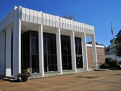
---|---|
Coordinates: 34°19′4″N89°56′33″W / 34.31778°N 89.94250°W | |
Country | United States |
State | Mississippi |
County | Panola |
Government | |
• Type | Mayor-Aldermen |
• Mayor | Hal Ferrell |
• Aldermen | List of Aldermen |
Area | |
• Total | 19.95 sq mi (51.67 km2) |
• Land | 19.95 sq mi (51.67 km2) |
• Water | 0.00 sq mi (0.00 km2) |
Elevation | 233 ft (71 m) |
Population (2020) | |
• Total | 7,523 |
• Density | 377.07/sq mi (145.59/km2) |
Time zone | UTC-6 (Central (CST)) |
• Summer (DST) | UTC-5 (CDT) |
ZIP code | 38606 |
Area code | 662 |
FIPS code | 28-03620 |
GNIS feature ID | 0666568 |
Website | Official website |
Batesville is a city in Panola County, Mississippi, United States. The population was 7,523 at the 2020 census, up from 7,463 at the 2010 census.
Batesville is one of two county seats which the legislature established for Panola County, related to a longstanding rivalry between towns on either side of the Tallahatchie River; the other is Sardis, located north of the river.
Batesville was founded in the 1850s following the construction of the Mississippi and Tennessee Railroad. [3]
According to the United States Census Bureau, the city has a total area of 11.1 square miles (29 km2), all land.
Census | Pop. | Note | %± |
---|---|---|---|
1870 | 227 | — | |
1880 | 442 | 94.7% | |
1890 | 705 | 59.5% | |
1900 | 556 | −21.1% | |
1910 | 774 | 39.2% | |
1920 | 1,050 | 35.7% | |
1930 | 1,062 | 1.1% | |
1940 | 1,815 | 70.9% | |
1950 | 2,463 | 35.7% | |
1960 | 3,284 | 33.3% | |
1970 | 3,796 | 15.6% | |
1980 | 5,162 | 36.0% | |
1990 | 6,403 | 24.0% | |
2000 | 7,113 | 11.1% | |
2010 | 7,463 | 4.9% | |
2020 | 7,523 | 0.8% | |
U.S. Decennial Census [4] |
Race | Num. | Perc. |
---|---|---|
White | 3,405 | 45.26% |
Black or African American | 3,725 | 49.51% |
Native American | 3 | 0.04% |
Asian | 43 | 0.57% |
Other/Mixed | 135 | 1.79% |
Hispanic or Latino | 212 | 2.82% |
As of the 2020 United States Census, there were 7,523 people, 3,089 households, and 2,494 families residing in the city. [6]
As of the census [7] of 2000, there were 7,113 people, 2,577 households, and 1,821 families residing in the city. The population density was 638.2 inhabitants per square mile (246.4/km2). There were 2,791 housing units at an average density of 250.4 per square mile (96.7/km2). The racial makeup of the city was 56.43% White, 41.88% African American, 0.06% Native American, 0.38% Asian, 0.04% Pacific Islander, 0.82% from other races, and 0.39% from two or more races. Hispanic or Latino of any race were 1.60% of the population.
There were 2,577 households, out of which 35.7% had children under the age of 18 living with them, 44.7% were married couples living together, 21.5% had a female householder with no husband present, and 29.3% were non-families. 26.2% of all households were made up of individuals, and 12.6% had someone living alone who was 65 years of age or older. The average household size was 2.59 and the average family size was 3.14.
In the city, the population was spread out, with 28.9% under the age of 18, 11.6% from 18 to 24, 26.4% from 25 to 44, 18.6% from 45 to 64, and 14.4% who were 65 years of age or older. The median age was 33 years. For every 100 females, there were 85.9 males. For every 100 females age 18 and over, there were 78.4 males. The median income for a household in the city was $29,875, and the median income for a family was $38,849. Males had a median income of $30,998 versus $22,029 for females. The per capita income for the city was $15,814. About 21.9% of families and 28.7% of the population were below the poverty line, including 36.1% of those under age 18 and 27.0% of those age 65 or over.
South Panola School District (SPSD) operates schools in Batesville and has its headquarters in Batesville. [8] Batesville Elementary School, [9] Batesville Intermediate School, [10] Batesville Middle School, [11] Batesville Junior High School, [12] and South Panola High School serve Batesville. [13]
A private academy founded in 1987, North Delta School, also serves Panola County and the surrounding area. [14]
Rail service is provided by Grenada Railway (formerly Illinois Central Railroad).
Amtrak's City of New Orleans used to provide passenger service, but the train was rerouted to the Delta region in 1995.
The short-lived Batesville Southwestern Railroad was established in Batesville.
Tunica County is a county located in the U.S. state of Mississippi. As of the 2020 census, the population was 9,782. Its county seat is Tunica. The county is named for the Tunica Native Americans. Most migrated to central Louisiana during the colonial period.
Tallahatchie County is a county in the U.S. state of Mississippi. At the 2020 census, the population was 12,715. Its county seats are Charleston and Sumner.
Sharkey County is a county located in the U.S. state of Mississippi. Part of the eastern border is formed by the Yazoo River. According to the 2020 census, the population was 3,800, making it the second-least populous county in Mississippi, after Issaquena County. Its county seat is Rolling Fork. The county is named after William L. Sharkey, the provisional Governor of Mississippi in 1865.
Quitman County is a county located in the U.S. state of Mississippi. As of the 2020 census, the population was 6,176, making it the third-least populous county in Mississippi. Its county seat is Marks. The county is named after John A. Quitman, Governor of Mississippi from 1835 to 1836 and from 1850 to 1851.
Panola County is a county located in the U.S. state of Mississippi. As of the 2020 census, the population was 33,208. Its county seats are Sardis and Batesville. The county is located just east of the Mississippi Delta in the northern part of the state. It is bisected by the Tallahatchie River flowing to the southwest; travel difficulties because of the river resulted in two county seats being established.
Coahoma County is a county located in the U.S. state of Mississippi. As of the 2020 census, the population was 21,390. Its county seat is Clarksdale.
Bolivar County is a county located on the western border of the U.S. state of Mississippi. As of the 2020 census, the population was 30,985. Its county seats are Rosedale and Cleveland. The county is named in honor of Simón Bolívar, early 19th-century leader of the liberation of several South American territories from Spain.
Arkansas City is a town in Desha County, Arkansas, United States. The population was 376 at the 2010 census. The town is the county seat of Desha County. Arkansas City Commercial District, located at Desoto Avenue and Sprague Street, is listed on the National Register of Historic Places.
Sulphur Rock is a town in Independence County, Arkansas, United States. The population was 456 at the 2010 census.
Strawberry is a town in Lawrence County, Arkansas, United States. The population was 302 at the 2010 census.
Benoit is a town in Bolivar County, Mississippi, United States. Per the 2020 Census, the population was 365.
Morgan City, Mississippi is a town in Leflore County along Mississippi Highway 7. The population was 255 at the 2010 census, down from 305 at the 2000 census. It is part of the Greenwood, Mississippi micropolitan area.
Como is a town in Panola County, Mississippi, which borders the Mississippi Delta and is in the northern part of the state, known as hill country. The population was 1,279 as of the 2010 census.
Sardis is a town in Panola County, Mississippi. As of the 2020 census, the town population was 1,748. Sardis is one of two county seats for Panola County; the other is Batesville, on the south side of the Tallahatchie River.
Inverness is a town in Sunflower County, Mississippi, United States. The population was 1,019 at the 2010 census. As the town had the largest cotton gin in the Mississippi Delta, it served as a gathering place for farmers from the region when they brought their cotton for processing. The town was heavily damaged by a tornado in 1971.
Moorhead is a city in Sunflower County, Mississippi, United States. As of the 2010 census, the city population was 2,405.
Pope is a village in Panola County, Mississippi. The population was 241 at the 2000 census.
Ruleville is a city in Sunflower County, Mississippi, United States, in the Mississippi Delta region. The population was 3,007 at the 2010 census. It is the second-largest community in the rural county.
Crenshaw is a town in Panola and Quitman counties in the U.S. state of Mississippi. The population was 885 at the 2010 census.
Crowder is a town in Panola and Quitman counties in the state of Mississippi. The population was 712 at the 2010 census.
{{cite book}}
: |work=
ignored (help)