Mound Landing, Mississippi

Last updated
Mound Landing, Mississippi
USA Mississippi location map.svg
Red pog.svg
Mound Landing, Mississippi
Location within the state of Mississippi
Usa edcp location map.svg
Red pog.svg
Mound Landing, Mississippi
Mound Landing, Mississippi (the United States)
Coordinates: 33°36′26″N91°07′37″W / 33.60722°N 91.12694°W / 33.60722; -91.12694 Coordinates: 33°36′26″N91°07′37″W / 33.60722°N 91.12694°W / 33.60722; -91.12694
CountryUnited States
State Mississippi
County Bolivar
Elevation
135 ft (41 m)
Time zone UTC-6 (Central (CST))
  Summer (DST) UTC-5 (CDT)
GNIS feature ID692087 [1]

Mound Landing is a ghost town in Bolivar County, Mississippi, United States. [1]

Contents

The settlement was located at Choctaw Bend on the Mississippi River.

History

Lloyd's map of the lower Mississippi River (map no. 3).jpg
1862 map showing William Perkins' plantation
The Great Mississippi Flood of 1927 began at this break in the Mississippi River levee at Mound Landing. 1927 Mississippi Flood Levee Breach.jpg
The Great Mississippi Flood of 1927 began at this break in the Mississippi River levee at Mound Landing.

The area was settled in 1840 by William P. Perkins, who used slave labor to clear 2,000 acres (810 ha) of canebrakes on which he established Mound Plantation, a cotton plantation. [2] [3]

Mound Plantation and its river landing were named for three nearby Indian mounds. [2]

Perkins eventually owned 3,200 acres (1,300 ha) of land at the settlement and, by 1850, was Bolivar County's largest land owner and one of the United States' largest slaveholders. [3]

Mound Landing had a post office as early as 1880. [4]

In 1886, the population of Mound Landing was 50. [5]

A levee was erected in 1867 to protect the settlement from river flooding. The levee was locally financed, and subsequent improvements to the levee were made. A ferry landing was located at the settlement, with a ramp which permitted vehicles to pass over the top of the levee. [6]

In April 1927, as water levels on the Mississippi River began to rise due to heavy rains, an unknown number of Negro prisoners were brought in chains to Mound Landing by the National Guard to fill sandbags at gunpoint in an effort to reinforce the levee. On April 21, the levee at Mound Landing broke, killing at least 100 prisoners and carrying their bodies several miles from the settlement. The Great Mississippi Flood of 1927 was one of the most damaging floods in the United States, inundating 1,800 sq mi (4,700 km2) of land in the Mississippi Delta, taking 246 lives, and displacing 700,000 people. [7] [8] [9] A historic marker describing when "the Mississippi River broke the levee at Mound Landing" is located on Mississippi Highway 1, approximately 2.5 mi (4.0 km) east of the former settlement. [10]

All that remains at Mound Landing is a boatramp located on private property owned by a hunting club. [11]

Notable person

Related Research Articles

West Baton Rouge Parish, Louisiana Parish in Louisiana, United States

West Baton Rouge Parish is one of the sixty-four parishes in the U.S. state of Louisiana. Established in 1807, its parish seat is Port Allen. With a 2020 census population of 27,199 residents, West Baton Rouge Parish is part of the Baton Rouge metropolitan statistical area.

Mound Bayou, Mississippi City in Mississippi, United States

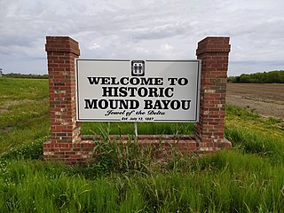
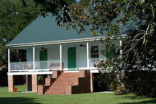
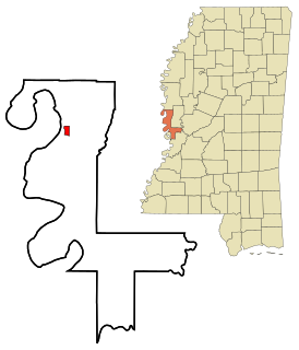
Mound Bayou is a city in Bolivar County, Mississippi, United States. The population was 1,533 at the 2010 census, down from 2,102 in 2000. It was founded as an independent black community in 1887 by former slaves led by Isaiah Montgomery.

Mayersville, Mississippi Town in Mississippi, United States

Mayersville is a town on the east bank of the Mississippi River, and the county seat for Issaquena County, Mississippi, United States. It is located in the Mississippi Delta region, known for cotton cultivation in the antebellum era. Once the trading center for the county, the town was superseded when railroads were built into the area. The population of the majority-black town was 547 at the 2010 census, down from 795 at the 2000 census.

American Bottom Flood plain of the Mississippi River in Illinois

The American Bottom is the flood plain of the Mississippi River in the Metro-East region of Southern Illinois, extending from Alton, Illinois, south to the Kaskaskia River. It is also sometimes called "American Bottoms". The area is about 175 square miles (450 km2), mostly protected from flooding in the 21st century by a levee and drainage canal system. Immediately across the river from St. Louis, Missouri, are industrial and urban areas, but many swamps and the major Horseshoe Lake are reminders of the Bottoms' riparian nature. This plain served as the center for the pre-Columbian Cahokia Mounds civilization, and later the French settlement of Illinois Country. Deforestation of the river banks in the 19th century to fuel steamboats had dramatic environmental effects in this region. The Mississippi River between St. Louis and the confluence with the Ohio River became wider and more shallow, as unstable banks collapsed into the water. This resulted in more severe flooding and lateral changes of the major channel, causing the destruction of several French colonial towns, such as Kaskaskia, which relocated; Cahokia, and St. Philippe, Illinois.

The Village of Holly Bluff is a small unincorporated community in Yazoo County, Mississippi, in the Mississippi Delta.

Mississippi River floods

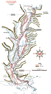
The Mississippi River and its tributaries have flooded on numerous occasions. This is a list of major floods.

Commerce, Mississippi Ghost Town in Mississippi, United States

Commerce is a ghost town in Tunica County, Mississippi, United States. Commerce Landing was the town's port.

Bolivar, Mississippi Census-designated place in Mississippi, United States

Bolivar is a census-designated place and unincorporated community in Bolivar County, Mississippi, United States.

Concordia is a ghost town in Bolivar County, Mississippi, United States, located on the eastern edge of the Mississippi Levee, approximately 2.5 mi (4.0 km) west of Mississippi Highway 1.

Princeton is a ghost town located in Washington County, Mississippi, United States.

Eutaw is a ghost town in Bolivar County, Mississippi, United States. The settlement had a port on the Mississippi River called "Eutaw Landing."

Brunswick is a ghost town in Warren County, Mississippi. Brunswick Landing, north of the community, was located directly on the Mississippi River.

Australia is a former town located in Bolivar County, Mississippi, United States. Australia was located on the Mississippi River.

Seyppel is an unincorporated community in Crittenden County, Arkansas, United States.

Leota is a ghost town located in Washington County, Mississippi, United States. The settlement, along with its river port Leota Landing, were at one time located directly on the Mississippi River.

Refuge is an unincorporated community located in Washington County, Mississippi, United States.

Roseacres is an unincorporated community in Coahoma County, Mississippi, United States.

Huntington is a ghost town in Bolivar County, Mississippi, United States.

Riverton is a ghost town in Bolivar County, Mississippi, United States.

Walter Sillers Sr. was an American lawyer, politician, businessman, and planter in Mississippi. He played a significant role in the economic, agricultural, and political culture of the Mississippi Delta region. A cotton planter, he was an advocate for the establishment of crop control policies for the Southern United States through the development of planter's cooperatives. He was a key figure in the Mississippi Democratic Party and was responsible for the construction of levees in the Mississippi River Valley.

References

  1. 1 2 "Mound Landing". Geographic Names Information System . United States Geological Survey.
  2. 1 2 Biographical and Historical Memoirs of Mississippi: Embracing an Authentic and Comprehensive Account of the Chief Events in the History of the State and a Record of the Lives of Many of the Most Worthy and Illustrious Families and Individuals. Goodspeed. 1891. pp.  586.
  3. 1 2 "Summary of "Wealth, Land and Slaveholding in Mississippi: A Planter Family's Life of Privilege, 1818–1913" by Ray R. Albin" (PDF). Santa Clara County Historical and Genealogical Society. Retrieved December 14, 2016.
  4. United States Official Postal Guide. United States Post Office. 1880. p. 98.
  5. Medical and Surgical Directory of the United States. Polk & Company. 1886. pp.  530.
  6. Bragg, Marion (1977). Historic Names and Places on the Lower Mississippi River (PDF). Mississippi River Commission. p. 123. Archived from the original (PDF) on 2016-03-04. Retrieved 2016-12-15.
  7. Tischauser, Leslie V. (2012). Jim Crow Laws. ABC-CLIO. p. 74. ISBN   9780313386091.
  8. Morris, Christopher (2012). The Big Muddy: An Environmental History of the Mississippi and Its Peoples from Hernando de Soto to Hurricane Katrina. Oxford University Press. ISBN   978-0-19-997706-2.
  9. "The State of Mississippi Standard Mitigation Plan" (PDF). Mississippi Emergency Management Agency. September 2010.
  10. Rogers, William. "Historical Markers in Bolivar County". William Rogers. Retrieved December 14, 2016.
  11. "Rosedale to Arkansas City". Rivergator. Retrieved December 14, 2016.
  12. The Transactions of the Third Annual Meeting of the Association of Military Surgeons, of the National Guard of the United States. Buxton and Skinner. 1894.