Magee, Mississippi

Last updated

Magee, Mississippi
Downtown Magee, Mississippi March 2013.jpg
Downtown Magee in March 2013
Flag of Magee, Mississippi.png
Simpson County Mississippi Incorporated and Unincorporated areas Magee Highlighted.svg
Location of Magee, Mississippi
Usa edcp location map.svg
Red pog.svg
Magee, Mississippi
Location in the United States
Coordinates: 31°52′22″N89°44′1″W / 31.87278°N 89.73361°W / 31.87278; -89.73361
CountryUnited States
State Mississippi
County Simpson
City February 25, 1900
Government
  Type Mayor-Council
   Mayor Dale Berry [1]
   Board of Aldermen Mark Grubbs
Lewana Thompson
Sammie Tebo
Patrick Brown
Sue Honea
Area
[2]
  Total5.26 sq mi (13.62 km2)
  Land5.26 sq mi (13.62 km2)
  Water0.00 sq mi (0.00 km2)
Elevation
433 ft (132 m)
Population
 (2020)
  Total3,988
  Density758.32/sq mi (292.80/km2)
Time zone UTC−6 (Central (CST))
  Summer (DST) UTC−5 (CDT)
ZIP code
39111
Area code 601
FIPS code 28-44600
GNIS feature ID0673055
Website www.cityofmagee.com

Magee is a city in Simpson County, Mississippi, United States. It is part of the Jackson metropolitan area.

Contents

History

The first settlers in the area were Arthur Mangum and Phil Magee, who came into the area around 1820. Pioneers from Virginia and the Carolinas followed. The town of Magee was originally named Mangum, after Arthur Mangum; it kept this name until 1859. [3]

In 1840, Willis Magee built a grist mill on Little Goodwater Creek, inside the present city limits. He started the first and only postal service in the area in 1855. [4]

Robert Solomon Magee was the first post master in Magee and the city of Magee was named after him.

Richard Farthing came to Magee in 1859 when he was in the leather tanning business. He bought 80 acres of land and also built a tanyard and used water from the mill pond to tan his leather. [5] The population of Magee in 1919 was 786. There were approximately 23 businesses in the area at the time. [5]

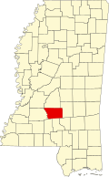
Magee is approximately 42 miles south of Jackson, 45 miles north of Hattiesburg, [5] and 12 miles south of Mendenhall, the county seat of Simpson County. [6]

Magee's first mayor was R.P. Vinson, who served from 1900 to 1907. [5]

In 2013, First Baptist Church in downtown Magee was seriously damaged by a fire but has been restored. [7]

Windham's Restaurant is located in Magee, and was established in 1963, locally known as "Zip's". In 2015, the Zip Burger was voted the best hamburger in Mississippi. [8] [9]

In 2017, the Magee Sportsplex was renamed the Jimmy Clyde Sportsplex in honor of former Magee mayor Jimmy Clyde. [10]

As of 2017, the mayor of Magee is Dale Berry. [11]

The city of Magee was featured in the Discovery Channel reality TV series Dirty Jobs. [12]

Geography

According to the United States Census Bureau, the city has a total area of 4.9 square miles (13 km2), all land. Magee is located between Jackson and Hattiesburg on U.S. Highway 49 at the intersection of three Mississippi Highways: 541, 545, and 28. Magee is approximately 155 miles north of New Orleans, Louisiana, and approximately 142 miles north of Mobile, Alabama. [13] [14]

Climate

Magee has a humid subtropical climate, with an annual mean temperature 65.8 degrees and average annual rainfall of 56.9 inches (1,450 mm).

March 2009 tornado

On March 26, 2009, around 1:30 a.m., an EF3 tornado struck the north part of the city. The tornado destroyed 60 homes and caused 25 injuries, with no fatalities. The tornado significantly damaged the town's water treatment plant, interrupting service to the entire town. Circuit Riders and other technicians from the Mississippi Rural Water Association worked with the city staff, local contractors and the Mississippi Emergency Management Agency to restore water service. [15] Using four MEMA generators, the rural water staff was able to restore service to Magee by 2:20 p.m. the next day.

Demographics

Historical population
CensusPop.Note
1910 685
1920 7306.6%
1930 96432.1%
1940 1,22126.7%
1950 1,73842.3%
1960 2,03917.3%
1970 2,97345.8%
1980 3,49717.6%
1990 3,6073.1%
2000 4,20016.4%
2010 4,4085.0%
2020 3,988−9.5%
U.S. Decennial Census [16]
Magee racial composition as of 2020 [17]
RaceNum.Perc.
White (non-Hispanic)1,77244.43%
Black or African American (non-Hispanic)1,90647.79%
Native American 70.18%
Asian 370.93%
Pacific Islander 10.03%
Other/Mixed 1343.36%
Hispanic or Latino 1313.28%

As of the 2020 United States census, there were 3,988 people, 1,465 households, and 933 families residing in the city.

Economy

Magee Post Office This is a photo of the Magee Post Office.jpg
Magee Post Office
Main Street Downtown Magee,Mississippi Main Street 2013.jpg
Main Street

Prominent area industries include Tyson Foods, Polk's Meat Products, Real Pure Beverage Group, and Howard Industry.

The Simpson County Development Foundation Industrial Park is an ultramodern, 205-acre (0.83 km2) industrial park located on four-lane Highway 49.

Arts and culture

The Chamber of Commerce sponsors the annual Homecoming, the Christmas Parade, tree lighting and caroling.

Crazy Day is an annual event on Main Street, traditionally held the third Saturday of the month of September. Locals set up booths to sell products or homemade goods.

Magee is also the home of the former Broadcountry Cinema 3 Theater, opened in 1985 and owned by Butch McCall. The theater was closed in 2010. The theater now serves as the location of Shining Starz ABA Autism Therapy. [18] [19]

A new civic center provides space for meetings for civic clubs and other organizations and houses the Magee Chamber of Commerce office.

Magee Public Library, the first public library in Magee, was established in 1935. Maude Turner was librarian. In 1937, the library was named Mims Williams Memorial Library. It is now a member of the Central Mississippi Regional Library System. The new library was built in 1975.

Education

The City of Magee is served by the Simpson County School District.

Public schools

Higher learning

A branch of Copiah-Lincoln Community College is located in Magee.

Media

Newspapers

The Magee Courier and Simpson County News serve Magee. [20]

Online news

Mageenews.com serves the local area. [21]

Radio and television

Infrastructure

Transportation

Public services

A new city hall, police station and city jail have been completed. There are 16 full-time police personnel, including the Chief of Police and 12 auxiliary officers.

Magee has 36 trained volunteer firemen and one full-time Fire Marshall, four class A pumpers, 1 class A pumper/tanker, 1 ladder truck, one rescue unit and two utility trucks. Emergency medical services are provided by ASAP EMS, CORP.

In the Magee, Mississippi National Guard Unit, there are 149 members with five full-time personnel.

Notable people

Related Research Articles

<span class="mw-page-title-main">Simpson County, Mississippi</span> County in Mississippi, United States

Simpson County is a county located in the U.S. state of Mississippi. Its western border is formed by the Pearl River, an important transportation route in the 19th century. As of the 2020 census, the population was 25,949. The county seat is Mendenhall. The county is named for Josiah Simpson (1787-1817), a territorial judge who also served as a delegate to Mississippi's Constitutional Convention.

<span class="mw-page-title-main">Perry County, Mississippi</span> County in Mississippi, United States

Perry County is a county located in the U.S. state of Mississippi. As of the 2020 census, the population was 11,511. The county seat is New Augusta. The county is named after the War of 1812 naval hero, Oliver Hazard Perry.

<span class="mw-page-title-main">Jackson County, Mississippi</span> County in Mississippi, United States

Jackson County is a county located in the U.S. state of Mississippi. As of the 2020 census, the population was 143,252, making it the fifth-most populous county in Mississippi. Its county seat is Pascagoula. The county was named for Andrew Jackson, general in the United States Army and afterward President of the United States.

<span class="mw-page-title-main">Hazlehurst, Mississippi</span> City in Mississippi, United States

Hazlehurst is a city in and the county seat of Copiah County, Mississippi, United States, located about 30 miles (48 km) south of the state capital Jackson along Interstate 55. The population was 4,009 at the 2010 census. It is part of the Jackson Metropolitan Statistical Area. Its economy is based on agriculture, particularly tomatoes and cabbage.

<span class="mw-page-title-main">Petal, Mississippi</span> City in Mississippi, United States

Petal is a city in Forrest County, Mississippi, along the Leaf River. It is part of the Hattiesburg, Mississippi Metropolitan Statistical Area. The population was 10,454 in the 2010 census, increasing to 11,010 in the 2020 census.

<span class="mw-page-title-main">Gautier, Mississippi</span> City Gautier in Mississippi, United States

Gautier is a city in Jackson County, Mississippi, United States, along the Gulf of Mexico west of Pascagoula. It is part of the Pascagoula Metropolitan Statistical Area. The population was 18,572 at the 2010 census, up from 11,681 at the 2000 census. In 2002, Gautier had annexed land more than doubling its area.

<span class="mw-page-title-main">Moss Point, Mississippi</span> City in Mississippi, United States

Moss Point is a city in Jackson County, Mississippi, United States. The population was 12,147 in 2020, a decline from the figure of 13,704 in 2010. The Moss Point Historic District and several individual buildings are listed on the National Register of Historic Places' Jackson County listings.

<span class="mw-page-title-main">Laurel, Mississippi</span> City in Mississippi, United States

Laurel is a city in and the second county seat of Jones County, Mississippi, United States. As of the 2020 census, the city had a population of 17,161. Laurel is northeast of Ellisville, the first county seat, which contains the first county courthouse. It has the second county courthouse, as Jones County has two judicial districts. Laurel is the headquarters of the Jones County Sheriff's Department, which administers in the county. Laurel is the principal city of a micropolitan statistical area named for it. Major employers include Howard Industries, Sanderson Farms, Masonite International, Family Health Center, Howse Implement, Thermo-Kool, and South Central Regional Medical Center. Laurel is home to the Lauren Rogers Museum of Art, Mississippi's oldest art museum, established by the family of Lauren Eastman Rogers.

<span class="mw-page-title-main">Columbia, Mississippi</span> City in Mississippi, United States

Columbia is a U.S. city in and the county seat of Marion County, Mississippi, which was formed six years before Mississippi was admitted to statehood. Columbia was named for Columbia, South Carolina, from which many of the early settlers had migrated. The population was 6,582 as of the 2010 census, and 5,864 in 2020.

<span class="mw-page-title-main">Braxton, Mississippi</span> Village in Mississippi, United States

Braxton is a village in Simpson County, Mississippi, United States. The village's population was 181 at the 2000 census. It is part of the Jackson, Mississippi Metropolitan Statistical Area. Its zip code is 39044.

<span class="mw-page-title-main">Mendenhall, Mississippi</span> City in Mississippi, United States

Mendenhall is a city in Simpson County, Mississippi, United States. The population was 2,504 at the 2010 census. It is the county seat of Simpson County. Mendenhall is part of the Jackson Metropolitan Statistical Area. Mendenhall has one of the highest trained volunteer fire depts in the area. Mendenhall has 1 full-time fire marshall. Of the 30 members 17 are NFPA 1001 Base certified, 2 are NFPA 1001-2 certified, 1 paramedic and 8 emt's, 4 are first responder certified. Mendenhall has 3 class A pumpers with 1 being a dual purpose engine that has equipment for rescue and medical calls, 1 3,000 gallon tanker, 1 custom brush truck. Mendenhall carries a class 6 fire rating.

<span class="mw-page-title-main">Louisville, Mississippi</span> City in Mississippi, United States

Louisville is a city in Winston County, Mississippi. The population was 6,631 at the 2010 census. It is the county seat of Winston County.

<span class="mw-page-title-main">Hattiesburg, Mississippi</span> City in Mississippi, United States

Hattiesburg is the 5th most populous city in the U.S. state of Mississippi, located primarily in Forrest County and extending west into Lamar County. The city population was 45,989 at the 2010 census, with the population now being 48,730 in 2020. Hattiesburg is the principal city of the Hattiesburg Metropolitan Statistical Area, which encompasses Covington, Forrest, Lamar, and Perry counties. The city is located in the Pine Belt region.

<span class="mw-page-title-main">Mangum, Oklahoma</span> City in Oklahoma, United States

Mangum is a city in and county seat of Greer County, Oklahoma, United States. The population was 3,010 at the 2010 census. It was originally part of Old Greer County in the Texas panhandle. The community was named for A. S. Mangum, who owned the land on which the town was founded in 1882. It became part of the Oklahoma Territory in 1896, and thus part of the state of Oklahoma on November 16, 1907.

<span class="mw-page-title-main">Mississippi Highway 469</span> Highway in Mississippi

Mississippi Highway 469 is a state highway in central Mississippi, located in Simpson and Rankin counties. The route starts at MS 28 near Georgetown, and it travels north through western Simpson County. The road enters the community of Harrisville and enters Rankin County soon after. It intersects U.S. Route 49 in Florence, and it ends at MS 468 near Whitfield. The route was designated in 1953, and it was extended southwards to MS 20 in 1956. By 1960, all of the route was paved with asphalt.

<span class="mw-page-title-main">Mississippi Highway 28</span> Highway in Mississippi

Mississippi Highway 28 (MS 28) is a state highway in south-central Mississippi, United States, that runs east–west from U.S. Highway 84 (US 84) west of Laurel to US 61/MS 33 in Fayette. It travels approximately 126 miles (203 km), serving Jefferson, Copiah, Simpson, Smith, and Jones counties.

<span class="mw-page-title-main">Jackson–Vicksburg–Brookhaven combined statistical area</span>

The Jackson–Vicksburg–Brookhaven, MS Combined Statistical Area is made up of eight counties in central Mississippi and consists of the Jackson Metropolitan Statistical Area, the Brookhaven, MS Micropolitan Statistical Area, the Vicksburg micropolitan area, and the Yazoo City Micropolitan Statistical Area. The 2010 census placed the Jackson–Vicksburg–Brookhaven CSA population at 650,764, although as of 2019, it's estimated to have increased to 666,318.

<span class="mw-page-title-main">Jackson metropolitan area, Mississippi</span> Metropolitan statistical area in Mississippi, United States

Jackson, MS Metropolitan Statistical Area is a metropolitan statistical area (MSA) in the central region of the U.S. state of Mississippi that covers seven counties: Copiah, Hinds, Holmes, Madison, Rankin, Simpson, and Yazoo. As of the 2010 census, the Jackson MSA had a population of 586,320. According to 2019 estimates, the population has slightly increased to 594,806. Jackson is the principal city of the MSA.

<span class="mw-page-title-main">Mississippi Highway 149</span> Highway in Mississippi

Mississippi Highway 149 is a state highway in Mississippi. The route designation is given to six former segments of U.S. Route 49, and two former sections of US 49W, within the state that have been bypassed. The sections run through Wiggins, Mount Olive, between Magee and Sanatorium, between Mendenhall and Braxton, in Richland, Mississippi, between Yazoo City and Silver City, Inverness, and Clarksdale. The total length of the eight sections of MS 149 is 58.073 miles (93.459 km).

<span class="mw-page-title-main">Mississippi Highway 540</span> State highway in Mississippi

Mississippi Highway 540 (MS 540) is a state highway through Simpson and Smith counties in central Mississippi. First created in 1958, the highway consists of two segments- one running about 10+12 miles (16.9 km) from Harrisville to D'Lo and a second 21.7-mile-long (34.9 km) road from Mendenhall to Raleigh.

References

  1. "Our City Welcomes You". City Of Magee. Retrieved July 1, 2016.
  2. "2020 U.S. Gazetteer Files". United States Census Bureau. Retrieved July 24, 2022.
  3. "mangum - magg07.htm - Generated by Personal Ancestral File". Freepages.genealogy.rootsweb.ancestry.com. Retrieved May 2, 2017.
  4. Magee The First 100 Years 1900-2000. John P. "Pat" Brown.
  5. 1 2 3 4 Magee The First 100 Years 1900-2000. John P. "Pat" Brown.
  6. "Distance between Mendenhall, MS and Magee, MS". www.distance-cities.com.
  7. "First Baptist Church in Magee rebuilt, better than ever". May 30, 2017. Retrieved May 15, 2019.
  8. "Zip Burger in Magee Named Best Burger in Mississippi". Eat, Drink, Mississippi. Archived from the original on August 16, 2016. Retrieved July 13, 2016.
  9. Honea, Sue (February 18, 2015). "Zip Burger named top burger in State - MageeNews.com" . Retrieved June 6, 2018.
  10. Ratcliffe, Jason (July 8, 2017). "Jimmy Clyde Sportsplex". Magee News.
  11. Honea, Sue (May 17, 2017). "Magee's Mayor Dale Berry - MageeNews.com" . Retrieved May 23, 2018.
  12. "Magee's Dirty Job!". mageenews.com. January 17, 2022. Retrieved January 18, 2022.
  13. "Magee, MS→Mobile, AL" . Retrieved November 19, 2019.
  14. "How far is magee%2Cms to New Orleans - Search" . Retrieved November 19, 2019.
  15. "Rural Water assists Mississippi town after tornado". National Rural Water Association. 2009. Retrieved July 8, 2009.
  16. "Census of Population and Housing". Census.gov. Retrieved June 4, 2015.
  17. "Explore Census Data". data.census.gov. Retrieved December 17, 2021.
  18. "Shining Starz ABA" . Retrieved April 28, 2023.
  19. "Broadcountry Cinema III in Magee, MS - Cinema Treasures" . Retrieved May 19, 2019.
  20. "Home | Magee Courier-Simpson County News". www.simpsoncounty.ms. Retrieved June 5, 2020.
  21. "Home". MageeNews.com. Retrieved June 5, 2020.