Franklin County, Mississippi

Last updated

Franklin County
Franklin MS Courthouse RT.jpg
Franklin County Courthouse, Meadville, Mississippi.
Map of Mississippi highlighting Franklin County.svg
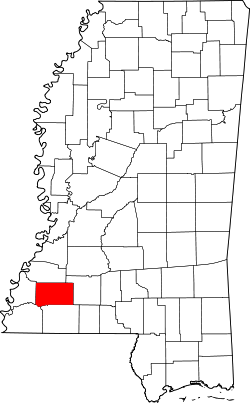
Location within the U.S. state of Mississippi
Mississippi in United States.svg
Mississippi's location within the U.S.
Coordinates: 31°29′N90°54′W / 31.48°N 90.9°W / 31.48; -90.9
CountryFlag of the United States.svg United States
StateFlag of Mississippi.svg  Mississippi
Founded1809
Named for Benjamin Franklin
Seat Meadville
Largest town Bude
Area
  Total567 sq mi (1,470 km2)
  Land564 sq mi (1,460 km2)
  Water3.0 sq mi (8 km2)  0.5%
Population
 (2020)
  Total7,675
  Density14/sq mi (5.2/km2)
Time zone UTC−6 (Central)
  Summer (DST) UTC−5 (CDT)
Congressional district 3rd
Website www.franklincountyms.com

Franklin County is a county located in the U.S. state of Mississippi. As of the 2020 census, the population was 7,675. [1] Its county seat is Meadville. [2] The county was formed on December 21, 1809, from portions of Adams County and named for Founding Father Benjamin Franklin. [3] It is bisected by the Homochitto River, which runs diagonally through the county from northeast to southwest.

Contents

History

This was the fourth county organized in Mississippi. It was initially developed for agriculture, specifically cotton plantations based on enslaved labor of African Americans. Cotton continued to be important to the economy through the 19th century and into the early 20th century.

This still rural county has had a decline in population by about half since 1910. It is the fourth least populous county in the state. Mechanization of agriculture and the blight of the boll weevil both reduced the need for farm workers; they left the area and often the state. Many African Americans went north or west in the Great Migration before and after World War II. The county in the 21st century is majority white in population; in the 2000 census, African Americans composed more than 36% of the population. (See Demographics section below.)

As in the rest of the state, the county had racially segregated facilities under Jim Crow from the late 19th century. Many white residents opposed the civil rights movement of the mid-20th century. In May 1964, Ku Klux Klan members abducted and killed two young black men, Henry Hezekiah Dee and Charles Eddie Moore of Meadville, before Freedom Summer started. Their bodies were not discovered in the Mississippi River until July 1964, during the hunt for three disappeared civil rights workers.

No one was prosecuted at the time, but the case was reopened in 2007, after a documentary had been released on it by Canadian Broadcasting Company. Local man James Ford Seale was convicted of the kidnappings and deaths by an all-white jury in federal court. [4] In 2008 the families of Dee and Moore filed a civil suit against the Franklin County government, charging complicity by its law enforcement in the deaths. On June 21, 2010, Franklin County agreed to an undisclosed settlement in the civil suit with the families of Charles Moore and Henry Dee. [5] [6] [7] [8]

Geography

According to the U.S. Census Bureau, the county has a total area of 567 square miles (1,470 km2), of which 564 square miles (1,460 km2) is land and 3.0 square miles (7.8 km2) (0.5%) is water. [9]

Major highways

Adjacent counties

National protected area

Communities

Towns

Unincorporated communities

Demographics

Historical population
CensusPop.Note
1810 2,016
1820 3,82189.5%
1830 4,62221.0%
1840 4,7753.3%
1850 5,90423.6%
1860 8,26540.0%
1870 7,498−9.3%
1880 9,72929.8%
1890 10,4247.1%
1900 13,67831.2%
1910 15,19311.1%
1920 14,156−6.8%
1930 12,268−13.3%
1940 12,5041.9%
1950 10,929−12.6%
1960 9,286−15.0%
1970 8,011−13.7%
1980 8,2082.5%
1990 8,3772.1%
2000 8,4480.8%
2010 8,118−3.9%
2020 7,675−5.5%
U.S. Decennial Census [10]
1790-1960 [11] 1900-1990 [12]
1990-2000 [13] 2010-2013 [14]
Franklin County racial composition as of 2020 [15]
Num.Perc.
White (non-Hispanic)4,91063.97%
Black or African American (non-Hispanic)2,56333.39%
Native American 20.03%
Asian 80.1%
Other/Mixed 1321.72%
Hispanic or Latino 600.78%

As of the 2020 United States census, there were 7,675 people, 2,928 households, and 2,096 families residing in the county.

Politics

United States presidential election results for Franklin County, Mississippi [16]
Year Republican Democratic Third party
No.%No.%No.%
2020 2,92365.52%1,48033.18%581.30%
2016 2,72163.43%1,50235.01%671.56%
2012 2,73560.87%1,72638.42%320.71%
2008 2,90962.09%1,73336.99%430.92%
2004 2,89364.42%1,57435.05%240.53%
2000 2,42761.40%1,48637.59%401.01%
1996 1,58647.50%1,38141.36%37211.14%
1992 1,94249.31%1,58740.30%40910.39%
1988 2,37659.97%1,56339.45%230.58%
1984 2,56462.86%1,49436.63%210.51%
1980 2,02649.31%2,04049.65%431.05%
1976 1,71950.63%1,57846.48%982.89%
1972 2,36178.73%56118.71%772.57%
1968 2316.71%78222.72%2,42970.57%
1964 2,21196.05%913.95%00.00%
1960 1247.38%44126.25%1,11566.37%
1956 17711.46%86255.83%50532.71%
1952 51430.60%1,16669.40%00.00%
1948 120.98%554.48%1,16094.54%
1944 493.89%1,21196.11%00.00%
1940 292.06%1,37697.94%00.00%
1936 332.91%1,09896.83%30.26%
1932 252.53%96597.47%00.00%
1928 18116.67%90583.33%00.00%
1924 365.74%59194.26%00.00%
1920 20323.97%64175.68%30.35%
1916 222.76%76996.49%60.75%
1912 41.10%30182.69%5916.21%

In the 1964 Presidential election Barry Goldwater reportedly received 96.05% of the county's vote. [17] Although the white-majority county has supported Southern Democrats such as Jimmy Carter for the presidency, since 2000 the Republican candidate has consistently received over 60% of the vote. [18]

See also

Related Research Articles

<span class="mw-page-title-main">Adams County, Mississippi</span> County in Mississippi, United States

Adams County is a county located in the U.S. state of Mississippi. As of the 2020 census, the population was 29,538. The county seat is Natchez.

<span class="mw-page-title-main">Hooker County, Nebraska</span> County in Nebraska, United States

Hooker County is a county in the U.S. state of Nebraska. As of the 2020 United States Census, the population was 711. Its county seat is Mullen, which is the county's only community of substantial size.

<span class="mw-page-title-main">Winston County, Mississippi</span> County in Mississippi, United States

Winston County is a county located in the U.S. state of Mississippi. In the 2020 census, the population was 17,714. Its county seat is Louisville. The county is named for Louis Winston (1784–1824), a colonel in the militia, a prominent lawyer, and a judge of the Mississippi Supreme Court.

<span class="mw-page-title-main">Wilkinson County, Mississippi</span> County in Mississippi, United States

Wilkinson County is a county located in the southwest corner of the U.S. state of Mississippi. As of 2020, its population was 8,587. Its county seat is Woodville. Bordered by the Mississippi River on the west, the county is named for James Wilkinson, a Revolutionary War military leader and first governor of the Louisiana Territory after its acquisition by the United States in 1803.

<span class="mw-page-title-main">Tippah County, Mississippi</span> County in Mississippi, United States

Tippah County is a county located on the northern border of the U.S. state of Mississippi. As of the 2020 census, the population was 21,815. Its county seat is Ripley. The name "Tippah" is derived from a Chickasaw language word meaning "cut off." It was taken from the creek of the same name that flows across much of the original county from northeast to southwest before emptying into the Tallahatchie River. The creek probably was so named because it, and the ridges on either side, "cut off" the western part of the region from the eastern portion.

<span class="mw-page-title-main">Prentiss County, Mississippi</span> County in Mississippi, United States

Prentiss County is a county located in the U.S. state of Mississippi. As of the 2020 census, the population was 25,008. Its county seat is Booneville. The county is named for Seargent Smith Prentiss, a noted speaker and US Congressman from Natchez.

<span class="mw-page-title-main">Neshoba County, Mississippi</span> County in Mississippi, United States

Neshoba County is located in the central part of the U.S. state of Mississippi. As of the 2020 census, the population was 29,087. Its county seat is Philadelphia. It was named after Nashoba, a Choctaw chief. His name means "wolf" in the Choctaw language.

<span class="mw-page-title-main">Lincoln County, Mississippi</span> County in Mississippi, United States

Lincoln County is a county located in the U.S. state of Mississippi. As of the 2020 census, the population was 34,907. Its county seat is Brookhaven.

<span class="mw-page-title-main">Lauderdale County, Mississippi</span> County in Mississippi, United States

Lauderdale County is a county located on the eastern border of the U.S. state of Mississippi. As of the 2020 census, the population was 72,984. The county seat is Meridian. The county is named for Colonel James Lauderdale, who was killed at the Battle of New Orleans in the War of 1812. Lauderdale County is included in the Meridian, MS Micropolitan Statistical Area.

<span class="mw-page-title-main">Jefferson County, Mississippi</span> County in Mississippi, United States

Jefferson County is a county located in the U.S. state of Mississippi; its western border is formed by the Mississippi River. As of the 2020 census, the population was 7,260, making it the fourth-least populous county in Mississippi. Its county seat is Fayette. The county is named for U.S. President Thomas Jefferson.

<span class="mw-page-title-main">Jackson County, Mississippi</span> County in Mississippi, United States

Jackson County is a county located in the U.S. state of Mississippi. As of the 2020 census, the population was 143,252, making it the fifth-most populous county in Mississippi. Its county seat is Pascagoula. The county was named for Andrew Jackson, general in the United States Army and afterward President of the United States.

<span class="mw-page-title-main">Harrison County, Mississippi</span> County in Mississippi, United States

Harrison County is a county located in the U.S. state of Mississippi. As of the 2020 census, the population was 208,621, making it the second-most populous county in Mississippi. Its county seats are Biloxi and Gulfport. The county is named after U.S. President William Henry Harrison.

<span class="mw-page-title-main">Forrest County, Mississippi</span> County in Mississippi, United States

Forrest County is located in the U.S. state of Mississippi. As of the 2020 census, the population was 78,158. Its county seat and largest city is Hattiesburg. The county was created from Perry County in 1908 and named in honor of Nathan Bedford Forrest, a Confederate general in the American Civil War and the first Grand Wizard of the Ku Klux Klan. Forrest County is part of the Hattiesburg, MS Metropolitan Statistical Area.

<span class="mw-page-title-main">Copiah County, Mississippi</span> County in Mississippi, United States

Copiah County is a county located in the U.S. state of Mississippi. As of the 2020 census, the population was 28,368. The county seat is Hazlehurst.

<span class="mw-page-title-main">Bolivar County, Mississippi</span> County in Mississippi, United States

Bolivar County is a county located on the western border of the U.S. state of Mississippi. As of the 2020 census, the population was 30,985. Its county seats are Rosedale and Cleveland. The county is named in honor of Simón Bolívar, early 19th-century leader of the liberation of several South American territories from Spain.

<span class="mw-page-title-main">Amite County, Mississippi</span> County in Mississippi, United States

Amite County is a county located in the state of Mississippi on its southern border with Louisiana. As of the 2020 census, the population was 12,720. Its county seat is Liberty. The county is named after the Amite River, which runs through the county.

<span class="mw-page-title-main">Roxie, Mississippi</span> Town in Mississippi, United States

Roxie is a town in Franklin County, Mississippi, United States. The population was 497 at the 2010 census, down from 569 at the 2000 census. This rural town developed with the construction of railroads in the area.

<span class="mw-page-title-main">Meadville, Mississippi</span> Town in Mississippi, United States

Meadville is a town in and the county seat of Franklin County, Mississippi, United States, in the southwest part of the state. The population was 449 at the 2010 census, down from 519 at the 2000 census. It is situated north of the Homochitto River, which runs from the northeast to the southwest through the county on its way to its outlet at the Mississippi River.

<span class="mw-page-title-main">James Ford Seale</span> American Ku Klux Klan member and convict

James Ford Seale was a Ku Klux Klan member charged by the U.S. Justice Department on January 24, 2007, and subsequently convicted on June 14, 2007, for the May 1964 kidnapping and murder of Henry Hezekiah Dee and Charles Eddie Moore, two African-American young men in Meadville, Mississippi. At the time of his arrest, Seale worked at a lumber plant in Roxie, Mississippi. He also worked as a crop duster and was a police officer in Louisiana briefly in the 1970s. He was a member of the militant Klan organization known as the Silver Dollar Group, whose members were identified with a silver dollar; occasionally minted the year of the member's birth.

Mississippi Cold Case is a 2007 feature documentary produced by David Ridgen of the Canadian Broadcasting Corporation about the Ku Klux Klan murders of two 19-year-old black men, Henry Hezekiah Dee and Charles Eddie Moore, in Southwest Mississippi in May 1964 during the Civil Rights Movement and Freedom Summer. It also explores the 21st-century quest for justice by the brother of Moore. The documentary won numerous awards as a documentary and for its investigative journalism.

References

  1. "Census - Geography Profile: Franklin County, Mississippi". United States Census Bureau . Retrieved January 8, 2023.
  2. "Find a County". National Association of Counties. Archived from the original on May 31, 2011. Retrieved June 7, 2011.
  3. Gannett, Henry (1905). The Origin of Certain Place Names in the United States. Govt. Print. Off. pp.  131.
  4. "Ex-KKK man guilty in 1964 killing". BBC.com. June 15, 2007. Retrieved August 26, 2008.
  5. "Families sue Franklin over Klan slayings". Clarion Ledger. August 7, 2008. Retrieved August 26, 2008.[ dead link ]
  6. "Dee, Moore families files suit against Franklin County, Miss., in 1964 murders". Concordia Sentinel. August 11, 2008. Archived from the original on August 16, 2008. Retrieved August 26, 2008.
  7. Walker, Adrian (August 8, 2008). "A righteous quest". The Boston Globe.com. Retrieved August 26, 2008.
  8. "Miss. Officials Agree To Settlement In '64 Slayings". NPR. June 21, 2010.
  9. "2010 Census Gazetteer Files". United States Census Bureau. August 22, 2012. Archived from the original on September 28, 2013. Retrieved November 3, 2014.
  10. "U.S. Decennial Census". United States Census Bureau. Retrieved November 3, 2014.
  11. "Historical Census Browser". University of Virginia Library. Retrieved November 3, 2014.
  12. "Population of Counties by Decennial Census: 1900 to 1990". United States Census Bureau. Retrieved November 3, 2014.
  13. "Census 2000 PHC-T-4. Ranking Tables for Counties: 1990 and 2000" (PDF). United States Census Bureau. Archived (PDF) from the original on March 27, 2010. Retrieved November 3, 2014.
  14. "State & County QuickFacts". United States Census Bureau. Archived from the original on June 7, 2011. Retrieved September 3, 2013.
  15. "Explore Census Data". data.census.gov. Retrieved December 17, 2021.
  16. Leip, David. "Dave Leip's Atlas of U.S. Presidential Elections". uselectionatlas.org. Retrieved March 3, 2018.
  17. David Leip's Presidential Election Atlas - 1964 statistics
  18. The New York Times Electoral Map (Zoom in on Mississippi)

31°29′N90°54′W / 31.48°N 90.90°W / 31.48; -90.90