
Money is an unincorporated community near Greenwood in Leflore County, Mississippi, United States, in the Mississippi Delta. It has fewer than 100 residents, down from 400 in the early 1950s when a cotton mill operated there. Money is located on a railroad line along the Tallahatchie River, a tributary of the Yazoo River in the eastern part of the Mississippi Delta. The community has ZIP code 38945 in the Greenwood, Mississippi micropolitan area.
Stanton is an unincorporated community in Adams County, Mississippi. It is the nearest community to Emerald Mound site, a National Historic Landmark.
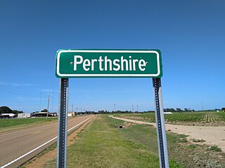
Perthshire is an unincorporated community located in Bolivar County, Mississippi, United States along Mississippi Highway 1. Perthshire is approximately 5 miles (8.0 km) south of Deeson and approximately 3 miles (4.8 km) north of Gunnison. Perthshire is located on the Riverside Division of the former Yazoo and Mississippi Valley Railroad. Perthshire was once home to six general stores.

Lamont is an unincorporated community located in southern Bolivar County, Mississippi, United States on Mississippi Highway 1 on the Bolivar County/Washington County border. Lamont is approximately 4 miles (6.4 km) north of Winterville and approximately 5 miles (8.0 km) south of Scott. Lamont is located at the junction of two branches of the former Yazoo and Mississippi Valley Railroad.
Bobo is a census-designated place and unincorporated community in Coahoma County, Mississippi, United States. Bobo is located on U.S. routes 61 and 278, southwest of Clarksdale.

Rich is an unincorporated community in Coahoma County, Mississippi, United States.
Hillhouse is an unincorporated community located in Coahoma County, Mississippi, United States. Hillhouse is approximately 3 miles (4.8 km) south of Rena Lara and 16 miles (26 km) north of Gunnison on Mississippi Highway 1. Hillhouse is located on the former Yazoo and Mississippi Valley Railroad and was once home to three general stores. A post office operated under the name Hillhouse from 1890 to 1972.

Hushpuckena is an unincorporated community located in Bolivar County, Mississippi, United States along U.S. Route 61. Hushpuckena is located approximately 3 miles (4.8 km) south of Duncan and approximately 4 miles (6.4 km) north of Shelby. Hushpuckena is located on the former Yazoo and Mississippi Valley Railroad.

Round Lake, also spelled Roundlake, is an unincorporated community located in Bolivar County, Mississippi, United States along Mississippi Highway 1. Round Lake is approximately 7 miles (11 km) west of Duncan and approximately 2 miles (3.2 km) north of Deeson. Round Lake is located on the former Yazoo and Mississippi Valley Railroad. Round Lake was formerly home to three general stores and two grocery stores.

O'Reilly is an unincorporated community located in Bolivar County, Mississippi, United States, along U.S. Route 61. O'Reilly is approximately 3 miles (4.8 km) south of Boyle and approximately 6 miles (9.7 km) north of Shaw. O'Reilly is located on the former Yazoo and Mississippi Valley Railroad.
Clover Hill is an unincorporated community located in Coahoma County, Mississippi, United States. Clover Hill is approximately 4 miles (6.4 km) north of Lyon and approximately 4 miles (6.4 km) south of Rudyard. The community is located on the former plantation of J. T. Fargason. Clover Hill once had a depot on the former Yazoo and Mississippi Valley Railroad. A post office operated under the name Clover Hill from 1884 to 1935.
Howard is an unincorporated community located in Holmes County, Mississippi and is approximately 5 miles (8.0 km) south of Tchula. The community was once a stop on the Yazoo and Mississippi Valley Railroad. Howard was incorporated in 1888 but lost that status at an unknown date. A post office operated under the name Howard from 1887 to 1920.
Lake View is a census-designated place and unincorporated community located in DeSoto County, Mississippi, United States, near the Mississippi/Tennessee border just south of Memphis and north of the village of Walls. Lake View is located on the former Yazoo and Mississippi Valley Railroad.
Roundaway is an unincorporated community located in Coahoma County, Mississippi, United States. Roundaway is approximately 14 miles (23 km) south of Clarksdale and 2 miles (3.2 km) north of Baltzer on New Africa Road. Roundaway is located on the former Yazoo and Mississippi Valley Railroad. A public school was once operated in Roundaway. A post office operated under the name Roundaway from 1905 to 1935.
Pattison, also known as Martin, is a census-designated place and unincorporated community in Claiborne County, Mississippi, United States. Its ZIP code is 39144.

Hopson is an unincorporated community located in Coahoma County, Mississippi, United States, south of Clarksdale and U.S. Route 61 along U.S. Route 49. Hopson is located on the former Yazoo and Mississippi Valley Railroad. A post office operated under the name Hopson from 1857 to 1867. In 1944 The Hopson Planting Company used International Harvester cotton pickers to harvest cotton, becoming the first farm to mechanically cultivate and produce an entire cotton crop. The former Hopson Plantation Company Store is now operated as a restaurant and music venue.

Swiftwater is an unincorporated community located in Washington County, Mississippi, United States.
Pluto is an unincorporated community in Holmes County, Mississippi, United States. Pluto is located on the Yazoo River. A post office operated under the name Pluto from 1886 to 1918.

Wautubbee is an unincorporated community in Clarke County, Mississippi, United States.
Knoxville is an unincorporated community in Franklin County, Mississippi, United States.


