Lee County, Mississippi

Last updated

Lee County
County of Lee
Tupelo MS Court house clock tower.JPG
Clock tower of the Lee County Courthouse
Map of Mississippi highlighting Lee County.svg
Location within the U.S. state of Mississippi
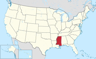
Mississippi in United States.svg
Mississippi's location within the U.S.
Coordinates: 34°17′N88°41′W / 34.29°N 88.68°W / 34.29; -88.68
CountryFlag of the United States.svg United States
StateFlag of Mississippi.svg Mississippi
FoundedOctober 26, 1866
(158 years ago)
 (1866-10-26)
Named after Gen. Robert E. Lee
Seat Tupelo
Largest cityTupelo
Area
  Total
453 sq mi (1,170 km2)
  Land450 sq mi (1,200 km2)
  Water3.2 sq mi (8 km2)  0.7%
Population
 (2020)
  Total
83,343
  Estimate 
(2024)
83,012 Decrease2.svg
  Density180/sq mi (71/km2)
Time zone UTC−6 (Central)
  Summer (DST) UTC−5 (CDT)
ZIP Codes
38801, 38804, 38824, 38826, 38828, 38843, 38849, 38857, 38858, 38860, 38862, 38866, 38868, 38879
Area code 662
Congressional district 1st
Website leecoms.com

Lee County is a county in U.S. state of Mississippi. At the 2020 census, the population was 83,343. Its county seat is Tupelo. Lee County is included in the Tupelo Micropolitan Statistical Area.

Contents

History

Lee County was established by the Mississippi Legislature on October 26, 1866, and named for General Robert E. Lee, [1] General in Chief of the Armies of the Confederate States. It was formed from Itawamba and Pontotoc counties; therefore, the record and list of early settlers mentioned in those counties embrace a great number who were residents of what is present day Lee County. [2]

Geography

According to the U.S. Census Bureau, the county has a total area of 453 square miles (1,170 km2), of which 450 square miles (1,200 km2) is land and 3.2 square miles (8.3 km2) (0.7%) is water. [3]

Major highways

Adjacent counties

National protected areas

Demographics

Historical population
CensusPop.Note
1870 15,955
1880 20,47028.3%
1890 20,040−2.1%
1900 21,9569.6%
1910 28,89431.6%
1920 29,6182.5%
1930 35,31319.2%
1940 38,83810.0%
1950 38,237−1.5%
1960 40,5896.2%
1970 46,14813.7%
1980 57,06123.6%
1990 65,58114.9%
2000 75,75515.5%
2010 82,9109.4%
2020 83,3430.5%
2024 (est.)83,012 [4] −0.4%
U.S. Decennial Census [5]
1790-1960 [6] 1900-1990 [7]
1990-2000 [8] 2010-2013 [9] 2018 [10]
Family in a wagon in Lee County, 1935. Photo by Arthur Rothstein. Family in a wagon, Lee County, Mississippi, 1935.jpg
Family in a wagon in Lee County, 1935. Photo by Arthur Rothstein.

2020 census

Lee County Racial Composition [11]
RaceNum.Perc.
White 52,85463.42%
Black or African American 24,13128.95%
Native American 940.11%
Asian 9201.1%
Pacific Islander 250.03%
Other/Mixed 2,4912.99%
Hispanic or Latino 2,8283.39%

As of the 2020 United States census, there were 83,343 people, 30,378 households, and 21,437 families residing in the county.

2000 census

As of the census [12] of 2000, there were 75,755 people, 29,200 households, and 20,819 families residing in the county. The population density was 168 inhabitants per square mile (65/km2). There were 31,887 housing units at an average density of 71 per square mile (27/km2). The racial makeup of the county was 73.66% White, 24.51% Black or African American, 0.13% Native American, 0.52% Asian, 0.01% Pacific Islander, 0.43% from other races, and 0.74% from two or more races. 1.16% of the population were Hispanic or Latino of any race. There were 29,200 households, out of which 36.10% had children under the age of 18 living with them, 52.60% were married couples living together, 14.60% had a female householder with no husband present, and 28.70% were non-families. 25.00% of all households were made up of individuals, and 8.50% had someone living alone who was 65 years of age or older. The average household size was 2.55 and the average family size was 3.05. In the county, the population was spread out, with 27.70% under the age of 18, 8.50% from 18 to 24, 30.50% from 25 to 44, 21.80% from 45 to 64, and 11.50% who were 65 years of age or older. The median age was 35 years. For every 100 females, there were 92.30 males. For every 100 females age 18 and over, there were 87.50 males. The median income for a household in the county was $36,165, and the median income for a family was $43,149. Males had a median income of $31,039 versus $22,235 for females. The per capita income for the county was $18,956. About 10.50% of families and 13.40% of the population were below the poverty line, including 17.90% of those under age 18 and 15.50% of those age 65 or over. Lee County has the ninth highest per capita income in the state of Mississippi.

Communities

Cities

---Towns---

Census-designated places

Unincorporated communities

Education

Lee County is served by the Baldwyn, Lee County, Nettleton, and Tupelo school districts. [13]

Politics

Lee County has been a Republican stronghold since the mid-1980s. The last Democratic presidential candidate who carried this county was Jimmy Carter in the election of 1980.

United States presidential election results for Lee County, Mississippi [14]
Year Republican Democratic Third party(ies)
No.%No.%No.%
1912 392.62%1,39093.54%573.84%
1916 915.12%1,68394.60%50.28%
1920 30215.38%1,65284.11%100.51%
1924 1525.48%2,62194.52%00.00%
1928 36711.75%2,75788.25%00.00%
1932 1293.36%3,70496.51%50.13%
1936 421.16%3,58598.84%00.00%
1940 1203.05%3,81496.93%10.03%
1944 2306.15%3,50993.85%00.00%
1948 822.13%63616.54%3,12881.33%
1952 2,00232.42%4,17467.58%00.00%
1956 92918.01%3,88375.30%3456.69%
1960 1,55023.34%3,65355.01%1,43821.65%
1964 5,16568.19%2,40931.81%00.00%
1968 2,52218.45%1,91213.99%9,23267.55%
1972 10,73082.60%1,63212.56%6294.84%
1976 7,36645.10%8,50452.07%4632.83%
1980 8,32644.08%10,04753.19%5162.73%
1984 13,31267.47%6,20831.46%2101.06%
1988 13,76766.42%6,60431.86%3571.72%
1992 12,23154.36%7,71034.27%2,56011.38%
1996 11,81554.48%8,43838.91%1,4336.61%
2000 15,55161.97%9,14236.43%4011.60%
2004 20,25466.11%10,12733.05%2580.84%
2008 22,69464.91%12,02134.39%2450.70%
2012 22,41563.49%12,56335.58%3280.93%
2016 22,22067.51%10,02930.47%6642.02%
2020 24,20765.51%12,18932.98%5581.51%
2024 24,33968.87%10,61630.04%3831.08%

See also

References

  1. Gannett, Henry (1905). The Origin of Certain Place Names in the United States (Report). U.S. Geological survey. Bulletin no. 258 (2nd ed.). Washington: Government Printing Office. p. 184. LCCN   05000751. OCLC   1156805 via United States Geological Survey.
  2. Lowry, Robert; McCardle, William H. (1891). A History of Mississippi, From the Discovery of the Great River by Hernando De Soto, Including the Earliest Settlement Made by the French, Under Iberville, to the Death of Jefferson Davis. Jackson, Miss.: R. H. Henry & Co. p. 520. LCCN   01002485. OCLC   2109804. OL   271554M.
  3. "2010 Census Gazetteer Files". United States Census Bureau. August 22, 2012. Archived from the original on September 28, 2013. Retrieved November 6, 2014.
  4. "County Population Totals and Components of Change: 2020-2024". United States Census Bureau. Retrieved September 3, 2025.
  5. "U.S. Decennial Census". United States Census Bureau. Retrieved November 6, 2014.
  6. "Historical Census Browser". University of Virginia Library. Retrieved November 6, 2014.
  7. "Population of Counties by Decennial Census: 1900 to 1990". United States Census Bureau. Retrieved November 6, 2014.
  8. "Census 2000 PHC-T-4. Ranking Tables for Counties: 1990 and 2000" (PDF). United States Census Bureau. Archived (PDF) from the original on March 27, 2010. Retrieved November 6, 2014.
  9. "State & County QuickFacts". United States Census Bureau. Archived from the original on June 7, 2011. Retrieved September 4, 2013.
  10. "Lee County, Mississippi". United States Census Bureau. Retrieved November 2, 2019.
  11. "Explore Census Data". data.census.gov. Retrieved December 8, 2021.
  12. "U.S. Census website". United States Census Bureau . Retrieved January 31, 2008.
  13. "2020 CENSUS - SCHOOL DISTRICT REFERENCE MAP: Lee County, MS" (PDF). U.S. Census Bureau. Archived (PDF) from the original on August 1, 2022. Retrieved July 31, 2022. - Text list
  14. Leip, David. "Dave Leip's Atlas of U.S. Presidential Elections". uselectionatlas.org. Retrieved March 5, 2018.
Government
General information