Lee County is a county in U.S. state of Mississippi. At the 2020 census, the population was 83,343. Lee County is included in the Tupelo Micropolitan Statistical Area.

The Des Moines River is a tributary of the Mississippi River in the upper Midwestern United States that is approximately 525 miles (845 km) long from its farther headwaters. The largest river flowing across the state of Iowa, it rises in southern Minnesota and flows across Iowa from northwest to southeast, passing from the glaciated plains into the unglaciated hills near the capital city of Des Moines, named after the river, in the center of the state. The river continues to flow to a southeastern direction away from Des Moines, later flowing directly into the Mississippi River.

The Kentucky River is a tributary of the Ohio River, 260 miles (418 km) long, in the U.S. Commonwealth of Kentucky. The river and its tributaries drain much of the central region of the state, with its upper course passing through the coal-mining regions of the Cumberland Mountains, and its lower course passing through the Bluegrass region in the north central part of the state. Its watershed encompasses about 7,000 square miles (18,000 km2). It supplies drinking water to about one-sixth of the population of the Commonwealth of Kentucky.

The Tug Fork is a tributary of the Big Sandy River, 159 miles (256 km) long, in southwestern West Virginia, southwestern Virginia, and eastern Kentucky in the United States. Via the Big Sandy and Ohio rivers, it is part of the watershed of the Mississippi River.

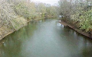
The Tombigbee River is a tributary of the Mobile River, approximately 200 mi (325 km) long, in the U.S. states of Mississippi and Alabama. Together with the Alabama, it merges to form the short Mobile River before the latter empties into Mobile Bay on the Gulf of Mexico. The Tombigbee watershed encompasses much of the rural coastal plain of western Alabama and northeastern Mississippi, flowing generally southward. The river provides one of the principal routes of commercial navigation in the southern United States, as it is navigable along much of its length through locks and connected in its upper reaches to the Tennessee River via the Tennessee-Tombigbee Waterway.
The Spoon River is a 147-mile-long (237 km) tributary of the Illinois River in west-central Illinois in the United States. The river drains largely agricultural prairie country between Peoria and Galesburg. The river is noted for giving its name to the fictional Illinois town in the 1915 poetry work Spoon River Anthology by Edgar Lee Masters, who was from Lewistown, which is near the river.

Bucksnort is a spring in Hickman County, Tennessee, United States, located on Sugar Creek, 0.2 miles (0.32 km) downstream of the confluence of the South Fork of Sugar Creek, 0.2 miles (0.32 km) to the south-east of Exit 152 on Interstate 40, and 2.7 miles (4.3 km) west of Spot. There are no U.S. Census statistics for the location and there is no post office. A trout farm business operated just upstream and adjacent to the I-40 in 1967, operated by Mr. and Mrs. Joda Austin.
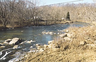
The Buckhannon River is a 45.4-mile-long (73.1 km) tributary of the Tygart Valley River in north-central West Virginia, USA. Via the Tygart Valley, Monongahela and Ohio rivers, it is part of the watershed of the Mississippi River, draining an area of 309 square miles (800 km2) on the unglaciated portion of the Allegheny Plateau. It provides drinking water for much of Upshur County.

The Bad Axe River is a 4.2-mile-long (6.8 km) tributary of the Mississippi River in southwestern Wisconsin in the United States. "Bad axe" is a translation from the French, "la mauvaise hache", but the origin of the name is unknown. The river's mouth at the Mississippi was the site of the Battle of Bad Axe, an 1832 U.S. Army massacre of Sauk and Fox Indians at the end of the Black Hawk War.
The Zumbro River is a tributary of the Mississippi River in the Driftless Area of southeastern Minnesota in the United States. It is 64.6 miles (104.0 km) long from the confluence of its principal tributaries and drains a watershed of 1,428 square miles (3,700 km2). The river's name in English is a change from its French name Rivière des Embarras due to its mouth near Pine Island in the Mississippi River; the pronunciation changed from to. The Dakota name for this river is Wapka Wazi Oju, having reference to the grove of great white pines at Pine Island.

The Crow River is a tributary of the Mississippi River in south-central Minnesota in the United States. It drains a watershed of 2,756 square miles (7,140 km2).
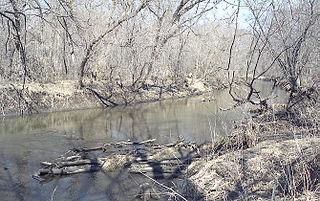
The Blackwater River is a 79.3-mile-long (127.6 km) tributary of the Lamine River in west-central Missouri in the United States. Via the Lamine and Missouri rivers, it is part of the watershed of the Mississippi River. The Blackwater River was named from the character of its banks and water.
The Fabius River is a 3.5-mile-long (5.6 km) tributary of the Mississippi River in northeastern Missouri in the United States. It is formed near its mouth by the confluence of the North Fabius River and the South Fabius River. The North Fabius River also flows through southeastern Iowa. The Middle Fabius River joins the North Fabius 8.9 miles (14.3 km) upstream of that river's mouth.
The Yellow Bank River is a 12.0-mile-long (19.3 km) tributary of the Minnesota River in western Minnesota in the United States. It is formed by the confluence of two longer streams, the North Fork Yellow Bank River and the South Fork Yellow Bank River, which also flow in northeastern South Dakota. Via the Minnesota River, the Yellow Bank River is part of the watershed of the Mississippi River, draining an area of approximately 460 square miles (1,190 km²) in an agricultural region.

The Holly River is a tributary of the Elk River in central West Virginia in the United States. Via the Elk, Kanawha, and Ohio Rivers, it is part of the watershed of the Mississippi River, draining an area of 148 square miles (380 km2) in a rural region of the Allegheny Mountains. It is approximately 3.9 miles (6.3 km) long, or 28 miles (45 km) including its Left Fork. The river was named for the holly bushes along its course.
Steer Creek is a tributary of the Little Kanawha River in central West Virginia in the United States. Via the Little Kanawha and Ohio rivers, it is part of the watershed of the Mississippi River, draining an area of 184 square miles (480 km2) in a rural region on the unglaciated portion of the Allegheny Plateau. It is 6.3 miles (10.1 km) long, or 31.7 miles (51.0 km) long including its Right Fork.

The Salt River is a tributary of the Mississippi River in eastern Missouri in the United States. The river is approximately 55 miles (89 km) long and drains an area of 2,518 sq mi (6,520 km2) in parts of twelve Missouri counties.
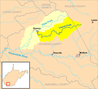
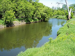
The Laurel Fork is a tributary of the Clear Fork, 23.5 miles (37.8 km) long, in southern West Virginia in the United States. Via the Clear Fork and the Guyandotte and Ohio rivers, it is part of the watershed of the Mississippi River, draining an area of 56.4 square miles (146 km2) in a rural area on the unglaciated portion of the Allegheny Plateau.
Lombardy is an unincorporated community located in northern Sunflower County, Mississippi. Lombardy is approximately 5.3 miles (8.5 km) south of Baltzer and approximately 7 miles (11 km) east of Mound Bayou at the junction of Lombardy and Mound Bayou Roads.
Ellistown is an unincorporated community in Union County, Mississippi.