
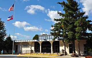
Union County is a county located in the U.S. state of Mississippi. As of the 2010 census, the population was 27,134. Its county seat is New Albany. According to most sources, the county received its name by being a union of pieces of several large counties, like other Union counties in other states. However, other sources say that the name was meant to mark the re-union of Mississippi and the other Confederate states after the Civil War.
Tishomingo County is a county located in the northeastern corner of the U.S. state of Mississippi. As of the 2010 census, the population was 19,593. Its county seat is Iuka.

The Tombigbee River is a tributary of the Mobile River, approximately 200 mi (325 km) long, in the U.S. states of Mississippi and Alabama. Together with the Alabama, it merges to form the short Mobile River before the latter empties into Mobile Bay on the Gulf of Mexico. The Tombigbee watershed encompasses much of the rural coastal plain of western Alabama and northeastern Mississippi, flowing generally southward. The river provides one of the principal routes of commercial navigation in the southern United States, as it is navigable along much of its length through locks and connected in its upper reaches to the Tennessee River via the Tennessee-Tombigbee Waterway.

The Grand Rounds National Scenic Byway is a linked series of park areas in Minneapolis, Minnesota, United States, that takes a roughly circular path through the city. The Minneapolis Park and Recreation Board developed the system over many years. The corridors include roads for automobile traffic plus separate paths for pedestrians and bicycles, and extend slightly into neighboring cities. About 50 miles (80 km) of roadway and paths are in the system, and much of it was built in the 1930s as part of Civilian Conservation Corps projects.

WYAB 103.9 FM is a radio station serving the city of Jackson, Mississippi, including Madison County, Yazoo County, Rankin County, and Hinds County. The studios of WYAB are located within the Cotton Exchange Plaza in Flora, Mississippi.
Nesbit is an unincorporated community in DeSoto County, Mississippi, United States. Nesbit is approximately 7 miles (11 km) south of Horn Lake, approximately 9 miles (14 km) south of Southaven and approximately 5 miles (8.0 km) north of Hernando near U.S. Route 51 and Interstate 55. Nesbit is located on the former Illinois Central Railroad.

Trace State Park is a public recreation area located off Mississippi Highway 6, approximately 7 miles (11 km) east of Pontotoc and 7 miles (11 km) west of Tupelo in the U.S. state of Mississippi. The state park surrounds 565-acre (229 ha) Trace Lake and is named for the nearby Natchez Trace trail. Famed frontiersman Davy Crockett once lived within the area bounded by the park.

Arkabutla Lake is a reservoir on the Coldwater River in the U.S. state of Mississippi. It was created following the construction of the Arkabutla Dam in 1940 on the Coldwater River.
Tralake is an unincorporated community located in Washington County, Mississippi. Tralake is approximately 5.8 miles (9.3 km) west-southwest of Kinlock, approximately 5.6 miles (9.0 km) west-southwest of Tribbett and approximately 4.9 miles (7.9 km) east of Arcola along Mississippi Highway 438.
Ingomar is an unincorporated community in Merced County, California. It is located on the Southern Pacific Railroad 10.5 miles (17 km) northwest of Los Banos, at an elevation of 92 feet.
Enid is an unincorporated community located in Tallahatchie County, Mississippi, United States. Enid is located near U.S. Highway 51 approximately 7 miles (11 km) north of Oakland, Mississippi and approximately 9 miles (14 km) south of Pope, Mississippi.

Paynes is an unincorporated community located in Tallahatchie County, Mississippi. Paynes is approximately 7 miles (11 km) northwest of Cascilla and approximately 6 miles (9.7 km) south of Charleston on Mississippi Highway 35.

Linn is an unincorporated community located in Sunflower County, Mississippi. Linn is located on Mississippi Highway 442 and is approximately 6 miles (9.7 km) east of Doddsville and approximately 3 miles (4.8 km) north of Steiner.
Boyer is an unincorporated community located in Sunflower County, Mississippi. Boyer is located on Steiner-Boyer Road and is approximately 7 miles (11 km) north of Indianola and approximately 4 miles (6.4 km) south of Roundaway.
Stephenville is an unincorporated community located in Sunflower County, Mississippi, United States. Stephenville is approximately 6 miles (9.7 km) north of Indianola and approximately 2 miles (3.2 km) northwest of Boyer along Mississippi Highway 448.

Round Lake, also spelled Roundlake, is an unincorporated community located in Bolivar County, Mississippi, United States along Mississippi Highway 1. Round Lake is approximately 7 miles (11 km) west of Duncan and approximately 2 miles (3.2 km) north of Deeson. Round Lake is located on the former Yazoo and Mississippi Valley Railroad. Round Lake was formerly home to three general stores and two grocery stores.
Waxhaw is an unincorporated community located in Bolivar County, Mississippi, United States. Waxhaw is approximately 3 miles (4.8 km) south of Gunnison and approximately 6 miles (9.7 km) north of Rosedale. It was also known as Waxhaw Plantation. Waxhaw is located on the former Yazoo and Mississippi Valley Railroad.
Ingomar Mound is the large central mound and sole remaining feature of a ceremonial center of the late Mississippian Period of cultural development. A total of 13 mounds composing the group have been excavated. Believed to be a temple mound, Ingomar is the only structure of the group not overrun by later agriculture and development, thus generally undisturbed when archeologists began studying the complex of mounds. At least one of the mounds in the group was a flat-topped burial mound. Ingomar is one of the largest such mounds found in the Southeast. Ingomar is important because of its potential for the testing of theories about aboriginal settlement pattern hypotheses, such as the Clay's system environments theory and Steponaitis' spatial efficiency theory

Minneapolis is often considered one of the top biking and walking cities in the United States due to its vast network of trails and dedicated pedestrian areas. In 2020, Walk Score rated Minneapolis as 13th highest among cities over 200,000 people. Some bicycling ratings list Minneapolis at the top of all United States cities, while others list Minneapolis in the top ten. There are over 80 miles (130 km) of paved, protected pathways in Minneapolis for use as transportation and recreation. The city's Grand Rounds National Scenic Byway parkway system accounts for the vast majority of the city's shared-use paths at approximately 50 miles (80 km) of dedicated biking and walking areas. By 2008, other city, county, and park board areas accounted for approximately 30 miles (48 km) of additional trails, for a city-wide total of approximately 80 miles (130 km) of protected pathways. The network of shared biking and walking paths continued to grow into the late 2010s with the additions of the Hiawatha LRT Trail gap remediation, Min Hi Line pilot projects, and Samatar Crossing. The city also features several natural-surface hiking trails, mountain-biking paths, groomed cross-country ski trails in winter, and other pedestrian walkways.


