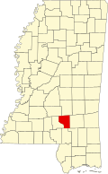
Covington County, Mississippi | |
|---|---|
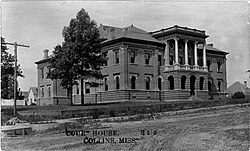 Covington County Courthouse | |
 Location within the U.S. state of Mississippi | |
| Coordinates: 31°38′N89°33′W / 31.63°N 89.55°W | |
| Country | |
| State | |
| Founded | 1819 |
| Named after | Leonard Covington |
| Seat | Collins |
| Largest city | Collins |
| Area | |
• Total | 415 sq mi (1,070 km2) |
| • Land | 414 sq mi (1,070 km2) |
| • Water | 1.1 sq mi (2.8 km2) 0.3% |
| Population (2020) | |
• Total | 18,340 |
• Estimate (2024) | 18,015 |
| • Density | 44.3/sq mi (17.1/km2) |
| Time zone | UTC−6 (Central) |
| • Summer (DST) | UTC−5 (CDT) |
| Congressional district | 3rd |
| Website | www |
Covington County is a county located in the U.S. state of Mississippi. As of the 2020 census, the population was 18,340. [1] Its county seat is Collins. [2] The county is named for U.S. Army officer and Congressman Leonard Covington. [3]
Contents
- History
- Geography
- Adjacent counties
- Transportation
- Major highways
- Minor highways
- Demographics
- 2020 census
- Education
- Politics
- National politics
- State politics
- Local politics
- Visitor attractions
- Okatoma River
- Mitchell Farms
- Grand Paradise Water Park
- Communities
- Cities
- Towns
- Unincorporated communities
- See also
- Notable people
- References
- External links