Newton County, Mississippi

Last updated

Newton County
A&V Railroad Depot.JPG
Map of Mississippi highlighting Newton County.svg
Location within the U.S. state of Mississippi
Mississippi in United States.svg
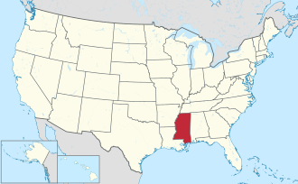
Mississippi's location within the U.S.
Coordinates: 32°25′N89°07′W / 32.41°N 89.12°W / 32.41; -89.12
CountryFlag of the United States.svg United States
StateFlag of Mississippi.svg  Mississippi
Founded1836
Seat Decatur
Largest city Newton
Area
  Total
580 sq mi (1,500 km2)
  Land578 sq mi (1,500 km2)
  Water1.5 sq mi (4 km2)  0.3%
Population
 (2020)
  Total
21,291
  Density37/sq mi (14/km2)
Time zone UTC−6 (Central)
  Summer (DST) UTC−5 (CDT)
Congressional district 3rd
Website www.newtoncountyms.net

Newton County is a county located in the U.S. state of Mississippi. As of the 2020 census, the population was 21,291. [1] Its county seat is Decatur. [2]

Contents

History

The land that would become Newton County was purchased from the Choctaw under the terms of the Treaty of Dancing Rabbit Creek. Newton County was split off from the southern part of Neshoba County and organized on February 26, 1836. [3] The county is named for scientist Isaac Newton. [4] [5]

The Battle of Newton's Station was fought in the county on April 24, 1863, during Grierson's Raid of the American Civil War. Union troops pulled up railroad tracks and burned the depot at Newton's Station. [6]

In February 1864, General William Tecumseh Sherman crossed the county, burning the county seat at Decatur and was nearly captured during the Meridian Campaign. Sherman stopped during the return trip from Meridian and slept at Boler's Inn in the town of Union. [7]

On October 8, 1908, a black sharecropper named Shep Jones had a disagreement with his white employer, leading to the employer's death[ weasel words ]. While searching for Jones, a white mob destroyed property owned by black people[ vague ], burned their church and meeting lodge, threatened black families[ vague ], and hanged Jones' father-in-law and two other black men. Many black people fled Newton County. No arrests or restitution occurred. [8]

Geography

According to the U.S. Census Bureau, the county has a total area of 580 square miles (1,500 km2), of which 578 square miles (1,500 km2) is land and 1.5 square miles (3.9 km2) (0.3%) is water. [9]

Major highways

Adjacent counties

National protected area

Demographics

Historical population
CensusPop.Note
1840 2,527
1850 4,46576.7%
1860 9,661116.4%
1870 10,0674.2%
1880 13,43633.5%
1890 16,62523.7%
1900 19,70818.5%
1910 23,08517.1%
1920 20,727−10.2%
1930 22,91010.5%
1940 24,2495.8%
1950 22,681−6.5%
1960 19,517−14.0%
1970 18,983−2.7%
1980 19,9445.1%
1990 20,2911.7%
2000 21,8387.6%
2010 21,720−0.5%
2020 21,291−2.0%
2023 (est.)21,019 [10] −1.3%
U.S. Decennial Census [11]
1790-1960 [12] 1900-1990 [13]
1990-2000 [14] 2010-2013 [15]

2020 census

Newton County Racial Composition [16]
RaceNum.Perc.
White 12,79660.1%
Black or African American 6,44730.28%
Native American 1,1695.49%
Asian 770.36%
Other/Mixed 4732.22%
Hispanic or Latino 3291.55%

As of the 2020 United States Census, there were 21,291 people, 8,037 households, and 5,697 families residing in the county.

2000 census

As of the census [17] of 2000, there were 21,838 people, 8,221 households, and 6,001 families residing in the county. The population density was 38 people per square mile (15 people/km2). There were 9,259 housing units at an average density of 16 per square mile (6.2/km2). The racial makeup of the county was 65.01% white, 30.37% black or African American, 3.68% Native American, 0.18% Asian, 0.33% from other races, and 0.44% from two or more races. 0.91% of the population were Hispanic or Latino of any race.

There were 8,221 households, out of which 33.50% had children under the age of 18 living with them, 53.00% were married couples living together, 16.00% had a female householder with no husband present, and 27.00% were non-families. 24.60% of all households were made up of individuals, and 11.60% had someone living alone who was 65 years of age or older. The average household size was 2.57 and the average family size was 3.04.

In the county, the population was spread out, with 26.20% under the age of 18, 11.20% from 18 to 24, 26.00% from 25 to 44, 21.70% from 45 to 64, and 14.90% who were 65 years of age or older. The median age was 35 years. For every 100 females there were 92.40 males. For every 100 females age 18 and over, there were 88.70 males.

The median income for a household in the county was $28,735, and the median income for a family was $34,606. Males had a median income of $27,820 versus $20,757 for females. The per capita income for the county was $14,008. About 16.40% of families and 19.90% of the population were below the poverty line, including 26.30% of those under age 18 and 21.70% of those age 65 or over.

Communities

City

Towns

Census-designated place

Unincorporated communities

Ghost towns

Politics

United States presidential election results for Newton County, Mississippi [18]
Year Republican Democratic Third party(ies)
No.%No.%No.%
2024 6,64171.23%2,60327.92%790.85%
2020 6,99768.71%3,07530.20%1111.09%
2016 6,54869.38%2,75629.20%1341.42%
2012 6,39465.40%3,31933.95%640.65%
2008 6,57966.76%3,21832.65%580.59%
2004 6,16572.63%2,28026.86%430.51%
2000 5,54071.59%2,14727.75%510.66%
1996 4,22361.30%2,16331.40%5037.30%
1992 5,12865.69%2,14627.49%5326.82%
1988 5,65870.70%2,33229.14%130.16%
1984 5,91173.23%2,12726.35%340.42%
1980 4,31754.36%3,45543.51%1692.13%
1976 3,81357.00%2,74140.97%1362.03%
1972 5,58588.05%5979.41%1612.54%
1968 5427.85%79911.58%5,56180.57%
1964 4,73595.21%2384.79%00.00%
1960 50815.05%91227.01%1,95657.94%
1956 36011.52%2,35975.46%40713.02%
1952 85125.70%2,46074.30%00.00%
1948 391.47%1696.38%2,44292.15%
1944 562.18%2,51697.82%00.00%
1940 411.61%2,49598.27%30.12%
1936 391.46%2,62498.42%30.11%
1932 562.41%2,25397.11%110.47%
1928 36815.07%2,07484.93%00.00%
1924 723.95%1,65790.94%935.10%
1920 1087.73%1,20886.41%825.87%
1916 191.34%1,34194.70%563.95%
1912 60.47%1,19794.62%624.90%

Education

School districts include: [19]

Conehatta Elementary School of the Choctaw Tribal School System is in the community. [20]

See also

Related Research Articles

<span class="mw-page-title-main">Morgan County, Alabama</span> County in Alabama, United States

Morgan County is a county in the north-central part of the U.S. state of Alabama. As of the 2020 census, its population was 123,421. The county seat is Decatur. On June 14, 1821, it was renamed in honor of American Revolutionary War General Daniel Morgan of Virginia. It is a prohibition or dry county, although alcohol sales are allowed in the cities of Decatur, Hartselle, and Priceville. Morgan County is included in the Decatur, AL Metropolitan Statistical Area, which is also included in the Huntsville-Decatur-Albertville, AL Combined Statistical Area. It is a part of the North, Northwest, and North-Central regions of Alabama.

<span class="mw-page-title-main">Lawrence County, Alabama</span> County in Alabama, United States

Lawrence County is a county in the northern part of the U.S. state of Alabama. As of the 2020 census, the population was 33,073. The county seat is Moulton. The county was named after James Lawrence, a captain in the United States Navy from New Jersey.

<span class="mw-page-title-main">Marshall County, Alabama</span> County in Alabama, United States

Marshall County is a county of the state of Alabama, United States. As of the 2020 census the population was 97,612. Its county seat is Guntersville. A second courthouse is in Albertville. Its name is in honor of John Marshall, famous Chief Justice of the United States. Marshall County is a dry county, with the exception of the five cities of Albertville, Arab, Grant, Guntersville, and Boaz. Marshall County comprises the Albertville, AL Micropolitan Statistical Area, which is also included in the Huntsville-Decatur-Albertville, AL Combined Statistical Area.

<span class="mw-page-title-main">Decatur County, Tennessee</span> County in Tennessee, United States

Decatur County is a county located in the U.S. state of Tennessee. As of the 2020 census, the population was 11,435. Its county seat is Decaturville.

<span class="mw-page-title-main">Winston County, Mississippi</span> County in Mississippi, United States

Winston County is a county located in the U.S. state of Mississippi. In the 2020 census, the population was 17,714. Its county seat is Louisville. The county is named for Louis Winston (1784–1824), a colonel in the militia, a prominent lawyer, and a judge of the Mississippi Supreme Court.

<span class="mw-page-title-main">Tate County, Mississippi</span> County in Mississippi, United States

Tate County is a county located in the northwestern portion of the U.S. state of Mississippi. As of the 2020 census, the population was 28,064. Its county seat is Senatobia. Organized in 1873 during the Reconstruction era, from portions of DeSoto, Marshall, and Tunica counties, the county is named for Thomas Simpson Tate, one of the first prominent American settlers of the area.

<span class="mw-page-title-main">Sharkey County, Mississippi</span> County in Mississippi, United States

Sharkey County is a county located in the U.S. state of Mississippi. Part of the eastern border is formed by the Yazoo River. According to the 2020 census, the population was 3,800, making it the second-least populous county in Mississippi, after Issaquena County. Its county seat is Rolling Fork. The county is named after William L. Sharkey, the provisional Governor of Mississippi in 1865.

<span class="mw-page-title-main">Neshoba County, Mississippi</span> County in Mississippi, United States

Neshoba County is a county located in the central part of the U.S. state of Mississippi. As of the 2020 census, the population was 29,087. Its county seat is Philadelphia.

<span class="mw-page-title-main">Lincoln County, Mississippi</span> County in Mississippi, United States

Lincoln County is a county located in the U.S. state of Mississippi. As of the 2020 census, the population was 34,907. Its county seat is Brookhaven. The county was created by the legislature on April 7, 1870, during the Reconstruction Era. It was formed from portions of Lawrence, Pike, Franklin, Copiah, and Amite counties. It was named for Abraham Lincoln, the 16th President of the United States. Lincoln County comprises the Brookhaven, MS Micropolitan Statistical Area, which is included in the Jackson–Vicksburg–Brookhaven Combined Statistical Area. The county is southwest of the state capital of Jackson.

<span class="mw-page-title-main">Leake County, Mississippi</span> County in Mississippi, United States

Leake County is a county in the center of the U.S. state of Mississippi. As of the 2020 census, the population was 21,275. Its county seat is Carthage. The county is named for Walter Leake, the Governor of Mississippi from 1822 to 1825.

<span class="mw-page-title-main">Decatur, Arkansas</span> City in Arkansas, United States

Decatur is a city, in Benton County, Arkansas, United States. The population was 1,773 at the 2020 census. It is part of the Northwest Arkansas region. This town is named after Commodore Stephen Decatur, Jr.

<span class="mw-page-title-main">Decatur City, Iowa</span> City in Iowa, United States

Decatur is a city in Decatur County, Iowa, United States. The population was 175 at the time of the 2020 census.

<span class="mw-page-title-main">Jennings, Kansas</span> City in Decatur County, Kansas

Jennings is a city in Decatur County, Kansas, United States. As of the 2020 census, the population of the city was 81.

<span class="mw-page-title-main">Pearl River, Mississippi</span> CDP in Mississippi, United States

Pearl River is a census-designated place (CDP) in Neshoba County, Mississippi. It is one of the eight communities of the Mississippi Band of Choctaw Indians Reservation and the population is 80% Choctaw. The population was 3,156 at the 2000 census.

<span class="mw-page-title-main">Philadelphia, Mississippi</span> City in Mississippi, United States

Philadelphia is a city in and the county seat of Neshoba County, Mississippi, United States. The population was 7,118 at the 2020 census.

<span class="mw-page-title-main">Tucker, Mississippi</span> CDP in Mississippi, United States

Tucker is a census-designated place (CDP) in Neshoba County, Mississippi. It is one of the eight communities of the Mississippi Band of Choctaw Indians Reservation and the population is 93% Choctaw. The population was 642 at the 2020 census.

<span class="mw-page-title-main">Decatur, Mississippi</span> Town in Mississippi, United States

Decatur is a town in and the county seat of Newton County, Mississippi. The population was 1,841 at the 2010 census. This town is named after war hero Stephen Decatur Jr.

<span class="mw-page-title-main">Conehatta, Mississippi</span> CDP in Mississippi, United States

Conehatta is a census-designated place (CDP) in Newton County, Mississippi. The population was 1376 at the 2020 census. It is one of the eight communities included in the Mississippi Band of Choctaw Indians Reservation and the population is 76% Choctaw.

<span class="mw-page-title-main">Bogue Chitto, Mississippi</span> Census-designated place in Mississippi, United States

Bogue Chitto is a census-designated place (CDP) situated in Kemper and Neshoba counties, Mississippi. The population was 864 at the 2020 census. It is part of the Mississippi Band of Choctaw Indians Reservation and the population is 93% Choctaw.

<span class="mw-page-title-main">Union, Mississippi</span> Town in Mississippi, United States

Union is a town in Neshoba and Newton counties, Mississippi. The population was 2,042 at the 2020 census.

References

  1. "Census - Geography Profile: Newton County, Mississippi". United States Census Bureau . Retrieved January 14, 2023.
  2. "Find a County". National Association of Counties . Retrieved June 7, 2011.
  3. r2WPadmin. "Newton County". Mississippi Encyclopedia. Retrieved December 15, 2023.{{cite web}}: CS1 maint: numeric names: authors list (link)
  4. Rowland, Dunbar (1907). Mississippi: Comprising Sketches of Counties, Towns, Events, Institutions, and Persons, Arranged in Cyclopedic Form. Vol. 2. Southern Historical Publishing Association. p. 339.
  5. "Newton County Mississippi". Newton County. Retrieved December 15, 2023.
  6. "Grierson's Raid Historical Marker". www.hmdb.org. Retrieved December 15, 2023.
  7. "Boler's Inn Historical Marker". www.hmdb.org. Retrieved December 15, 2023.
  8. "Descendants of Lynching Victims Dedicate Historical Marker in Hickory, Mississippi". Equal Justice Initiative. August 19, 2021. Retrieved October 12, 2021.
  9. "2010 Census Gazetteer Files". United States Census Bureau. August 22, 2012. Archived from the original on September 28, 2013. Retrieved November 6, 2014.
  10. "Annual Estimates of the Resident Population for Counties: April 1, 2020 to July 1, 2023". United States Census Bureau. Retrieved April 5, 2024.
  11. "U.S. Decennial Census". United States Census Bureau. Retrieved November 6, 2014.
  12. "Historical Census Browser". University of Virginia Library. Retrieved November 6, 2014.
  13. "Population of Counties by Decennial Census: 1900 to 1990". United States Census Bureau. Retrieved November 6, 2014.
  14. "Census 2000 PHC-T-4. Ranking Tables for Counties: 1990 and 2000" (PDF). United States Census Bureau. Archived (PDF) from the original on March 27, 2010. Retrieved November 6, 2014.
  15. "State & County QuickFacts". United States Census Bureau. Archived from the original on March 9, 2013. Retrieved September 4, 2013.
  16. "Explore Census Data". data.census.gov. Retrieved December 8, 2021.
  17. "U.S. Census website". United States Census Bureau . Retrieved January 31, 2008.
  18. Leip, David. "Dave Leip's Atlas of U.S. Presidential Elections". uselectionatlas.org. Retrieved March 4, 2018.
  19. "2020 CENSUS - SCHOOL DISTRICT REFERENCE MAP: Newton County, MS" (PDF). U.S. Census Bureau. Archived (PDF) from the original on July 19, 2021. Retrieved August 6, 2022. - Text list
  20. "Home". Conehatta Elementary School. Retrieved August 6, 2022. 851 Tushka Drive Conehatta, MS 39057

Further reading

32°25′N89°07′W / 32.41°N 89.12°W / 32.41; -89.12