Newton, Mississippi | |
---|---|
Coordinates: 32°19′17″N89°09′48″W / 32.32139°N 89.16333°W [1] | |
Country | United States |
State | Mississippi |
County | Newton |
Government | |
• Mayor | Antonio Hoye (D) |
Area | |
• Total | 7.17 sq mi (18.57 km2) |
• Land | 7.15 sq mi (18.53 km2) |
• Water | 0.02 sq mi (0.04 km2) |
Elevation | 423 ft (129 m) |
Population (2020) | |
• Total | 3,195 |
• Density | 446.67/sq mi (172.46/km2) |
Time zone | UTC-6 (Central (CST)) |
• Summer (DST) | UTC-5 (CDT) |
ZIP code | 39345 |
Area code | 601 |
FIPS code | 28-51720 |
Website | City of Newton |
Newton is a city in Newton County, Mississippi. The population was 3,195 in the 2020 census.
The Battle of Newton's Station was fought here on April 24, 1863 during Grierson's Raid of the American Civil War.
On February 13, 1948, a tornado, with an estimated intensity of F3 on the Fujita scale, impacted the town, killing five people and destroying 30 homes. [3]
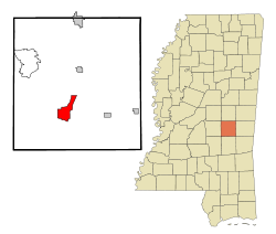
Newton is located south of I-20 and U.S. Route 80 approximately 25 miles west of Meridian in south central Newton County. Potterchitto Creek flows past the west and north sides of the city. [4]
According to the United States Census Bureau, the city has a total area of 7.2 square miles (19 km2), of which 7.2 square miles (19 km2) is land and 0.14% is water.
Climate data for Newton Experiment Station, Mississippi (1991–2020 normals, extremes 1948–present) | |||||||||||||
---|---|---|---|---|---|---|---|---|---|---|---|---|---|
Month | Jan | Feb | Mar | Apr | May | Jun | Jul | Aug | Sep | Oct | Nov | Dec | Year |
Record high °F (°C) | 81 (27) | 85 (29) | 89 (32) | 93 (34) | 97 (36) | 103 (39) | 104 (40) | 107 (42) | 104 (40) | 100 (38) | 91 (33) | 84 (29) | 107 (42) |
Mean daily maximum °F (°C) | 58.1 (14.5) | 62.6 (17.0) | 70.1 (21.2) | 77.1 (25.1) | 84.4 (29.1) | 90.7 (32.6) | 93.2 (34.0) | 92.9 (33.8) | 89.0 (31.7) | 79.7 (26.5) | 68.3 (20.2) | 60.6 (15.9) | 77.2 (25.1) |
Daily mean °F (°C) | 45.6 (7.6) | 49.3 (9.6) | 56.3 (13.5) | 63.5 (17.5) | 71.7 (22.1) | 78.7 (25.9) | 81.3 (27.4) | 80.5 (26.9) | 75.7 (24.3) | 64.8 (18.2) | 54.0 (12.2) | 48.1 (8.9) | 64.1 (17.8) |
Mean daily minimum °F (°C) | 33.0 (0.6) | 36.0 (2.2) | 42.6 (5.9) | 49.8 (9.9) | 59.0 (15.0) | 66.6 (19.2) | 69.3 (20.7) | 68.2 (20.1) | 62.3 (16.8) | 49.9 (9.9) | 39.7 (4.3) | 35.6 (2.0) | 51.0 (10.6) |
Record low °F (°C) | 9 (−13) | 15 (−9) | 16 (−9) | 27 (−3) | 39 (4) | 46 (8) | 59 (15) | 53 (12) | 41 (5) | 28 (−2) | 20 (−7) | 14 (−10) | 9 (−13) |
Average precipitation inches (mm) | 5.76 (146) | 5.54 (141) | 5.39 (137) | 6.12 (155) | 4.08 (104) | 4.90 (124) | 4.83 (123) | 4.64 (118) | 3.24 (82) | 3.83 (97) | 4.60 (117) | 5.54 (141) | 58.47 (1,485) |
Average snowfall inches (cm) | 0.3 (0.76) | 0.1 (0.25) | trace | 0.0 (0.0) | 0.0 (0.0) | 0.0 (0.0) | 0.0 (0.0) | 0.0 (0.0) | 0.0 (0.0) | 0.0 (0.0) | 0.0 (0.0) | 0.0 (0.0) | 0.4 (1.0) |
Average precipitation days (≥ 0.01 in) | 10.9 | 9.5 | 9.9 | 8.4 | 8.8 | 10.2 | 11.7 | 9.9 | 6.6 | 6.5 | 8.4 | 10.7 | 111.5 |
Average snowy days (≥ 0.1 in) | 0.2 | 0.1 | 0.1 | 0.0 | 0.0 | 0.0 | 0.0 | 0.0 | 0.0 | 0.0 | 0.0 | 0.0 | 0.4 |
Source: NOAA [5] [6] |
Census | Pop. | Note | %± |
---|---|---|---|
1870 | 154 | — | |
1900 | 537 | — | |
1910 | 1,878 | 249.7% | |
1920 | 1,604 | −14.6% | |
1930 | 2,011 | 25.4% | |
1940 | 1,800 | −10.5% | |
1950 | 2,912 | 61.8% | |
1960 | 3,178 | 9.1% | |
1970 | 3,556 | 11.9% | |
1980 | 3,708 | 4.3% | |
1990 | 3,701 | −0.2% | |
2000 | 3,699 | −0.1% | |
2010 | 3,373 | −8.8% | |
2020 | 3,195 | −5.3% | |
U.S. Decennial Census [7] |
Race | Num. | Perc. |
---|---|---|
White | 833 | 26.07% |
Black or African American | 2,225 | 69.64% |
Native American | 4 | 0.13% |
Asian | 11 | 0.34% |
Other/Mixed | 82 | 2.57% |
Hispanic or Latino | 40 | 1.25% |
As of the 2020 United States Census, there were 3,195 people, 1,305 households, and 877 families residing in the city.
As of 2008, there were 3,674 people, 1,420 households, and 971 families residing in the city. The population density was 516.7 inhabitants per square mile (199.5/km2). There were 1,638 housing units at an average density of 228.8 per square mile (88.3/km2). The racial makeup of the city was 43.90% White, 54.69% African American, 0.14% Native American, 0.62% Asian, 0.19% from other races, and 0.46% from two or more races. Hispanic or Latino of any race were 0.87% of the population.
There were 1,420 households, out of which 30.8% had children under the age of 18 living with them, 42.1% were married couples living together, 22.3% had a female householder with no husband present, and 31.6% were non-families. 29.5% of all households were made up of individuals, and 14.0% had someone living alone who was 65 years of age or older. The average household size was 2.50 and the average family size was 3.07.
In the city, the population was spread out, with 27.4% under the age of 18, 9.4% from 18 to 24, 24.4% from 25 to 44, 19.6% from 45 to 64, and 19.2% who were 65 years of age or older. The median age was 37 years. For every 100 females, there were 80.4 males. For every 100 females age 18 and over, there were 74.3 males.
The median income for a household in the city was $30,067, and the median income for a family was $32,527. Males had a median income of $26,471 versus $19,333 for females. The per capita income for the city was $15,476. About 20.1% of families and 24.9% of the population were below the poverty line, including 35.2% of those under age 18 and 17.6% of those age 65 or over.
The City of Newton is served by the Newton Municipal School District.
Newton County is a county located in the U.S. state of Mississippi. As of the 2020 census, the population was 21,291. Its county seat is Decatur.
Newton County is a county located in the north central portion of the U.S. state of Georgia. As of the 2020 census, the population was 112,483. The county seat is Covington.
Paulden is a census designated place (CDP) in Yavapai County, Arizona, United States. The population was 5,231 at the 2010 census.
Hardy is the 2nd oldest city in Sharp and Fulton counties in the U.S. state of Arkansas. The population was 765 in 2020.
Holly Springs is a city in Cherokee County, Georgia, United States. The population was 9,189 as of the 2010 census, up from 3,195 in 2000.
Calhoun City is a town in Calhoun County, Mississippi, United States. The population was 1,774 at the 2010 census.
Fulton is a city in and the county seat of Itawamba County, Mississippi, United States. The population was 4,542 at the 2020 census.
Escatawpa is an unincorporated community and census-designated place (CDP) in Jackson County, Mississippi, United States. It is part of the Pascagoula Metropolitan Statistical Area. The population was 3,254 at the 2020 census.
Decatur is a town in and the county seat of Newton County, Mississippi. The population was 1,841 at the 2010 census. This town is named after war hero Stephen Decatur, Jr.
Hickory is a town in Newton County, Mississippi. The population was 530 at the 2010 census. The town is named after Andrew Jackson, who was nicknamed "Old Hickory."
Forest is a city and the county seat of Scott County, Mississippi, United States. The population was 5,684 at the 2010 census and the population is a minority-majority.
Raleigh is a town and the county seat of Smith County, Mississippi, United States. The population was 1,094 at the 2020 census, making it the second largest town in Smith County. Named for English explorer Sir Walter Raleigh, Raleigh has been home to such Mississippians as Governor Robert Lowry, Governor/U.S. Senator Anselm McLaurin and pioneer William H. Hardy.
Wheaton is a city in Wheaton Township, Barry County, Missouri, United States. The population was 696 at the 2010 census.
Velda City is a city in St. Louis County, Missouri, United States. The population was 1,420 at the 2010 census.
Coopersville is a city located in north central Ottawa County in the U.S. state of Michigan. The population was 4,828 at the 2020 census. It is primarily a farming community.
Conehatta is a census-designated place (CDP) in Newton County, Mississippi. The population was 997 at the 2000 census. It is one of the eight communities included in the Mississippi Band of Choctaw Indians Reservation and the population is 76% Choctaw.
Ransom Township is a township in Lackawanna County, Pennsylvania, United States. The population was 1,401 at the 2020 census. The township includes the village of Milwaukee.
Union is a town in Neshoba and Newton counties, Mississippi. The population was 1,988 at the 2010 census.
Lake is a town in Newton and Scott counties, Mississippi. The population was 408 at the 2000 census.
Sugar Creek is a city primarily in Jackson County, Missouri with a very small part of the city limits in Clay County, Missouri, United States. The population was 3,271 at the 2020 census. It is part of the Kansas City metropolitan area.