Perdue, Mississippi

Last updated

Perdue, Mississippi
Perdue, Mississippi.jpg
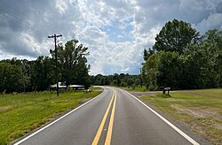
Mississippi Highway 494 in Perdue
USA Mississippi location map.svg
Red pog.svg
Perdue, Mississippi
Usa edcp location map.svg
Red pog.svg
Perdue, Mississippi
Coordinates: 32°30′53″N88°58′56″W / 32.51472°N 88.98222°W / 32.51472; -88.98222
Country United States
State Mississippi
County Newton
Elevation
397 ft (121 m)
Time zone UTC-6 (Central (CST))
  Summer (DST) UTC-5 (CDT)
Area code 601
GNIS feature ID692139 [1]

Perdue is an unincorporated community located in Newton County, Mississippi, United States. Its ZIP Code is 39337. [2]

History

Perdue was first established in 1905 as the junction of the Gulf, Mobile and Northern Railroad and Buckwalter Lumber Company logging road based out of Union, Mississippi. There was a commissary there, maintained by the railroad, which served the lumbermen that resided there. Dummy lines were built north extending into Neshoba County, where logging was done by contractors. The town had a large depot and several camp cars where railroad employees lived. At one point, it had nearly 100 residents. [3] When all of the timber was gone, logging was abandoned and the town lost most of its industry. [4]

References

  1. U.S. Geological Survey Geographic Names Information System: Perdue, Mississippi
  2. United States Postal Service (2021). "USPS - Look Up a ZIP Code" . Retrieved June 22, 2021.
  3. Beeman, Carl T. "10 Dec 1986, 54 - The Newton Record at Newspapers.com". Newspapers.com. Retrieved June 22, 2021.
  4. Brieger, James F (1997). Hometown Mississippi. Jackson, Miss.: Town Square Books, Inc. ISBN   978-1-886017-05-4. OCLC   38255017.