Chickasaw County | |
---|---|
Coordinates: 33°55′N88°57′W / 33.92°N 88.95°W | |
Country | United States |
State | Mississippi |
Founded | 1836 |
Named for | Chickasaw people |
Seat | Houston and Okolona |
Largest city | Houston |
Area | |
• Total | 504 sq mi (1,310 km2) |
• Land | 502 sq mi (1,300 km2) |
• Water | 2.5 sq mi (6 km2) 0.5% |
Population (2020) | |
• Total | 17,106 |
• Density | 34/sq mi (13/km2) |
Time zone | UTC−6 (Central) |
• Summer (DST) | UTC−5 (CDT) |
Congressional district | 1st |
Website | www |
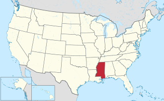
Chickasaw County is a county located in the U.S. state of Mississippi. As of the 2020 census, the population was 17,106. [1] Its county seats are Houston and Okolona. [2] The county is named for the Chickasaw people, who lived in this area for hundreds of years. Most were forcibly removed to Indian Territory in the 1830s, but some remained and became citizens of the state and the United States.
The Mississippi state legislature created Chickasaw County in 1836, following the cession of the land by the Chickasaw Indians. It was quickly settled by Americans from the east, mainly from the Southern states. By the time of the Civil War, riverfront landings had been developed by the many large cotton plantations worked by slaves, who outnumbered the white residents of the county. [3]
The American Civil War devastated the local economy, completely destroying the plantation-based infrastructure of Chickasaw County. The newly freed slaves had to adapt to the new labor system, in which the white landowners still retained partial control over their lives through the practice of sharecropping. The economy declined again in the late 19th century, when falling cotton prices reduced both black and white residents to poverty. Farmers eventually began diversifying their crops, and the economy slowly began to improve. [3]
According to the U.S. Census Bureau, the county has a total area of 504 square miles (1,310 km2), of which 502 square miles (1,300 km2) is land and 2.5 square miles (6.5 km2) (0.5%) is water. [4]
Census | Pop. | Note | %± |
---|---|---|---|
1840 | 2,955 | — | |
1850 | 16,369 | 453.9% | |
1860 | 16,426 | 0.3% | |
1870 | 19,899 | 21.1% | |
1880 | 17,905 | −10.0% | |
1890 | 19,891 | 11.1% | |
1900 | 19,892 | 0.0% | |
1910 | 22,846 | 14.9% | |
1920 | 22,212 | −2.8% | |
1930 | 20,835 | −6.2% | |
1940 | 21,427 | 2.8% | |
1950 | 18,951 | −11.6% | |
1960 | 16,891 | −10.9% | |
1970 | 16,805 | −0.5% | |
1980 | 17,853 | 6.2% | |
1990 | 18,085 | 1.3% | |
2000 | 19,440 | 7.5% | |
2010 | 17,392 | −10.5% | |
2020 | 17,106 | −1.6% | |
2023 (est.) | 16,866 | [5] | −1.4% |
U.S. Decennial Census [6] 1790-1960 [7] 1900-1990 [8] 1990-2000 [9] 2010-2013 [10] |
Race | Num. | Perc. |
---|---|---|
White | 8,584 | 50.18% |
Black or African American | 7,407 | 43.3% |
Native American | 13 | 0.08% |
Asian | 41 | 0.24% |
Pacific Islander | 4 | 0.04% |
Other/Mixed | 419 | 2.45% |
Hispanic or Latino | 642 | 3.75% |
As of the 2020 United States Census, there were 17,106 people, 6,476 households, and 4,278 families residing in the county.
As of the 2010 United States Census, there were 17,392 people living in the county. 54.0% were White, 42.1% Black or African American, 0.3% Asian, 0.1% Native American, 2.5% of some other race and 1.0% of two or more races. 3.7% were Hispanic or Latino (of any race).
As of the census [12] of 2000, there were 19,440 people, 7,253 households, and 5,287 families living in the county. The population density was 39 people per square mile (15 people/km2). There were 7,981 housing units at an average density of 16 units per square mile (6.2 units/km2). The racial makeup of the county was 56.89% White, 41.26% Black or African American, 0.19% Native American, 0.17% Asian, 0.04% Pacific Islander, 0.99% from other races, and 0.46% from two or more races. 2.29% of the population were Hispanic or Latino of any race.
According to the census [12] of 2000, the largest ancestry groups in Chickasaw County were English 44.1%, African 41% and Scots-Irish 13.5%.
There were 7,253 households, out of which 36.30% had children under the age of 18 living with them, 50.80% were married couples living together, 18.00% had a female householder with no husband present, and 27.10% were non-families. 24.90% of all households were made up of individuals, and 11.90% had someone living alone who was 65 years of age or older. The average household size was 2.65 and the average family size was 3.17.
In the county, the population was spread out, with 28.60% under the age of 18, 9.30% from 18 to 24, 27.60% from 25 to 44, 21.00% from 45 to 64, and 13.50% who were 65 years of age or older. The median age was 34 years. For every 100 females there were 92.60 males. For every 100 females age 18 and over, there were 87.40 males.
The median income for a household in the county was $26,364, and the median income for a family was $33,819. Males had a median income of $25,459 versus $20,099 for females. The per capita income for the county was $13,279. About 16.80% of families and 20.00% of the population were below the poverty line, including 23.90% of those under age 18 and 22.40% of those age 65 or over.
Year | Republican | Democratic | Third party(ies) | |||
---|---|---|---|---|---|---|
No. | % | No. | % | No. | % | |
2024 | 4,079 | 56.39% | 3,090 | 42.71% | 65 | 0.90% |
2020 | 4,175 | 51.28% | 3,810 | 46.80% | 156 | 1.92% |
2016 | 4,127 | 52.31% | 3,649 | 46.25% | 114 | 1.44% |
2012 | 3,994 | 46.97% | 4,378 | 51.49% | 131 | 1.54% |
2008 | 4,395 | 48.52% | 4,588 | 50.65% | 75 | 0.83% |
2004 | 4,193 | 50.22% | 4,078 | 48.84% | 79 | 0.95% |
2000 | 3,549 | 49.46% | 3,519 | 49.05% | 107 | 1.49% |
1996 | 2,535 | 42.75% | 2,971 | 50.10% | 424 | 7.15% |
1992 | 3,150 | 44.96% | 3,220 | 45.95% | 637 | 9.09% |
1988 | 3,390 | 55.35% | 2,713 | 44.29% | 22 | 0.36% |
1984 | 3,605 | 60.52% | 2,329 | 39.10% | 23 | 0.39% |
1980 | 2,540 | 40.13% | 3,622 | 57.23% | 167 | 2.64% |
1976 | 2,581 | 45.10% | 2,891 | 50.52% | 251 | 4.39% |
1972 | 3,753 | 84.66% | 579 | 13.06% | 101 | 2.28% |
1968 | 381 | 7.38% | 720 | 13.95% | 4,062 | 78.68% |
1964 | 3,138 | 91.83% | 279 | 8.17% | 0 | 0.00% |
1960 | 385 | 15.17% | 791 | 31.17% | 1,362 | 53.66% |
1956 | 231 | 11.24% | 1,650 | 80.25% | 175 | 8.51% |
1952 | 685 | 27.51% | 1,805 | 72.49% | 0 | 0.00% |
1948 | 12 | 0.61% | 115 | 5.89% | 1,827 | 93.50% |
1944 | 180 | 8.51% | 1,935 | 91.49% | 0 | 0.00% |
1940 | 58 | 3.18% | 1,764 | 96.76% | 1 | 0.05% |
1936 | 18 | 1.14% | 1,559 | 98.80% | 1 | 0.06% |
1932 | 16 | 1.08% | 1,455 | 98.64% | 4 | 0.27% |
1928 | 171 | 10.26% | 1,495 | 89.74% | 0 | 0.00% |
1924 | 86 | 6.07% | 1,301 | 91.88% | 29 | 2.05% |
1920 | 194 | 16.67% | 944 | 81.10% | 26 | 2.23% |
1916 | 47 | 3.61% | 1,215 | 93.32% | 40 | 3.07% |
1912 | 19 | 2.00% | 856 | 90.30% | 73 | 7.70% |
Candieland, the plantation of the fictional Calvin Candie, played by Leonardo DiCaprio in Quentin Tarantino's film Django Unchained , is located in Chickasaw County. [16]
Titus Andromedon, from the Netflix series Unbreakable Kimmy Schmidt , is from Chickasaw County
Adams County is a county located in the U.S. state of Mississippi. As of the 2020 census, the population was 29,538. The county seat is Natchez. The county is the first to have been organized in the former Mississippi Territory. It is named for the second President of the United States, John Adams, who held that office when the county was organized in 1799. Adams County is part of the Natchez micropolitan area which consists of Adams County, Mississippi and Concordia Parish, Louisiana.
Clay County is a county in the U.S. state of Mississippi. As of the 2020 census, the population was 18,636. Its county seat is West Point. Its name is in honor of American statesman Henry Clay, member of the United States Senate from Kentucky and United States Secretary of State in the 19th century. J. Wesley Caradine, an African American, was the first state representative for Clay County after it was established in 1871. The federal government formerly designated Clay County as the West Point Micropolitan Statistical Area, but the county lost that status in 2013. It is part of the Golden Triangle region of the state.
Hickman County is a county located in the U.S. state of Tennessee. As of the 2020 Census, the population was 24,925. Its county seat is Centerville. As of 2023, Hickman County is part of the Nashville–Davidson–Murfreesboro–Franklin, TN Metropolitan Statistical Area, although it was once removed in 2018.
Webster County is a county located in center of the U.S. state of Mississippi, bordered on the south by the Big Black River. As of the 2020 census, the population was 9,926.
Tishomingo County is a county located in the northeastern corner of the U.S. state of Mississippi. As of the 2020 census, the population was 18,850. Its county seat is Iuka.
Prentiss County is a county located in the U.S. state of Mississippi. As of the 2020 census, the population was 25,008. Its county seat is Booneville. The county is named for Seargent Smith Prentiss, a noted speaker and US Congressman from Natchez.
Pontotoc County is a county located in the U.S. state of Mississippi. As of the 2020 census, the population was 31,184. Its county seat is Pontotoc. It was created on February 9, 1836, from lands ceded to the United States under the Chickasaw Cession. Pontotoc is a Chickasaw word meaning "land of hanging grapes". The original Natchez Trace and the current-day Natchez Trace Parkway both pass through the southeast corner of Pontotoc County.
Monroe County is a county on the northeast border of the U.S. state of Mississippi next to Alabama. As of the 2020 census, the population was 34,180. Its county seat is Aberdeen.
Madison County is a county located in the U.S. state of Mississippi. As of the 2020 census, the population was 109,145. The county seat is Canton. The county is named for Founding Father and U.S. President James Madison. Madison County is part of the Jackson, MS Metropolitan Statistical Area.
Lee County is a county in U.S. state of Mississippi. At the 2020 census, the population was 83,343. Its county seat is Tupelo. Lee County is included in the Tupelo Micropolitan Statistical Area.
Leake County is a county in the center of the U.S. state of Mississippi. As of the 2020 census, the population was 21,275. Its county seat is Carthage. The county is named for Walter Leake, the Governor of Mississippi from 1822 to 1825.
Itawamba County is a county located in the U.S. state of Mississippi. As of the 2020 United States Census, the population was 23,863. Its county seat is Fulton. The county is part of the Tupelo, MS Micropolitan Statistical Area.
Calhoun County is a county located in the U.S. state of Mississippi. As of the 2020 census, the population was 13,266. Its county seat is Pittsboro. The county is named after John C. Calhoun, the U.S. Vice President and U.S. Senator from South Carolina.
Attala County is a county located in the U.S. state of Mississippi. As of the 2020 census, the population was 17,889. Its county seat is Kosciusko. Attala County is named for Atala, a fictional Native American heroine from an early-19th-century novel of the same name by François-René de Chateaubriand.
Chickasaw is a city in Mobile County, Alabama, United States. As of the 2020 census the population was 6,457, up from 6,106 at the 2010 census. It is part of the Mobile metropolitan area.
Houston is a city and one of two county seats of Chickasaw County, in northeastern Mississippi, United States. The population was 3,623 at the 2010 census.
Okolona is a city in and one of the two county seats of Chickasaw County, Mississippi, United States. It is located near the eastern border of the county. The population was 2,692 at the 2010 census. It had a large furniture industry and the Wilson Park resort.
French Camp is a town in Choctaw County, Mississippi, United States. The population was 174 at the 2010 census, down from 393 in 2000.
Shannon is a town in Lee County, Mississippi. The population was 1,496 at the 2020 Census.
Tishomingo is a town in Tishomingo County, Mississippi, United States. The population of the city of Tishomingo was 339 at the 2010 census.