The Illinois River is a principal tributary of the Mississippi River at approximately 273 miles (439 km) in length. Located in the U.S. state of Illinois, the river has a drainage basin of 28,756.6 square miles (74,479 km2). The Illinois River begins with the confluence of the Des Plaines and Kankakee rivers in the Chicago metropolitan area, and it generally flows to the southwest across Illinois, until it empties into the Mississippi near Grafton, Illinois. Its drainage basin extends into southeastern Wisconsin, northwestern Indiana, and a very small area of southwestern Michigan in addition to central Illinois. Along its shores are several river ports, including Peoria, Illinois. Historic and recreation areas on the river include Starved Rock, and the internationally important wetlands of the Emiquon Complex and Dixon Waterfowl Refuge.

Lula is a town in Coahoma County, Mississippi, United States. Per the 2020 census, the population was 204.

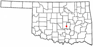
Maud is a city on the boundary between Pottawatomie and Seminole counties in the U.S. state of Oklahoma. The population was 867 by the 2020 United States census. The locale was named for Maud Stearns, a sister to the wives of two men who owned the first general store.

Waddesdon is a village in Buckinghamshire, England, 6 miles (10 km) west-north-west of Aylesbury on the A41 road. The village also includes the hamlets of Eythrope and Wormstone. Waddesdon was an agricultural settlement with milling, silk weaving and lace making enterprises.

The Tombigbee River is a tributary of the Mobile River, approximately 200 mi (325 km) long, in the U.S. states of Mississippi and Alabama. Together with the Alabama, it merges to form the short Mobile River before the latter empties into Mobile Bay on the Gulf of Mexico. The Tombigbee watershed encompasses much of the rural coastal plain of western Alabama and northeastern Mississippi, flowing generally southward. The river provides one of the principal routes of commercial navigation in the southern United States, as it is navigable along much of its length through locks and connected in its upper reaches to the Tennessee River via the Tennessee-Tombigbee Waterway.

The Perdido River, also historically known as Rio Perdido or by its native name of Cassaba, is a 65.4-mile-long (105.3 km) river in the U.S. states of Alabama and Florida; the Perdido, a designated Outstanding Florida Waters river, forms part of the boundary between the two states along nearly its entire length and drains into the Gulf of Mexico. During the early 19th century it played a central role in a series of rotating boundary changes and disputes among France, Spain, Great Britain, and the United States.

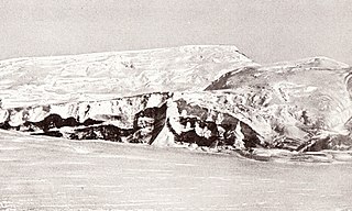
The Queen Maud Mountains are a major group of mountains, ranges and subordinate features of the Transantarctic Mountains, lying between the Beardmore and Reedy Glaciers and including the area from the head of the Ross Ice Shelf to the Antarctic Plateau in Antarctica. Captain Roald Amundsen and his South Pole party ascended Axel Heiberg Glacier near the central part of this group in November 1911, naming these mountains for the Norwegian queen Maud of Wales.

The Grand Rounds National Scenic Byway is a linked series of park areas in Minneapolis, Minnesota, United States, that takes a roughly circular path through the city. The Minneapolis Park and Recreation Board developed the system over many years. The corridors include roads for automobile traffic plus separate paths for pedestrians and bicycles, and extend slightly into neighboring cities. About 50 miles (80 km) of roadway and paths are in the system, and much of it was built in the 1930s as part of Civilian Conservation Corps projects.
Nesbit is an unincorporated community in DeSoto County, Mississippi, United States.
Tralake is an unincorporated community located in Washington County, Mississippi. Tralake is approximately 5.8 miles (9.3 km) west-southwest of Kinlock, approximately 5.6 miles (9.0 km) west-southwest of Tribbett and approximately 4.9 miles (7.9 km) east of Arcola along Mississippi Highway 438.

Hollywood is an unincorporated community located near U.S. Route 61 in Tunica County, Mississippi, United States. It is approximately 4 miles (6.4 km) north of North Tunica, approximately 5 miles (8.0 km) north of Tunica, and approximately 22 miles (35 km) south of Memphis, Tennessee.

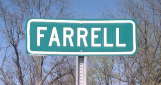
Farrell is an unincorporated community and census-designated place in Coahoma County, Mississippi, United States. Per the 2020 census, the population was 200. Farrell is located approximately 4 miles (6 km) south of Stovall and 4 miles (6 km) north of Sherard on Mississippi Highway 1. It is approximately 9 miles (14 km) northwest of Clarksdale, the county seat.

Steiner is an unincorporated community located in Sunflower County, Mississippi. Steiner is located on Mississippi Highway 442 and is approximately 2.5 miles (4.0 km) north of Roundaway and approximately 3 miles (4.8 km) south of Linn.
Boyer is an unincorporated community located in Sunflower County, Mississippi. Boyer is located on Steiner-Boyer Road and is approximately 7 miles (11 km) north of Indianola and approximately 4 miles (6.4 km) south of Roundaway.

Choctaw is an unincorporated community located in Bolivar County, Mississippi, United States. Choctaw is approximately 4 miles (6.4 km) south of Shaw and approximately 12 miles (19 km) east of Stringtown, served by Mississippi Highway 450.
Claremont, also known as Rose, is an unincorporated community located in Coahoma County, Mississippi, United States. Claremont is approximately 2 miles (3.2 km) north of Mattson and approximately 4 miles (6.4 km) south of Clarksdale. Claremont is located on the former Yazoo and Mississippi Valley Railroad. A post office operated under the name Rose from 1904 to 1905 and under the name Claremont from 1905 to 1932.

Tumby is a village in the East Lindsey district of Lincolnshire, England. It is situated approximately 2 miles (3.2 km) north from Coningsby and 6.5 miles (10.5 km) south from Horncastle, and in the civil parish of Kirkby on Bain.

Mileston is an unincorporated community located in Holmes County, Mississippi. Mileston is located on U.S. Highway 49E and Highway 12, approximately 6 miles (9.7 km) south of Tchula, approximately 4 miles (6.4 km) north of Thornton and approximately 3 miles (4.8 km) southeast of Marcella.

Minneapolis is often considered one of the top biking and walking cities in the United States due to its vast network of trails and dedicated pedestrian areas. In 2020, Walk Score rated Minneapolis as 13th highest among cities over 200,000 people. Some bicycling ratings list Minneapolis at the top of all United States cities, while others list Minneapolis in the top ten. There are over 80 miles (130 km) of paved, protected pathways in Minneapolis for use as transportation and recreation. The city's Grand Rounds National Scenic Byway parkway system accounts for the vast majority of the city's shared-use paths at approximately 50 miles (80 km) of dedicated biking and walking areas. By 2008, other city, county, and park board areas accounted for approximately 30 miles (48 km) of additional trails, for a city-wide total of approximately 80 miles (130 km) of protected pathways. The network of shared biking and walking paths continued to grow into the late 2010s with the additions of the Hiawatha LRT Trail gap remediation, Min Hi Line pilot projects, and Samatar Crossing. The city also features several natural-surface hiking trails, mountain-biking paths, groomed cross-country ski trails in winter, and other pedestrian walkways.


