
Warren County is a county located in the U.S. state of Mississippi. Its western border is formed by the Mississippi River. As of the 2020 census, the population was 44,722. Its county seat is Vicksburg. Established by legislative act of December 22, 1809, Warren County is named for American Revolutionary War officer Joseph Warren.

Spanish Lake is an unincorporated community and census-designated place (CDP) in St. Louis County, Missouri, United States. The population was 18,413 at the 2020 census.

Tunica Resorts, formerly known as Robinsonville until 2005, is a census-designated place (CDP) in northern Tunica County, Mississippi, United States, north of the county seat of Tunica. The community is situated mostly between the Mississippi River and U.S. Route 61, along the border with Arkansas. The population as of the 2020 census was 2,132.
Redwood is a census-designated place and unincorporated community located southeast of Twin Lake in Warren County, Mississippi, United States. The town is located near the junction of U.S. Route 61 and Mississippi Highway 3, approximately 10 miles north of Vicksburg. Its zip code is 39156.
Mississippi State is a census-designated place in Oktibbeha County, Mississippi, United States. It is the official designated name for the area encompassing Mississippi State University, which lies partly in the nearby incorporated municipality of Starkville. The population at the 2020 census was 4,968.
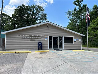
Bovina is a census-designated place and unincorporated community located about 7 miles (11 km) east of Vicksburg in Warren County, Mississippi, on Interstate 20. It is part of the Vicksburg Micropolitan Statistical Area.

Lauderdale is an unincorporated community and census-designated place (CDP) in Lauderdale County, Mississippi, United States. The population of Lauderdale was 395 at the 2020 census. It is located along U.S. Highway 45, 16 miles (26 km) northeast of Meridian.

Triumph is an unincorporated community and census-designated place in Plaquemines Parish, Louisiana, United States. It is located on the south bank of the Mississippi River. As of the 2020 census, its population was 268.
Austin is a census-designated place and unincorporated community in Tunica County, Mississippi, United States. Per the 2020 Census, the population was 51.
Eudora is a census-designated place and unincorporated community located in southwestern DeSoto County, Mississippi, United States, approximately 25 miles (40 km) south of Memphis, Tennessee. The intersection of Mississippi Highway 301 and old Mississippi Highway 304 has been the traditional heart of Eudora for decades.

Eastabuchie is a census-designated place and unincorporated community in southwestern Jones County, Mississippi. It is located along U.S. Route 11, just north of the Forrest County line. the community has a post office with the ZIP code 39436. Eastabuchie is part of the Laurel Micropolitan Statistical Area.

White Oak is a census-designated place located on Mississippi Highway 4 in Tunica County, Mississippi. White Oak is approximately 2 miles (3.2 km) east of Evansville and approximately 8 miles (13 km) west of Savage. The population at the 2020 census was 692.
Nicholson is an unincorporated community and census-designated place (CDP) in Pearl River County, Mississippi, United States. As of the 2020 census, its population was 2,833. Its ZIP code is 39463.
Cloverdale is a census-designated place (CDP) in Adams County, Mississippi, United States, located to the south of the city of Natchez. As of the 2020 census, it had a population of 557.
Mississippi Valley State University is a census-designated place in Leflore County, Mississippi, United States. The population at the 2020 census was 805. It is the location of Mississippi Valley State University and is adjacent to Itta Bena.

Bolivar is a census-designated place and unincorporated community in Bolivar County, Mississippi, United States.
Arnold Line is an unincorporated area and census-designated place (CDP) in Lamar County, Mississippi, United States. As of the 2020 census it had a population of 2,333. It is part of the Hattiesburg Metropolitan Statistical Area.
Hide-A-Way Lake is an unincorporated community and census-designated place in Pearl River County, Mississippi, United States. Its population was 2,065 as of the 2020 census.
Lake Cherokee is an unincorporated community and census-designated place (CDP) in Gregg and Rusk counties, Texas, United States. Its population was 2,980 as of the 2020 census. Lake Cherokee is located 12 miles southeast of Gregg and northeastern Rusk counties on Cherokee Bayou. The lake is owned by the Cherokee Water Company to supply water for municipal, industrial, and recreational purposes. It has a capacity of 68,700 acre-feet. The lake impounds Cherokee Bayou. The top of the dam is at the elevation of 295 feet above the average sea level, but it has a max design of 291 feet above the average sea level.
Eagle Lake is an unincorporated community and census-designated place (CDP) in Will County, Illinois, United States. It is near the southeast corner of the county, in the northeast corner of Washington Township. It is 5 miles (8 km) northeast of Beecher and 1.5 miles (2.4 km) west of the Indiana state line.


