Tishomingo, Mississippi

Last updated

Tishomingo, Mississippi
Town of Tishomingo
Tishomingo-Main-ms.jpg
Main Street (MS 25) in Tishomingo
Flag of Tishomingo, Mississippi.png
Tishomingo County Mississippi Incorporated and Unincorporated areas Tishomingo Highlighted.svg
Location of Tishomingo, Mississippi
Usa edcp relief location map.png
Red pog.svg
Tishomingo
Location in the United States
Coordinates: 34°38′5″N88°13′48″W / 34.63472°N 88.23000°W / 34.63472; -88.23000
Country Flag of the United States.svg  United States
State Flag of Mississippi.svg  Mississippi
County Tishomingo
Named for Tishomingo
Government
  MayorJames Tennyson
Area
[1]
  Total0.85 sq mi (2.21 km2)
  Land0.85 sq mi (2.21 km2)
  Water0.00 sq mi (0.00 km2)
Elevation
512 ft (156 m)
Population
 (2020)
  Total370
  Density433.76/sq mi (167.49/km2)
Time zone UTC-6 (Central (CST))
  Summer (DST) UTC-5 (CDT)
ZIP code
38873
Area code 662
FIPS code 28-73720
GNIS feature ID0678781
Website Official website OOjs UI icon edit-ltr-progressive.svg

Tishomingo is a town in Tishomingo County, Mississippi, United States. The population of the city of Tishomingo was 339 at the 2010 census.

Contents

History

Tishomingo Filling Station (1939) Tishomingo Filling Station - NARA - 281041.jpg
Tishomingo Filling Station (1939)

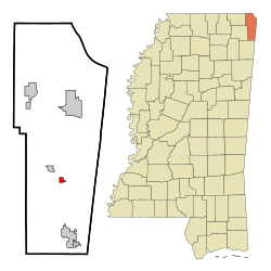
Tishomingo is named for Tishomingo, who signed the Treaty of Pontotoc in 1832. He served with Major-General Anthony Wayne against the Shawnees in the Northwest Territory and received a silver medal from President George Washington. During the War of 1812, he served under Andrew Jackson. After his service in the military, he retired to become a farmer until white settlers came onto his land. In 1837, a final treaty forced the Chickasaws to move to the Indian Territory in present-day Oklahoma. Tishomingo died of smallpox on the Trail of Tears and is buried in Arkansas somewhere near Little Rock. [2] His son, Iuka, is the namesake of the county seat of Tishomingo County, Mississippi.

This town developed with the building of the Illinois Central Railroad. Andrew Jackson also camped at the site of Tishomingo, on his way to visit the Creek nation.

National Register of Historic Places

Four sites near Tishomingo are listed on the National Register of Historic Places, including Bear Creek Mound and Village Site, and Tishomingo State Park.

Geography

According to the United States Census Bureau, the town has a total area of 0.6 square miles (1.6 km2), all land. The town is situated along Mississippi Highway 25, south of the highway's intersection with Mississippi Highway 30, and north of its intersection with the Natchez Trace Parkway. The Mississippi-Alabama border lies a few miles to the east, Tishomingo State Park lies to the southeast, and Bay Springs Lake (part of the Tennessee-Tombigbee Waterway) lies to the west. Via MS-25, Iuka, the county seat of Tishomingo County, is 13 mi (21 km) north, and Belmont is 9 mi (14 km) south.

Communities near Tishomingo

Rivers and streams

Demographics

Historical population
CensusPop.Note
1910 212
1920 27328.8%
1930 40247.3%
1940 4235.2%
1950 335−20.8%
1960 41523.9%
1970 410−1.2%
1980 387−5.6%
1990 332−14.2%
2000 316−4.8%
2010 3397.3%
2020 3709.1%
U.S. Decennial Census [3]

As of the census [4] of 2000, there were 316 people, 144 households, and 87 families residing in the town. The population density was 572.5 inhabitants per square mile (221.0/km2). There were 165 housing units at an average density of 299.0 per square mile (115.4/km2). The racial makeup of the town was 97.15% White, 1.90% African American, 0.63% from other races, and 0.32% from two or more races. 1.27% of the population were Hispanic or Latino of any race.

There were 144 households, out of which 28.5% had children under the age of 18 living with them, 48.6% were married couples living together, 11.1% had a female householder with no husband present, and 38.9% were non-families. 36.8% of all households were made up of individuals, and 16.7% had someone living alone who was 65 years of age or older. The average household size was 2.19 and the average family size was 2.89.

In the town, the population was spread out, with 23.7% under the age of 18, 7.6% from 18 to 24, 26.6% from 25 to 44, 21.2% from 45 to 64, and 20.9% who were 65 years of age or older. The median age was 40 years. For every 100 females, there were 73.6 males. For every 100 females age 18 and over, there were 74.6 males.

The median income for a household in the town was $19,044, and the median income for a family was $31,250. Males had a median income of $26,250 versus $14,107 for females. The per capita income for the town was $18,480. 20.9% of the population and 16.5% of families were below the poverty line. Out of the total population, 18.9% of those under the age of 18 and 27.3% of those 65 and older were living below the poverty line.

Education

Public schools

Libraries

Recreation

Notable people

Related Research Articles

<span class="mw-page-title-main">Tishomingo County, Mississippi</span> County in Mississippi, United States

Tishomingo County is a county located in the northeastern corner of the U.S. state of Mississippi. As of the 2020 census, the population was 18,850. Its county seat is Iuka.

<span class="mw-page-title-main">Prentiss County, Mississippi</span> County in Mississippi, United States

Prentiss County is a county located in the U.S. state of Mississippi. As of the 2020 census, the population was 25,008. Its county seat is Booneville. The county is named for Seargent Smith Prentiss, a noted speaker and US Congressman from Natchez.

<span class="mw-page-title-main">Alcorn County, Mississippi</span> County in Mississippi, United States

Alcorn County is a county located in the northeastern portion of the U.S. state of Mississippi. As of the 2020 census, the population was 34,740. Its county seat is Corinth. The county is named in honor of Governor James L. Alcorn.

<span class="mw-page-title-main">Columbus, Kentucky</span> City in Kentucky, United States

Columbus is a home rule-class city in Hickman County, Kentucky, in the United States. The population was 140 at the 2020 census, a decline from 229 in 2000. The city lies at the western end of the state, less than a mile from the Mississippi River.

<span class="mw-page-title-main">Carrollton, Mississippi</span> Town in Mississippi, United States

Carrollton is a town in and the second county seat of Carroll County, Mississippi, United States, which is within the Mississippi Delta. The population was 190 at the 2010 census, down from 408 in 2000. Centrally located in the county, the town is part of the Greenwood, Mississippi micropolitan area. The first county seat, Vaiden, was founded in the eastern part of the county during its early settlement.

<span class="mw-page-title-main">Ackerman, Mississippi</span> Town in Mississippi, United States

Ackerman is a town in Choctaw County, Mississippi, United States. The population was 1,594 according to 2020 census, which shows an increase from 1,510 reported in the 2010 census It is the county seat of Choctaw County.

<span class="mw-page-title-main">Pachuta, Mississippi</span> Town in Mississippi, United States

Pachuta is a town in Clarke County, Mississippi, United States. The population was 261 at the 2010 census.

<span class="mw-page-title-main">Puckett, Mississippi</span> Village in Mississippi, United States

Puckett is a village in Rankin County, Mississippi, United States. According to the 2020 census, the population was 342. It is part of the Jackson Metropolitan Statistical Area.

<span class="mw-page-title-main">Belmont, Mississippi</span> Town in Mississippi, United States

Belmont is a town in Tishomingo County, Mississippi, United States. The population was 2,021 at the 2010 census.

<span class="mw-page-title-main">Burnsville, Mississippi</span> Town in Mississippi, United States

Burnsville is a town in Tishomingo County in northeastern Mississippi, United States. The population was 936 at the 2010 census.

<span class="mw-page-title-main">Golden, Mississippi</span> Town in Mississippi, United States

Golden is a town in Tishomingo County, Mississippi, United States. The population was 191 at the 2010 census. The village's current mayor is Davy Ginn.

<span class="mw-page-title-main">Iuka, Mississippi</span> City in Mississippi, United States

Iuka is a city in and the county seat of Tishomingo County, Mississippi, United States. Its population was 3,028 at the 2010 census. Woodall Mountain, the highest point in Mississippi, is located just south of Iuka.

<span class="mw-page-title-main">Paden, Mississippi</span> Village in Mississippi, United States

Paden is a village in Tishomingo County, Mississippi, United States. The population was 116 at the 2010 census.

<span class="mw-page-title-main">Silver Creek, Mississippi</span> Town in Mississippi, United States

Silver Creek is a town in Lawrence County, Mississippi, United States. The population was 210 at the 2010 census. Silver Creek is accessed from U.S. Route 84 and Mississippi Highway 43. The film Jesse James' Women (1954) was filmed in Silver Creek.

<span class="mw-page-title-main">Ravia, Oklahoma</span> Town in Oklahoma, United States

Ravia is a town in Johnston County, Oklahoma, United States. The population was 528 at the 2010 census, up from 459 in 2000.

<span class="mw-page-title-main">Tishomingo, Oklahoma</span> City in Oklahoma

Tishomingo is the largest city in, and the county seat of, Johnston County, Oklahoma, United States. The population was 3,034 at the 2010 census, a decline of 4.1 percent from the figure of 3,162 in 2000. It was the first capital of the Chickasaw Nation, from 1856 until Oklahoma statehood in 1907. The city is home to Murray State College, a community college with an annual enrollment of 3,015 students. Tishomingo is part of the Texoma region.

<span class="mw-page-title-main">Wapanucka, Oklahoma</span> Town in Oklahoma, United States

Wapanucka is a town in northeastern Johnston County, Oklahoma, United States. The population was 438 at the 2010 census, a 1.6 percent decrease from the figure of 445 in 2000. It is about 20 miles (32 km) northeast of Tishomingo. The town name refers to the Delaware Nation and means "Eastern Land People."

<span class="mw-page-title-main">Farmington, La Crosse County, Wisconsin</span> Town in Wisconsin, United States

Farmington is a town in La Crosse County, Wisconsin, United States. The population was 2,061 at the 2010 census, up from 1,733 at the 2000 census. It is part of the La Crosse Metropolitan Statistical Area. The unincorporated communities of Burr Oak, Mindoro, and Stevenstown are in the town.

<span class="mw-page-title-main">Baldwyn, Mississippi</span> City in Mississippi, United States

Baldwyn is a city located in Lee and Prentiss counties, Mississippi, located in the northern part of the Tupelo micropolitan area. The population was 3,071 at the 2020 census.

<span class="mw-page-title-main">Nettleton, Mississippi</span> City in Mississippi, United States

Nettleton is a city in Lee and Monroe counties in the U.S. state of Mississippi. The population was 1,935 at the 2020 census. Incorporated in 1888, the town was named after George Henry Nettleton, president of the Kansas City, Memphis and Birmingham Railroad (KCM&B).

References

  1. "2020 U.S. Gazetteer Files". United States Census Bureau. Retrieved July 24, 2022.
  2. Muriel H. Wright], "Official Seals of the Five Civilized Tribes," Chronicles of Oklahoma, Vol. 18, No. 4 (December 1940), pp. 362-363.
  3. "Census of Population and Housing". Census.gov. Retrieved June 4, 2015.
  4. "U.S. Census website". United States Census Bureau . Retrieved January 31, 2008.