Cerro Gordo, Tennessee

Last updated
Cerro Gordo, Tennessee
USA Tennessee location map.svg
Red pog.svg
Cerro Gordo
Usa edcp location map.svg
Red pog.svg
Cerro Gordo
Coordinates: 35°18′13″N88°10′50″W / 35.30361°N 88.18056°W / 35.30361; -88.18056
Country United States
State Tennessee
County Hardin
Elevation
407 ft (124 m)
Time zone UTC-6 (Central (CST))
  Summer (DST) UTC-5 (CDT)
Area code 731
GNIS feature ID1305836 [1]

Cerro Gordo is an unincorporated community in Hardin County, Tennessee. Cerro Gordo is located on the east bank of the Tennessee River, north of Savannah. It is most notable as the May 1816 landing site of the Hardin Expedition. Cerro Gordo is Spanish for large hill.

The Hardin Expedition

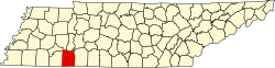
Twenty-six settlers, in two parties, struck out from Knoxville in late spring of 1816 bound for the general area which would eventually become Savannah. The first party came by boat, landing in May at "the easteward curve" of the Tennessee River. [2] at Cerro Gordo. The second, and larger party, had traversed overland and suffered many delays. This second party was led by Joseph Hardin, Jr., son of Col. Joseph Hardin who had, before his death, accumulated several land grants to the area as rewards for his Revolutionary service. Joseph, Jr., as well as his brother, James Hardin (founder of the rival settlement of Hardinville, at modern-day Old Town, located on Hardin's Creek), executed land grants [3] in the area. Both had fought alongside their father in the war and had been likewise rewarded with land patents. [4]

Additional settlers from the initial expedition were dispatched almost immediately to establish a nearby community downriver at Saltillo.

Related Research Articles

<span class="mw-page-title-main">Williamson County, Tennessee</span> County in Tennessee, United States

Williamson County is a county in the U.S. state of Tennessee. As of the 2020 United States census, the population was 247,726. The county seat is Franklin, and the county is located in Middle Tennessee. The county is named after Hugh Williamson, a North Carolina politician who signed the U.S. Constitution. Adjusted for relative cost of living, Williamson County is one of the wealthiest counties in the United States. Williamson County is part of the Nashville-Davidson–Murfreesboro–Franklin, TN Metropolitan Statistical Area. In the 19th century, tobacco and hemp were cultivated here, and planters also raised blooded livestock, including horses and cattle.

<span class="mw-page-title-main">Perry County, Tennessee</span> Administrative region of the U.S.

Perry County is a county located in the U.S. state of Tennessee. As of the 2020 census, the population was 8,366, with an average population density of 20.2 persons per square mile it is the least densely populated county in Tennessee. Its county seat and largest town is Linden. It is named after American naval commander and War of 1812 hero Oliver Hazard Perry.

<span class="mw-page-title-main">Hardin County, Tennessee</span> County in Tennessee, United States

Hardin County is a county located in the U.S. state of Tennessee. As of the 2020 census, the population was 26,831. The county seat is Savannah. Hardin County is located north of and along the borders of Mississippi and Alabama. The county was founded in November 1819 and named posthumously for Col. Joseph Hardin, a Revolutionary War soldier and a legislative representative for the Province of North Carolina; the State of Franklin; and the Southwest Territory. Hardin County was the site of the Battle of Shiloh during the Civil War.

<span class="mw-page-title-main">Calhoun County, Illinois</span> County in Illinois, United States

Calhoun County is a county in the U.S. state of Illinois. As of the 2010 census, the population was 5,089, making it Illinois’ third-least populous county. Its county seat and biggest community is Hardin, with a population of 801. Its smallest incorporated community is Hamburg, with a population of 99. Calhoun County is at the tip of the peninsula formed by the courses of the Mississippi and Illinois rivers above their confluence and is almost completely surrounded by water. Calhoun County is sparsely populated; it has just five municipalities, all of them villages.

<span class="mw-page-title-main">Saltillo, Tennessee</span> Town in Tennessee, United States

Saltillo is a town in Hardin County, Tennessee, United States. The population was 420 at the 2020 census. Saltillo is located on the left bank of the Tennessee River, about 12 miles north of Savannah.

<span class="mw-page-title-main">Savannah, Tennessee</span> City in Tennessee, United States

Savannah is a city in and the county seat of Hardin County, Tennessee, United States. The population was 7,213 at the 2020 census. Savannah is located along the east side of the Tennessee River.

<span class="mw-page-title-main">Clarksville, Tennessee</span> City in Tennessee, United States

Clarksville is the county seat of Montgomery County, Tennessee, United States. It is the fifth-largest city in the state, after Nashville, Memphis, Knoxville, and Chattanooga. The city had a population of 166,722 as of the 2020 United States census.

<span class="mw-page-title-main">West Tennessee</span> Geographic and cultural region of Tennessee, United States

West Tennessee is one of the three Grand Divisions of the U.S. state of Tennessee that roughly comprises the western quarter of the state. The region includes 21 counties between the Tennessee and Mississippi rivers, delineated by state law. Its geography consists primarily of flat lands with rich soil and vast floodplain areas of the Mississippi River. Of the three regions, West Tennessee is the most sharply defined geographically, and is the lowest-lying. It is both the least populous and smallest, in land area, of the three Grand Divisions. Its largest city is Memphis, the state's second most populous city.

The Cherokee Path was the primary route of English and Scots traders from Charleston to Columbia, South Carolina in Colonial America. It was the way they reached Cherokee towns and territories along the upper Keowee River and its tributaries. In its lower section it was known as the Savannah River. They referred to these towns along the Keowee and Tugaloo rivers as the Lower Towns, in contrast to the Middle Towns in Western North Carolina and the Overhill Towns in present-day southeastern Tennessee west of the Appalachian Mountains.

Shiloh is an unincorporated community in Hardin County, Tennessee.

<span class="mw-page-title-main">Nutbush, Tennessee</span> Unincorporated community in Tennessee, United States

Nutbush is a rural unincorporated community in Haywood County, Tennessee, United States, in the western part of the state, approximately 50 miles northeast of Memphis. It was established in the early 19th century by European-American settlers who bought enslaved African Americans to develop the area's cotton plantations. The houses and churches that were built during this time still stand.

<span class="mw-page-title-main">Fort Nashborough</span> United States historic place

Fort Nashborough, also known as Fort Bluff, Bluff Station, French Lick Fort, Cumberland River Fort and other names, was the stockade established in early 1779 in the French Lick area of the Cumberland River valley, as a forerunner to the settlement that would become the city of Nashville, Tennessee. The fort was not a military garrison. The log stockade was square in shape and covered 2 acres (8,100 m2). It contained 20 log cabins and was protection for the settlers against wild animals and Indians. James Robertson and John Donelson are considered the founders, and colloquially, the "founders of Tennessee". The fort was abandoned in 1794, but the settlement, now the town of Nashville, became the capital of the new state of Tennessee in 1796.

<span class="mw-page-title-main">Pickwick Landing Dam</span> Dam in Tennessee, United States

Pickwick Landing Dam is a hydroelectric dam on the Tennessee River in Hardin County, in the U.S. state of Tennessee. The dam is one of nine dams on the river owned and operated by the Tennessee Valley Authority, which built the dam in the 1930s as part of a New Deal-era initiative to create a continuous navigation channel between the river's mouth and Knoxville, and bring economic development to the area. The dam impounds the 43,100-acre (17,400 ha) Pickwick Lake and its tailwaters are part of Kentucky Lake.

<span class="mw-page-title-main">Pittsburg Landing, Tennessee</span>

Pittsburg Landing is a river landing on the west bank of the Tennessee River in Hardin County, Tennessee. It was named for "Pitts" Tucker who operated a tavern at the site in the years preceding the Civil War. The landing helped connect the west side of the river to a road on the east that went back to Savannah. The landing was home to many families of settlers that migrated from about 1840 to 1860. It is located at latitude 35.15222 and longitude -88.32278 with an elevation of 482 feet (147 m). The aforementioned tavern was on the site that is now Shiloh National Military Park Visitor Center and Shiloh National Military Park/Pittsburgh Landing Graveyard.

Colonel Samuel Barton was a pioneer and Patriot of the American Revolution (1775–1783) but is remembered more for the exploration and settlement of what was to become Nashville, Tennessee. Little is known of his early youth. Family tradition holds that Samuel, born in Virginia, was left bound as an apprentice while his father returned to England for business only to be lost at sea. Recent y-DNA testing of a male descendant of Samuel Barton has shown that this branch of Barton's are part of a lineage whose earliest known member in America was Lewis Barton of Maryland.

<span class="mw-page-title-main">Tennessee State Route 69</span> Highway in Tennessee

State Route 69 is a state highway in West and Middle Tennessee that runs parallel to the Tennessee River for the majority of its length. SR 69 carries both primary and secondary highway designations and is routed through rural areas.

<span class="mw-page-title-main">Cherry Mansion</span> Historic house in Tennessee, United States

Cherry Mansion is a historic antebellum house in Savannah, Tennessee, located on a bluff overlooking the east bank of the Tennessee River. It has historical significance for its role as General Ulysses S. Grant's headquarters at the time of the Civil War Battle of Shiloh.

Joseph Hardin Sr. was an Assemblyman for the Province of North Carolina, and was a signatory of the Tryon Resolves. Early in the War for Independence, as a member of the militia from Tryon County, Hardin fought the Cherokee allies of Britain along the western frontier. Later in the war, having taken his family over the Appalachian Mountains to the Washington District for safety against the advance of the Red Coats out of South Carolina, Hardin joined the Overmountain Men. He saw action at the Battle of Ramsour's Mill and the decisive Battle of Kings Mountain. Following the peace with Britain, Hardin was a co-founder and second Speaker of the House for the State of Franklin; and an Assemblyman in the Southwest Territory before its statehood as Tennessee.

<span class="mw-page-title-main">Bledsoe Creek State Park</span> State-protected area of Tennessee, United States

Bledsoe Creek State Park is a state park in Sumner County, Tennessee, in the southeastern United States. The park consists of 169 acres (0.68 km2) managed by the Tennessee Department of Environment and Conservation. The park spans much of the west shore of the Bledsoe Creek embayment of Old Hickory Lake, an impoundment of the Cumberland River created with the completion of Old Hickory Dam by the U.S. Army Corps of Engineers in 1954.

Walkertown is an unincorporated community in Hardin County, Tennessee. Walkertown is located immediately south of Savannah and is served by Tennessee State Route 128 and Tennessee State Route 69. Walkertown was founded by James Walker Haynes in 1826. Known descendants of James Walker Haynes are James Walker Haynes, Jr. and his son Jacob Walker Haynes. James Walker Haynes, Jr. lives in Savannah, TN and Jacob Walker Haynes currently lives in Chattanooga, TN.

References

  1. "US Board on Geographic Names". United States Geological Survey. 2007-10-25. Retrieved 2008-01-31.
  2. Brazelton, B.G. (2008) [1885; Cumberland Presbyterian Publishing House, Nashville, TN]. A History of Hardin County, Tennessee. Kissinger. ISBN   978-1-4374-5605-9.[sic]
  3. NC Military Grants 1788–1903; entry No. 2128; 1,000 acres (4.0 km2); May 10, 1784
  4. "History of Tennessee: From the Earliest Time to the Present; Together with an Historical and a Biographical Sketch of Henderson, Chester, McNairy, Decatur, and Hardin Counties"; (Goodspeed Pub. Co.; 1886; Nashville, TN); Pgs. 829-841