Adamsville, Tennessee

Last updated

Adamsville, Tennessee
Pusser-home.jpg
Motto: 
The Biggest Little Town in Tennessee
McNairy County Tennessee Incorporated and Unincorporated areas Adamsville Highlighted 4700240.svg
Location of Adamsville in McNairy County, Tennessee.
Coordinates: 35°15′0″N88°23′25″W / 35.25000°N 88.39028°W / 35.25000; -88.39028
Country United States
State Tennessee
Counties McNairy, Hardin
Incorporated1870
Government
  MayorDavid Leckner
  Vice MayorMark Massey
Area
[1]
  Total7.09 sq mi (18.35 km2)
  Land7.04 sq mi (18.23 km2)
  Water0.05 sq mi (0.12 km2)
Elevation
515 ft (157 m)
Population
 (2020) [2]
  Total2,265
  Density321.78/sq mi (124.25/km2)
Time zone UTC-6 (Central (CST))
  Summer (DST) UTC-5 (CDT)
ZIP code
38310
Area code 731
FIPS code 47-00240 [3]
GNIS feature ID 1269295 [4]
Website www.cityofadamsville.com

Adamsville is a town in Hardin and McNairy counties, Tennessee, United States. The population was 2,207 at the 2010 census. Adamsville is named after George D. Adams, who operated an inn and stagecoach stop in the 1840s. [5] Adamsville's nickname is the "Biggest Little Town in Tennessee" and was the home of Sheriff Buford Pusser.

Contents

History

The area in and around Adamsville was first surveyed by Davy Crockett. [6] Just after 1818, George C. Adams and his family were the first settlers of European ancestry to locate to the area. A trading post would be opened, just north of where the Adamsville Cemetery is today. The trading post served the local Native communities and Anglo settlers. In 1838 the Bell's detachment of the Trail of Tears traveled through Adamsville. Settlers from North Carolina and Maury County, Tennessee migrated to the area and the settlement developed an agricultural economy. When the Battle of Shiloh was fought in 1862, Union Army soldiers were camped in Adamsville. [7]

Adamsville was incorporated in 1870. [6] [8] The town struggled to grow until roads were improved in the early 20th century. Agriculture remained the main economic developer until the textile industry came into the area with Myrna Mills factory opening, and then other factories following. [7]

Severe Weather

In 1991 a strong F3 tornado ripped through the little town destroying homes, the tornado had also moved through neighboring city of Selmer.

On March 31, 2023, a large and destructive EF3 tornado tore through the outskirts of town, killing 9 people and injuring 23. The tornado caused major damage to trees and many homes in the area. [9]

Geography

Adamsville is located at 35°15′0″N88°23′25″W / 35.25000°N 88.39028°W / 35.25000; -88.39028 (35.250124, -88.390311). [10]

According to the United States Census Bureau, the town has a total area of 6.9 square miles (18.0 km2), of which 6.9 square miles (17.9 km2) is land and 0.1 square mile (0.1 km2) (0.72%) is water.

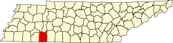
Adamsville is located primarily in McNairy County; only a small part of the municipal area lies in Hardin County.

Demographics

Historical population
CensusPop.Note
1900 459
1920 459
1930 64340.1%
1940 71911.8%
1950 92728.9%
1960 1,04612.8%
1970 1,34428.5%
1980 1,4538.1%
1990 1,74520.1%
2000 1,98313.6%
2010 2,20711.3%
2020 2,2652.6%
Sources: [11] [12] [2]

2020 census

Adamsville racial composition [13]
RaceNum.Perc.
White (non-Hispanic)2,06691.21%
Black or African American (non-Hispanic)592.6%
Native American 20.09%
Asian 100.44%
Other/Mixed 873.84%
Hispanic or Latino 411.81%

As of the 2020 United States census, there were 2,265 people, 836 households, and 519 families residing in the town.

2000 census

As of the census [3] of 2000, there were 1,983 people, 835 households, and 552 families residing in the town. The population density was 287.3 inhabitants per square mile (110.9/km2). There were 937 housing units at an average density of 135.8 per square mile (52.4/km2). The racial makeup of the town was 98.13% White, 1.01% African American, 0.05% Native American, 0.10% Asian, and 0.71% from two or more races. Hispanic or Latino of any race were 0.50% of the population.

There were 835 households, out of which 25.6% had children under the age of 18 living with them, 52.2% were married couples living together, 10.7% had a female householder with no husband present, and 33.8% were non-families. 31.4% of all households were made up of individuals, and 18.6% had someone living alone who was 65 years of age or older. The average household size was 2.20 and the average family size was 2.73.

In the town, the population was spread out, with 20.5% under the age of 18, 6.1% from 18 to 24, 23.4% from 25 to 44, 24.2% from 45 to 64, and 25.8% who were 65 years of age or older. The median age was 45 years. For every 100 females, there were 72.4 males. For every 100 females age 18 and over, there were 70.6 males.

The median income for a household in the town was $30,929, and the median income for a family was $37,993. Males had a median income of $31,154 versus $21,250 for females. The per capita income for the town was $18,806. About 13.0% of families and 16.2% of the population were below the poverty line, including 13.9% of those under age 18 and 36.0% of those age 65 or over.

Economy

Adamsville has an 85-acre industrial park and four miles east of the town proper is the Tennessee Technology Center. Ripley Industries, a parts supplier for the automotive industry and related industrial fabricators, has its corporate headquarters in the town. Jones Exhaust Systems, engineering consultants Aqua Dynamics Group, Langley Wire Cloth Products, and Better Source Supply Company all have major locations in the town, as well. [14] The Adamsville Partnership organization was formed by local businesses, property owners, professionals and related parties to promote the community. [15]

Arts and culture

A slugburger with onion rings. Slug burger.jpg
A slugburger with onion rings.

An Adamsville restaurant serves "slugburgers", a delicacy found in west Tennessee, northeast Mississippi and northwest Alabama. The Fat Cat slugburger consists of a hamburger patty made of beef and soy grits which is then deep fried and served on a bun with condiments. Another local delicacy found in restaurants is the baked cabbage. [16]

Annual events

Adamsville holds a large number of annual events. Every Memorial Day weekend the four-day Buford Pusser Festival is held at the Buford Pusser Memorial Park. The local preliminary for Miss Tennessee, the Miss Walking Tall Pageant is held at The Marty Community Center. A number of other cultural events such as the HeeHaw Show, Founders Day, and a 5K Run in the spring. [17]

Points of interest

The Buford Pusser Home and Museum is located in Adamsville in the former home of the county sheriff. [18] Pusser is also buried in the Adamsville Cemetery. [19] Gibb's Gas & Oil Collectibles is an appointment only museum of old gas pumps, gas and oil signs, oil cans, and other service station memorabilia. [18] Adamsville's public library is the Irving Meek Jr. Memorial Library. [20] The local War Memorial Park is located off of Highway 64 and Old Stage. It commemorates veterans and those who died from Adamsville in World War I and II, the Korean War and Vietnam War. [19] The Old Home Motel was built in 1960 by Joe and Juanita Richardson. Buford Pusser lived at the hotel for a time, and Elvis Presley stayed the night there. [19]

Parks and recreation

Established in 1998, the Adamsville Recreation & Parks Department maintains flag and American football leagues, a cheerleading team, basketball and soccer teams. The town also offers other sports for youth and adults including softball and baseball. Every year the department plans a 5K run to coincide with the annual Buford Pusser Memorial Festival. The city park, also named after Buford Pusser, sits on land that was founded as a sandlot and horse barn by Pusser and the Adamsville Jaycees in 1973. The city park formed out of a fundraiser which featured musicians George Jones and Tammy Wynette, and continued funding and grants go towards improving the park. The city park has a lighted basketball court and tennis courts, a playground, three ball fields, an open-air pavilion, grills and picnic tables, and a walking track. [20] Shiloh Golf Course is an 18-hole golf course. The golf course is on historical land: the number two and number four greens lie along the road where General Lew Wallace marched his three brigades to the Battle of Shiloh on April 6, 1862. [18]

The department also maintains a senior center which distributes Meals on Wheels and related services. The Marty community center is also maintained by the Recreation & Parks department for public use and also has live entertainment, including the monthly Adamsville Bluegrass Jamboree. [18] [20]

Government

Adamsville's government consists of the following: a City Commission, a mayor, and four commissioners. Every two years elections are held on the first Saturday of October, and the mayor and commissioners serve four year staggered terms. The town also has a city administrator, who serves in a full-time paid position overseeing general day-to-day needs of the city business. [21]

Schools

The town is served by two public schools: Adamsville Elementary School and Adamsville High School. The elementary school is accredited by the Southern Association of Colleges and Schools and serves Pre-Kindergarten 4 & 5 to 8th graders. The high school provides education to 9-12th graders in the county. The school has been listed as one of U.S. News & World Report's best high schools in America.

Adamsville High School's marching band has won 1st place at the TN Division 1 State Marching Band Championship nine times since 1999 and has not placed lower than 2nd since 2004. [22] As the school's attendance grew in number, the band was eventually promoted to Division 2 status in 2016. The band won its first Division 2 championship in 2017 and repeated as champions in 2018 and 2019 making the band 12 time state champions. The school mascot is the cardinal. [23]

Historic people

Buford Pusser, legendary McNairy County sheriff [24]

Ray Blanton, The 44th Governor of Tennessee.

Ashley Durham Booth, Miss Tennessee Teen USA 2006, Miss Tennessee USA 2011, and runner-up Miss USA 2011.

Dewey Phillips, Rock n' roll disc jockey. Phillips was the first DJ to spin a record of Elvis Presley on the air waves. [7]

Related Research Articles

<span class="mw-page-title-main">McNairy County, Tennessee</span> County in Tennessee, United States

McNairy County is a county located in the U.S. state of Tennessee. As of the 2020 census, the population was 25,866. Its county seat and largest city is Selmer. McNairy County is located along Tennessee's border with the state of Mississippi.

<span class="mw-page-title-main">Hardin County, Tennessee</span> County in Tennessee, United States

Hardin County is a county located in the U.S. state of Tennessee. As of the 2020 census, the population was 26,831. The county seat is Savannah. Hardin County is located north of and along the borders of Mississippi and Alabama. The county was founded in November 1819 and named posthumously for Col. Joseph Hardin, a Revolutionary War soldier and a legislative representative for the Province of North Carolina; the State of Franklin; and the Southwest Territory. Hardin County was the site of the Battle of Shiloh during the Civil War.

<span class="mw-page-title-main">Chester County, Tennessee</span> County in Tennessee, United States

Chester County is a county located in the U.S. state of Tennessee. As of the 2020 census, the population was 17,341. Its county seat is Henderson. The county was created in 1879 and organized in 1882. Chester County is included in the Jackson, TN Metropolitan Statistical Area.

<span class="mw-page-title-main">Alcorn County, Mississippi</span> County in Mississippi, United States

Alcorn County is a county located in the northeastern portion of the U.S. state of Mississippi. As of the 2020 census, the population was 34,740. Its county seat is Corinth. The county is named in honor of Governor James L. Alcorn.

<span class="mw-page-title-main">Wynne, Arkansas</span> City in Arkansas, United States

Wynne is the county seat and largest city of Cross County, Arkansas, United States. The population was 8,314 at the 2020 Census. Nestled between the Arkansas Delta and Crowley's Ridge, Wynne is the closest city to the second-largest state park in Arkansas, Village Creek State Park.

<span class="mw-page-title-main">De Soto, Missouri</span> City in Missouri, United States

De Soto is a city in Jefferson County, Missouri, United States. The population was 6,449 at the 2020 census and the city is part of the St. Louis metropolitan area. The Van Metre family were first to settle in 1803. The town was organized in 1857 and is named for the explorer Hernando De Soto, who claimed the Louisiana Territory for Spain. De Soto was the city closest to the mean center of U.S. population in 1980. The city celebrated its Bicentennial in 2003. The city made national news on and after May 6, 2003, when straight-line winds and a tornado struck.

<span class="mw-page-title-main">Stoneville, North Carolina</span> Town in North Carolina, United States

Stoneville is a town in Rockingham County, North Carolina, United States. Stoneville is part of the Greensboro–High Point metropolitan area of the Piedmont Triad. On March 20, 1998, an F-3 tornado touched down in neighboring Madison and Mayodan after the system had crossed into Rockingham County from Stokes County. Then, it strengthened into an F-3 as it crossed Route 220 as it followed the train tracks to downtown Stoneville.

<span class="mw-page-title-main">Shelby, Ohio</span> City in Ohio, United States

Shelby is a city in Richland County in the U.S. state of Ohio, northwest of the city of Mansfield. It is part of the Mansfield, Ohio Metropolitan Statistical Area. The population was 9,282 as of the 2020 census.

<span class="mw-page-title-main">Crump, Tennessee</span> City in Tennessee, United States

Crump is a city in Hardin County, Tennessee, United States. The population was 1,428 at the 2010 census, and 1,594 at the 2020 census.

<span class="mw-page-title-main">Lafayette, Tennessee</span> City in Tennessee, United States

Lafayette is a city in Macon County, Tennessee, United States. The population was 4,474 at the 2010 census, and had 5,584 in 2020. It is the county seat of Macon County.

<span class="mw-page-title-main">Chapel Hill, Tennessee</span> Town in Tennessee, United States

Chapel Hill is a town in northeastern Marshall County, Tennessee, United States. The town was named after Chapel Hill, North Carolina, by settlers from that area. The population was 1,717 as of the 2020 census.

<span class="mw-page-title-main">Bethel Springs, Tennessee</span> Town in Tennessee, United States

Bethel Springs is a town in McNairy County, Tennessee. The population was 998 at the 2020 census.

<span class="mw-page-title-main">Finger, Tennessee</span> Town in McNairy County, Tennessee

Finger is a town in McNairy and Chester counties, Tennessee. The population was 350 at the 2000 census.

<span class="mw-page-title-main">Michie, Tennessee</span> Town in Tennessee, United States

Michie is a town in McNairy County, Tennessee. The population was 647 at the 2000 census and 591 at the 2010 census.

<span class="mw-page-title-main">Selmer, Tennessee</span> Town in Tennessee, United States

Selmer is a city in and the county seat of McNairy County, Tennessee, in the southwestern part of the state. The population was 4,396 at the 2010 census and estimated at 4,400 at the 2018 census. It is named after Selma, Alabama.

<span class="mw-page-title-main">Brentwood, Tennessee</span> City in Tennessee, United States

Brentwood is a city in Williamson County, Tennessee, United States. The population was 45,373 as of the 2020 United States census. It is a suburb of Nashville and included in the Nashville metropolitan area.

<span class="mw-page-title-main">Milledgeville, Tennessee</span> Town in Tennessee, United States

Milledgeville is a town in Chester, Hardin, and McNairy counties, Tennessee, United States. The population was 265 at the 2010 census.

<span class="mw-page-title-main">Grand Junction, Tennessee</span> City in Tennessee, United States

Grand Junction is a city between the border of Hardeman and Fayette County, Tennessee, United States. The population was 325 at the 2010 census, and was estimated to be 303 in 2015.

<span class="mw-page-title-main">Buford Pusser</span> American policeman, sheriff, and wrestler (1937-1974)

Buford Hayse Pusser was the sheriff of McNairy County, Tennessee, from 1964 to 1970, and constable of Adamsville from 1970 to 1972. Pusser is known for his virtual one-man war on moonshining, prostitution, gambling, and other vices along the Mississippi–Tennessee state line. His efforts have inspired several books, songs, movies and a TV series. He was also a wrestler known as "Buford the Bull" in the Mid-South.

<span class="mw-page-title-main">Tennessee State Route 117</span> State highway in Tennessee, United States

State Route 117 is a very short state highway in extreme eastern McNairy County, Tennessee. This highway passes through one town (Adamsville) and acts as a shortcut from Adamsville to the nearby Shiloh National Military Park.

References

  1. "ArcGIS REST Services Directory". United States Census Bureau. Retrieved October 15, 2022.
  2. 1 2 "Census Population API". United States Census Bureau. Retrieved October 15, 2022.
  3. 1 2 "U.S. Census website". United States Census Bureau . Retrieved January 31, 2008.
  4. "US Board on Geographic Names". United States Geological Survey. October 25, 2007. Retrieved January 31, 2008.
  5. Siler, Tom (1985). Tennessee Towns: from Adams to Yorkville. Knoxville, Tennessee: East Tennessee Historical Society. p. 1.
  6. 1 2 "Adamsville". Tennessee Department of Tourist Development. 2011. Retrieved November 19, 2011.
  7. 1 2 3 "History of Adamsville". History. City of Adamsville. Archived from the original on February 4, 2012. Retrieved November 19, 2011. Ashley Durham,
  8. History of Tennessee from the Earliest Time to the Present. Southern Historical Press. 1886. p. 828. ISBN   9780893080976.
  9. "ArcGIS Web Application".
  10. "US Gazetteer files: 2010, 2000, and 1990". United States Census Bureau. February 12, 2011. Retrieved April 23, 2011.
  11. "Census of Population and Housing: Decennial Censuses". United States Census Bureau . Retrieved March 4, 2012.
  12. "Incorporated Places and Minor Civil Divisions Datasets: Subcounty Resident Population Estimates: April 1, 2010 to July 1, 2012". Population Estimates. U.S. Census Bureau. Archived from the original on June 11, 2013. Retrieved December 11, 2013.
  13. "Explore Census Data". data.census.gov. Retrieved December 8, 2021.
  14. "Adamsville Industry". Industrial Park. City of Adamsville. Archived from the original on February 4, 2012. Retrieved November 19, 2011.
  15. "Adamsville Partnership". Adamsville Partnership. 2010. Retrieved November 19, 2011.
  16. "Dine". Our Town. Adamsville Partnership. 2010. Archived from the original on October 8, 2011. Retrieved November 19, 2011.
  17. "Adamsville Events". Events. Adamsville Partnership. 2010. Archived from the original on October 8, 2011. Retrieved November 19, 2011.
  18. 1 2 3 4 "City Attractions". Area Info. City of Adamsville. Archived from the original on February 4, 2012. Retrieved November 19, 2011.
  19. 1 2 3 "See & Do". Our Town. Adamsville Partnership. 2010. Archived from the original on October 8, 2011. Retrieved November 19, 2011.
  20. 1 2 3 "Recreation & Parks Department". Recreation. City of Adamsville. Archived from the original on February 4, 2012. Retrieved November 19, 2011.
  21. "Our City Leaders". City Leaders. City of Adamsville. Archived from the original on December 1, 2011. Retrieved November 19, 2011.
  22. "Tennessee Division 1 State Marching Band Championship". Archived from the original on October 26, 2014. Retrieved May 19, 2017.
  23. "Adamsville Schools". Area Info. City of Adamsville. Archived from the original on January 24, 2012. Retrieved November 19, 2011.
  24. "Buford Pusser, the Man, his Career, and Tragedies". History. Buford Pusser Home & Museum. 2006. Archived from the original on October 3, 2011. Retrieved November 19, 2011.