Related Research Articles

McNairy County is a county located in the U.S. state of Tennessee. As of the 2020 census, the population was 25,866. The county seat and largest city is Selmer. McNairy County is located along Tennessee's border with the state of Mississippi.
Hopewell is a census-designated place (CDP) and unincorporated community in Bradley County, Tennessee, United States. The population was 2,087 at the 2020 Census. It is included in the Cleveland, Tennessee Metropolitan Statistical Area.

Selmer is a City in and the county seat of McNairy County, Tennessee, in the southwestern part of the state. The population was 4,446 as of the 2020 census. It is named after Selma, Alabama.

Collinwood is a city in Wayne County, Tennessee, United States. The population was 982 at the 2010 census, down from 1,024 in 2000.

Adamsville is a city in Hardin and McNairy counties, Tennessee, United States. The population was 2,207 at the 2010 census. Adamsville is named after George D. Adams, who operated an inn and stagecoach stop in the 1840s. Adamsville's nickname is the "Biggest Little Town in Tennessee" and was the home of Sheriff Buford Pusser.

Cascade Heights is an affluent neighborhood in southwest Atlanta. It is bisected by Cascade Road, which was known as Sandtown Road in the nineteenth century. The road follows the path of the ancient Sandtown Trail which ran from Stone Mountain to the Creek village of Sandtown on the Chattahoochee River and from there on into Alabama. Ironically, the name lived on even after the Indians were expelled in the 1830s.

Karns is an unincorporated community and census-designated place in northwest Knox County, Tennessee, about 11 miles (18 km) northwest of the center of Knoxville. The population of the CDP was 3,536 at the 2020 census.
Westfield is an unincorporated community in Harris County, Texas, United States, located along Interstate 45 and the Union Pacific Railroad nineteen miles (30 km) north of Downtown Houston.

Wheat was a farming community in Roane County, Tennessee. The area is now in the city of Oak Ridge.

Del Rio is an unincorporated community in Cocke County, Tennessee, United States. Although it is not a census-designated place, the ZIP Code Tabulation Area for the ZIP Code (37727) that serves Del Rio had a population of 2,138, according to the 2000 census.

Lauderdale is an unincorporated community and census-designated place (CDP) in Lauderdale County, Mississippi, United States. The population of Lauderdale was 395 at the 2020 census. It is located along U.S. Highway 45, 16 miles (26 km) northeast of Meridian.

Kodak is an unincorporated community and a neighborhood of Sevierville in Sevier County, Tennessee, United States. It is located along State Highway 139 and State Highway 66, and just south of I-40 and Knoxville, Tennessee. The elevation of Kodak is about 896 feet above sea level.
Lutts is an unincorporated community in Wayne County, Tennessee, United States. It is also known as "Pinhook."

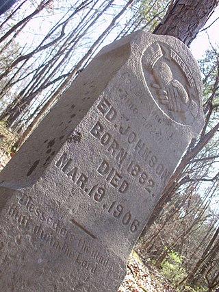
On March 19, 1906, Ed Johnson, a young African American man, was murdered by a lynch mob in his home town of Chattanooga, Tennessee. He had been wrongfully sentenced to death for the rape of Nevada Taylor, but Justice John Marshall Harlan of the United States Supreme Court had issued a stay of execution. To prevent delay or avoidance of execution, a mob broke into the jail where Johnson was held, and abducted and lynched him from the Walnut Street Bridge.

Metropolitan is an unincorporated community in Humboldt County, California. It is located on McDairmid Prairie, on the north side of the Eel River floodplain three miles downstream of Scotia, at an elevation of 72 feet.
Root Creek was a hamlet in Sections 21-22 and 27-28 of the Town of Greenfield in Milwaukee County, Wisconsin, United States, on the Milwaukee-Janesville plank road, at what is now roughly the intersection of that thoroughfare and 68th Street. The body of water after which it was named is nowadays referred to as the Root River.
Boston is an unincorporated community in the Boston Mountains of southeastern Madison County, Arkansas, United States. The community is located on Arkansas Highway 16 between Pettigrew to the southwest and Red Star to the northeast. The community is on a high ridge at an elevation of 2,329 feet (710 m). The location is at the headwaters of four streams: Kings River to the northeast, War Eagle Creek to the northwest, the White River to the east and southwest and Little Mulberry Creek to the southeast.

Chambersburg Township is a township in Iredell County, North Carolina, United States. The 2010 United States Census reported a total population of 11,344.

Cool Springs Township is a non-functioning administrative division of Iredell County, North Carolina, United States. By the requirements of the North Carolina Constitution of 1868, the counties were divided into townships, which included Cool Springs township as one of sixteen townships in Iredell County.

State Route 152 is a 36.88-mile-long (59.35 km) east-west state highway traversing the flat farmland of West Tennessee.
References
- ↑ "Post Offices". Jim Forte Postal History. Retrieved 5 January 2017.
- ↑ History of Tennessee from the Earliest Time to the Present. Southern Historical Press. 1886. p. 828. ISBN 9780893080976.
35°08′41″N88°36′05″W / 35.14472°N 88.60139°W
