Lauderdale County | |
---|---|
Coordinates: 35°46′N89°38′W / 35.76°N 89.63°W | |
Country | United States |
State | Tennessee |
Founded | 1835 |
Named for | James Lauderdale [1] |
Seat | Ripley |
Largest city | Ripley |
Area | |
• Total | 508 sq mi (1,320 km2) |
• Land | 472 sq mi (1,220 km2) |
• Water | 36 sq mi (90 km2) 7.0% |
Population (2020) | |
• Total | 25,143 |
• Density | 59/sq mi (23/km2) |
Time zone | UTC−6 (Central) |
• Summer (DST) | UTC−5 (CDT) |
Congressional district | 8th |
Website | lauderdalecountytn |
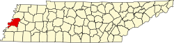
Lauderdale County is a county located on the western edge of the U.S. state of Tennessee, with its border the Mississippi River. As of the 2020 census, the population was 25,143. Its county seat is Ripley. [2] Since the antebellum years, it has been developed for cotton as a major commodity crop.
Lauderdale County was created in 1835 from parts of Tipton, Dyer and Haywood counties. It was named for Lieutenant Colonel James Lauderdale, who was killed at the Battle of New Orleans in the War of 1812. [1] Planters developed large cotton plantations along the waterways, and used enslaved African Americans in gangs to work and process this commodity crop. After the American Civil War, many freedmen initially stayed in the area, working the land as sharecroppers or tenant farmers. Whites used violence to enforce white supremacy after the war, continuing after Reconstruction. In the period after Reconstruction and into the early 20th century, whites in Lauderdale County committed eight lynchings of blacks. This was the fifth-highest total of any county in the state, but three other counties also had eight lynchings each in this period. [3]
In 1861, the Confederate States Army built extensive defensive fortifications in Lauderdale County along the Mississippi River and named the site for General Gideon J. Pillow. Because of its strategic location, the fort was taken over by the Union Army in 1864, which had occupied the state since 1862.
In 1864, Confederates attacked and overran the fort's Union defenders, who were about evenly split between white and black soldiers. They were reported to have refused to surrender, but historians have disputed this account. The Confederates gave the soldiers no quarter, and killed black soldiers in twice the proportion of white ones. After the Union Army established the United States Colored Troops (USCT), made up of numerous recruits who were escaped slaves, Southern military officials vowed to kill them rather than take them prisoner. [4] People in the North considered this event to be a massacre, and blacks in the Union Army used the cry, "Remember Fort Pillow!" to rally during the remainder of the war.
Fort Pillow State Park has a museum to interpret the battle and also has reconstructed fortifications on the original site of the fort.
According to the U.S. Census Bureau, the county has a total area of 508 square miles (1,320 km2), of which 472 square miles (1,220 km2) is land and 36 square miles (93 km2) (7.0%) is water. [5] The county's western boundary is formed by the Mississippi River, its northern boundary with Dyer County is formed by the Forked Deer River, and its southern boundary with Haywood County is formed by the Hatchie River. [1]
Lauderdale County is situated on the southeastern edge of the New Madrid Seismic Zone, an area with a high earthquake risk.
Census | Pop. | Note | %± |
---|---|---|---|
1840 | 3,435 | — | |
1850 | 5,169 | 50.5% | |
1860 | 7,559 | 46.2% | |
1870 | 10,838 | 43.4% | |
1880 | 14,918 | 37.6% | |
1890 | 18,756 | 25.7% | |
1900 | 21,971 | 17.1% | |
1910 | 21,105 | −3.9% | |
1920 | 21,494 | 1.8% | |
1930 | 23,406 | 8.9% | |
1940 | 24,461 | 4.5% | |
1950 | 25,047 | 2.4% | |
1960 | 21,844 | −12.8% | |
1970 | 20,271 | −7.2% | |
1980 | 24,555 | 21.1% | |
1990 | 23,491 | −4.3% | |
2000 | 27,101 | 15.4% | |
2010 | 27,815 | 2.6% | |
2020 | 25,143 | −9.6% | |
U.S. Decennial Census [6] 1790-1960 [7] 1900-1990 [8] 1990-2000 [9] 2010-2020 [10] 2020 [11] |
Race | Num. | Perc. |
---|---|---|
White (non-Hispanic) | 15,016 | 59.72% |
Black or African American (non-Hispanic) | 8,385 | 33.35% |
Native American | 133 | 0.53% |
Asian | 53 | 0.21% |
Other/Mixed | 969 | 3.85% |
Hispanic or Latino | 587 | 2.33% |
As of the 2020 United States census, there were 25,143 people, 9,675 households, and 6,753 families residing in the county.
As of the census [14] of 2000, there were 27,101 people, 9,567 households, and 6,811 families residing in the county. The population density was 58 people per square mile (22 people/km2). There were 10,563 housing units at an average density of 22 units per square mile (8.5/km2). The racial makeup of the county was 63.82% White, 34.08% Black or African American, 0.62% Native American, 0.16% Asian, 0.02% Pacific Islander, 0.52% from other races, and 0.78% from two or more races. 1.16% of the population were Hispanic or Latino of any race.
There were 9,567 households, out of which 32.80% had children under the age of 18 living with them, 49.70% were married couples living together, 17.60% had a female householder with no husband present, and 28.80% were non-families. 25.60% of all households were made up of individuals, and 11.10% had someone living alone who was 65 years of age or older. The average household size was 2.55 and the average family size was 3.06.
In the county, the population was spread out, with 24.80% under the age of 18, 10.30% from 18 to 24, 31.20% from 25 to 44, 21.70% from 45 to 64, and 12.10% who were 65 years of age or older. The median age was 35 years. For every 100 females there were 108.10 males. For every 100 females age 18 and over, there were 109.00 males.
The median income for a household in the county was $29,751, and the median income for a family was $36,841. Males had a median income of $28,325 versus $21,238 for females. The per capita income for the county was $13,682. About 16.20% of families and 19.20% of the population were below the poverty line, including 24.70% of those under age 18 and 26.50% of those age 65 or over.
Sleepy John Estes was a U.S. blues guitarist, songwriter and vocalist, born in Ripley, Tennessee. [15] He died on June 5, 1977, in his home of 17 years in Brownsville, Haywood County, Tennessee. [16] [17] [18] Sleepy John is buried at Elam Baptist Church Cemetery in Durhamville, Lauderdale County. [18]
The Veterans' Museum on the grounds of the former Dyersburg Army Air Base in Halls is dedicated to the preservation and documentation of materials related to military activities from World War I to the present day wars and conflicts, as well as documenting the history of the air base itself.
Year | Republican | Democratic | Third party(ies) | |||
---|---|---|---|---|---|---|
No. | % | No. | % | No. | % | |
2020 | 5,674 | 63.29% | 3,193 | 35.62% | 98 | 1.09% |
2016 | 4,884 | 60.39% | 3,056 | 37.79% | 147 | 1.82% |
2012 | 4,616 | 53.12% | 4,011 | 46.16% | 62 | 0.71% |
2008 | 4,933 | 52.83% | 4,322 | 46.28% | 83 | 0.89% |
2004 | 4,164 | 47.96% | 4,474 | 51.53% | 44 | 0.51% |
2000 | 3,329 | 43.70% | 4,224 | 55.45% | 65 | 0.85% |
1996 | 2,481 | 34.63% | 4,349 | 60.71% | 334 | 4.66% |
1992 | 2,928 | 36.79% | 4,452 | 55.94% | 578 | 7.26% |
1988 | 3,308 | 49.83% | 3,296 | 49.65% | 35 | 0.53% |
1984 | 3,566 | 50.23% | 3,506 | 49.39% | 27 | 0.38% |
1980 | 2,818 | 38.95% | 4,318 | 59.68% | 99 | 1.37% |
1976 | 2,105 | 30.61% | 4,747 | 69.03% | 25 | 0.36% |
1972 | 3,597 | 64.40% | 1,771 | 31.71% | 217 | 3.89% |
1968 | 1,080 | 15.99% | 2,108 | 31.21% | 3,566 | 52.80% |
1964 | 1,880 | 32.83% | 3,847 | 67.17% | 0 | 0.00% |
1960 | 1,322 | 27.36% | 3,462 | 71.65% | 48 | 0.99% |
1956 | 1,049 | 18.94% | 4,383 | 79.12% | 108 | 1.95% |
1952 | 1,390 | 24.26% | 4,340 | 75.74% | 0 | 0.00% |
1948 | 298 | 7.68% | 2,556 | 65.89% | 1,025 | 26.42% |
1944 | 381 | 9.25% | 3,732 | 90.65% | 4 | 0.10% |
1940 | 317 | 4.80% | 6,279 | 95.09% | 7 | 0.11% |
1936 | 203 | 5.41% | 3,540 | 94.27% | 12 | 0.32% |
1932 | 174 | 7.40% | 2,137 | 90.94% | 39 | 1.66% |
1928 | 430 | 13.32% | 2,798 | 86.68% | 0 | 0.00% |
1924 | 242 | 12.96% | 1,596 | 85.44% | 30 | 1.61% |
1920 | 1,190 | 33.97% | 2,313 | 66.03% | 0 | 0.00% |
1916 | 532 | 25.26% | 1,572 | 74.64% | 2 | 0.09% |
1912 | 186 | 10.18% | 1,020 | 55.83% | 621 | 33.99% |
The Tennessee Department of Corrections operates the West Tennessee State Penitentiary in unincorporated Lauderdale County, near Henning. [20] Previously the Cold Creek Correctional Facility was located in the area. [21]
All parts of the county are in the Lauderdale County School District. [22]
Sumter County is a county located in the west central portion of Alabama. At the 2020 census, the population was 12,345. Its county seat is Livingston. Its name is in honor of General Thomas Sumter of South Carolina. The University of West Alabama is in Livingston.
Roane County is a county of the U.S. state of Tennessee. As of the 2020 census, the population was 53,404. Its county seat is Kingston. Roane County is included in the Knoxville, TN Metropolitan Statistical Area.
Haywood County is a county located in the U.S. state of Tennessee, in the region known as West Tennessee. As of the 2020 census, the population was 17,864. Its county seat and largest city is Brownsville. It is one of only two remaining counties in Tennessee, along with Shelby County, with a majority African-American population.
Hardeman County is a county located in the U.S. state of Tennessee. As of the 2020 census, the population was 25,462. Its county seat is Bolivar.
Crockett County is a county located in the U.S. state of Tennessee. As of the 2020 census, the population was 13,911. Its county seat is Alamo. Crockett County is included in the Jackson, TN Metropolitan Statistical Area.
Waterloo is a town in Lauderdale County, Alabama, United States. It is part of the Florence–Muscle Shoals metropolitan area, known as "The Shoals". As of the 2010 census, the population of the town was 203, down from 208 in 2000. The town and surrounding area is served by Waterloo High School and by the Waterloo Volunteer Fire Department.
Oak Grove is a home rule-class city adjacent to the Fort Campbell army base in Christian County, Kentucky, in the United States. The population was 7,931 as of the 2020 census, up from 7,489 as of the 2010 U.S. Census. It is part of the Clarksville, Tennessee metropolitan area.
Prospect is a town in Waldo County, Maine, United States. The population was 698 at the 2020 census.
Sleepy Eye is a small city in rural Brown County, Minnesota, United States. The city is named after a famed local Dakota chief from the 1800s. The population was 3,599 at the 2010 census.
Doniphan is a city in Ripley County, Missouri, United States. The population was 1,781 at the 2020 census. It is the county seat of Ripley County.
Piperton is a city in Fayette County, Tennessee, United States. The population was 2,263 at the 2020 census. In 2007, USA Today cited the National Motorist Association when it listed Piperton as one of the worst cities for speeding tickets across the USA.
Middleton is a city in Hardeman County, Tennessee, United States. The population was 706 at the 2010 census, up from 602 at the 2000 census. It is located at the intersection of Tennessee State Route 125 and Tennessee State Route 57. Its slogan is the "Crossroads of the South".
Brownsville is a city in and the county seat of Haywood County, Tennessee, United States. Its population as of the 2020 census was 9,788. The city is named after General Jacob Jennings Brown, an American officer of the War of 1812.
Henning is a town in Lauderdale County, Tennessee, United States. The population was 945 at the 2010 census.
Ripley is a city in Lauderdale County, Tennessee, United States. The population was 8,445 at the 2010 census. It is the county seat of Lauderdale County.
John Adam Estes, known as Sleepy John Estes, was an American blues guitarist, songwriter and vocalist. His music influenced such artists as the Beatles, Bob Dylan and Led Zeppelin.
State Route 87 is a secondary state highway located in Lauderdale and Haywood counties in West Tennessee. SR 87 runs west to east through mixed terrain of bluffs and rolling hills in Lauderdale County and mostly river bottoms in Haywood County. SR 87 is a two-lane facility throughout its length and features a 50-55 MPH speed limit depending on terrain. This highway is also narrow and in poor condition in several locations. This highway provides direct access to West Tennessee State Penitentiary and indirect access to Fort Pillow State Park via State Route 207. The western terminus of SR 87 is notable due to the extreme levels of erosion from the Mississippi River that has created a very sharp and unstable "cliff" that forced TDOT to erect a barricade to stop vehicles from driving over the edge and into the river.
State Route 19 or the Tina Turner Highway is a state highway in Haywood and Lauderdale counties in Tennessee, United States. State Route 19 is 42.81 mi (69 km) long.
Golddust is a rural unincorporated community in Lauderdale County, Tennessee, United States. It is located on the banks of the Mississippi River. Golddust is one of the earliest European-American settlements in Lauderdale County.
Durhamville is a rural unincorporated community in Lauderdale County, Tennessee, United States. Durhamville is the second oldest town in Lauderdale County. It was founded by Colonel Thomas Durham in 1829 or 1830. Thomas Durham owned a store in the town since 1826.