State Route 371 is a state highway in Riverside County, California, serving as a 20.75-mile (33.39 km) connector from SR 79 near Aguanga to SR 74 near Anza. The highway crosses through the private community of Lake Riverside, as well as Cahuilla and the Cahuilla Indian Reservation. It is the primary road running through Anza but mostly serves rural areas.

State Route 20 (SR 20) is a 73.978-mile-long (119.056 km) state highway in the northern part of the U.S. state of Alabama. It travels from the Tennessee state line, where it continues as Tennessee State Route 69, northwest of Florence, east to Interstate 65 (I-65), east of Decatur. It crosses the Tennessee River at Florence and also at Decatur

State Road 87 is a 51.687-mile-long (83.182 km) north–south highway in the state of Florida that extends from U.S. Route 98 to the Alabama state line where it becomes State Route 41. All of SR 87 is contained within Santa Rosa County.

State Route 371 (SR 371) was a 6.0-mile-long (9.7 km) two-lane south-to-north state highway in unincorporated Forsyth County in the north-central part of the U.S. state of Georgia. The highway connected SR 9 in the south to SR 20 in the north. SR 371 served as a connecting route for the residential neighborhoods between SR 9 and SR 20 to SR 400, the major north–south commuter route into and out of Atlanta. SR 371's path is known locally as Post Road.

State Route 70 is a primary state highway in Lee County, Virginia, running from the Tennessee state line to U.S. Route 58 in Jonesville. Its continuation in Tennessee, also numbered State Route 70, continues south to the North Carolina state line at North Carolina Highway 208.

North Carolina Highway 87 (NC 87) is a primary state highway in the U.S. state of North Carolina. NC 87 begins in the Atlantic coastal town of Southport and crosses into Virginia at the Virginia state line five miles (8 km) north of Eden in Rockingham County. At 240 miles (390 km) in length, NC 87 is the second longest state highway in the U.S. state of North Carolina with only North Carolina Highway 24 being longer. Labeled as a north–south route, NC 87 travels along a relatively straight southeast–northwest path, connecting Cape Fear region with the Piedmont. It is also the main north-south route connecting the cities of Fayetteville, Sanford, Burlington and Reidsville.

State Route 87 is a primary state highway in the U.S. state of Virginia. Known for its entire length as Morehead Avenue, the state highway runs 4.10 miles (6.60 km) from the North Carolina state line, where the highway continues as North Carolina Highway 14 /NC 87, north to its terminus at U.S. Route 220 in Ridgeway in southern Henry County.

North Carolina Highway 60 (NC 60) is a primary state highway in the extreme southwestern corner of North Carolina. The highway runs north–south from the Georgia state line to U.S. Route 64/U.S. Route 74 (US 64/US 74), near Ranger.
State Route 17 is a major north-to-south highway within the U.S. state of Alabama. Covering 346.562 miles (557.737 km), it travels the length of the state between US 90 in Mobile and SR 13 at the Tennessee state line, north of Zip City.
State Route 157 (SR 157) is a 91-mile-long (146 km) state highway in the northern and northwestern parts of the U.S. state of Alabama. Its southern terminus is at an intersection with U.S. Route 278 (US 278) approximately 10 miles (16 km) east of Cullman, where it continues as County Road 719. The northern terminus of the highway is at the Tennessee state line northwest of Florence, where it continues as Tennessee State Route 227 (SR 227).

State Route 181 is a primary state highway running through Lake, Dyer, and Lauderdale counties in Tennessee. This highway traverses very sparsely populated areas and is located entirely within the flood plains of the Mississippi River, Obion River and Forked Deer River. SR 181 is constructed as a modern two-lane facility with paved shoulders and a 55 mph (89 km/h) speed limit throughout its length. Prior to its designation as a state highway, it was a narrow gravel road. It is constructed atop the "Big Levee" in Dyer County and is used as a primary defense against floodwaters from the Mississippi River itself, however, floodwaters from the Obion River often back up on the eastern side of the levee. This highway doesn't pass through any municipalities or unincorporated communities. The area is a popular destination for fishermen and hunters.

State Route 64 (SR 64) is an 18.230-mile-long (29.338 km) east–west state highway entirely within Lauderdale County in the northwest portion of the U.S. state of Alabama. The western terminus of the highway is at an intersection with U.S. Route 43 (US 43) near Green Hill, an unincorporated community south of the Tennessee state line. The eastern terminus of the highway is at an intersection with SR 207 north of Anderson.
State Route 87 is a secondary state highway located in Lauderdale and Haywood counties in West Tennessee. SR 87 runs west to east through mixed terrain of bluffs and rolling hills in Lauderdale County and mostly river bottoms in Haywood County. SR 87 is a two-lane facility throughout its length and features a 50-55 MPH speed limit depending on terrain. This highway is also narrow and in poor condition in several locations. This highway provides direct access to West Tennessee State Penitentiary and indirect access to Fort Pillow State Park via State Route 207. The western terminus of SR 87 is notable due to the extreme levels of erosion from the Mississippi River that has created a very sharp and unstable "cliff" that forced TDOT to erect a barricade to stop vehicles from driving over the edge and into the river.

State Route 35 is a highway in northern Utah connecting SR-32 in Francis to SR-87 in Duchesne in a span of sixty-two miles.

State Route 74 (SR 74) is a north–south state highway located primarily in Bradley County, Tennessee. It runs from the Georgia state line to downtown Cleveland. The route serves as a major shortcut, along with SR 60, for Cleveland citizens to commute to Atlanta, Georgia.

State Route 308 is a secondary state route located in northern Bradley County, Tennessee that serves the city of Charleston. The route is 7.5 miles (12.1 km) long and is located entirely in Bradley County.

State Route 207, also known as Park Road, is a short 1.1-mile-long (1.8 km) state highway in Lauderdale County, Tennessee. It connects SR 87 and the community of Fulton with Fort Pillow State Park. It is the primary road in and out of the park and is two-lane highway for its entire duration.

State Route 208 is a short 1.44 mile long north-south state highway in Ripley, Tennessee. For its entire length, SR 208 is known as Cleveland Street.
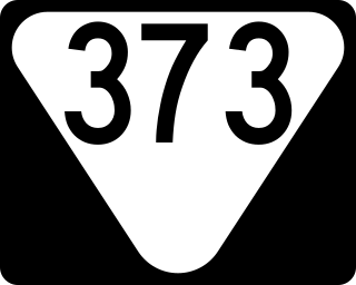
State Route 373 is a 17.1-mile-long (27.5 km) east-west state highway in southern Middle Tennessee. It connects the community of Culleoka with the cities of Lewisburg and Columbia, along with I-65.


