Halls, Tennessee

Last updated

Halls, Tennessee
Welcome to Halls.jpg
Lauderdale County Tennessee Incorporated and Unincorporated areas Halls Highlighted 4731820.svg
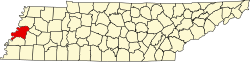
Location of Halls in Lauderdale County, Tennessee.
Coordinates: 35°52′32″N89°23′46″W / 35.87556°N 89.39611°W / 35.87556; -89.39611
Country United States
State Tennessee
County Lauderdale
Area
[1]
  Total3.69 sq mi (9.56 km2)
  Land3.68 sq mi (9.54 km2)
  Water0.01 sq mi (0.02 km2)
Elevation
[2]
318 ft (97 m)
Population
 (2020) [3]
  Total2,091
  Density567.90/sq mi (219.25/km2)
Time zone UTC-6 (Central (CST))
  Summer (DST) UTC-5 (CDT)
ZIP code
38040
Area code 731
FIPS code 47-31820 [4]
GNIS feature ID1286606 [2]
Website www.town.halls.tn.us

Halls is a town in Lauderdale County, Tennessee, United States. The population was 2,255 at the 2010 census.

Contents

The town was founded in 1882 as a railroad station stop. It is named after Hansford R. Hall, one of the founders. Among the early business ventures were sawmills and cotton gins, founded in the 1880s to process local lumber and cotton.

History

The town was not established until 1882, when the Newport News & Mississippi Valley Railroad (later the Illinois Central Railroad) set up a railroad stop on land in northern Lauderdale County. By 1899, the town had its own bank, and the following year the Cumberland Telephone and Telegraph Company had set up a line connecting it to the county seat, Ripley. [5]

The village was originally named Hall's Station in honor of Hansford R. Hall, one of the founders. Other founders were J. S. Stephens and S. A. Jordan, early businessmen of Lauderdale County.

E. Stanfield, general merchant, was first to set up a business at Hall's Station in 1882. Other early businesses included Young & Sawyer, a steam-powered cotton gin; D. P. Shoffner, steam sawmill and wagon material; J. H. Farmer, saw-, grist- and planing-mill and cotton gin. As of 1887 there were about 400 people in the community. [6]

In August 1942, the U.S. Army Air Forces constructed Dyersburg Army Air Field on the north side of town. This was a major B-17 and B-24 base during World War 2. It closed in 1946 and was eventually converted to a municipal airport. [7]

On January 17, 1999 a tornado struck Halls damaging a restaurant and The Halls First United Methodist Church. The church has since been rebuilt in another location. [8]

Geography

Halls is located at 35°52′32″N89°23′46″W / 35.87556°N 89.39611°W / 35.87556; -89.39611 . [9]

According to the United States Census Bureau, the town has a total area of 3.7 square miles (9.6 km2), of which 3.7 square miles (9.6 km2) is land and 0.27% is water.

Halls is situated on the southeastern edge of the New Madrid Seismic Zone, an area with a high earthquake risk.

Demographics

Historical population
CensusPop.Note
1890 441
1900 395−10.4%
1910 882123.3%
1920 1,40058.7%
1930 1,4745.3%
1940 1,5112.5%
1950 1,80819.7%
1960 1,8904.5%
1970 2,32322.9%
1980 2,4445.2%
1990 2,431−0.5%
2000 2,311−4.9%
2010 2,255−2.4%
2020 2,091−7.3%
Sources: [10] [11] [3]

2020 census

Halls racial composition [12]
RaceNum.Perc.
White (non-Hispanic)1,31963.08%
Black or African American (non-Hispanic)55726.64%
Native American 100.48%
Asian 30.14%
Other/Mixed 1366.5%
Hispanic or Latino 663.16%

As of the 2020 United States census, there were 2,091 people, 887 households, and 557 families residing in the town.

2000 census

As of the census [4] of 2000, there were 2,311 people, 946 households, and 642 families residing in the town. The population density was 630.8 inhabitants per square mile (243.6/km2). There were 1,051 housing units at an average density of 286.9 per square mile (110.8/km2). The racial makeup of the town was 70.45% White, 28.13% African American, 0.48% Native American, 0.09% Asian, 0.04% Pacific Islander, 0.17% from other races, and 0.65% from two or more races. Hispanic or Latino of any race were 0.65% of the population.

There were 946 households, out of which 29.7% had children under the age of 18 living with them, 45.3% were married couples living together, 17.7% had a female householder with no husband present, and 32.1% were non-families. 30.0% of all households were made up of individuals, and 15.9% had someone living alone who was 65 years of age or older. The average household size was 2.44 and the average family size was 3.03.

In the town, the population was spread out, with 26.7% under the age of 18, 7.7% from 18 to 24, 26.8% from 25 to 44, 22.3% from 45 to 64, and 16.4% who were 65 years of age or older. The median age was 37 years. For every 100 females, there were 87.1 males. For every 100 females age 18 and over, there were 81.8 males.

The median income for a household in the town was $24,142, and the median income for a family was $29,063. Males had a median income of $26,528 versus $19,300 for females. The per capita income for the town was $15,011. About 21.8% of families and 23.3% of the population were below the poverty line, including 29.2% of those under age 18 and 29.0% of those age 65 or over.

Transportation

Arnold Field, a former WW2 B-24 base, is the city's airport. It contains a single 4,700 foot concrete runway.

The town of Halls is served by the Fulton Division of the Canadian National Railroad.

Veterans' Museum

A-7 Corsair II in front of the Veterans' Museum in Halls Corsair dyaab halls tn.jpg
A-7 Corsair II in front of the Veterans' Museum in Halls

The Veterans' Museum, on the grounds of the former Dyersburg Army Air Base (Arnold Field), is dedicated to the preservation and documentation of materials related to military activities from World War I to the Iraq War, as well as documenting the history of the air base itself.

Related Research Articles

<span class="mw-page-title-main">Lauderdale County, Alabama</span> County in Alabama, United States

Lauderdale County is a county located in the northwestern corner of the U.S. state of Alabama. At the 2020 census the population was 93,564. Its county seat is Florence. Its name is in honor of Colonel James Lauderdale, of Tennessee. Lauderdale is part of the Florence-Muscle Shoals, AL Metropolitan Statistical Area, also known as "The Shoals".

<span class="mw-page-title-main">Lauderdale County, Tennessee</span> County in Tennessee, United States

Lauderdale County is a county located on the western edge of the U.S. state of Tennessee, with its border the Mississippi River. As of the 2020 census, the population was 25,143. Its county seat is Ripley. Since the antebellum years, it has been developed for cotton as a major commodity crop.

<span class="mw-page-title-main">Dyer County, Tennessee</span> County in Tennessee, United States

Dyer County is a county located in the westernmost part of the U.S. state of Tennessee. As of the 2020 census, the population was 36,801. The county seat is Dyersburg. Dyer County comprises the Dyersburg, TN Micropolitan Statistical Area.

<span class="mw-page-title-main">Sulligent, Alabama</span> City in Alabama, United States

Sulligent is a city in Lamar County, Alabama, United States. As of the 2010 census, the population of the city was 1,927, down from its record high of 2,151 in 2000. From 1910-1950 and again in 2000, it was the largest community in Lamar County before losing the distinction both times to the county seat of Vernon. The name is derived from railroad personnel.

<span class="mw-page-title-main">Rison, Arkansas</span> City in Arkansas, United States

Rison, officially the City of Rison, is a city in and the county seat of Cleveland County, Arkansas, United States. Its population was 1,344 at the 2010 U.S. census. It is included in the Pine Bluff, Arkansas Metropolitan Statistical Area. Rison is a bedroom community for people who work in Pine Bluff. The largest employers are the city and county governments, the Cleveland County School District, the Cleveland County Nursing Home. There are two banks, eight churches, and about forty-five businesses within the city limits. Among the local properties listed on the National Register of Historic Places are the Rison Cities Service Station and the Rison Texaco Service Station.

<span class="mw-page-title-main">Atkins, Arkansas</span> City in Arkansas, United States

Atkins is a city in Pope County, Arkansas, United States. The population was 3,016 at the 2010 census. It is part of the Russellville Micropolitan Statistical Area.

<span class="mw-page-title-main">Marion, Mississippi</span> Town in Mississippi, United States

Marion is a town in Lauderdale County, Mississippi, United States. It is a northeastern suburb of Meridian, the county seat. The population of Marion was 1,479 at the 2010 census.

<span class="mw-page-title-main">Amory, Mississippi</span> City in Mississippi, United States

Amory is a city in Monroe County, Mississippi, United States. The population was 6,666 at the 2020 census, down from 7,316 in 2010. Located in the northeastern part of the state near the Alabama border, it was founded in 1887 as a railroad town by the Kansas City, Memphis and Birmingham Railroad. As a result, Cotton Gin Port, along the Tombigbee River to the east, was abandoned as businesses and people moved for railroad access.

<span class="mw-page-title-main">Oakland, Mississippi</span> Town in Mississippi, United States

Oakland is a town in Yalobusha County, Mississippi, United States. The population was 527 at the time of the 2010 census.

<span class="mw-page-title-main">Stuart, Oklahoma</span> Town in Oklahoma, United States

Stuart is a town in southeastern Hughes County, Oklahoma, United States. The population was 180 at the 2010 census, down from 220 in 2000.

<span class="mw-page-title-main">Maury City, Tennessee</span> Town in Tennessee, United States

Maury City is a town in Crockett County, Tennessee. The population was 674 at the 2010 census. Locals pronounce the town's name as "Murray City."

<span class="mw-page-title-main">Hickory Valley, Tennessee</span> Town in Tennessee, United States

Hickory Valley is a town in Hardeman County, Tennessee, United States. The population was 99 at the 2010 census. Hickory Valley's origin dates back to the blending of three independent pioneer settlements in the area that were founded by three men: William Shinault in 1820, Drury Wood in 1826 and William Barnett in 1827.

<span class="mw-page-title-main">Ripley, Tennessee</span> City in Tennessee, United States

Ripley is a city in Lauderdale County, Tennessee, United States. The population was 8,445 at the 2010 census. It is the county seat of Lauderdale County.

<span class="mw-page-title-main">Atoka, Tennessee</span> Town

Atoka is a local government area with a town charter in Tipton County, Tennessee, United States. In 1888, Atoka was a stop on the Newport News & Mississippi Valley Railroad. Today the City of New Orleans Amtrak passenger train makes its daily route between New Orleans and Chicago, through Atoka. The population was 10,008 at the 2020 census, making the Town of Atoka the largest municipality in Tipton County.

<span class="mw-page-title-main">Brighton, Tennessee</span> Town in Tennessee, United States

Brighton is a town in Tipton County, Tennessee, United States. The population was 2,735 at the 2010 census.

Burlison is a town in Tipton County, Tennessee. The population was 425 at the 2010 census.

<span class="mw-page-title-main">Burton, Texas</span> City in Texas, United States

Burton is a city in Washington County, Texas, United States. The population was 359 at the 2000 census. Prior to the 2010 census, Burton changed its status from a town to a city. The population was 300 at the 2010 census.

<span class="mw-page-title-main">Trimble, Tennessee</span> Town in Tennessee, United States

Trimble is a town in Dyer and Obion counties in the U.S. state of Tennessee. The population was 637 at the 2010 census.

<span class="mw-page-title-main">Humboldt, Tennessee</span> City in Tennessee, United States

Humboldt is a city in Gibson and Madison counties, Tennessee. The population was 8,452 at the 2010 census, a decline of 1,015 from 2000. It is the principal city of and is included in the Humboldt, Tennessee Micropolitan Statistical Area, which is included in the Jackson, Tennessee-Humboldt, Tennessee Combined Statistical Area.

<span class="mw-page-title-main">Minetto (CDP), New York</span> CDP in New York, United States

Minetto is a hamlet in Oswego County, New York, United States. The population was 1,069 at the 2010 census.

References

  1. "ArcGIS REST Services Directory". United States Census Bureau. Retrieved October 15, 2022.
  2. 1 2 U.S. Geological Survey Geographic Names Information System: Halls, Tennessee
  3. 1 2 "Census Population API". United States Census Bureau. Retrieved October 15, 2022.
  4. 1 2 "U.S. Census website". United States Census Bureau . Retrieved January 31, 2008.
  5. Rust, Randal. "Lauderdale County". Tennessee Encyclopedia. Retrieved December 20, 2023.
  6. Lauderdale County History, Goodspeed Publishing Co., 1887. Retrieved from Tennessee GenWeb website, April 10, 2011.
  7. Fulbright, Jim. The Aviation History of Tennessee. Bicentennial Production of the Tennessee Department of Transportation, Aeronautics Division. p. 80.
  8. , Retrieved from Lauderdale County website, September 19, 2019.
  9. "Halls". Geographic Names Information System . United States Geological Survey, United States Department of the Interior . Retrieved May 3, 2009.
  10. "Census of Population and Housing: Decennial Censuses". United States Census Bureau . Retrieved March 4, 2012.
  11. "Incorporated Places and Minor Civil Divisions Datasets: Subcounty Resident Population Estimates: April 1, 2010 to July 1, 2012". Population Estimates. U.S. Census Bureau. Archived from the original on June 11, 2013. Retrieved December 11, 2013.
  12. "Explore Census Data". data.census.gov. Retrieved December 8, 2021.