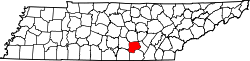
Grundy County, Tennessee

Last updated

Grundy County
Grundy-county-courthouse-tn2.jpg
Grundy County Courthouse in Altamont
Grundy-co-tn.jpg
Map of Tennessee highlighting Grundy County.svg
Location within the U.S. state of Tennessee
Tennessee in United States.svg
Tennessee's location within the U.S.
Coordinates: 35°23′N85°43′W / 35.39°N 85.72°W / 35.39; -85.72
CountryFlag of the United States.svg United States
StateFlag of Tennessee.svg  Tennessee
Founded1844
Named for Felix Grundy [1]
Seat Altamont
Largest city Gruetli-Laager
Area
  Total361 sq mi (930 km2)
  Land361 sq mi (930 km2)
  Water0.6 sq mi (2 km2)  0.2%
Population
 (2020)
  Total13,529 Decrease2.svg
  Density38/sq mi (15/km2)
Time zone UTC−6 (Central)
  Summer (DST) UTC−5 (CDT)
Congressional district 4th
Website grundycountytn.net

Grundy County is a county located in the U.S. state of Tennessee. It is located in Middle Tennessee, bordering East Tennessee. As of 2021, the population was 13,622. [2] Its county seat is Altamont. [3] The county is named in honor of Felix Grundy. [4]

Contents

History

Grundy County has a rich history and today is the home of a vast recreational wilderness known as the South Cumberland State Park which offers extensive hiking, camping, and rock climbing. Most of Grundy County is atop the Cumberland Plateau averaging a height of around 1,800 feet above sea level. Many locations in the county offer beautiful vistas and grand waterfalls. The county seat of Grundy County is Altamont, founded in the 1840s.

Thirty years before the Civil War, the resort town of Beersheba Springs was founded around a natural mineral springs near the current site of a popular wilderness area known as the Savage Gulf. Visitors to the Savage Gulf are amazed by the beautiful views and extensive hiking trails. In the mid-1860s, the town of Gruetli-Laager was formed by an immigrant population from Switzerland. Today many of the original family names are found amongst the local population. Today many people, on their way to Fiery Gizzard and Foster Falls, will pass through the quaint and friendly town of Tracy City. Tracy City is home to the Grundy County Historical Society which is located in the Tennessee Consolidated Coal Company Library & Research Center and is staffed daily by many local residents who assist visitors with tours of the museum and offer assistance for genealogical research. Near by Tracy City many visitors enjoy Grundy Lakes. The Grundy Lakes Park surrounds a series of mountain lakes and streams. The park offers swimming, picnic areas and a lengthy paved road used by runners and walkers. The lake is bordered by a honey comb of Coke Ovens that remain from when coal was mined in the area.

Stereo card c. 1900 showing an overlook at Beersheba Springs 'The Lookout', height 500 ft., near Beersheba Springs, Tenn, from Robert N. Dennis collection of stereoscopic views.jpg
Stereo card c. 1900 showing an overlook at Beersheba Springs

The county has several saltpeter mines. Saltpeter is the main ingredient of gunpowder and was obtained by leaching the earth from several local caves. Fultz Saltpeter Cave, located in Fultz Cove, and Hubbard Saltpeter Cave, located in Hubbard Cove, were both significant operations. Woodlee Cave, located in Northcutts Cove, was also mined for saltpeter. Saltpeter was mined during both the War of 1812 and the Civil War, so these caves may have been mined during either, or both, time periods. [5]

James K. Shook School is but one of many buildings to succumb to arson in Grundy County. James K. Shook School.jpg
James K. Shook School is but one of many buildings to succumb to arson in Grundy County.

In the 20th century, Grundy County earned a reputation for arson. The business district of Tracy City was nearly destroyed when ten buildings were wiped out by an intentional blaze on April 27, 1935. The Tracy City L&N Depot combusted after a century on August 24, 1971. The sheriff reported 21 other fires, mostly arson, prior to that in 1971 alone. After 86 years, James K. Shook School burned to the ground circa May 1976. Offices of newspapers have not been spared, either. The Grundy County Times was set ablaze in 1917, and the Herald office suffered an explosion in 1967 and was destroyed by arson in 1978. After 105 years standing, the Grundy County Courthouse was destroyed by arson on May 3, 1990. [6]

Some vandals appear to favor dynamite. In the 1960s and 1970s, four dynamite blasts destroyed or damaged waterworks, another a lumber yard, and another a doctor's clinic. Such was the problem at abandoned county schools that insurance was difficult to obtain. Glenn Bonner, school superintendent at the time, said, "Just as soon as a building becomes vacant — boom!" [6]

When asked about these crimes and others, Tennessee Bureau of Investigation's Bill Thompson downplayed the blazes saying, "I'm not going to say that Grundy County is any different than any other rural county. There are a ton of good people there." [6]

Geography

Northcutt's Cove Chapel near Altamont Northcutts Cove Chapel.JPG
Northcutt's Cove Chapel near Altamont
View near Pelham Pelham-powerlines-tn1.jpg
View near Pelham

According to the U.S. Census Bureau, the county has a total area of 361 square miles (930 km2), of which 361 square miles (930 km2) is land and 0.6 square miles (1.6 km2) (0.2%) is water. [7]

Natural features

Grundy County contains much of the Fiery Gizzard Trail, renowned for scenic beauty and diversity. [8]

Wonder Cave is located on the north side of Layne's Cove at the foot of the Cumberland Plateau. It was discovered in 1897 by Robert A. Nelson, Melville Anderson, and Will Fitzgerald, who crawled into a small opening next to a large, well-known spring. In 1898, the cave was purchased by R. M. Payne who enlarged the small opening, built trails, and opened the cave to the public as a commercial cave. Wonder Cave was a major tourist attraction for nearly 80 years, but construction of the Interstate Highway system diverted tourists away from the old, main highway, Highway 41, and the cave eventually closed. [9]

Adjacent counties

State protected areas

Demographics

Historical population
CensusPop.Note
1850 2,773
1860 3,09311.5%
1870 3,2505.1%
1880 4,59241.3%
1890 6,34538.2%
1900 7,80223.0%
1910 8,3226.7%
1920 9,75317.2%
1930 9,717−0.4%
1940 11,55218.9%
1950 12,5588.7%
1960 11,512−8.3%
1970 10,631−7.7%
1980 13,78729.7%
1990 13,362−3.1%
2000 14,3327.3%
2010 13,703−4.4%
2020 13,529−1.3%
U.S. Decennial Census [10]
1790-1960 [11] 1900-1990 [12]
1990-2000 [13] 2010-2014 [2]
Age pyramid Grundy County USA Grundy County, Tennessee.csv age pyramid.svg
Age pyramid Grundy County

2020 census

Grundy County racial composition [15]
RaceNumberPercentage
White (non-Hispanic)12,62093.28%
Black or African American (non-Hispanic)380.28%
Native American 330.24%
Asian 440.33%
Other/Mixed 6194.58%
Hispanic or Latino 1751.29%

As of the 2020 United States census, there were 13,529 people, 4,820 households, and 3,320 families residing in the county.

2000 census

As of the census [16] of 2000, there were 14,332 people, 5,562 households, and 4,054 families residing in the county. The population density was 40 people per square mile (15 people/km2). There were 6,282 housing units at an average density of 17 per square mile (6.6/km2). The racial makeup of the county was 98.33% White, 0.14% Black or African American, 0.30% Native American, 0.17% Asian, 0.35% from other races, and 0.71% from two or more races. 0.98% of the population were Hispanic or Latino of any race.

There were 5,562 households, out of which 33.40% had children under the age of 18 living with them, 56.60% were married couples living together, 12.00% had a female householder with no husband present, and 27.10% were non-families. 24.00% of all households were made up of individuals, and 10.20% had someone living alone who was 65 years of age or older. The average household size was 2.54 and the average family size was 3.01.

In the county, the population was spread out, with 25.10% under the age of 18, 9.00% from 18 to 24, 27.80% from 25 to 44, 24.10% from 45 to 64, and 14.00% who were 65 years of age or older. The median age was 37 years. For every 100 females there were 96.70 males. For every 100 females age 18 and over, there were 94.30 males.

The median income for a household in the county was $22,959, and the median income for a family was $27,691. Males had a median income of $27,063 versus $17,447 for females. The per capita income for the county was $12,039. About 22.60% of families and 25.80% of the population were below the poverty line, including 31.50% of those under age 18 and 23.60% of those age 65 or over.

Communities

Cities

Towns

Census-designated place

Politics

United States presidential election results for Grundy County, Tennessee [17]
Year Republican Democratic Third party
No.%No.%No.%
2020 4,80282.02%98816.87%651.11%
2016 3,63676.34%99920.97%1282.69%
2012 2,51659.38%1,64338.78%781.84%
2008 2,56355.33%1,97142.55%982.12%
2004 2,10742.75%2,78956.58%330.67%
2000 1,55333.79%2,97064.62%731.59%
1996 1,09427.03%2,59664.15%3578.82%
1992 1,00422.89%2,99768.33%3858.78%
1988 1,42937.05%2,41562.61%130.34%
1984 1,39634.77%2,59664.66%230.57%
1980 1,13928.34%2,83770.59%431.07%
1976 85022.84%2,85076.59%210.56%
1972 1,36454.49%1,00540.15%1345.35%
1968 61817.33%1,30736.64%1,64246.03%
1964 68619.82%2,77580.18%00.00%
1960 78626.55%2,14372.40%311.05%
1956 91830.36%2,07668.65%300.99%
1952 70921.47%2,58378.23%100.30%
1948 43116.74%2,00978.02%1355.24%
1944 40621.52%1,46277.48%191.01%
1940 29814.49%1,74985.07%90.44%
1936 23813.76%1,48886.01%40.23%
1932 19816.62%97882.12%151.26%
1928 38038.31%60861.29%40.40%
1924 17322.64%39451.57%19725.79%
1920 44732.99%74554.98%16312.03%
1916 31927.55%73663.56%1038.89%
1912 12214.20%52961.58%20824.21%
1908 26126.61%57658.72%14414.68%
1904 26427.59%55457.89%13914.52%
1900 35729.21%85269.72%131.06%
1896 28621.80%99775.99%292.21%
1892 23622.29%77973.56%444.15%
1888 21618.77%90178.28%342.95%
1884 18824.32%58575.68%00.00%
1880 6312.02%46187.98%00.00%

As part of Middle Tennessee, Grundy County has historically been one of the strongest Democratic counties in the state. It voted Democratic in every presidential election from 1880 to 2004, except for in 1968 (when segregationist George Wallace won the county), and 1972 when many traditional Democratic voters around the nation voted for incumbent Republican Richard Nixon. However, like most of the rural south, Grundy County has shifted towards the Republican Party in recent years, but was one of the last counties in Tennessee to make the switch to the party. [18] The last Democratic presidential candidate to win Grundy County was John Kerry in 2004, who won 18 out of Tennessee's 95 counties, whereas Al Gore won 36 in 2000. Grundy County was also won by Democratic U.S. senate candidates Bob Clement in 2002 and Harold Ford Jr. in 2006, both of whom lost. Republican presidential nominee John McCain won the county by nearly 13% in 2008, becoming the first Republican presidential candidate to win Grundy County since Nixon won it 36 years earlier, and by 2016, Grundy County had taken a major shift toward the GOP, when Republican Donald Trump received 76% of the vote, a figure closer to what is usually seen in historically Republican East Tennessee counties. Four years later, he did even better in the county, getting 82% of the vote and holding the Democratic candidate to under 20% for the first time in the county's history.

Notable people

Cultural reference

Grundy County is featured in the country song Sold (The Grundy County Auction Incident) by John Michael Montgomery, as the place where the auction takes place. [19]

See also

Related Research Articles

<span class="mw-page-title-main">Putnam County, Tennessee</span> County in Tennessee, United States

Putnam County is a county located in the U.S. state of Tennessee. As of the 2020 census, the population was 79,854. Its county seat is Cookeville. Putnam County is part of the Cookeville, TN Micropolitan Statistical Area.

<span class="mw-page-title-main">Montgomery County, Tennessee</span> County in Tennessee, United States

Montgomery County is a county in the U.S. state of Tennessee. As of the 2020 United States census, the population was 220,069. The county seat is Clarksville. The county was created in 1796. Montgomery County is included in the Clarksville, TN–KY Metropolitan Statistical Area.

<span class="mw-page-title-main">Wilson County, Tennessee</span> County in Tennessee, United States

Wilson County is a county in the U.S. state of Tennessee. It is in Middle Tennessee. As of the 2020 census, the population was 147,737. Its county seat is Lebanon. The largest city is Mt. Juliet. Wilson County is part of the Nashville-Davidson–Murfreesboro–Franklin, TN Metropolitan Statistical Area.

<span class="mw-page-title-main">White County, Tennessee</span> County in Tennessee, United States

White County is a county located in the U.S. state of Tennessee. As of the 2020 census, the population was 27,351. Its county seat is Sparta.

<span class="mw-page-title-main">Warren County, Tennessee</span> County in Tennessee, United States

Warren County is a county located on the Cumberland Plateau in Middle Tennessee, one of the three Grand Divisions of the U.S. state of Tennessee. As of the 2020 census, the population was 40,953. Its county seat is McMinnville. Warren County comprises the McMinnville, TN Micropolitan Statistical Area.

<span class="mw-page-title-main">Van Buren County, Tennessee</span> County in Tennessee, United States

Van Buren County is a county located in the U.S. state of Tennessee. As of the 2020 census, the population was 6,168, making it the second-least populous county in Tennessee. Its county seat is Spencer.

<span class="mw-page-title-main">Stewart County, Tennessee</span> County in Tennessee, United States

Stewart County is a county located on the northwestern corner of Middle Tennessee, in the U.S. state of Tennessee. As of the 2020 census, the population was 13,657. Its county seat is Dover. Stewart County is part of the Clarksville Metropolitan Statistical Area.

<span class="mw-page-title-main">Smith County, Tennessee</span> County in Tennessee, United States

Smith County is a county in the U.S. state of Tennessee. As of the 2020 census, the population was 19,904. Smith County is located in the region of the state known as Middle Tennessee. Its county seat is Carthage. The county was organized in 1799 and is named for Daniel Smith, a Revolutionary War veteran who made the first map of Tennessee and served as a United States senator.

<span class="mw-page-title-main">Marion County, Tennessee</span> County in Tennessee, United States

Marion County is a county located in the U.S. state of Tennessee. As of the 2020 census, the population was 28,837. Its county seat is Jasper. Marion County is part of the Chattanooga, AL–TN–GA Metropolitan Statistical Area. Marion County is in the Central time zone, while Chattanooga proper is in the Eastern time zone.

<span class="mw-page-title-main">Hamilton County, Tennessee</span> County in Tennessee, United States

Hamilton County is a county located in the U.S. state of Tennessee. It is located in the southern part of East Tennessee on the border with Georgia. As of the 2020 census, the population was 366,207, making it the fourth-most populous county in Tennessee. Its county seat is Chattanooga, located along the Tennessee River. The county was named for Alexander Hamilton, the first secretary of the treasury.

<span class="mw-page-title-main">Franklin County, Tennessee</span> County in Tennessee, United States

Franklin County is a county in the U.S. state of Tennessee. It is located on the eastern boundary of Middle Tennessee in the southern part of the state. As of the 2020 census, the population was 42,774. Its county seat is Winchester. Franklin County is part of the Tullahoma-Manchester, TN Micropolitan Statistical Area.

<span class="mw-page-title-main">Fentress County, Tennessee</span> County in Tennessee, United States

Fentress County is a county located in the U.S. state of Tennessee. As of the 2020 census, the population was 18,489. Its county seat is Jamestown.

<span class="mw-page-title-main">DeKalb County, Tennessee</span> County in Tennessee, United States

DeKalb County is a county located in the U.S. state of Tennessee. As of the 2020 census, the population was 20,080. Its county seat is Smithville. The county was created by the General Assembly of Tennessee on December 2, 1837, and was named for Revolutionary War hero Major General Johann de Kalb.

<span class="mw-page-title-main">Cumberland County, Tennessee</span> County in Tennessee, United States

Cumberland County is a county located in the U.S. state of Tennessee. As of the 2020 census, the population was 61,145. Its county seat is Crossville. Cumberland County comprises the Crossville, TN micropolitan statistical area.

<span class="mw-page-title-main">Campbell County, Tennessee</span> County in Tennessee, United States

Campbell County is a county in the U.S. state of Tennessee. It is located on the state's northern border in East Tennessee. As of the 2020 census, its population was 39,272. Its county seat is Jacksboro. Campbell County is included in the Knoxville metropolitan statistical area.

<span class="mw-page-title-main">Altamont, Tennessee</span> Town in Tennessee, United States

Altamont is a town in Grundy County, Tennessee, United States. The population was 1,117 at the 2020 census. It is the county seat of Grundy County.

<span class="mw-page-title-main">Tracy City, Tennessee</span> Town in Tennessee, United States

Tracy City is a town in Grundy County, Tennessee, United States. Incorporated in 1915, the population was 1,481 at the 2010 census. Named after financier Samuel Franklin Tracy, the city developed out of railroad and mining interests after coal was found in 1840. In 2010 the people of Tracy City elected a dead man, Carl Robin Geary, as mayor.

<span class="mw-page-title-main">Monteagle, Tennessee</span> Town in Tennessee, United States

Monteagle is a town in Franklin, Grundy, and Marion counties in the U.S. state of Tennessee, in the Cumberland Plateau region of the southeastern part of the state. The population was 1,238 at the 2000 census – 804 of the town's 1,238 residents (64.9%) lived in Grundy County, 428 (34.6%) in Marion County, and 6 (0.5%) in Franklin County. The population at the 2020 census was 1,393.

<span class="mw-page-title-main">South Cumberland State Park</span> State park in Tennessee

South Cumberland State Park is a state park in the middle and southeast portions of Tennessee on the Cumberland Plateau.

<span class="mw-page-title-main">Fiery Gizzard Trail</span> Trail in eastern Tennessee, United States

The Fiery Gizzard Trail runs from Tracy City, Tennessee to Foster Falls in Marion County, Tennessee. It is renowned for its beauty and diversity, cited by Backpacker magazine as one of the top 25 hiking trails in the United States. The 12.5-mile (20.1 km) trail offers scenic views, waterfalls, rock formations, and hemlock trees over 200 years old.

References

  1. William Ray Turner, "Grundy County," Tennessee Encyclopedia of History and Culture. Retrieved: October 16, 2013.
  2. 1 2 "State & County QuickFacts". United States Census Bureau. Retrieved July 2, 2022.
  3. "Find a County". National Association of Counties. Archived from the original on May 31, 2011. Retrieved June 7, 2011.
  4. Gannett, Henry (1905). The Origin of Certain Place Names in the United States. Govt. Print. Off. pp.  145.
  5. Thomas C. Barr, Jr., "Caves of Tennessee", Bulletin 64 of the Tennessee Division of Geology, 1961, 568 pages.
  6. 1 2 3 George, Dan (May 19, 1990). "Courthouse fire adds to county's history of arson". Dallas Morning News. Altamont, Tennessee. Associated Press. Retrieved April 10, 2012.
  7. "2010 Census Gazetteer Files". United States Census Bureau. August 22, 2012. Retrieved April 5, 2015.
  8. "Fiery Gizzard Trail: Difficult but interesting overnight trail along Fiery Creek Gorge". Secret Falls. Retrieved July 8, 2012.
  9. Thomas C. Barr, Jr., "Caves of Tennessee", 1961, pages 234-241. This description includes a detailed map and several photographs.
  10. "U.S. Decennial Census". United States Census Bureau. Retrieved April 5, 2015.
  11. "Historical Census Browser". University of Virginia Library. Retrieved April 5, 2015.
  12. Forstall, Richard L., ed. (March 27, 1995). "Population of Counties by Decennial Census: 1900 to 1990". United States Census Bureau. Retrieved April 5, 2015.
  13. "Census 2000 PHC-T-4. Ranking Tables for Counties: 1990 and 2000" (PDF). United States Census Bureau. April 2, 2001. Archived (PDF) from the original on October 9, 2022. Retrieved April 5, 2015.
  14. Based on 2000 census data
  15. "Explore Census Data". data.census.gov. Retrieved December 26, 2021.
  16. "U.S. Census website". United States Census Bureau . Retrieved May 14, 2011.
  17. Leip, David. "Dave Leip's Atlas of U.S. Presidential Elections". uselectionatlas.org. Retrieved March 10, 2018.
  18. Cohn, Nate; ‘Demographic Shift: Southern Whites’ Loyalty to G.O.P. Nearing That of Blacks to Democrats’, New York Times , April 24, 2014
  19. "Sold" . Retrieved September 16, 2022.

35°23′N85°43′W / 35.39°N 85.72°W / 35.39; -85.72