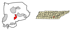
Coalmont, Tennessee | |
---|---|
Coordinates: 35°20′40″N85°43′2″W / 35.34444°N 85.71722°W | |
Country | United States |
State | Tennessee |
County | Grundy |
Area | |
• Total | 6.19 sq mi (16.04 km2) |
• Land | 6.06 sq mi (15.69 km2) |
• Water | 0.14 sq mi (0.35 km2) |
Elevation | 1,883 ft (574 m) |
Population | |
• Total | 784 |
• Density | 129.44/sq mi (49.98/km2) |
Time zone | UTC-6 (Central (CST)) |
• Summer (DST) | UTC-5 (CDT) |
ZIP code | 37313 |
Area code | 931 |
FIPS code | 47-15920 [4] |
GNIS feature ID | 1306006 [2] |
Coalmont is a city in Grundy County, Tennessee, United States. Established in 1904, the city has an area of 6 square miles. The population was 841 at the 2010 census.
Coalmont was established as a coal mining company town around 1904, operated by the Sewanee Coal, Coke and Land Company. Residences, businesses and commercial buildings in Coalmont were built and owned by the company, but individual miners could also build their own homes. [5] A battery of coke ovens dating from the first decade of the 20th century is listed on the National Register of Historic Places. [5] The Coalmont Bank Building also is listed.
Coalmont is located at 35°20′40″N85°43′2″W / 35.34444°N 85.71722°W (35.344309, -85.717252). [6]
According to the United States Census Bureau, the city has a total area of 6.1 square miles (16 km2), of which, 5.9 square miles (15 km2) of it is land and 0.1 square miles (0.26 km2) of it (2.14%) is water.
Climate data for Coalmont, Tennessee, 1991–2020 normals, extremes 1999–present | |||||||||||||
---|---|---|---|---|---|---|---|---|---|---|---|---|---|
Month | Jan | Feb | Mar | Apr | May | Jun | Jul | Aug | Sep | Oct | Nov | Dec | Year |
Record high °F (°C) | 72 (22) | 78 (26) | 83 (28) | 83 (28) | 88 (31) | 100 (38) | 98 (37) | 98 (37) | 95 (35) | 92 (33) | 82 (28) | 71 (22) | 100 (38) |
Mean maximum °F (°C) | 63.3 (17.4) | 66.4 (19.1) | 74.1 (23.4) | 79.7 (26.5) | 84.3 (29.1) | 89.3 (31.8) | 90.4 (32.4) | 89.9 (32.2) | 87.3 (30.7) | 82.2 (27.9) | 71.5 (21.9) | 66.0 (18.9) | 92.2 (33.4) |
Mean daily maximum °F (°C) | 45.3 (7.4) | 48.7 (9.3) | 57.4 (14.1) | 66.4 (19.1) | 73.5 (23.1) | 80.0 (26.7) | 83.2 (28.4) | 82.8 (28.2) | 78.1 (25.6) | 68.3 (20.2) | 57.4 (14.1) | 48.1 (8.9) | 65.8 (18.8) |
Daily mean °F (°C) | 35.4 (1.9) | 38.4 (3.6) | 46.0 (7.8) | 54.4 (12.4) | 62.6 (17.0) | 69.8 (21.0) | 73.2 (22.9) | 72.2 (22.3) | 66.6 (19.2) | 55.8 (13.2) | 45.8 (7.7) | 38.4 (3.6) | 54.9 (12.7) |
Mean daily minimum °F (°C) | 25.6 (−3.6) | 28.1 (−2.2) | 34.5 (1.4) | 42.4 (5.8) | 51.7 (10.9) | 59.7 (15.4) | 63.2 (17.3) | 61.6 (16.4) | 55.1 (12.8) | 43.3 (6.3) | 34.2 (1.2) | 28.7 (−1.8) | 44.0 (6.7) |
Mean minimum °F (°C) | 5.5 (−14.7) | 10.1 (−12.2) | 18.1 (−7.7) | 26.9 (−2.8) | 34.4 (1.3) | 48.5 (9.2) | 53.4 (11.9) | 52.3 (11.3) | 41.1 (5.1) | 27.1 (−2.7) | 17.3 (−8.2) | 13.0 (−10.6) | 3.7 (−15.7) |
Record low °F (°C) | −8 (−22) | −4 (−20) | 8 (−13) | 18 (−8) | 24 (−4) | 41 (5) | 47 (8) | 44 (7) | 32 (0) | 21 (−6) | 10 (−12) | 5 (−15) | −8 (−22) |
Average precipitation inches (mm) | 5.76 (146) | 5.54 (141) | 6.13 (156) | 6.15 (156) | 5.08 (129) | 5.26 (134) | 6.09 (155) | 4.27 (108) | 4.24 (108) | 3.45 (88) | 4.83 (123) | 6.38 (162) | 63.18 (1,606) |
Average precipitation days (≥ 0.01 in) | 12.1 | 12.4 | 13.1 | 11.9 | 12.7 | 11.9 | 13.2 | 11.5 | 9.2 | 9.5 | 10.1 | 12.8 | 140.4 |
Source 1: NOAA [7] | |||||||||||||
Source 2: National Weather Service (mean maxima/minima 2006–2020) [8] |
Census | Pop. | Note | %± |
---|---|---|---|
1960 | 458 | — | |
1970 | 518 | 13.1% | |
1980 | 625 | 20.7% | |
1990 | 813 | 30.1% | |
2000 | 948 | 16.6% | |
2010 | 841 | −11.3% | |
2020 | 784 | −6.8% | |
Sources: [9] [10] [3] |
Race | Number | Percentage |
---|---|---|
White (non-Hispanic) | 754 | 96.17% |
Black or African American (non-Hispanic) | 5 | 0.64% |
Native American | 2 | 0.26% |
Other/Mixed | 19 | 2.42% |
Hispanic or Latino | 4 | 0.51% |
As of the 2020 United States census, there were 784 people, 308 households, and 209 families residing in the city.
As of the census [4] of 2000, there were 948 people, 369 households, and 281 families residing in the city. The population density was 159.4 inhabitants per square mile (61.5/km2). There were 404 housing units at an average density of 67.9 per square mile (26.2/km2). The racial makeup of the city was 99.26% White, 0.11% African American, 0.11% Native American, and 0.53% from two or more races. Hispanic or Latino of any race were 0.21% of the population.
There were 369 households, out of which 36.9% had children under the age of 18 living with them, 58.3% were married couples living together, 15.4% had a female householder with no husband present, and 23.6% were non-families. 19.8% of all households were made up of individuals, and 8.4% had someone living alone who was 65 years of age or older. The average household size was 2.57 and the average family size was 2.97.
In the city, the population was spread out, with 25.1% under the age of 18, 10.7% from 18 to 24, 29.4% from 25 to 44, 24.3% from 45 to 64, and 10.5% who were 65 years of age or older. The median age was 35 years. For every 100 females, there were 90.7 males. For every 100 females age 18 and over, there were 92.4 males.
The median income for a household in the city was $21,750, and the median income for a family was $24,583. Males had a median income of $30,966 versus $17,656 for females. The per capita income for the city was $11,842. About 27.3% of families and 27.0% of the population were below the poverty line, including 28.7% of those under age 18 and 19.0% of those age 65 or over.
Grundy County is a county located in the U.S. state of Tennessee. It is located in Middle Tennessee, bordering East Tennessee. As of 2021, the population was 13,622. Its county seat is Altamont. The county is named in honor of Felix Grundy.
Equality is a village in Gallatin County, Illinois, United States. The population was 539 at the 2020 census. Near the village are two points of interest, the Crenshaw House and the Garden of the Gods Wilderness. Equality was the county seat of Gallatin County from 1826–1851.
Rapids City is a village in Rock Island County, Illinois, United States. The population was 964 at the time of the 2020 census; up from 959 at the 2010 census.
Oakland Acres is a city in Jasper County, Iowa, United States. The population was 176 at the time of the 2020 census.
Guernsey is a town in Poweshiek County, Iowa, United States. The population was 63 at the time of the 2020 census.
New Liberty is a city in Scott County, Iowa, United States. The population was 138 at the time of the 2020 census.
Chelsea is a town in Kennebec County, Maine, United States. The population was 2,778 at the 2020 census. It is home to the Togus Veterans Administration facilities.
Coates is a town in the U.S. state of Minnesota located west of the Upper Mississippi River on the exurban fringe in central Dakota County.
Galt is a city in eastern Grundy County, Missouri, United States. The population was 168 at the 2020 census.
Jette is a census-designated place (CDP) in Lake County, Montana, United States. The population was 253 at the 2010 census.
Glen is a town in Montgomery County, New York, United States. The population was 2,507 at the 2010 census. The town was named after Jacob Glen, an early landowner.
Oliver is a census-designated place (CDP) in Fayette County, Pennsylvania, United States. The population was 2,535 at the 2010 census, down from 2,925 at the 2000 census. Oliver is located in North Union Township.
Coalmont is a borough in Huntingdon County, Pennsylvania, United States. The population was 91 at the 2020 census.
Dudley is a borough in Huntingdon County, Pennsylvania, United States. The population was 185 at the 2020 census.
Altamont is a town in Grundy County, Tennessee, United States. The population was 1,117 at the 2020 census. It is the county seat of Grundy County.
Palmer is a town in Grundy County, Tennessee, United States. The population was 672 at the 2010 census.
Tracy City is a town in Grundy County, Tennessee, United States. Incorporated in 1915, the population was 1,481 at the 2010 census. Named after financier Samuel Franklin Tracy, the city developed out of railroad and mining interests after coal was found in 1840. In 2010 the people of Tracy City elected a dead man, Carl Robin Geary, as mayor.
Granger is a city in Yakima County, Washington, United States. The population was 3,624 at the 2020 census. Although it was classified as a town in 2000, it has since been reclassified as a city.
Hartland is a village along the Bark River in Waukesha County, Wisconsin, United States, that is a suburb of Milwaukee. The population was 9,501 at the 2020 census.
Southeast Roseau is an unorganized territory in Roseau County, Minnesota, United States. The population was 215 at the 2020 census.