Pelham, Tennessee | |
|---|---|
 | |
 Pelham  Pelham | |
| Coordinates: 35°18′36″N85°52′51″W / 35.31000°N 85.88083°W | |
| Country | United States |
| State | Tennessee |
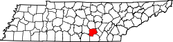
| County | Grundy |
| Area | |
• Total | 16.64 sq mi (43.10 km2) |
| • Land | 16.64 sq mi (43.10 km2) |
| • Water | 0 sq mi (0.00 km2) |
| Elevation | 1,024 ft (312 m) |
| Population | |
• Total | 371 |
| • Density | 22.3/sq mi (8.61/km2) |
| Time zone | UTC-6 (Central (CST)) |
| • Summer (DST) | UTC-5 (CDT) |
| ZIP code | 37366 |
| Area code | 931 |
| GNIS feature ID | 1297123 [2] |
Pelham is an unincorporated community and census-designated place (CDP) in Grundy County, Tennessee, United States. As of the 2010 census, its population was 403. [4] Pelham is located at the junction of U.S. Route 41, State Route 2, and State Route 50 near the base of the Cumberland Plateau, 5.35 miles (8.61 km) north-northwest of Monteagle. [5] Pelham has a post office with ZIP code 37366, which opened on April 4, 1832. [6] [7]
The community is believed to have been named for a family of early settlers. [8] There is a school in Pelham. It is Pelham Elementary school.