Altamont, Tennessee

Last updated

Altamont, Tennessee
Grundy-County-Courthouse-Altamont-tn3.jpg
Grundy County Courthouse in Altamont
Grundy County Tennessee Incorporated and Unincorporated areas Altamont Highlighted 4700940.svg
Location of Altamont in Grundy County, Tennessee.
Coordinates: 35°26′2″N85°43′57″W / 35.43389°N 85.73250°W / 35.43389; -85.73250
Country United States
State Tennessee
County Grundy
Established1848
Incorporated1854 [1]
Named for Fusion of alto ("altitude") and mont ("mountain")
Area
[2]
  Total19.82 sq mi (51.35 km2)
  Land19.82 sq mi (51.35 km2)
  Water0.00 sq mi (0.00 km2)
Elevation
[3]
1,854 ft (565 m)
Population
 (2020) [4]
  Total1,117
  Density56.35/sq mi (21.75/km2)
Time zone UTC-6 (Central (CST))
  Summer (DST) UTC-5 (CDT)
ZIP code
37301
Area code 931
FIPS code 47-00940 [5]
GNIS feature ID1275640 [3]

Altamont is a town in Grundy County, Tennessee, United States. The population was 1,117 at the 2020 census. [6] It is the county seat of Grundy County. [7]

Contents

History

Altamont was established in 1848 as a county seat for Grundy County, which had been created in 1844. General Adrian Northcutt, a prominent local farmer and military officer, was the prime advocate for the site's selection. [8] The town's name comes from combining alto (meaning "altitude") and mont (meaning "mountain"). [9] Although the Civil War somewhat stunted the town's growth, by 1870 Altamont's population had grown to 217. [10]

The Northcutt House, built in 1885 H.B. Northcutt House.JPG
The Northcutt House, built in 1885

Altamont has one of the oldest Mormon congregations in the southeastern United States. The congregation was formed in the 1890s, and a Mormon chapel was built in Northcutt Cove just north of Altamont in 1909. Shortly thereafter, several members of the congregation migrated to Altamont. A Mormon chapel was completed along Main Street in 1947, and a newer chapel was completed just off Viola Road in 1981. [11]

In 1988, Altamont's school building was renovated and now houses the Altamont City Hall and the Altamont Library and Museum. The building was renamed the "Florence R. Scruggs Municipal Building" in 1996, after a long-time teacher at the school. [12]

Geography

Veterans' Park in Altamont Altamont-park-tn1.jpg
Veterans' Park in Altamont

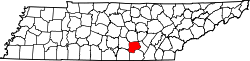
Altamont is located in north-central Grundy County at 35°26′2″N85°43′57″W / 35.43389°N 85.73250°W / 35.43389; -85.73250 (35.433954, -85.732428). [13] It is situated atop the southern Cumberland Plateau between the plateau's Highland Rim escarpment to the west and Savage Gulf to the east. The latter is a gorge sliced by the upper watershed of the Collins River (Altamont is part of this watershed) as the river descends from the plateau to the Highland Rim en route to its mouth at the Caney Fork in adjacent Warren County. Altamont is surrounded by hills on all sides, and the central area of the town itself straddles a flattened-out hillslope.

Several state highways intersect at the center of Altamont. Tennessee State Route 56 (Main Street) connects Altamont to Beersheba Springs and McMinnville to the north and Coalmont, Tracy City and Monteagle to the south. Tennessee State Route 108, connects the town to Viola and McMinnville to the northwest and Whitwell to the southeast. Tennessee State Route 50 connects Altamont to Pelham and Interstate 24 to the southwest.

According to the United States Census Bureau, the town has a total area of 20.2 square miles (52.2 km2), all land. [14]

Demographics

Historical population
CensusPop.Note
1880 110
1890 67−39.1%
1920 114
1930 14022.8%
1940 23870.0%
1950 29624.4%
1960 55286.5%
1970 546−1.1%
1980 67924.4%
1990 6790.0%
2000 1,13667.3%
2010 1,045−8.0%
2020 1,1176.9%
Sources: [15] [16] [4]

2020 census

Altamont racial composition [17]
RaceNumberPercentage
White (non-Hispanic)1,04393.38%
Black or African American (non-Hispanic)10.09%
Native American 40.36%
Asian 40.36%
Other/Mixed 524.66%
Hispanic or Latino 131.16%

As of the 2020 United States census, there were 1,117 people, 362 households, and 240 families residing in the town.

2000 census

As of the census [5] of 2000, there were 1,136 people, 400 households, and 309 families residing in the town. The population density was 51.5 inhabitants per square mile (19.9/km2). There were 438 housing units at an average density of 19.9 per square mile (7.7/km2). The racial makeup of the town was 97.89% White, 0.09% African American, 0.53% Native American, 0.09% Asian, 0.88% from other races, and 0.53% from two or more races. Hispanic or Latino of any race were 2.02% of the population.

Altamont City Hall Altamont-city-hall-tn1.jpg
Altamont City Hall

There were 400 households, out of which 38.3% had children under the age of 18 living with them, 62.3% were married couples living together, 10.0% had a female householder with no husband present, and 22.8% were non-families. 20.0% of all households were made up of individuals, and 5.8% had someone living alone who was 65 years of age or older. The average household size was 2.76 and the average family size was 3.15.

In the town, the population was spread out, with 27.3% under the age of 18, 9.3% from 18 to 24, 30.1% from 25 to 44, 22.1% from 45 to 64, and 11.2% who were 65 years of age or older. The median age was 33 years. For every 100 females, there were 108.8 males. For every 100 females age 18 and over, there were 113.4 males.

The median income for a household in the town was $21,767, and the median income for a family was $25,000. Males had a median income of $26,944 versus $15,000 for females. The per capita income for the town was $10,074. About 28.9% of families and 32.1% of the population were below the poverty line, including 34.4% of those under age 18 and 32.4% of those age 65 or over.

Notable people

Related Research Articles

<span class="mw-page-title-main">Grundy County, Tennessee</span> County in Tennessee, United States

Grundy County is a county located in the U.S. state of Tennessee. It is located in Middle Tennessee, bordering East Tennessee. As of 2021, the population was 13,622. Its county seat is Altamont. The county is named in honor of Felix Grundy.

<span class="mw-page-title-main">Franklin County, Tennessee</span> County in Tennessee, United States

Franklin County is a county in the U.S. state of Tennessee. It is located on the eastern boundary of Middle Tennessee in the southern part of the state. As of the 2020 census, the population was 42,774. Its county seat is Winchester. Franklin County is part of the Tullahoma-Manchester, TN Micropolitan Statistical Area.

<span class="mw-page-title-main">Parrish, Alabama</span> Town in Alabama, United States

Parrish is a town in Walker County, Alabama, United States. It was incorporated in October 1922. At the 2010 census the population was 982, down from 1,268 in 2000.

<span class="mw-page-title-main">Durand, Illinois</span> Village in Illinois, United States

Durand is a village in Winnebago County, Illinois, United States. It is part of the Rockford, Illinois Metropolitan Statistical Area The population was 1,443 at the 2010 census, up from 1,081 in 2000.

<span class="mw-page-title-main">Grundy Center, Iowa</span> City in Iowa, United States

Grundy Center is a city in Grundy County, Iowa. The population was 2,796 at the time of the 2020 census, a 7.7% increase from 2,596 at the 2000 census. Grundy Center is also the county seat of Grundy County. Grundy Center is part of the Waterloo–Cedar Falls Metropolitan Statistical Area.

<span class="mw-page-title-main">Altamont, Kansas</span> City in Labette County, Kansas

Altamont is a city in Labette County, Kansas, United States. As of the 2020 census, the population of the city was 1,061.

<span class="mw-page-title-main">Meadowlands, Minnesota</span> City in Minnesota, United States

Meadowlands is a city in Saint Louis County, Minnesota, United States. The population was 134 at the 2010 census.

<span class="mw-page-title-main">Altamont, Oregon</span> Unincorporated community in the state of Oregon, United States

Altamont is a census-designated place (CDP) and unincorporated community in Klamath County, Oregon, United States, southeast of Klamath Falls. As of the 2010 Census, the population was 19,257. All mailing addresses in Altamont are Klamath Falls addresses, although Altamont is outside of the city limits of Klamath Falls.

<span class="mw-page-title-main">Woodbury, Tennessee</span> Town in Tennessee, United States

Woodbury is a town in Cannon County, Tennessee, United States. Woodbury is part of the Nashville Metropolitan Statistical Area and is located 55 miles (89 km) southeast of downtown Nashville. The population of Woodbury was 2,680 at the 2010 census. It is the county seat of Cannon County.

<span class="mw-page-title-main">Charlotte, Tennessee</span> Town in Tennessee, United States

Charlotte is a town in Dickson County, Tennessee, United States. The population was 1,656 at the 2020 census. It is the county seat of Dickson County. This town is part of the Nashville metropolitan area.

<span class="mw-page-title-main">Beersheba Springs, Tennessee</span> Town in Tennessee, United States

Beersheba Springs is a town in Grundy County, Tennessee, United States, in the south central part of the state. The population was 477 at the 2010 census. A prominent resort town in the 19th century, Beersheba Springs was developed in 1854 by retired wealthy slave trader, John Armfield, who bought property in the area. It became a destination for wealthy guests from Nashville and other cities.

<span class="mw-page-title-main">Gruetli-Laager, Tennessee</span> City in Tennessee, United States

Gruetli-Laager is a city in Grundy County, Tennessee, United States. The population was 1,813 at the 2010 census. As its name implies, Gruetli-Laager consists of two communities— Gruetli and Laager— incorporated as a single city.

<span class="mw-page-title-main">Palmer, Tennessee</span> Town in Tennessee, United States

Palmer is a town in Grundy County, Tennessee, United States. The population was 672 at the 2010 census.

<span class="mw-page-title-main">Tracy City, Tennessee</span> Town in Tennessee, United States

Tracy City is a town in Grundy County, Tennessee, United States. Incorporated in 1915, the population was 1,481 at the 2010 census. Named after financier Samuel Franklin Tracy, the city developed out of railroad and mining interests after coal was found in 1840. In 2010 the people of Tracy City elected a dead man, Carl Robin Geary, as mayor.

<span class="mw-page-title-main">Jasper, Tennessee</span> Town in Marion County, Tennessee

Jasper is a town in and the county seat of Marion County, Tennessee, United States. The population was 3,612 at the 2020 census. The town was formed in 1820 from lands acquired from Betsy Pack (1770–1851), daughter of Cherokee Chief John Lowery. Jasper is part of the Chattanooga, TN–GA Metropolitan Statistical Area.

<span class="mw-page-title-main">Byrdstown, Tennessee</span> Town in Tennessee, United States

Byrdstown is a town in Pickett County, Tennessee, United States. The population was 798 at the 2020 census. It is the county seat of Pickett County.

<span class="mw-page-title-main">Centertown, Tennessee</span> Town in Tennessee, United States

Centertown is a town in Warren County, Tennessee, United States. The population was 243 at the 2010 census.

<span class="mw-page-title-main">McMinnville, Tennessee</span> City in Tennessee, United States

McMinnville is the largest city in and the county seat of Warren County, Tennessee, United States. The population was 13,788 at the 2020 census. It was named after Governor Joseph McMinn.

<span class="mw-page-title-main">Viola, Tennessee</span> Town in Tennessee, United States

Viola is a town in Warren County, Tennessee, United States. The population was 129 at the 2000 census and 131 at the 2010 census.

<span class="mw-page-title-main">Pearisburg, Virginia</span> Town in Virginia, United States

Pearisburg is a town in Giles County, Virginia, and the county seat. The population was 2,786 at the time of the 2010 census. Pearisburg is part of the Blacksburg–Christiansburg Metropolitan Statistical Area.

References

  1. Tennessee Blue Book , 2005-2006, pp. 618-625.
  2. "ArcGIS REST Services Directory". United States Census Bureau. Retrieved October 15, 2022.
  3. 1 2 U.S. Geological Survey Geographic Names Information System: Altamont, Tennessee
  4. 1 2 "Census Population API". United States Census Bureau. Retrieved October 15, 2022.
  5. 1 2 "U.S. Census website". United States Census Bureau . Retrieved January 31, 2008.
  6. Tennessee Department of Economic and Community Development, Certified Population of Tennessee Incorporated Municipalities and Counties Archived June 30, 2014, at the Wayback Machine , State of Tennessee official website, July 14, 2011. Retrieved: December 6, 2013.
  7. "Find a County". National Association of Counties. Archived from the original on May 31, 2011. Retrieved June 7, 2011.
  8. Charles Sherrill, "Grundy County in 1850 Archived 2011-07-26 at the Wayback Machine ." The Pathfinder vol. II, no. 2 (1997), 3. Warning: Large .pdf file.
  9. William Ray Turner, Mona G. Moreland (ed.), "Odds and Ends Archived 2011-07-26 at the Wayback Machine ." The Pathfinder vol. VII, no. 3 (2002), 1. Warning: Large .pdf file.
  10. Charles Sherrill, "Grundy County in 1870 Archived 2011-07-26 at the Wayback Machine ." The Pathfinder vol. II, no. 4 (1997), 21.
  11. Mary Tate Brooks, "The Church of Jesus Christ of Latter-day Saints of Altamont, Tennessee Archived 2011-07-26 at the Wayback Machine ." The Pathfinder vol. II, no. 3 (1997), 7-9. Warning: Large .pdf file.
  12. Mary Tate Brooks, "Women of Grundy County: Florence Rolling Scruggs Archived 2011-07-26 at the Wayback Machine ." The Pathfinder vol. I, no. 3 (1996), 8. Warning: Large .pdf file.
  13. "US Gazetteer files: 2010, 2000, and 1990". United States Census Bureau. February 12, 2011. Retrieved April 23, 2011.
  14. "Geographic Identifiers: 2010 Demographic Profile Data (G001): Altamont town, Tennessee". American Factfinder. U.S. Census Bureau. Retrieved February 24, 2017.[ dead link ]
  15. "Census of Population and Housing: Decennial Censuses". United States Census Bureau . Retrieved March 4, 2012.
  16. "Incorporated Places and Minor Civil Divisions Datasets: Subcounty Resident Population Estimates: April 1, 2010 to July 1, 2012". Population Estimates. U.S. Census Bureau. Archived from the original on June 11, 2013. Retrieved December 11, 2013.
  17. "Explore Census Data". data.census.gov. Retrieved December 26, 2021.