
Decatur County is a county located in the U.S. state of Tennessee. As of the 2020 census, the population was 11,435. Its county seat is Decaturville.

Hartselle is the second largest city in Morgan County, Alabama, United States, 13 miles (21 km) south of Decatur. It is part of the Decatur Metropolitan Area and the Huntsville-Decatur Combined Statistical Area.

Trinity is a town in Morgan County, Alabama, United States. It is included in the Decatur Metropolitan Area and the Huntsville-Decatur Combined Statistical Area. As of the 2020 census, the population of the town was 2,526, up from 2,095 in 2010. It was incorporated in 1901.

Argenta is a village in Macon County, Illinois, United States, whose population was 913 at the 2020 census. It is included in the Decatur, Illinois Metropolitan Statistical Area.
Blue Mound is a village in Macon County, Illinois, United States. The population was 1,133 at the 2020 census. It is included in the Decatur, Illinois Metropolitan Statistical Area.

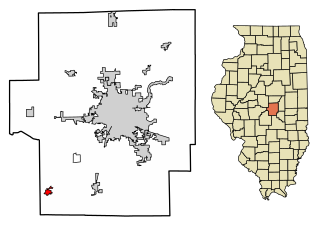
Maroa is a city in Macon County, Illinois, United States. Its population was 1,577 at the 2020 census, down from 1,801 in 2010. It is included in the Decatur, Illinois Metropolitan Statistical Area.

St. Paul or Saint Paul is a small town on the border of Decatur and Shelby counties in the U.S. state of Indiana. The population was 1,031 at the 2010 census.
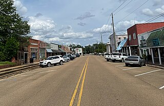
Decatur is a town in and the county seat of Newton County, Mississippi. The population was 1,841 at the 2010 census. This town is named after war hero Stephen Decatur, Jr.

Monfort Heights East was a census-designated place (CDP) in Green Township, Hamilton County, Ohio, United States. The population was 3,880 at the 2000 census. For the 2010 census the area was merged into the new Monfort Heights CDP.
Lurgan Township is a township in Franklin County, Pennsylvania, United States. The population was 2,207 at the 2020 census.

Tuscarora Township is a township that is located in southwestern Juniata County, Pennsylvania, United States. The population was 1,131 at the time of the 2020 census.
Hamlin Township is a township in McKean County, Pennsylvania, United States. The population was 685 at the 2020 census.
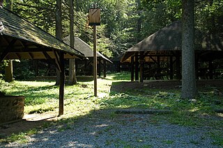
Toboyne Township is a township in Perry County, Pennsylvania, United States. The population was 467 at the 2020 census. Big Spring State Forest Picnic Area is on the western end of Toboyne Township near Conococheague Mountain. Fowlers Hollow State Park is also in the township. It is named after Taughboyne, County Donegal, Ireland.

Windsor is a borough in York County, Pennsylvania, United States. The population was 1,359 at the 2020 census. It was established in 1905 as Windsorville and was named after Windsor, England. It is part of the York–Hanover metropolitan area.

Parsons is a city in Decatur County, Tennessee, United States. The population was 2,373 at the 2010 census. Parsons is the largest city by population in Decatur County.

Decatur is a town in Meigs County, Tennessee, United States. The population was 1,563 at the 2020 census. It is the county seat of Meigs County.

Exeter is a town in Green County, Wisconsin, United States. The population was 1,261 at the 2000 census. The unincorporated communities of Dayton and Ross Crossing are located in the town.

Spruce is a town in Oconto County, Wisconsin, United States. The population was 835 at the 2010 census.

Scotts Hill is a town in Decatur and Henderson counties in the U.S. state of Tennessee. The population was 877 at the 2020 census.

La Valle is a village in Sauk County, Wisconsin, United States, along the Baraboo River. The population was 367 at the 2010 census. The village is located within the Town of La Valle.


