
Sevier County is a county of the U.S. state of Tennessee. As of the 2020 census, the population was 98,380. Its county seat and largest city is Sevierville. Sevier County comprises the Sevierville, TN Micropolitan Statistical Area, which is included in the Knoxville-Morristown-Sevierville, TN Combined Statistical Area.
Pittman Center is a town in Sevier County, Tennessee, United States. The population was 454 at the 2020 census and 502 at the 2010 census. The town borders Gatlinburg and the Great Smoky Mountains National Park. U.S. 321 passes through the town.
Sevierville is a city in and the county seat of Sevier County, Tennessee, located in eastern Tennessee. The population was 17,889 at the 2020 United States Census.

Seymour is a census-designated place (CDP) and unincorporated community in Blount and Sevier counties in the U.S. state of Tennessee. The CDP population was 14,705 at the 2020 U.S. census. It is included in the Knoxville, Tennessee Metropolitan Statistical Area.

U.S. Route 19 or U.S. Highway 19 (US 19) is a north–south United States Numbered Highway in the Eastern United States. Despite encroaching Interstate Highways, the route has remained a long-haul road, connecting the Gulf of Mexico with Lake Erie.

U.S. Route 411 (US 411) is an alternate parallel-highway associated with US 11. It extends for about 309.7 miles (498.4 km) from US 78 in Leeds, Alabama, to US 25W/US 70 in Newport, Tennessee. US 411 travels through northeastern Alabama, northwestern Georgia, and southeastern Tennessee. It is signed north-south, as with most highways that have odd numbers, but the route runs primarily in a northeast-southwest direction, and covers a more east-west mileage than it does north-south. Notable towns and cities along its route include Gadsden, Alabama; Rome, Georgia; Cartersville, Georgia; Maryville, Tennessee; Sevierville, Tennessee, and Newport, Tennessee.
The Great Smoky Mountains Parkway is a highway that travels 23.4 miles (37.7 km) between the Great Smoky Mountains National Park and Interstate 40 in Kodak, Tennessee, in East Tennessee. It serves as the main thoroughfare for Gatlinburg, Pigeon Forge, and Sevierville, and includes a 4.3-mile (6.9 km) spur of the Foothills Parkway. It is composed of sections of a number of numbered highways, including U.S. routes 441 and 321 and state routes 66 and 448.

U.S. Route 25W is the western branch of U.S. Route 25 from Newport, Tennessee, where US 25 splits into US 25E and US 25W, to North Corbin, Kentucky, where the two highways rejoin.

State Route 338 is a secondary highway located entirely within Sevier County in East Tennessee. The road runs generally south–north although like most roads in East Tennessee it has numerous winding turns.

State Route 66 is a state-maintained highway in eastern Tennessee, including a six-lane divided highway known as Winfield Dunn Parkway in Sevier County, a four-lane expressway in Hamblen and Jefferson counties and a two-lane rural collector through mountainous terrain continuing to the northeast terminus in Hancock County.
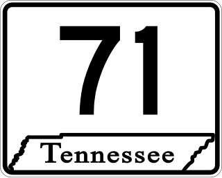
State Route 71 is a north–south state highway in Tennessee. For most of the length it is a "hidden" route, as it coincides with US 441 in all but a short section in Knoxville. The road begins at the North Carolina state line in Sevier County within the Great Smoky Mountains National Park at Newfound Gap and ends at an intersection with US 25W, SR 116, and SR 9 (hidden) in Rocky Top. Along its length SR 71 passes through Sevier County, a small portion of Blount County, Knox County, Anderson County, and in and out of Campbell County. Despite being signed on Hall of Fame Parkway in Knoxville, Tennessee, the Knox County TDOT map ignores SR 71 while SR 33 has a concurrency with US 441.

U.S. Route 441 stretches for 83.28 miles (134.03 km) through the mountains of East Tennessee, connecting Rocky Top with Knoxville, Sevierville, Gatlinburg, and the Great Smoky Mountains National Park, crossing into North Carolina at Newfound Gap. Near its northern terminus, US 441 crosses over Norris Dam and passes through Norris Dam State Park.

U.S. Route 129 is a north–south United States highway that runs for 52.8 miles (85.0 km) in East Tennessee, from the North Carolina state line, near Tapoco, to Knoxville. In Tennessee, the highway is completely overlapped by unsigned State Route 115. In the Greater Knoxville area, US 129 serves as a six-lane controlled-access highway known as Alcoa Highway.
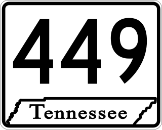
State Route 449 is a 6.2-mile-long (10.0 km) north–south state highway in Sevier County, within the eastern part of the U.S. state of Tennessee. It travels from US 411 overlaying Veterans Boulevard and some of Middle Creek Road in Sevierville south to US 441/US 321 (Parkway) in Pigeon Forge. It serves as a bypass around the busy tourist areas in Sevierville and Pigeon Forge.

Several special routes of U.S. Route 70 exist. In order from west to east, these special routes are as follows.

State Route 55 is an east–west highway in Middle Tennessee. The road begins at SR 50 in Lynchburg and ends at U.S. Route 70S and SR 380 in McMinnville. The current length is 49.3 mi (79.3 km). SR 55 heads northeast from Lynchburg to Tullahoma as a two-lane road. In Tullahoma, the route runs concurrent with US 41A. From here, SR 55 heads northeast as a multilane highway to Manchester, where it intersects US 41 and Interstate 24 (I-24). The route continues northeast, serving Summitville and Morrison before it reaches McMinnville.
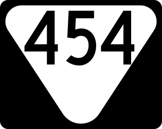
State Route 454 (SR 454) is state highway in Sevier County, Tennessee. It serves as bypass of Sevierville and Pigeon Forge and a route to the Gatlinburg Arts and Crafts Community.

State Route 35 is a north–south state highway in East Tennessee. The 81.35 miles (130.92 km) long state highway traverses Blount, Sevier, a small portion of Jefferson, Cocke, and Greene Counties. Most of the route is a secret, or hidden designation, as it runs concurrently with U.S. Highways in the area.

State Route 339 is a 23.1 miles (37.2 km) long east-west state highway in the mountains of East Tennessee, connecting Cherokee Hills with Cosby. For the majority of its length, SR 339 is known as Jones Cove Road, but other short sections are known as Long Springs Road and Old Newport Highway.

