Tennessee State Route 32

Last updated

Tennessee 32.svg Secondary Tennessee 32.svg

State Route 32

Tennessee State Route 32
SR 32; primary in red, secondary in blue, unsigned in green
Route information
Maintained by TDOT
Length89.4 mi (143.9 km)
ExistedOctober 1, 1923 [1] –present
Major junctions
South endMount Sterling Road at the North Carolina state line
Major intersections
North endUS 25E.svg US 25E at the Kentucky state line in the Cumberland Gap Tunnel at Cumberland Gap
Location
Country United States
State Tennessee
Counties Cocke, Jefferson, Hamblen, Grainger, Claiborne
Highway system
Tennessee 31.svg SR 31 Tennessee 33.svg SR 33

State Route 32 (SR 32) is a state highway in East Tennessee. For most of its route, it is an unsigned companion route concurrent with U.S. Route 25E (US 25E). [2] The highway stretches 89 miles from the North Carolina state line to the Tennessee-Kentucky state line near the town of Cumberland Gap.

Contents

From the junction with US 25W-US 70 in Newport to the Kentucky-Tennessee state line at the Cumberland Gap, SR 32 is designated as the East Tennessee Crossing Byway, a National Scenic Byway. [3] SR 32 is also designated as Appalachian Development Highway System (ADHS) Corridor S. The corridor follows SR 32 between I-81 in Morristown and State Route 63 (ADHS Corridor F) in Harrogate. [4]

Route description

Cocke County

SR 32 begins as a paved continuation of a North Carolina secondary highway (Mt. Sterling Road, a narrow gravel road), in the Cherokee National Forest in Cocke County, at the Tennessee-North Carolina state line, just north of Great Smoky Mountains National Park. SR 32 winds its way west through the Appalachian Mountains, along the southern border of the forest, for 11 miles, where it crosses the Appalachian Trail, before leaving the mountains and entering town of Cosby, where it comes to an intersection and becomes concurrent with US 321/SR 73. Many compare this stretch of SR 32 to the Tail of the Dragon due to its many curves and switchbacks. [5]

The highway turns north as it passes by several homes and businesses, while having intersections with the Foothills Parkway and with SR 339, just a few hundred feet from each other. Leaving Cosby, the three routes head north through farmland to an intersection with Wilton Springs Road, where SR 73 splits off to the east toward I-40. SR 32/US 321 continues through farmland as a newly improved 2-lane highway before entering Newport and widening to a 4-lane divided highway, just before turning east and having an interchange with I-40 (Exit 435). [6]

SR 32/US 321 then runs through a heavily congested retail area and becomes undivided. Upon entering downtown, it junctions with US 70/US 25/SR 9 (W Broadway Street), where US 321 splits off and goes east into downtown while SR 32 becomes unsigned and concurrent with US 25/US 70/SR 9 west. They then pass by several businesses before coming to the US 25 split for US 25W/US 25E, where SR 32 splits off to follow US 25E north and they leave Newport as a 2-lane highway. This concurrency continues through countryside before crossing the J. W. Walters Bridge over Douglas Lake/French Broad River and enter Jefferson County.

Jefferson County

US 25E/SR 32 continues north through countryside and farmland to enter White Pine along State Street, and has an intersection with SR 341. These concurrent highways then pass by several homes and businesses before becoming concurrent with SR 113, which provides access to downtown. US 25E, SR 32, and SR 113 then leave White Pine and continue north through farmland and crosses into Hamblen County.

Hamblen County

Olen R. Marshall Bridge connecting TN-32 to Bean Station and Morristown Olen R. Marshall (TN-32) Bridge.jpg
Olen R. Marshall Bridge connecting TN-32 to Bean Station and Morristown

The highway then widens to a 4-lane divided highway shortly before having an interchange with I-81 (Exit 8). The highway then enters Morristown and passes through an industrial area and has an intersection with SR 343, shortly before SR 113 splits off to the northeast. US 25E/SR 32 then bypass downtown to the east through wooded areas as it becomes a freeway and has its first interchange with SR 160 (Exit 1). The freeway then continues to an interchange with Crockett Square Drive/Walter State CC Drive (Exit 1A; provides access to Walters State Community College and a large retail area). Shortly afterwards they become concurrent with US 11E/SR 34 (Morris Boulevard) at Exit 2A, which quickly ends at Exit 2B with SR 66 (Andrew Johnson Highway). US 25E/SR 32 then downgrade to a divided highway as it passes through several neighborhoods before having an interchange with SR 343, just before crossing the Olen R. Marshall Memorial Bridge over Cherokee Lake/Holston River, where they leave Morristown and cross into Grainger County.

Grainger County

Tennessee State Route 32 descending the southern slope of Clinch Mountain in Grainger County towards Bean Station. TN-32Grainger.png
Tennessee State Route 32 descending the southern slope of Clinch Mountain in Grainger County towards Bean Station.

US 25E/SR 32 continues north past several lakefront homes and businesses before entering Bean Station and having a junction with SR 375 (Lake Shore Road). It then bypasses downtown, to the west, and has an interchange and becomes concurrent with US 11W/SR 1. It then curves to the west and passes by several homes and businesses before coming to another interchange, where US 11W/SR 1 splits off to the west while US 25E/SR 32 curves back to the north and leaves Bean Station. The highway then curves through, and climbs to, the crest of the Clinch Mountain range, just before entering Thorn Hill, where it intersects with SR 131. The highway then continues north to cross a bridge over the Clinch River and crosses into Claiborne County.

Claiborne County

US 25E/SR 32 then becomes undivided and gains a center turn as they turn northwest, where they join and begin an unsigned wrong-way concurrency with SR 33, just after crossing an arm of Norris Lake (Big Sycamore Creek). The highway then continues through countryside and farmland to the community of Springdale before curving around through a gap between two ridges and entering Tazewell. They bypass downtown to the east side before coming to an intersection with N Broad Street just on the north side, where SR 33 and goes south towards downtown and New Tazewell while US 25E/SR 32 turn north again. They have an intersection with SR 345 shortly afterwards before passing by several businesses before leaving Tazewell not too long afterwards.

Traveling northwest out of Tazewell, US 25E/SR 32 passes through countryside and farmland to cross the Powell River before becoming divided, shortly before entering Harrogate and have a junction, and brief concurrency with SR 63, shortly before passing by Lincoln Memorial University and going through downtown. The highway then leaves Harrogate and crosses a ridge before entering the town of Cumberland Gap, where they bypass downtown to the southwest and have an interchange with US 58/SR 383. The highway then continues north to the Cumberland Gap Tunnel at the Tennessee-Kentucky state line, where SR 32 ends and US 25E continues north into Kentucky.

Major intersections

CountyLocationmikmExitDestinationsNotes
Cocke Cherokee National Forest 0.00.0Mount Sterling Road North Carolina state line; southern terminus; continues south as a gravel road; SR 32 begins as a secondary highway
Cosby 11.2518.11South plate.svg
US 321.svg
US 321 south (Hooper Highway/SR 73 west) Gatlinburg, Great Smoky Mountains National Park
Southern end of US 321/SR 73 concurrency; SR 32 becomes a primary highway
12.7520.52 Foothills Parkway east to I-40.svg I-40 Current western end of section 8A of the Foothills Parkway
13.221.2West plate.svg
Secondary Tennessee 339.svg
SR 339 west (Jones Cove Road) Cherokee Hills
Eastern terminus of SR 339
1829North plate.svg
Secondary Tennessee 73.svg
To plate blue.svg
I-40.svg
SR 73 north (Wilton Springs Road) to I-40
Northern end of SR 73 concurrency
Newport 23.7538.22I-40.svg I-40  Knoxville, Asheville I-40 exit 435
South plate.svg
US 25.svg
East plate.svg
US 70.svg
North plate.svg
US 321.svg
US 25 south / US 70 east / US 321 north (E Broadway Street/SR 9 east/SR 35 north) – Downtown, Greeneville, Hot Springs, NC
Northern end of US 321 concurrency; southern end of US 25/US 70/SR 9/SR 35 concurrency; SR 32 becomes unsigned
Begin plate.svg
US 25E.svg
North plate.svg
US 25W.svg
West plate.svg
US 70.svg
US 25E begins / US 25W north / US 70 west (W Broadway Street/SR 9 west/SR 35 south) Dandridge, Sevierville
US 25 splits into US 25W/US 25E; northern end of US 70/SR 9/SR 35 concurrency; southern end of US 25E concurrency
Douglas Lake/French Broad River J. W. Walters Bridge over Douglas Lake/French Broad River
Jefferson Nina Road - Baneberry Access road into Baneberry
White Pine West plate.svg
Secondary Tennessee 341.svg
SR 341 west (Old Airport Road) Talbott
Eastern terminus of SR 341
South plate.svg
Secondary Tennessee 113.svg
SR 113 south (Main Street) Dandridge
Southern end of SR 113 concurrency
Hamblen I-81.svg I-81  Knoxville, Bristol I-81 exit 8
Morristown North plate.svg
Secondary Tennessee 343.svg
SR 343 north (Newport Highway) – Downtown
Southern terminus of SR 343; former route of US 25E/SR 32
North plate.svg
Secondary Tennessee 113.svg
SR 113 north Whitesburg
Northern end of SR 113 concurrency
1Tennessee 160.svg SR 160 (Enka Highway)south end of freeway; southern beltway around downtown and connector to I-81
1ACollege Square Drive/College Park Drive
2ASouth plate.svg
US 11E.svg
US 11E south (Morris Boulevard/SR 34 west) – Downtown
Southern end of US 11E/SR 34 concurrency
2BNorth plate.svg
US 11E.svg
US 11E north (Andrew Johnson Highway/SR 34 east/SR 66) – Downtown, Greeneville
Northern end of US 11E/SR 34 concurrency; north end of freeway
South plate.svg
Secondary Tennessee 343.svg
SR 343 south (Buffalo Trail) – Downtown
Northern terminus of SR 343; interchange; southbound exit and northbound entrance; missing movements signed on Cherokee Park Road
Cherokee Lake/Holston River Olen R. Marshall Memorial Bridge over Cherokee Lake/Holston River
Grainger Bean Station South plate.svg
Secondary Tennessee 375.svg
SR 375 south (Lakeshore Drive) Cherokee
Northern terminus of SR 375
North plate.svg
US 11W.svg
US 11W north (New Lee Highway/SR 1 east) Rogersville
Interchange; southern end of wrong-way US 11W/SR 1 concurrency
South plate.svg
US 11W.svg
US 11W south (Lee Highway/SR 1 west) Rutledge
Interchange; northern end of wrong-way US 11W/SR 1 concurrency
Thorn Hill Secondary Tennessee 131.svg SR 131 (Mountain Valley Highway 131) Washburn, Treadway
Clinch River Bridge over the Clinch River
Claiborne Bridge over arm of Norris Lake
North plate.svg
Tennessee 33.svg
SR 33 north Sneedville
Southern end of wrong-way SR 33 concurrency
Tazewell South plate.svg
Tennessee 33.svg
SR 33 south (N Broad Street) New Tazewell, Maynardville
Northern end of SR 33 wrong-way concurrency
North plate.svg
Secondary Tennessee 345.svg
SR 345 north (Cedar Fork Road)
Southern terminus of SR 345
Bridge over the Powell River
Harrogate East plate.svg
Secondary Tennessee 63.svg
SR 63 east (Forge Ridge Road) Sneedville
Southern end of SR 63 concurrency
West plate.svg
Tennessee 63.svg
SR 63 west (Appalachian Highway) Arthur, Speedwell, Fincastle, LaFollette
Northern end of SR 63 concurrency
Cumberland Gap East plate.svg
US 58.svg
US 58 east (Wilderness Road/SR 383 east) Jonesville, VA
Western terminus of US 58/SR 383
Cumberland Gap National Historical Park 89.4143.9North plate.svg
US 25E.svg
US 25E north Middlesboro
Cumberland Gap Tunnel; Kentucky state line; northern terminus of SR 32; US 25E continues north into Kentucky; SR 32 ends as an unsigned primary highway
1.000 mi = 1.609 km; 1.000 km = 0.621 mi

Related Research Articles

<span class="mw-page-title-main">U.S. Route 25</span> Highway in the United States

U.S. Route 25 or U.S. Highway 25 (US 25) is a north–south United States Numbered Highway that runs for 750 miles (1,210 km) in the Southern and Midwestern U.S. Its southern terminus is in Brunswick, Georgia, from where it proceeds mostly due north, passing through the cities of Augusta, Georgia; Greenville, South Carolina; and Asheville, North Carolina, before dividing into two branches, known as US 25W and US 25E between Newport, Tennessee, and North Corbin, Kentucky. After passing through Richmond and Lexington, Kentucky, it reaches its northern terminus at Ohio state line in Covington, Kentucky. The route is an important crossing of the Appalachian Mountains, and it is covered by three of the corridors of the Appalachian Development Highway System (ADHS). When the highway was originally established in 1926, the route extended from North Augusta, South Carolina, to Port Huron, Michigan. The southern end was extended to its current terminus in 1936, while the northern end was truncated in 1974.

<span class="mw-page-title-main">Tennessee State Route 56</span> Highway in Tennessee

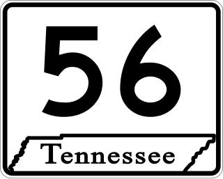
State Route 56 is a 160.6-mile-long (258.5 km) state highway that runs south to north in Middle Tennessee, from the Alabama state line near Sherwood to the Kentucky state line near Red Boiling Springs.

<span class="mw-page-title-main">U.S. Route 25E</span> Highway in Tennessee and Kentucky, United States

U.S. Route 25E (US 25E) is the eastern branch of US 25 from Newport, Tennessee, where US 25 splits into US 25E and US 25W, to North Corbin, Kentucky, where the two highways rejoin. The highway, however, continues as US 25E for roughly two miles (3.2 km) until it joins Interstate 75 (I-75) in the Laurel County community of North Corbin at exit 29. The highway serves the Appalachia regions of Kentucky's Cumberland Plateau and the Ridge-and-Valley section of East Tennessee, including the urbanized areas of Corbin and Middlesboro in Kentucky and Morristown in Tennessee.

<span class="mw-page-title-main">U.S. Route 25W</span> Highway in Tennessee and Kentucky, United States

U.S. Route 25W (US 25W) is the western branch of US 25 from Newport, Tennessee, where US 25 splits into US 25E and US 25W, to North Corbin, Kentucky, where the two highways rejoin.

<span class="mw-page-title-main">Tennessee State Route 22</span> State Highway in Tennessee

State Route 22 is a 172.8-mile long (278.1 km) south-to-north state highway in the western part of Tennessee, United States. It begins at the Mississippi state line in McNairy County, where the roadway continues as Mississippi Highway 2. It ends at the Kentucky state line in Lake County, when it crosses into the Kentucky Bend, a detached portion of Fulton County, Kentucky. The monument for the 1862 Battle of Island Number Ten in the American Civil War is located on SR 22, about 3 mi (4.8 km) north of Tiptonville.

<span class="mw-page-title-main">Tennessee State Route 66</span> State highway in Tennessee, United States

State Route 66 is a state-maintained highway in eastern Tennessee, including a six-lane divided highway known as Winfield Dunn Parkway in Sevier County, a four-lane expressway in Hamblen and Jefferson counties and a two-lane rural collector through mountainous terrain continuing to the northeast terminus in Hancock County.

<span class="mw-page-title-main">Tennessee State Route 9</span> Highway in Tennessee

State Route 9 (SR 9) is a west-to-east state highway in the U.S. state of Tennessee that is 131.33 miles (211.36 km) long. It begins in Campbell County and ends in Cocke County. SR 9 is little-known by the general public by this designation as it is overlain by U.S. Route 25W and U.S. Route 25 east of Newport; the "9" designation is seen on mileposts. The entire route is located in East Tennessee. Despite running concurrent with a North-South US Route, Route 9 is signed as east-west.

<span class="mw-page-title-main">Tennessee State Route 131</span> State highway in Tennessee, United States

State Route 131 is a south-to-north highway in the U.S. state of Tennessee that is 68.8 miles long. It is designated as a secondary route.

<span class="mw-page-title-main">Tennessee State Route 96</span> Highway in Tennessee

State Route 96 is an east–west and north–south highway in Middle Tennessee. The road begins in Dickson and ends in Granville. The current length is 126.7 mi (203.9 km). Along its path it goes through 10 counties. Locals mostly refer to it as Highway 96.

<span class="mw-page-title-main">Tennessee State Route 20</span> State highway in Tennessee, United States

State Route 20 (SR 20) is a 143.04-mile (230.20 km) long east–west primary state highway that begins in Dyersburg and ending near Summertown. SR 20 is unsigned and concurrent with U.S. Route 412 (US 412) for its entire length, except for a short section between Hohenwald and Summertown. Along its route, SR 20 traverses parts of both Middle Tennessee and West Tennessee.

<span class="mw-page-title-main">Tennessee State Route 15</span> Highway in Tennessee

State Route 15 is a west–east route from Memphis to Monteagle. For much of its route it has an unsigned concurrency with U.S. Route 64. SR 15 does travel through the southern part of all three Grand Divisions of the state: West Tennessee, Middle Tennessee, and East Tennessee.

<span class="mw-page-title-main">Tennessee State Route 160</span> State highway in Tennessee

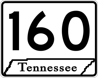
State Route 160 is a state highway in East Tennessee that has both four-lane expressway and two-lane rural collector sections. It serves as a arterial bypass route of US 11E/SR 34 in the city of Morristown in Hamblen County.

<span class="mw-page-title-main">U.S. Route 412 in Tennessee</span> U.S. Highway in Tennessee

In Tennessee, U.S. Route 412 stretches for 181.93 miles (292.79 km) through the farmland of West Tennessee and the hills of Middle Tennessee, starting at the Missouri state line near Dyersburg and running to an interchange between I-65 and SR 99 in Columbia.

<span class="mw-page-title-main">U.S. Route 31A</span> U.S. Highway in Tennessee

U.S. Route 31A is a 76.94-mile-long (123.82 km) alternate route of U.S. Route 31 that exists between Nashville and Pulaski, Tennessee. It is located entirely in Middle Tennessee and except for the Lewisburg bypass, where it is concurrent with SR 106, it is entirely concurrent with unsigned State Route 11.

<span class="mw-page-title-main">Tennessee State Route 33</span> State highway in Tennessee, United States

State Route 33 is a primary and secondary route in East Tennessee. It runs 176 miles, from the Georgia state line in Polk County, northeast to the Virginia state line north of Kyles Ford in Hancock County. South of Maryville, SR 33 is a "hidden" route which shares a concurrency with US 411.

<span class="mw-page-title-main">Tennessee State Route 113</span> State highway in Tennessee, United States

State Route 113 is a north–south state highway in East Tennessee.

<span class="mw-page-title-main">Tennessee State Route 53</span> Highway in Tennessee

State Route 53 (SR 53) is a north–south state highway that traverses six counties in Middle Tennessee. It is 113.5 miles (182.7 km) long.

<span class="mw-page-title-main">Tennessee State Route 28</span> State highway in Tennessee, United States

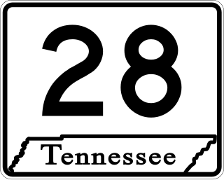
State Route 28 is a state highway in the state of Tennessee, traversing the state in a north–south axis from south of Jasper to the Kentucky state line at Static.

<span class="mw-page-title-main">Tennessee State Route 35</span> Highway in Tennessee

State Route 35 is a north–south state highway in East Tennessee. The 81.35 miles (130.92 km) long state highway traverses Blount, Sevier, a small portion of Jefferson, Cocke, and Greene Counties. Most of the route is a secret, or hidden designation, as it runs concurrently with U.S. Highways in the area.

<span class="mw-page-title-main">East Tennessee Crossing Byway</span> National Scenic Byway in East Tennessee

The East Tennessee Crossing Byway is a 83-mile (134 km) National Scenic Byway in the U.S. state of Tennessee. Established in 2009, it is one of the newest byways in the National Scenic Byway system. The scenic byway traverses mostly along an unsigned concurrency of U.S. Route 25E/State Route 32 (US 25E/SR 32) in East Tennessee.

References

Template:Attached KML/Tennessee State Route 32
KML is not from Wikidata
  1. Highway Planning Survey Division (1925). Biennial Report of the Commissioner of the Department of Highways and Public Works State of Tennessee for the Years 1923 and 1924 (PDF) (Report). Nashville: Tennessee Department of Highways and Public Works. pp. 39–44. Retrieved May 19, 2023.
  2. 2015 Official Transportation Map (PDF) (Map) (2015 ed.). Tennessee Department of Transportation. § Back (eastern TN). Retrieved March 26, 2015.
  3. O'Neil, Duay (October 20, 2009). "Hwy 25 East is Now a National Scenic Byway". The Newport Plain Talk. Archived from the original on July 14, 2011. Retrieved October 23, 2009.
  4. "ADHS Approved Corridors and Termini". Archived from the original on November 1, 2007.
  5. "State Route 32 - Tennessee". MotorcycleRoads.US. 2007–2014. Archived from the original on April 2, 2015. Retrieved June 22, 2018.
  6. "State Route 32 Proposed Improvements". Tennessee Department of Transportation. March 15, 2012. Retrieved November 23, 2013.