Cumberland Gap, Tennessee

Last updated

Cumberland Gap, Tennessee
Pinacles P9040352 Cumberland Gap, TN.JPG
Cumberland Gap, as viewed from the Pinnacle Overlook
Nickname: 
The Gap [1]
Claiborne County Tennessee Incorporated and Unincorporated areas Cumberland Gap Highlighted 4718880.svg
Location of Cumberland Gap in Claiborne County, Tennessee.
Coordinates: 36°35′56″N83°40′2″W / 36.59889°N 83.66722°W / 36.59889; -83.66722
CountryUnited States
State Tennessee
County Claiborne
Settled1770s [2]
Incorporated 1907 [3]
Named for Cumberland Gap mountain pass
Government
[3]
  Type Mayor-council
   Mayor Neal Pucciarelli
   Town Council
Aldermen
Area
[4]
  Total0.33 sq mi (0.85 km2)
  Land0.33 sq mi (0.85 km2)
  Water0.00 sq mi (0.00 km2)
Elevation
[5]
1,417 ft (432 m)
Population
 (2020) [6]
  Total313
  Density951.37/sq mi (367.34/km2)
Time zone UTC-5 (Eastern (EST))
  Summer (DST) UTC-4 (EDT)
ZIP codes
37724, 37752
Area code 423
FIPS code 47-18880 [7]
GNIS feature ID2406347 [5]
Website townofcumberlandgap.com

Cumberland Gap is a town in Claiborne County, Tennessee, United States. [5] Its population was 494 at the 2010 census, and estimated to be 490 in 2019. [8] The town is located below the Cumberland Gap, a historic mountain pass for which is the town's namesake, and inside of the boundaries of Cumberland Gap National Historical Park. [1]

Contents

The majority of the town's downtown area is listed on the National Register of Historic Places as the Cumberland Gap Historic District. [9]

History

The Cherokee and Shawnee Native American tribes traveled through a game trail known to the Shawnee as Athiamiowee. The tribes often fought each other and white settlers called the trail The Warriors' Path. The area that came to be known as the Cumberland Gap was a gateway on the trail through the mountains. [10] Although many settlers had traveled through the pass and their reports had traveled back east, Thomas Walker is credited as the settler who discovered the pass. Walker was hired by the Loyal Land Company to search for a suitable site for a settlement on the western side of the mountains. [11] It became a postal town in 1803, and was officially incorporated as a city in 1907.

The town changed hands four times during the Civil War, but no battles actually took place there.

In 1888, a work camp was established at Cumberland Gap by Scottish-born entrepreneur Alexander Arthur (18461912) to house workers needed to build a tunnel for the Knoxville, Cumberland Gap & Louisville Railroad. Arthur, who was attempting to establish a large-scale iron production operation in the Cumberland Gap region, founded the nearby cities of Middlesboro, Kentucky, and Harrogate, Tennessee, and the nearby community of Arthur. [12]

In 1996, the completion of the Cumberland Gap Tunnel re-routed US 25E, bypassing the town's central business district. This bypassing of the town caused the local economy to decline as annual payrolls for Cumberland Gap dropped 40% in a ten-year span from 1994 (two years before the tunnel's completion) to 2004. [1]

Geography

Cumberland Gap is located at 36°35′56″N83°40′2″W / 36.59889°N 83.66722°W / 36.59889; -83.66722 (36.598976, -83.667318). [13]

According to the United States Census Bureau, the town has a total area of 0.3 square miles (0.78 km2), all land.

Demographics

Historical population
CensusPop.Note
1910 347
1920 304−12.4%
1930 36921.4%
1940 40910.8%
1950 403−1.5%
1960 291−27.8%
1970 231−20.6%
1980 26313.9%
1990 210−20.2%
2000 204−2.9%
2010 494142.2%
2020 313−36.6%
Sources: [14] [15] [6]

2020 census

Cumberland Gap racial composition [16]
RaceNumberPercentage
White (non-Hispanic)26584.66%
Black or African American (non-Hispanic)92.88%
Native American 10.32%
Asian 227.03%
Other/Mixed 103.19%
Hispanic or Latino 61.92%

As of the 2020 United States census, there were 313 people, 115 households, and 48 families residing in the town.

2000 census

As of the census of 2000, there were 204 people, 89 households, and 51 families residing in the town. The population density was 629.9 inhabitants per square mile (243.2/km2). There were 111 housing units at an average density of 342.8/sq mi (132.4/km2). The racial makeup of the town was 99.02% White and 0.98% Native American. Cumberland Gap ranks 289th in city size in Tennessee according to the 2017 U.S. Census Bureau. [17]

There were 89 households, out of which 25.8% had children under the age of 18 living with them, 47.2% were married couples living together, 6.7% had a female householder with no husband present, and 41.6% were nonfamilies. 34.8% of all households were made up of individuals, and 15.7% had someone living alone who was 65 years of age or older. The average household size was 2.29 and the average family size was 3.06.

In the town, the population was spread out, with 21.1% under the age of 18, 10.3% from 18 to 24, 30.9% from 25 to 44, 23.0% from 45 to 64, and 14.7% who were 65 years of age or older. The median age was 37 years. For every 100 females, there were 90.7 males. For every 100 females age 18 and over, there were 83.0 males.

The median income for a household in the town was $36,250, and the median income for a family was $40,625. Males had a median income of $36,250 versus $17,083 for females. The per capita income for the town was $12,005. About 9.3% of families and 23.3% of the population were below the poverty line, including 26.7% of those under the age of 18 and 28.6% of those 65 or over.

Economy

The major industry sectors employing Cumberland Gap residents are healthcare, education, arts, and service. [1] Food preparation and service-related jobs have become the fastest growing within the town of Cumberland Gap. However, according to the American Community Survey, 10% of Cumberland Gap residents work inside of the town limits, with most commuting to other parts of Claiborne County, Middlesboro, and Campbell County. [1]

Arts and culture

Festivals

There are several festivals and events held in Cumberland Gap, [1] some of the more notable events include:

culture. [18]

music, and Appalachian heritage. [19]

Historic sites

Education

There are no schools in the town limits, but Cumberland Gap High School located southwest of Harrogate, Tennessee, is in Cumberland Gap's 37724 zip code.

Lincoln Memorial University is located in nearby Harrogate.

Notable person

Related Research Articles

<span class="mw-page-title-main">Wise County, Virginia</span> County in Virginia, United States

Wise County is a county located in the U.S. state of Virginia. The county was formed in 1856 from Lee, Scott, and Russell Counties and named for Henry A. Wise, who was the Governor of Virginia at the time. The county seat is in Wise.

<span class="mw-page-title-main">Lee County, Virginia</span> County in Virginia, United States

Lee County is the westernmost county in the U.S. Commonwealth of Virginia. As of the 2020 census, the population was 22,173. Its county seat is Jonesville.

<span class="mw-page-title-main">Union County, Tennessee</span> County in Tennessee, United States

Union County is a county located in the U.S. state of Tennessee. As of the 2020 census, its population was 19,802. Its county seat is Maynardville. Union County is included in the Knoxville metropolitan statistical area.

<span class="mw-page-title-main">Hancock County, Tennessee</span> County in Tennessee, United States

Hancock County is a county located in the northeastern part of the U.S. state of Tennessee. As of the 2020 census, the population was 6,662, making it the fourth-least populous county in Tennessee. Its county seat is Sneedville.

<span class="mw-page-title-main">Cocke County, Tennessee</span> County in Tennessee, United States

Cocke County is a county on the eastern border of the U.S. state of Tennessee. As of the 2020 census, the population was 35,999. Its county seat is Newport. Cocke County comprises the Newport, TN Micropolitan Statistical Area, which is part of the Knoxville-Morristown-Sevierville, Tennessee Combined Statistical Area.

<span class="mw-page-title-main">Claiborne County, Tennessee</span> County in Tennessee, United States

Claiborne County is a county located in the U.S. state of Tennessee. As of the 2020 census, the population was 32,043. Its county seat is Tazewell and its largest city is Harrogate.

<span class="mw-page-title-main">Campbell County, Tennessee</span> County in Tennessee, United States

Campbell County is a county in the U.S. state of Tennessee. It is located on the state's northern border in East Tennessee. As of the 2020 census, its population was 39,272. Its county seat is Jacksboro. Campbell County is included in the Knoxville metropolitan statistical area.

<span class="mw-page-title-main">Middlesboro, Kentucky</span> City in Kentucky, United States

Middlesboro is a home rule-class city in Bell County, Kentucky, United States. The population was 10,334 at the 2010 U.S. census, while its micropolitan area had a population of 69,060.

<span class="mw-page-title-main">Cumberland, Kentucky</span> City in Kentucky, United States

Cumberland is a home rule-class city in Harlan County, Kentucky, in the United States. The population according to the 2010 Census was 2,237, down from 2,611 at the 2000 census. The city sits at the confluence of Looney Creek and the Poor Fork Cumberland River.

<span class="mw-page-title-main">Everett, Pennsylvania</span> Borough in Pennsylvania, United States

Everett is a borough in Bedford County, Pennsylvania, United States. The population was 1,765 at the 2020 census.

<span class="mw-page-title-main">Roan Mountain, Tennessee</span> CDP in Tennessee, United States

Roan Mountain is a census-designated place (CDP) in Carter County, Tennessee, United States. The population was 1,360 at the 2010 census. It is part of the Johnson City Metropolitan Statistical Area, which is a component of the Johnson City–Kingsport–Bristol, TN-VA Combined Statistical Area – commonly known as the Tri-Cities region.

<span class="mw-page-title-main">New Tazewell, Tennessee</span> City in Tennessee, United States

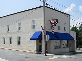
New Tazewell is a city in Claiborne County, Tennessee, United States. The population was 3,037 at the 2010 census.The population was 2,769 at the 2020 census.

<span class="mw-page-title-main">Tazewell, Tennessee</span> Town in Tennessee, United States

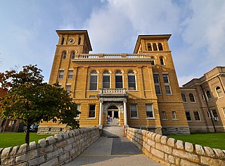
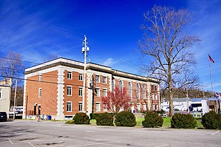
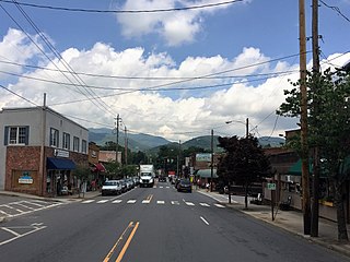
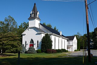
Tazewell is a town in and the county seat of Claiborne County, Tennessee, United States. The population was 2,165 at the 2000 census, 2,218 at the 2010 census, and 2,348 at the 2020 census. The town is named for Tazewell, Virginia, which itself was named for Henry Tazewell (1753–1799), a U.S. senator from Virginia.

<span class="mw-page-title-main">Bulls Gap, Tennessee</span> Town in Tennessee, United States

Bulls Gap is a town in Hawkins County, Tennessee, United States. The population was 756 at the 2020 census. It is part of the Metropolitan Statistical Area, which is a component of the Johnson City-Kingsport-Bristol, TN-VA Combined Statistical Area – commonly known as the "Tri-Cities" region.

<span class="mw-page-title-main">Round Hill, Loudoun County, Virginia</span> Town in Virginia

Round Hill is a town in Loudoun County, Virginia, United States. Its population was 693 at the 2020 census. The town is located at the crossroads of Virginia Routes 7 and 719, approximately 50 miles (80 km) northwest of Washington, D.C. The town's name refers a hill two miles northeast of a 910-foot (280 m) hill used during the American Civil War as a signal post by both Confederate and Union troops. House of Round Hill was built in 2004. Patsy Cline went to Round Hill Elementary School.

<span class="mw-page-title-main">Cumberland Gap</span> Narrow pass through the Cumberland Mountains

The Cumberland Gap is a pass in the eastern United States through the long ridge of the Cumberland Mountains, within the Appalachian Mountains and near the tripoint of Kentucky, Virginia, and Tennessee. At an elevation of 1,631 feet (497 m) above sea level, it is famous in American colonial history for its role as a key passageway through the lower central Appalachians.

<span class="mw-page-title-main">Harrogate, Tennessee</span> City in Claiborne County, Tennessee, United States

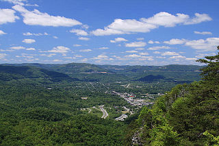
Harrogate is the largest city in Claiborne County, Tennessee, United States. It is adjacent to Cumberland Gap National Historical Park.

<span class="mw-page-title-main">U.S. Route 25E</span> Highway in Tennessee and Kentucky, United States

U.S. Route 25E (US 25E) is the eastern branch of US 25 from Newport, Tennessee, where US 25 splits into US 25E and US 25W, to North Corbin, Kentucky, where the two highways rejoin. The highway, however, continues as US 25E for roughly two miles (3.2 km) until it joins Interstate 75 (I-75) in the Laurel County community of North Corbin at exit 29. The highway serves the Appalachia regions of Kentucky's Cumberland Plateau and the Ridge-and-Valley section of East Tennessee, including the urbanized areas of Corbin and Middlesboro in Kentucky and Morristown in Tennessee.

<span class="mw-page-title-main">Clairfield, Tennessee</span> Unincorporated community in Tennessee, United States

Clairfield is an unincorporated community in Claiborne County, Tennessee, United States. It is located in the upper Clearfork Valley in the Cumberland Mountains of northeastern Tennessee. It is the site of a post office, assigned ZIP code 37715. The population of the Zip Code Tabulation Area corresponding to Clairfield's ZIP code was 1,002 as of the 2000 Census.

<span class="mw-page-title-main">East Tennessee Crossing Byway</span> National Scenic Byway in East Tennessee

The East Tennessee Crossing Byway is a 83-mile (134 km) National Scenic Byway in the U.S. state of Tennessee. Established in 2009, it is one of the newest byways in the National Scenic Byway system. The scenic byway traverses mostly along an unsigned concurrency of U.S. Route 25E/State Route 32 (US 25E/SR 32) in East Tennessee.

References

  1. 1 2 3 4 5 6 "Cumberland Gap Master Plan and Trailhead Development Plan" (PDF). Town of Cumberland Gap. Community Development Partners. December 1, 2019. Retrieved August 21, 2020.
  2. Kivett, John (October 8, 2017). "Claiborne County". Tennessee Encyclopedia . Tennessee Historical Society. Archived from the original on April 18, 2018. Retrieved August 20, 2020.
  3. 1 2 "Cumberland Gap". Municipal Technical Advisory Service. University of Tennessee . Retrieved August 20, 2020.
  4. "ArcGIS REST Services Directory". United States Census Bureau. Retrieved October 15, 2022.
  5. 1 2 3 U.S. Geological Survey Geographic Names Information System: Cumberland Gap, Tennessee
  6. 1 2 "Census Population API". United States Census Bureau. Retrieved October 15, 2022.
  7. "U.S. Census website". United States Census Bureau . Retrieved January 31, 2008.
  8. "Population and Housing Unit Estimates". United States Census Bureau. May 24, 2020. Retrieved May 27, 2020.
  9. "Cumberland Gap National Historic District". National Register of Historic Places . National Park Service . Retrieved August 21, 2020.
  10. "Warrior's Path". Cumberland Gap. National Park Service, U.S. Department of the Interior. Retrieved October 26, 2022.
  11. Luckett, William (1964). "Cumberland Gap National Historic Park". Tennessee Historical Quarterly. 23 (4). Retrieved October 26, 2022.
  12. Carolyn Sakowski, Touring the East Tennessee Backroads (Winston-Salem: J.F. Blair, 1993), pp. 178–179.
  13. "US Gazetteer files: 2010, 2000, and 1990". United States Census Bureau. February 12, 2011. Retrieved April 23, 2011.
  14. "Census of Population and Housing: Decennial Censuses". United States Census Bureau . Retrieved March 4, 2012.
  15. "Incorporated Places and Minor Civil Divisions Datasets: Subcounty Resident Population Estimates: April 1, 2010 to July 1, 2012". Population Estimates. U.S. Census Bureau. Archived from the original on June 11, 2013. Retrieved December 11, 2013.
  16. "Explore Census Data". data.census.gov. Retrieved December 27, 2021.
  17. "American Community Survey Summary File".
  18. "White Lightning Trail Festival". Claiborne Economic Partnership. May 25, 2016. Retrieved January 10, 2021.
  19. "Mountain Heritage Literary Festival". Lincoln Memorial University . Retrieved January 10, 2021.
  20. "Mountain Fiesta - CUMBERLAND GAP". Cumberland Gap Region. Retrieved January 10, 2021.
  21. "NPGallery Asset Detail". National Park Gallery. National Park Service . Retrieved January 10, 2021.
  22. Erlewine, Stephen. "Rodney Atkins". AllMusic . Retrieved January 10, 2021.

Further reading